
Debris Flow Geology
California Megadrought
|
NEW ESRI StoryMaps: What's On Our Shelves & NWNL Song Library & No Water No Life ESRI |
California Megadrought
Thomas Dunne
Hydrologist, Geomorphologist, and a Univ of CA/Santa Barbara Professor Bren School of Environmental Science & Management & Dept of Earth Science since 1995
Alison M. Jones
NWNL Director and Photographer
Thomas Dunn, scientist, author and a Guggenheim Fellow, is also a Montecito CA resident who experienced its deadly debris flow in January 2018. Six months later, I was in Santa Barbara for his lecture on conditions that set up the Montecito debris flow just blocks from his home. This is Part 1 of my interview after his lecture and compares Montecito’s unstable conditions and chaos following a “rain bomb” to Mt. St. Helens debris flow following its volcanic eruption.
(Part 2 of our talk covered his study of impacts of “Dams and Sedimentation in Kenya“ on forests and savannahs.) NWNL is grateful for such an opportunity to delve into comparative conditions with such a qualified scientist in both geology and hydrology – the perfect confluence to delve into unusual flows across several watersheds NWNL studies.)
LIKELY EXPECTATIONS
MOUNT ST. HELENS DEBRIS FLOWS
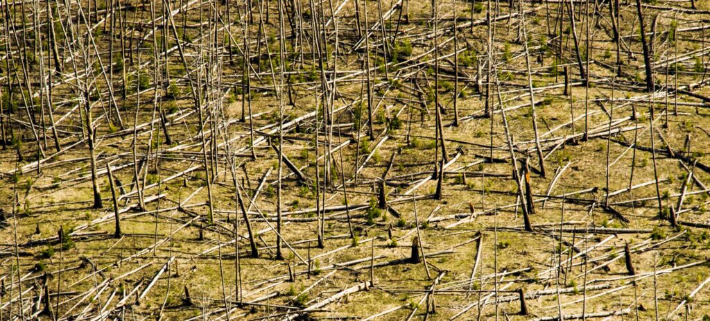
FLOWS IN FORESTED MOUNTAINS
FLOWS in TIMBERED & GRAVEL-HARVEST AREAS
POST-FIRE SOIL HYDROPHOBICITY
DEBRIS BASINS
WATERWAY SETBACKS
IGNORING EVIDENCE / ASSESSING RISK
THE URBAN-WILDFIRE INTERFACE
THE NEED TO LISTEN TO OTHERS
Key Quote It’s only a disaster if people are in the way…. The fundamental context is we live in harm’s way due to the choice we make to want views and space and so on. –Dr Thomas Dunne
All images © Alison M. Jones, unless otherwise noted. All rights reserved.
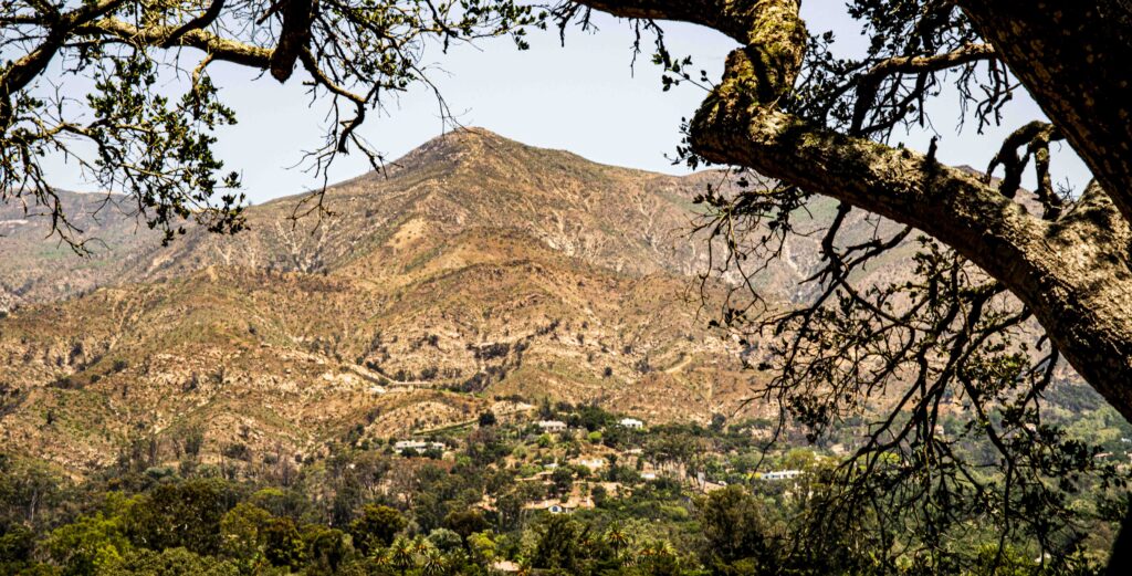
NWNL Dr. Dunne, thank you for your great lecture this week on specific geologic causes for Montecito’s January 2018 debris flow. I arrived in California two days earlier, and fortunately your Montecito neighbor Marco Farrell alerted me to this opportunity to attend. [Our NWNL interview with Marco is titled “Fire & Debris Flow per Eyewitness.”]
Today, I’d like to follow up on how mountains’ rills spread out into alluvial fans that create downhill pathways for water, boulders and debris. As well, I’m interested in comparing Montecito’s debris flow to that of Mount St. Helens in the Columbia River Basin. Together they demonstrate how gravel and timber harvesting as well as burns cause debris flows, California’s Central Valley sedimentation, and general erosion issues here in the US West. Are there ways to prevent the damaging impacts on human communities? Can we mitigate or possibly prevent such threats?
As we discuss the deadly January 2018 Montecito debris flow, I’m very interested in your description of the causes. To begin with a broad brush, how much of this flow was caused by today’s growing issues of climate change, drought, and fire?
THOMAS DUNNE The fundamental context is we live in harm’s way due to the choice we make to want views and space and so on. So, we live in harm’s way. In Montecito, we live on the piedmont of a steep mountain range of erodible rocks, prone to natural wildfires. That, along with occasional intense rainstorms, sets us up to have floods and, with lower frequency, debris flows.
We must look at temporal changes to that picture, in the nature of the hazards due to that context. We must take the issue of drought: California has always had droughts, and the droughts have always led to wildfires. We must realize wildfires have made us vulnerable to debris flows if we have the right rainstorm.
First, it seems our droughts are intensifying and more frequent. We don’t have a long-term record of that yet. It’s only gradually emerging, for a relatively simple reason: our temperatures are increasing, so vegetation dries out earlier and for a longer period. That makes our rainfall supply less effective at keeping our vegetation and soils moist. That alone is the most familiar, predictable and comprehensible influence of global warming. The warming leads to drying which intensifies drought.
We should expect wildfires to become somewhat more frequent. But we don’t know how much more frequently, partly because an important trigger for wildfires, once the vegetation is so dry, is human intervention. Whether it’s deliberate or accidental, what we do as inhabitants or visitors to chaparral-covered uplands increases the triggering of wildfires. The tendency toward climate warming increases the tendency to droughts, triggering conditions for more frequent ignition.
The other climatological determinant of the occurrence of debris flows is rainstorms. It’s difficult to recognize a signal in changes to a rainstorm’s character and intensity, because we don’t have a long enough record of this changed environment. It’s not clear whether the frequency of intense storms is increasing. Even predictions of climate models for rainstorm models are still quite general and not very precise. However, we have a generalized understanding that as climate warms, there’ll be more evaporation from the ocean, thus more moisture in the air, leading to larger and more intense rainstorms. That’s a generalized expectation without quantifying empirical evidence.
Back to the effect of drought and other climate factors on flood or reflow occurrence in these mountains. There’s reason to expect that rainstorm intensity will increase and debris flows and floods from these mountain canyons are likely to become larger and more frequent. Yet the magnitude of those increases is not yet predictable.
NWNL I remember hearing Al Gore use the term “rain bombs” regarding very intense, short bursts. Will they become more frequent?
THOMAS DUNNE We don’t need a motivational label for these intense rainstorms. There are physical reasons to expect conditions that trigger intense rainstorms. They and even longer rainstorms will increase as climate and the ocean warms. But signals of those changes and trends are intensely variable and very difficult to predict. If we think about climate change in a reasonable, qualitative way, as we do about everything else in our future – our safety, our wealth, our stability, etc. – without getting technical and measuring change by 1.05 or 1.15 – the trend in regions like coastal California would be increased frequency and intensity of drought and increased duration of rainstorms by some amount.
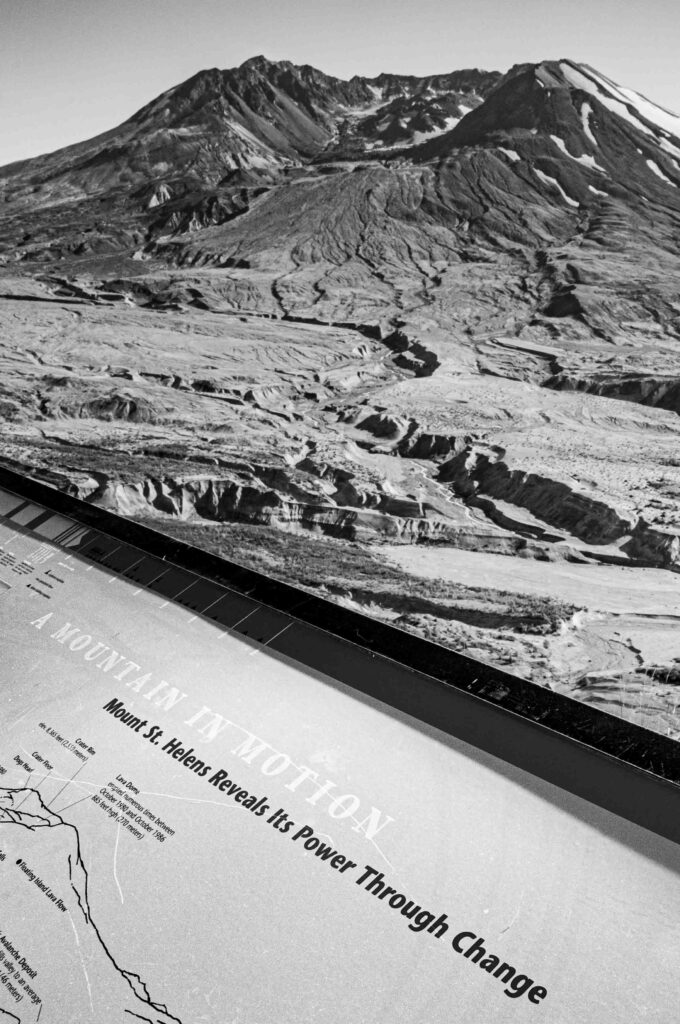
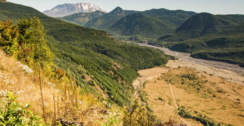
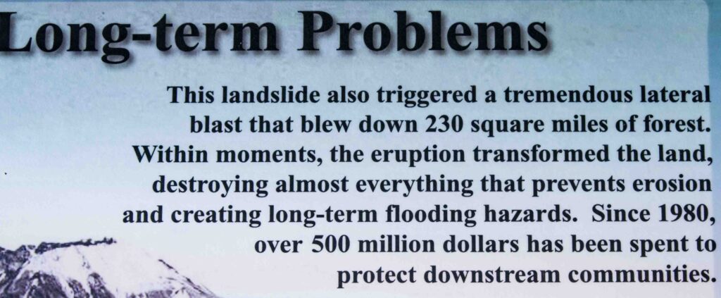
NWNL How would you compare conditions in Washington State’s Toutle River Basin before and after Mount St. Helens erupted. I was fascinated by signage at its interpretive center and park trails. How would you compare conditions involved with that volcanically caused debris flow to what happened here in Montecito? Similar or different?
THOMAS DUNNE It’s different in many profound ways because of the way they’re generated: the magnitude, the peat flow, the volume, timing, the availability of warning time, even the flow properties, material and whether it has boulders in it or not. They’re all very different. A debris flow can be generated by one mechanism, by volcanic eruption, by landslides in forested mountains, etc. The modes of generation, or differences in those modes, determines the differences in the nature of the hazard in a very profound way.
In the case of Mount St. Helens, two types of debris flow were generated during the eruption. Even though they were in the same eruption, they had profoundly different consequences. The first set of debris flows were generated high up on the cone of the volcano, right on the steep slopes. They were generated when hot pyroclastic flows came vertically out of the throat of the volcano and spilled down the sides of the volcano. That basically created a high-speed stream, or streams, of hot rock with temperatures of 700 degrees Celsius or so. Those streams of hot rock eroded and melted the cloak of snow and ice on the upper slopes of the volcanos.
That 700º C, high-speed, mud-generating mechanism eroded and immediately melted snow and ice. That mixed in with pyroclastic granular materials, setting rivers of debris flows on the upper slopes with very high rates of flow. We estimated the largest discharge at 60,000 cubic meters/second. That 20-meter-high debris flowed down the South Fork of the Toutle River, initially at 60 mph and declining to 20 mph. That particular generation process led to rapidly responding, short, but high peak flows. It was the equivalent of a summer thunderstorm occurring in an urban environment with very rapid rise and fall of the flow.
Fortunately, since it occurred on the volcano it was quite a long way from people. So that short, sharp wave of debris flow diminished downstream, before it reached inhabited parts of the valley, creating no damage. Similar debris flows occurred on the south side of the volcano that were smaller than the South Fork. They ran down into the reservoirs south of the mountain and weren’t too big. If they’d been much larger, they could have sent a wave of water destroying the dam there. We were lucky.
In contrast, there was no debris flow on the North Fork of the Toutle River during the eruption’s early phase that caused other debris flows. There was a huge rock avalanche that ran 22 kilometers down the valley at speeds of 300 km/hour and suddenly stopped. Then there was no debris flow for hours.
In that quiet time, snow and ice were blocked. The glacier ice, caught up in that big rock avalanche, was slowly melting because the rock material was quite hot. At about 100º C., it melted the ice blocks and saturating the debris. Five hours after the eruption began, the volcano entered a new eruptive phase of hot gases being pumped out. The whole mountain was being shaken, as if fluid was going through pipes. Saturated debris in the North Fork of the Toutle River caused by the melting ice blocks then started to be regularly pulsed by this shaking of the whole landscape.
As soon as that shaking began – five hours after eruption – mud was seen flowing over that debris avalanche and running down the North Fork of the Toutle River. That mud flowed down the valley for 4-5 hours until the shaking, called harmonic tremors, stopped. When that stopped, no more mud was produced, and its flow began to decline.
With St Helens, the mudflow persisted for a few minutes, but was the equivalent of having a big midwinter storm that creates a flood. That “storm” generated runoff down valley, filling the channel. It spilled over and then filled up the flood plain. The water kept on coming – a long, long flood that filled up all the natural storage in the valley floor,. It overtaxed the channel’s conveyance capacity all the way down – tens of kilometers.
The North Fork debris flow volume was 10 times that of the South Fork. Its peak discharge was much smaller than the South Fork debris flow; but because it kept on coming, that floodway was propagated all the way down the valley. That flood debris flow did damage, because it propagated and developed part of the Toutle River Valley.
So differences in generation mechanism caused differences in the nature of the debris flow, and, therefore, also does so when it encounters people in the nature of the hazard.
NWNL What about the impacts of flows coming downstream through forests?
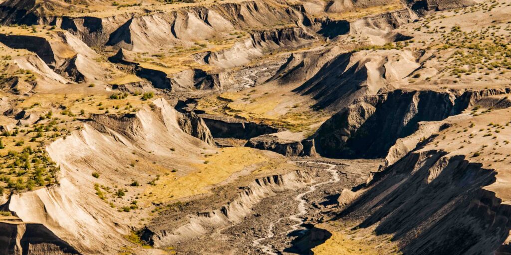
THOMAS DUNNE Well, they’re very different. In forested mountains, it is a natural event when, from time to time, we have landslides. Many of those landslides, as soon as their material begins to fail and slide off steep slopes, convert to a granular debris flow.
Such forest-mountain debris flows tend to have a much lower volume than those like Mount St. Helens ‘volcanic-generated flows or Montecito’s flow. Nevertheless, they’re potentially damaging, because, as their flows travel away from the original site of slope instability, they too can scour boulders from small mountain creek-beds. Those debris flows can increase in size and boulder content as they go down-valley, some increasing hundred-fold or more in volume.
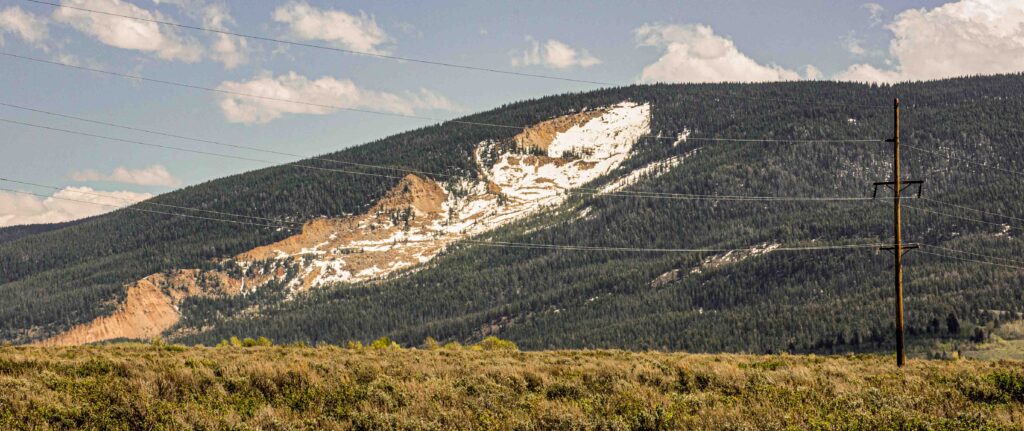
But such forest flows tend to be small enough that they don’t propagate far enough to affect most inhabited areas. Yet, they can take bridges, or the occasional creek-side property, particularly at a road-bridge crossing. There might be a motel on the bank, and the debris flow deposit goes over-bank and takes out the individual structure. But forest-mountain debris flows don’t propagate as far downstream or cause massive damage as either of the Montecito cases or the volcanic case.
NWNL Another type of debris flow occurs from forests that have been timbered or rocky areas used to mine gravel. What impacts come from that type of human intervention?
THOMAS DUNNE If mountains have faced timber harvest cycles, or we move into those areas, we intensify the fire hazard. Timber harvests transform vegetation cover over relatively large, contiguous areas. Not individual timber-harvest plots of perhaps 40 acres – but contiguous spreading of timber harvest projects, often into most of a drainage. Wildfires spread the same way.
When timbering or fires occur, there is weakening of the reinforcement tree roots have provide to the soil to hold it in place. In the worst case, that soil reinforcement goes away completely. But even if just weakened, the soil on steep slopes becomes more vulnerable to collapse when we have a large rainstorm.
In that case, we often see simultaneous occurrence of many landslides evolving into debris flows in the same catchment. Just as happened here in Montecito, many failures in small catchments, came together in a short period of time to create a large debris flow. This appears simultaneously in the landscape and creates larger debris flows. The larger they are, the farther downstream they propagate, and the more disruption they cause to river channels, for example.
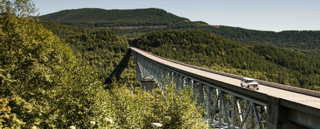
As seen in coastal British Columbia, the closer we live to those steep slopes and the more we put highways through mountains, infrastructure is vulnerable to that type of intensified debris flow hazard.
NWNL Putting highways through mountains can precipitate this?
THOMAS DUNNE When we put them highway bridges across river channels, they then are vulnerable to destruction by the debris flow. But I don’t think they significantly cause any more debris flow.
However, whether we put ski areas, developments, roads, or second homes up in the mountains, we tend to put them into areas near or across creeks, down which debris flows must travel. Thus, we invite increased vulnerability to what is already a natural hazard, that is intensified by wildfire or widespread timber harvesting.
NWNL What is the most helpful post-flow mediation for recovering and preventing further damage. I’ve heard about several approaches: requiring setbacks from creeks; establishing debris basins; turning damaged property into parkland rather than rebuilding. And should there be more prescribed burns? Or does that create more hydrophilic soil?
THOMAS DUNNE We have a whole basket of solutions. Some relate to our wildfire-dominated chaparral landscape. Others are more general. I never say what should be done. I’ll just list thoughts without general comment.
What’s important is heat of the fire and the extent of the fire. The larger the fraction of the landscape, the larger the cumulative watershed vulnerability to any hazard.
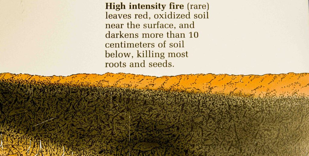
Is hydrophobicity in the soil surfaces aggravated by the heat of fires? Generally, the hotter the fire and heavier the fuel load, the greater impact the creation of water-repellant conditions on soil surface. Hydrophobicity, plus the burning-out of the roots, lowers soil reinforcement and affects impact rates of water into the soil. Both increase soil vulnerability in a catastrophic way.
There’s not much well-controlled quantitative experimental evidence of this; but if feasible, controlled burning over sufficiently large areas of the landscape would tend to lower fuel loads, thus lowering the intensity and the spread of fires. That would reduce damage to the topsoil after the fire.
NWNL How does how fire reduce the ability of the soil to absorb water?
THOMAS DUNNE That’s the most important question after a wildfire. If the soil’s surface is de-vegetated, it leaves it bare. If roots are burned out, it leaves it more vulnerable to erosion.
Many of our western forests have chaparral – vegetation consisting of coniferous trees and some woody, shrubby plants. They get very dry, so those fires burns hot. Chapparal leaves and its wood contain various oils. The heat of the fire evaporates those oils and much of that oily vapor spreads into the atmosphere as smoke and steam. That doesn’t do any damage; but some of that oily vapor spreads away from the fire and down into the soil, where just 1-2 cm. below the surface it’s much cooler than the fire. That oily vapor then condenses around individual soil particles, making them water-repellant – like spraying your vortex hiking gear with water-repellant material.
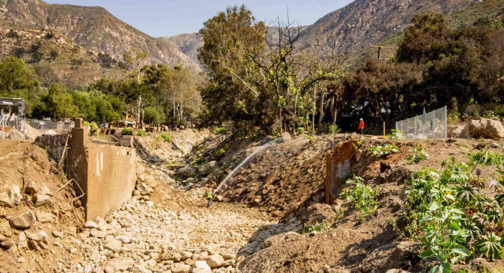
NWNL Another subject of importance in these hills are the debris basins. I walked up San Ysidro Creek this week to see that debris basin, having heard they had to rebuild its dam which it was damaged. I was intrigued after Representative Salud Carbajal’s town hall meeting where people asked why there weren’t more debris basins. The panel answered there isn’t any pace for more debris basins. How effective are debris basins? And do you think there could be more debris basins built in this Montecito area?
THOMAS DUNNE Of course. The fundamental reason there are no large debris basins above Montecito is that people moved in, planted their properties and built on them before anybody understood that there was a debris-flow hazard. That’s the fundamental problem today. As a result there isn’t much space, nor is the terrain above Montecito favorable for large debris basins. Whereas, the Santa Monica Creek watershed (further east) had space for large debris basin that hadn’t been developed. They were lucky, especially because if those boulders had washed down, Carpinteria, would have had serious problems. Looking into the future, the question is whether there’s potential for increasing Montecito’s debris basins.
Let’s start with the effects of debris basins. They can trap large boulders, and if carried down into inhabited areas, they can cause a lot of damage as we’ve just seen. However, we also saw that debris basins have a finite capacity. In small events they can trap all the boulders, so that only mud and water come over the dam. Since most debris flows are small, those basins can have a stabilizing effect.
However, like other flood-control structures, those dams are not so good in large events. They encourage people to believe they’re safe, so they ignore the fact that they’re building on the boulders of other larger debris flows from the past. Even if they accept those hazards, the debris flow basins lead them to believe that they’re protected from small events. So, the first thing debris basins do is to encourage risk-taking. The second risk arises if a big event overtaxes their storage capacity and its contents flow over the dam, rather than on a wider front at a higher elevation.
If there’s enough opportunity in the terrain to design a sufficiently large basin and you don’t mind the cost of building and maintaining them, you still pay a certain aesthetic price. They don’t look very good, seen from your high-value-view property downstream. There’s also an ecological price. They disrupt the restoration of steelhead trout runs and such. The community must balance the pluses and minuses, hopefully with more balanced information than they often offer.
NWNL How often is maintenance needed? Is it on an as-needed basis.
THOMAS DUNNE Yes, but in the last few years, when an El Nino winter is predicted, correctly or not, there’s a frantic flurry to clean them out, which suggests they’re not regularly cleaned out. If done only when there’s an impending crisis, there’s the risk of an unpredicted event coming when they haven’t been emptied.
NWNL Do you know the state of those debris basins on January 8th?
THOMAS DUNNE They were being cleaned out before the event. Basically, we just rely on the county to take care of them and hope they do.
NWNL I just saw the San Ysidro Ranch rebuilding structures established on the edge of the creek bed. It didn’t look like they were observing a 50-feet setback.
THOMAS DUNNE I don’t know the new rules. They are undefined and in flux. I heard folks using the term “like-for-like” and “like-for-like except for.…”
NWNL As I saw them, I thought about Mount St. Helens, and how its interpretive site has become a great educational experience. I don’t see any such efforts like that or efforts to reconsider creek set backs happening here. But maybe it’s too early?
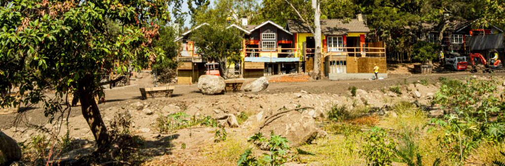
THOMAS DUNNE Well, no individual property owner wants to advertise that they were invaded by a debris flow. That would reduce the value of their property. I’m sure people will try to suppress any evidence or knowledge of this event soon, because it diminishes property values.
NWNL Marco says the debris flow that destroyed his mother’s lovely garden revealed it was the ancient bed of San Ysidro Creek. He said, “Whenever we tried to dig to plant a tree, we’d run into boulders that we realize now came down in past debris flows.” If so someone must have ignored that information to let building occur. “Caveat emptor!” But, looking forward, shouldn’t evidence of such ancient creek beds be shared? It seems potential buyers should be told, “Hey, these mountains can just drop their debris, and you could be in the path.”
THOMAS DUNNE Geologists run into this problem all the time. We understand processes that are hazardous. Whether it’s a flood or a debris flow, we generate information of potentially hazardous nature of terrains. But the general response of community individuals or their governance is to suppress that information.
When I got to Santa Barbara 20-odd years ago, one colleague generously introduced me to the geology of the area. He took me to one location and said, “So these are alluvial fans.” They’re mapped as alluvial fans on the geological map by public agencies. I answered, “These are not alluvial fans. These are debris-flow fans.” I studied them in Japan and in the Philippines. A debris-flow fan is constructed differently from an alluvial fan via different processes. They have a different risk profile. In general, Montecito, parts of Santa Barbara, and parts of Carpinteria are built on debris-flow fans.
Debris flows are not something that happened in the last Ice Age. They are things that can happen to us today, and in an ideal world we should have somebody take a systematic look at the history and current conditions of our local geology. This body might be a person or an organization that’s assimilating the evidence of debris flow fans and channels we know have moved around on a time scale of interest to the current generation of Montecito residents.
That would be an ideal solution. But neither the governing bodies nor individual property owners want to know that their property is threatened by debris flows. Secondly, nobody in the county or any other government agency has a lot of loose cash around to have a survey done. Also, nobody has any free time to think beyond their immediate responsibility. As a society, we’re not prepared to invest the time, nor the resources to give people time, nor to put the word out that this is a potentially dangerous area. It’s the fact that we’re human that causes us to have these problems.
NWNL Marco Farrell told me about the elders saying his garden was an ancient creek bed, and that the creek has been channelized and moved. It used to empty right where the Coral Casino is. I replied, “So Marco, if financially you can rebuild and it works, would you do that?” He replied, “Yes. This is our family’s sacred ground. We’ve raised our babies here. We’ve put our love and energy here.’
Now, you’ve just told me this could happen again.
THOMAS DUNNE Many people do that all over the world. Right here, we live on a slope called Mission Creek Fault. Two blocks from here that the fault is creeping and tearing apart the foundation of a property we almost bought. So, what do we do? We sit here and recognize there is a probability of an earthquake, and the probability of a fire. A fire here is much more probable than a debris flow at Marco’s place. Invested in our aesthetic, cultural and economic reasons, we did our own private risk analysis and said, ‘Yeah, we’ll take the chance.’ It’s the way people take chances to live in Hurricane Alley.
I think the most reasonable thing to do is to inform people; and then let them make their own decisions. It seems to me individuals can quite reasonably do their own risk analysis. But they should do so in an informed way, so it’s up to public agencies to give them that information.
NWNL Addressing the urban-wildfire interface, is there any talk of drawing a line and saying, “Okay, here’s the line, and you can no longer build above this.” The other question on risk is, “Are impervious surfaces, more driveways, shopping malls and concrete parking lots and such a further risk to mudslides, debris flows?
THOMAS DUNNE I think declaring private land outside a certain boundary as “no-build” is a legal issue. I’m not sure we can say that beyond a certain boundary “we won’t give you any fire protection.“ That’s a legal and Constitutional question.
Regarding impervious areas, they’re an aggravation of local urban water runoff and pollution hazards; but I don’t see how they’d aggravate debris flows. The only thing related to urban construction aggravating debris flows is undersized bridges of channel constrictions. Reinforcement in a riverbank presumably stops the river from undermining local properties, but those I’ve seen around Montecito constrict those channels as flow goes down there, so there’s a number of those that I’ve seen around Montecito.
That’s just one solution we could reasonably expect from public agencies – if they had the resources to do it. They could take a systematic survey of potential flow obstructions in these creeks and then address localized mitigation of the impervious area problem in urban areas. The fact that we have extensive impervious areas is a different but critical set of problems.
THOMAS DUNNE Much of what I’m telling you comes from a textbook that I wrote 40 years ago this year: Water in Environmental Planning.
NWNL Happy Anniversary. Certainly “planning” is the right place to start!
THOMAS DUNNE None of this information is new. It’s all been well understood for 40 years. It’s just a matter of getting it to seep into the thinking of agencies, the consulting firms that service the agencies, and the governing bodies that govern the agencies.
My book’s no longer in print, but my students say it’s available on Amazon. One entire chapter says flood control by itself is an out-of-date concept. Instead, we must start looking at the challenge of human occupants living in flood-prone lands. I owe the thoughts in these chapters due to Gilbert White, my intellectual hero all my career. Forty years before my book, he wrote a thesis at the University of Chicago laying out all options for mitigating flood hazard and flood losses. It took 36 years for his thesis to get into a textbook. That was 1978; and yet, even now, people are still asking. “ How big a debris flow basin should we have?” – as if that were the only thing to address. It drives me crazy. It’s like what am I doing with my life? Don’t get me wrong.
NWNL How frustrating!
THOMAS DUNNE Actually, I’m optimistic because I’ve been infecting students for the last 49 years with these sorts of things. As my old advisor, Reg Wollman, said, “Timing is everything. Once you get a piece of information into somebody’s head, you infect many of them; and a small fraction of them end up in a position of influence at the right time. That’s how an academic infects the population.”
I’m sure that in some places in the world some of Gilbert’s principles have been used. It’s just that they are not national policy. Gilbert did help influence the Flood Control Act in 1968, so some of his ideas got in. He was a very, very famous man. But when I see a new situation like this Montecito debris flow, it just brings out my inner Gilbert.
NWNL The world certainly needs thoughtful teachers like you and Gilbert. I just hope this interview, once published, will do a bit more to spread your principles on flood control and prevention of debris flows. Here’s to your “Inner Gilbert.”
Thank you for your time on this subject; and I look forward to our next topic on “Dams and Sedimentation in Kenya.”
Posted by NWNL on March 15, 2024.
Transcription edited and condensed for clarity by Alison M. Jones.
All images © Alison M. Jones, unless otherwise noted. All rights reserved.