
Dams & Sedimentation in Kenya
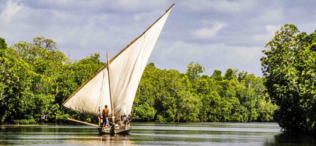
Mara River Basin
|
NEW ESRI StoryMaps: What's On Our Shelves & NWNL Song Library & No Water No Life ESRI |
Mara River Basin
Thomas Dunne
Hydrologist, Geomorphologist, and a Univ of CA/Santa Barbara Professor Bren School of Environmental Science & Management & Dept of Earth Science since 1995
Alison M. Jones
NWNL Director and Photographer
NWNL Before this Part 2 chat that covers East Africa, Dr. Dunne discussed “Debris Flow Geology” and related soil issues in the US West’s California and Washington State. Learning more on these topics has helped NWNL better understand many commonalities across our 6 case study watersheds (and “Spotlights”) in N. America and Africa. His extensive knowledge compares and contrasts causes and results of water and soil conditions and dams – from Montecito CA and Mount St. Helens in the U.S. to Kenya savannas, forests and rivers. Dr Dunne, having taught in Kenya, explains confluences of like conditions in many seemingly diverse watersheds.

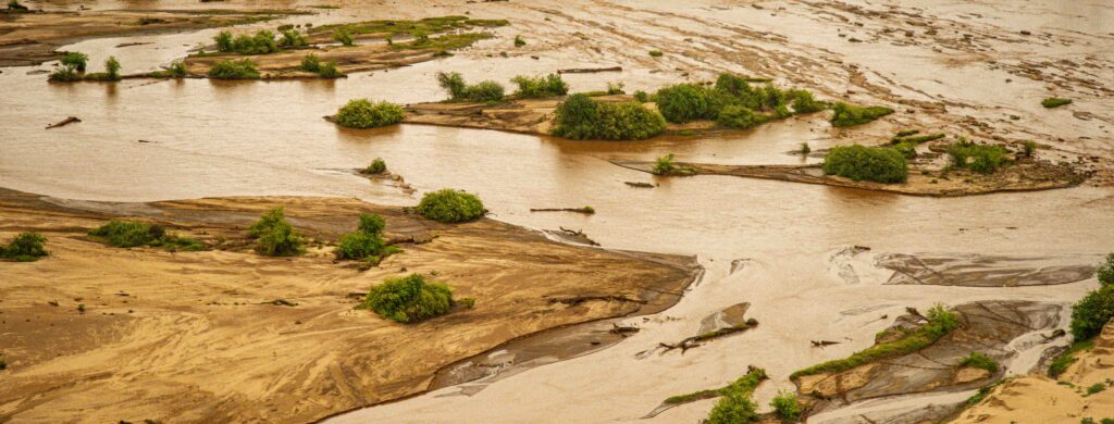
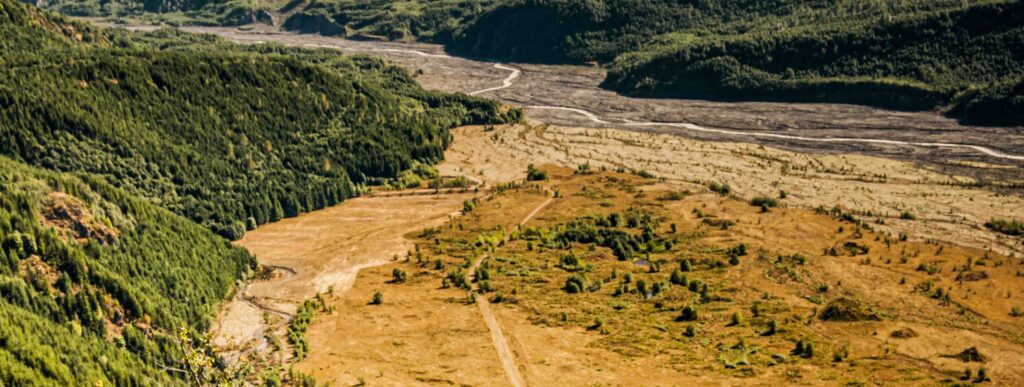
SEDIMENTATION in TANA & GALANA BASINS
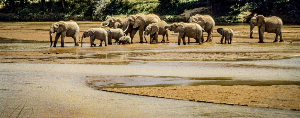
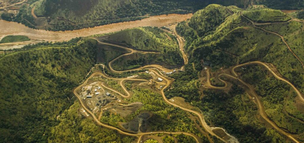
SEDIMENTATION in MARA RIVER BASIN
CHANGING PRIORITIES
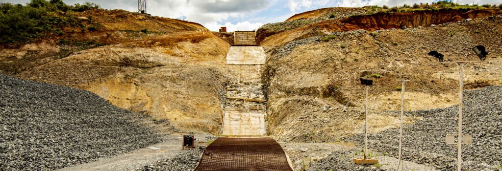
ETHIOPIA’S GIBE DAMS
Key Quote Hey … look in the reservoir and see whether it’s full. Know that even when the reservoir is half filled, its storage capacity is limited, so you’ll produce less power. It will affect your economics…. This assessment opens up many possibilities. –Dr. Thomas Dunne, to Kenya’s Ministry of Water Development
All images © Alison M. Jones, unless otherwise noted. All rights reserved.
NWNL We have just discussed causes, conditions and results of the January 2018 debris flows in Montecito, Mount St. Helens and elsewhere. Now I’m anxious to hear your thoughts, as a geologist and hydrologist, on sedimentation and erosion in California’s Central Valley and Kenya’s savannahs and forests.
Dams, which play a role in those topics, are a big part of our NWNL documentation, which began on the Columbia River. Now Kenya is proposing 52 new dams, nine of which would be on the Mara River.
THOMAS DUNNE The first Kenyan dam was in Kiambu, south of Mount Kenya in a dry area in Machakos County before the Tana River comes south to then bend northward to Mount Kenya and then down the Tana River. When I taught there, they’d just built that Kiambu dam and were planning on 2 more dams downstream.
For my own research, I went into the old paper-and-pencil records on yellow paper from the British Colonial Water Resources Department. I found all their sediment-collection data and flow records, known about by only one old Indian guy who still worked there in the stacks. I calculated sediment yields of all the rivers in Kenya that had been sampled, then amounting to about 70 or 80 rivers.
I concluded that Kiambu Dam’s reservoir must be nearly full of sediment, having read 3 consultant’s reports on building this dam, with references to companies from Britain, Norway and Canada. You’d expect those consultants understood current evidence of rapidly eroding tropical soil. But, they had no clue.
Three countries and three generations set this reservoir’s lifespan, used for economic value calculations, at 100- 300 years. So, I wrote an unofficial transcript report to the Ministry of Water Development with these thoughts:
Hey, you might want to look in the reservoir and see whether it’s full. I think it is, so you might want to think about that and decide to build other reservoirs – or figure out its economics, power, production, etc. Know that even when the reservoir is half filled, its storage capacity is limited, so you’ll produce less power. It will affect your economics. You can also decide whether doing soil conservation in the catchments will be worthwhile,. This assessment opens up many possibilities for you.”
I left to go back to McGill University; and they rehired the same consultants to look at my report with notes I’d studied for two years using Kenyans’ data. I had thought at least they’d get a third opinion. But they were worried, and so they defunded my student’s PhD thesis. Then I trained an African whose PhD thesis I supervised, to take over the courses I’d established on a Rockefeller Foundation task.
My estimate of the dam’s lifespan was conservative. Even more sediment accumulated. It would be interesting to see what they’ve done since, in terms of strategically evaluating their reservoirs. About 2 or 3 years ago, we were in the southern Rift Valley for Christmas with old friends and camping with a private engineer consultant from Nairobi who’d been there for decades. When I arrived, he said, “Oh, you must be the guy whose report is on my shelf.” I asked what had been done since in reservoir development.” He said, “Nothing.” That was 40-odd years ago.
Nothing has been done in Kenya in terms of data collection, analysis or strategic assessment of locales. I imagine those reservoirs are filling up, which is such a ridiculous pity. Why would Kenya waste its money like that? I suppose the answer is that somebody’s on the take.
NWNL That’s a common answer in Africa, unfortunately. Now the Chinese are in Africa building lots of dams, as are the Italians.
THOMAS DUNNE The Chinese have learned about dam lifespans, after the Russians sold dam-building to them in a big way in the 1950’s. The classic Yellow River dam filled up 4 years after it was built. But now, the Chinese have become very skillful at partially emptying sediment from their reservoirs. I haven’t seen those sites, but they tempt me. I would love to go to the Yellow River to see how they’re doing. I don’t think the Chinese are good at emptying out their small reservoirs in Kenya, particularly those with very flashy flora regimes. I think many of Kenya’s dams will be completely wasted.
NWNL Do you think sedimentation in Kenya is greater than in other places? How would you characterize or measure it?
THOMAS DUNNE Well, considered on a global scale, no. Kenya is not eroding more rapidly than other places. Yet there are regions of China, the Himalayas, Nepal, and places in other parts of Africa, that are eroding at a high rate. On a country-wide scale, there are certain areas in Kenya where erosion is very high and is having deleterious consequences.
NWNL What are those specific areas in Kenya?
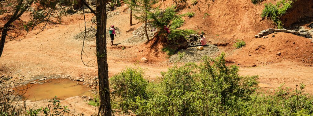
THOMAS DUNNE The eastern catchments of the Galana River and parts of the Tana River are shedding so much sediment towards the coast that they’re destroying coral reefs in the Indian Ocean. In fact, it’s clearly documented that it has destroyed the coral reefs in certain areas. In many other places, erosion is entering into gullies and thus reducing productivity.
Sediment that goes downstream ends up in inland swamps and is not doing a lot of damage. I’m sure locally it’s doing damage to the swamps temporarily, but swamps are long-term accumulations of sediment. Thus, swamp plants have a way of colonizing in the mud when they build out; so, sedimentation there is not an existential threat.
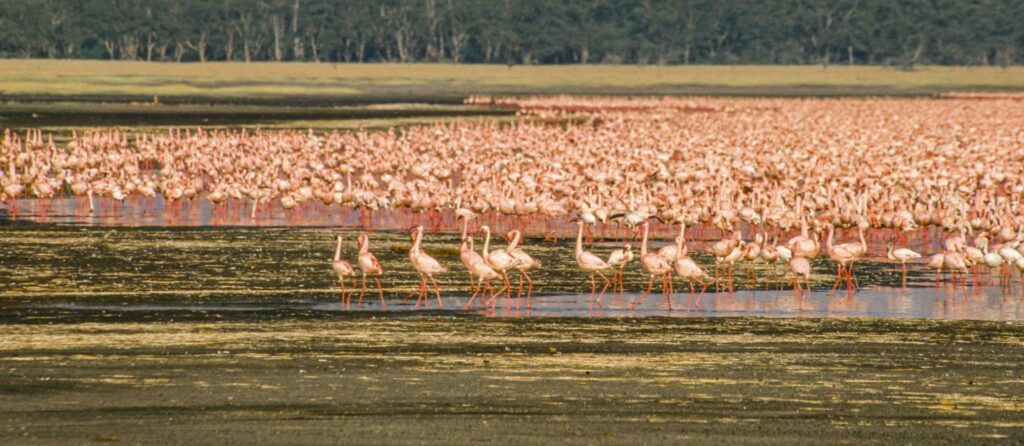
However, certain lakes like Nakuru and Naivasha are being filled with sediment around their margins, making them shallower and causing ecological changes. Of course, the damage to all the reservoirs that are being built is also a cost.
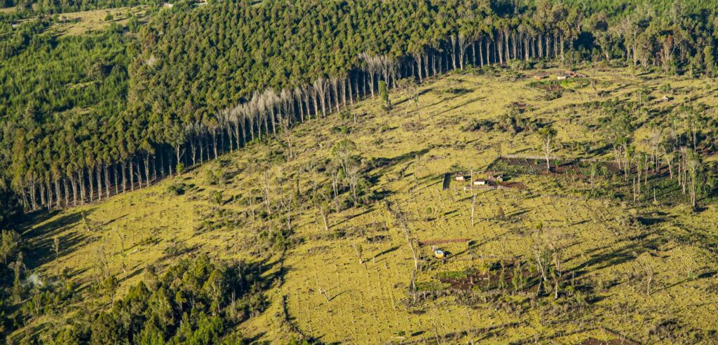
What I’m saying is that there are easy-to-identify regions or locations in Kenya and Tanzania, where there are significant soil erosion problems. I don’t know about Uganda, but I assume they also exist there. I would add that in certain parts of Kenya, there’ve been very successful soil conservation programs. The Swedish government was very effective in the ‘80s and may still be there. They were very effective at introducing good soil conservation techniques and good agronomy practices into areas like the Kiambu district, northwest of Nairobi, and the Nyari district.
Although Kenya still has significant erosion problems in those areas, some progress has been made. Local people, Kikuyus in particular, are innovative, industrious farmers who adopt new techniques very well and are very sensitive to the problem. Soon after independence, conservation was discouraged by the Kenyatta government.
Conservation was seen as a colonial conspiracy to suppress Africans from owning land and cutting up their big estates to give to Kenyans who would ruin them. That was massively incorrect in certain areas, particularly in Kikuyu-land, parts of Muchakos and the southwest of Kenya. I think Kenyans demonstrated that where soils are resistant to erosion that they can be very skillful conservationists.
There are certain other areas where soils are very vulnerable to erosion; but since the land doesn’t have the same value, they don’t invest the needed amount of time and money and don’t do skillful agronomy. Instead, they clear off the brush, plant corn and mix in cattle and change occurs rapidly. There’s long-term degradation of the landscape in places, and much of the sediment from those areas goes down to local rivers that carry it to the Lamu/Mombasa coastal zone.
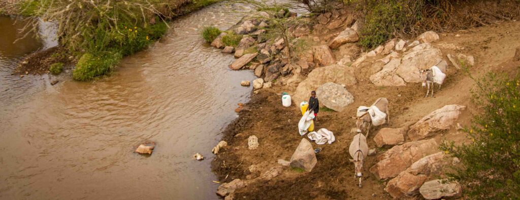
NWNL Since the Mara River Basin is one of NWNL’s 6 case study watersheds, I would appreciate hearing your knowledge of the conditions of the Mara River’s Mau Forest source and the Maasai Mara savannahs.
THOMAS DUNNE In 1971, I had a strategic view of conditions as I spent a year driving around Kenya once a month and twice a month around the Central District and Mount Kenya. I put my bedding roll in my Land Rover and drove and drove and drove to collect samples. I was interested in water chemistry and sediment yields. In that study, I combined old sedimentation records and flow records to create an assessment of the effects of land use on soil erosion, and then the effects of geology on water chemistry.
While that knowledge is largely out-of-date, I did have a recent update when I visited the southern Rift Valley for a while three years ago. At that time, the Mau Forest was intact, but again I’m out-of-date.
The person who has looked more recently at the forest itself is Michael McLean. He works in Holland at an institute whose acronym is IHE, with number of students.
NWNL Ah, his organization is MaMaSe. Its representative attended a January 2018 a meeting in Nairobi I was that was focused on environmental impacts on wildlife and their habitats.
THOMAS DUNNE Mike, one of our BREN students at the Univ of CA-Santa Barbara., also worked with us on the Amazon. We were together in Oxford, 2005. His students in Kenya make hydrologic assessments of land-use change impacts in the Mau Forest and the effects of its deforestation on the Mara River’s flow regime and associated biological communities in the Mara River. He’s an attractive and influential spokesperson, who sits on many UN committees promulgating hydrologic assessments.
NWNL I was at a meeting called by Swara magazine’s publisher, the East African Wild Life Society. Over 20 conservationists working in Kenya and Tanzania, particularly in the transboundary Mara River Basin, discussed impacts of proposed dams and how to address those plans before governments moved forward in their planning. MaMaSe, part of IHE, attended but they are leaving the Mara River Basin. They got an extension to stay just a little bit longer, but they have done an amazing amount of flow studies that are very helpful right now.
THOMAS DUNNE Mike’s an American and a good spokesman. My guess is that he’s still doing very good work.
NWNL I’ve heard that MaMaSe/IHE has been a very helpful tool right now, in the process of commenting on whether 9 new dams on the Mara River would be too much. They will be able to discuss why — if the government will listen.
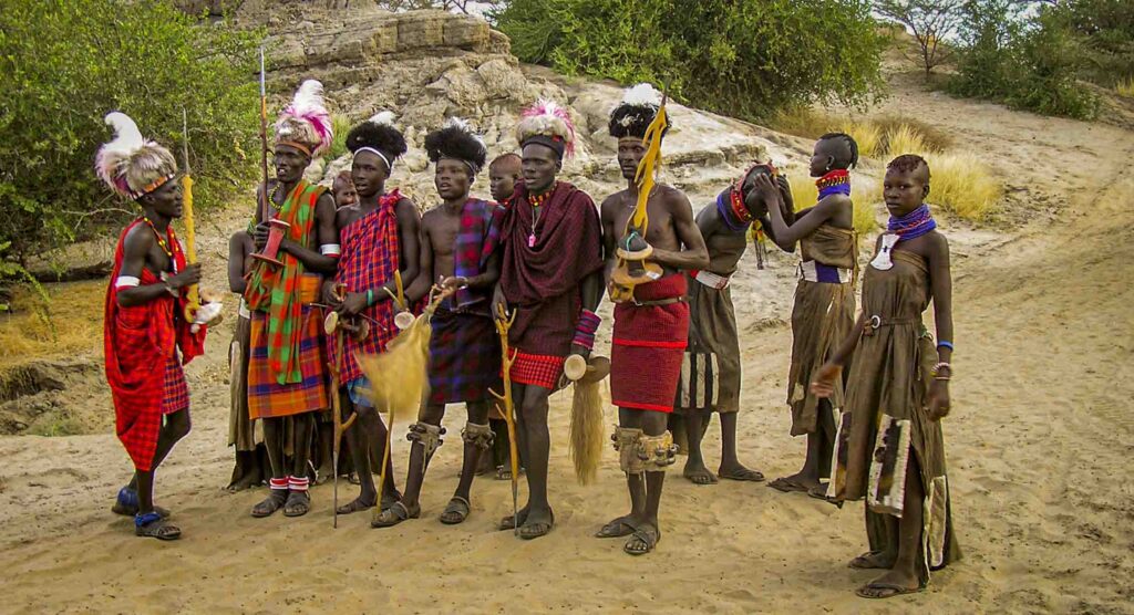
THOMAS DUNNE The people who will suffer are the Maasai in the southern Rift Valley. They’re less politically well-placed, compared to those paying off government to allow deforestation. Kenyan conservationist, David Jonah Weston, introduced me to his Maasai long-term collaborators. They showed me marks where the flow used to come when they walked down the road to school, versus where it is now.
They asked what options they had. Could they get stream gauges to monitor flows? I felt guilty, because giving them technical advice would let them believe they would have leverage. But unless they could work their way up the power system and gain standing with those abusing the resource, I don’t see the purpose of putting in stream gauges, since they can only document that the floods are getting bigger.
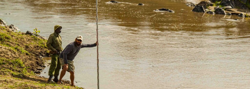
NWNL An organization called GLOWS has been monitoring water flows at the Mara River Bridge at least since 2009. That is being done; but, as you say, will anybody pay attention?
THOMAS DUNNE No, and they wanted to propagate this farther upstream. Like I say, you’ve got to find a way to engage.
NWNL Were these Maasai in Bomet, at the bottom of the Mau Forest?
THOMAS DUNNE No. We were in the southern Rift with Jonah Weston, we chatted with some Maasai, while staying in a tented camp, down in dry terrain.
NWNL And who in today’s government is going to listen to all these stats? The greatest tool of persuasion seems to be tourism dollars coming into the Maasai Mara.
THOMAS DUNNE With Jonah there to help, given his work for African wildlife, I told these people that they have a large Kenya staff and Mike McLean to help them. He could gather resources and create maps to show the flood’s going up at this point, and connectivity between this river and deforestation. That connection conceptually and visually needs to be made. These days people’s familiarity with maps is amazing, probably because of Google Earth, apps that let folks walk around with maps. Now, fortunately we can all utilize this to create maps and illustrate connections.
On Washington State’s Toutle River after the debris flow they built a dam to capture the sediment that’s still coming down 35 years later. Now they’re building it higher and higher. People in the area want it taken out. If they take it out, what will they do with all that sediment that they created? Control strategies tend to be more related to location or hazard specifics.
Government strategies, avoidance, setbacks, zoning, insurance –which has its bad and good sides—and the process of informing people about the nature of the problem are all very flexible. But they’re also more general strategies. The softer the science, the more transportable and usable it is, and the more technical the science, the harder it is. While science may be more critical in certain areas, it’s less transportable and generalizable. My tragedy is that I’m on the harder side.
THOMAS DUNNE The developing world, including the U.S., is now no longer facing that former wave of dam-building. But in other countries we can see that wave still propagating.
NWNL Especially in Africa….
THOMAS DUNNE I always think of Africa, Brazil, Asia, and China in particular, and to some extent, Canada as the development frontier. While my Canadian friends call it the development frontier; it’s only 30 years ago since those huge dams were put in in Quebec, in Labrador, and other places in Canada. When I’m asked to give advice, I say it’s not our position to say that developing nations shouldn’t exploit their resources as we did to create the wealth that they need for other perfectly good reasons.
However, the US can suggest, based upon its experience, to be careful, think, and carefully assess the viability and wisdom of each dam proposal. Right now the modus operandi seems to be carte blanche acceptance of every proposal. In Laos they’re building many dams that are collapsing. It’s forced improved honesty and rigor of assessments in thinking about dam site assessments and the long-term and downstream consequences of that dam site and the propagation of effects of that impoundment on downstream resources.
The economic lifetime of Kenya’s Kiambu Dam is over 100 years. Once they say over 100 years, people stop thinking. Thus, we also suggest ways to design impoundments and hydroelectric operations that minimize bad impacts. One example, from the Chinese, is to examine and design a dam and its reservoir bypass as much sediment as possible so that you a) increase the lifespan of the reservoir, and b) pass sediment downstream for ecological reasons. The third thing we suggest is to do full-cost accounting on building a dam, and to establish how much electricity will be produced. At some foreseeable date, it’s likely there’d be a need to take that dam out. What’s that cost? And downstream costs? Even if it’s hard to do, figure it out.
NWNL NWNL has focused heavily on the impacts of Ethiopia’s 3 new Gibe dams. The Gibe River is a tributary to Ethiopia’s Omo River that fills 90% of Lake Turkana in norther Kenya. Many tribes have lived there for thousands of years, but they were not consulted about the dams’ impacts. Nor were they notified about changes to come. Those Gibe Dams would stop the eons of 60-foot annual floods that they depend on for crops; and with these changes Lake Turkana could become two lakes.
THOMAS DUNNE You’re presuming the long-term equivalent of the Dead Sea, which is still dropping at one meter per year. Now they’re thinking about pumping water from the Red Sea over into the Dead Sea. That would change its chemistry. I’m not vilifying International Rivers opposition to the Gibe Dams. But I’ve known individuals that worked for them who say they’re opposed to every dam-building project that occurs. I think it’s unreasonable to expect some of these countries to ignore their water resources.
NWNL Certainly dams can provide financial profit and electricity for such regions.
THOMAS DUNNE My concerns come from a lack of full-cost accounting and lack of acknowledgement that there will be downsides. Those to be impacted must be told what the negative impacts will be – and how to mitigate them.
NWNL Wise words. Thank you, again for sharing your many observations and experiences.
Posted by NWNL on March 19, 2024.
Transcription edited and condensed for clarity by Alison M. Jones.
All images © Alison M. Jones, unless otherwise noted. All rights reserved.