
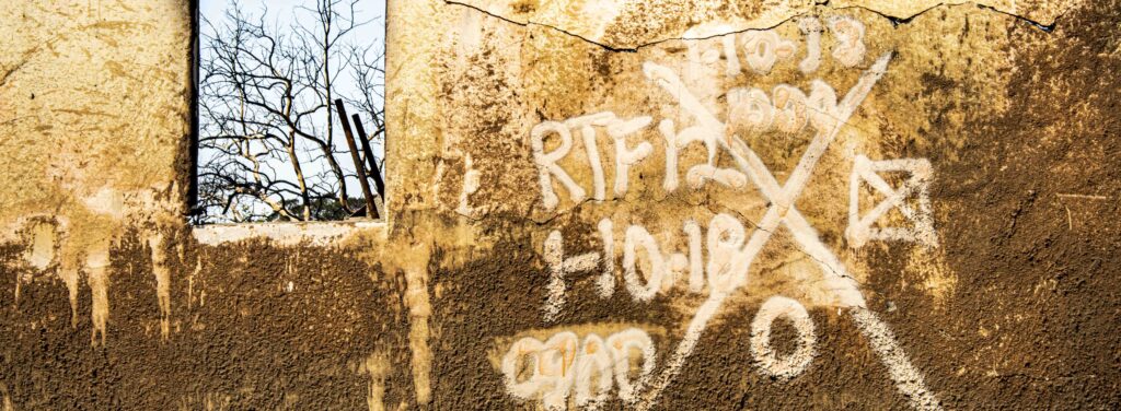
Fire & Debris Flow per Eyewitness
California Megadrought
|
NEW ESRI StoryMaps: What's On Our Shelves & NWNL Song Library & No Water No Life ESRI |
California Megadrought
Marco Farrell
Weatherman, Realtor and Spear fisherman
Alison M. Jones
NWNL Director and Photographer
Marco and his parents have been friends of mine since before the Thomas Fire and its ensuing debris flow (aka, mudslide) that devastated their lovely home on Olive Mill Road in Montecito. Marco was living with his parents to help around the house and in the yard. Fortunately, he was there to help during these twin disasters.
Their first evacuation on Dec. 7 was due to the devastating Thomas Fire. After escaping that, Marco then studied post-burn conditions in the hills above his parents’ home, realizing those newly bare slopes were now very vulnerable to any heavy rains. A deluge arrived mid-January. Marco realized their family home was in its debris path, so he prepared, waited and watched. This deadly “bombogenesis” (aka “rain bomb”) pulled down a torrent of boulders and mud, damaging lives and homes. This is his story.
ED Note: Santa Barbara has faced fires, droughts and floods since at least A.D. 212. The Great Flood of 1914 destroyed Old Town Montecito, Olive Mill Rd (Marco’s address) and Montecito Creek’s path. The wettest year recorded was 1998, when I lived in Santa Barbara. Today, with warmer weather from climate change and more buildings, the damages are even more intense.
LEARNING LOCAL WEATHER THREATS
FIRE ALERT
THE THOMAS FIRE
PREDICTIONS – PREPAREDNESS – EVACUATION
AFTER FIRE: A FOCUS on FLOODING
THE MUDFLOW: PHASES 1-4
ASSESSING THE MUDFLOW
ASSESSING DECISIONS MADE
REBUILDING with NEW GUIDELINES
PREVENTION: ENGINEERING, MARKERS, MEMORIES
TODAY’S WILDFIRES
If you are advised to evacuate and can, go, go, go, go. Even if you survive, the cost of a hotel room is nothing compared to the trauma my parents and I went through. It’s just not. Just go. Santa Barbara was built on debris from mudflow, after mudflow, after mudflow since the beginning of time…. Now, Santa Barbara’s fire season is 12 months. It used to be only 6-8 months long. --Marco Farrell
All images © Alison M. Jones, unless otherwise noted. All rights reserved.
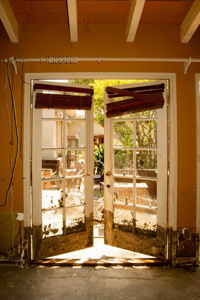
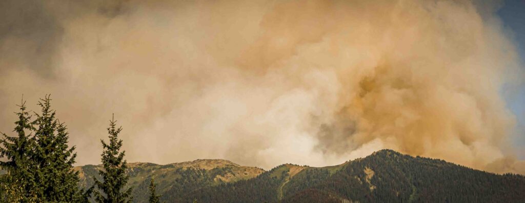
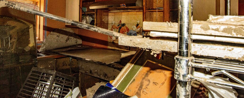
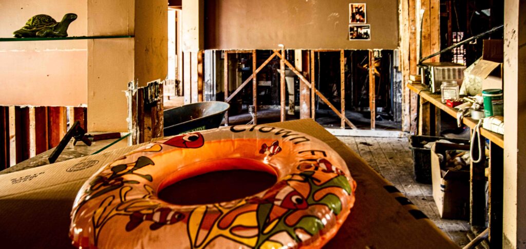
ALISON JONES Marco, you’ve done an amazing job of sharing your recent intense experiences with national and local news outlets. So, I thank you for once again describing the disruptive chaos of the twin events of December’s Thomas Fire and January’s Montecito Mudslide (or debris flow if you’re a geologist). You’ve chronicled deep impacts on your family and many others after the Thomas Fire burned 281,893 acres of vegetation across the hills that stand above your home. That lack of rooted chaparral and presence of its post-fire waxy residue allowed a deadly mudslide to turn your entire community and your family’s lovely home and garden into a boulder- and mud-filled disaster. Four inches of rain carried debris that roared past your home at 30 mph and forced its way through your home and destroyed about 100 other homes.
MARCO FARRELL Yes, through this journey I’ve learned quite a bit about fire behavior and am now very familiar with facts and interviews. I’m a co-host of a nationally syndicated, fishing talk-radio show. I also have multiple Facebook groups – the most popular one being “Pacific Weather Watch” that I started that 5 years ago during one of our stronger El Nino periods to cover weather phenomena, animals new to our area and changes that are prompting more warnings, watches and alerts.
That talk show morphed from an El Nino Watch to a Pacific Weather Watch — and, sadly, now includes fire watches. The show has a worldwide following, but is based on Pacific Coast weather, centered around our tri-county area of Santa Barbara, San Luis Obispo and Ventura.
ALISON JONES Whom do you rely upon for information?
MARCO FARRELL I work with 3 professional meteorologists who share Facebook reports and posts. One’s a bit bullish; one’s a bit bearish. Generally, they meet in between. We now have around 1,500-1,600 members. I think only one post has been questionable, which is rare with that many members posting. One was a little snippy. Other than that, people really play nice; politics don’t really rear their head; and we get to talk about weather.
ALISON JONES Let’s start with your description of an El Nino year….
MARCO FARRELL The El Nino phenomena starts along the Equator where winds generally blow from the east to the west. In an El Nino year, they reverse and blow towards the east, basically from Asia towards Central America. Warm water piles up and then spreads north and south. Once it hits the Americas, it typically brings warmer ocean waters creating effects we call “The Pineapple Express” – sending storms almost straight-line from Hawaii. I’ve seen a single band of clouds often centering around Santa Barbara. It’s interesting.
Santa Barbara, in turn, has a unique geology and topography. Our mountain ranges run east to west, while most mountain ranges in the world run north to south. We have a very Mediterranean climate here; and the Mediterranean also runs east/west.
Typical storms here come down from the northern Pacific and Alaska. They dip down and start with southeast winds. Because of the way the winds rotate, the bands of rain will come from the southeast. They hit our mountains that are so close to the ocean and form an “orographic lift,” where the ground forces the clouds up higher in the air. That squeezes moisture out of those clouds, so we tend to get heavier rains in our hills than we do in our coast, even though it’s just a few miles away.
Typically, El Nino brings heavier rainfalls. What we experienced in the past 5 years of El Nino’s was called the “RRR,” standing for a “ridiculously resilient ridge” of high pressure that pushes all low-pressure storms – that would normally be rainmakers here – up and above us. Thus, they hit in Oregon, Washington and further north. They talk about how the “big blob” of warm water in the Pacific plays a large role in forming this “Ridiculously Resilient Ridge.”
ALISON JONES I believe the term “Ridiculously Resilient Ridge,” aka RRR, was coined by meteorologist Daniel Swain.
MARCO FARRELL Yes, we depend on all nuggets of knowledge. My nuggets come from David Pu’u. He’s Hawaiian, a professional surf photographer, and a meteorologist in Ventura, just south of Santa Barbara. David’s forecasts and observations not only use the latest and greatest satellite imagery, but sometimes he gets information that isn’t supposed to be public, that’s hard to find, and not readily available. He also talks to village elders and farmers. Regarding both the fire and the mudflow, just one day ahead, he predicted their arrival here within about five or eight minutes.
He knows what a plump acorn on the ground means, versus a skinny acorn on the ground…, and what typically will come days, weeks, or months after that. He’s an amazing soul.
There are common threads that weave through all our stories. I knew David while growing up and we’ve together photographed time lapses of fires and their fantastically dynamic, beautiful and incredibly destructive pyro-cumulus clouds. Even though he’s a professional photographer, I’ve helped him in a real give-and-take with some technologies I’ve learned. Although it’s a master/student type of relationship, we both deeply appreciate and respect each other.
MARCO FARRELL Whenever a fire pops up, either David is on the horn to me or I’m on the horn to him. For instance, within 5 or 10 minutes of the start of the Santa Paula Fire, 42 miles away from here, I saw it on Facebook and called him, saying, “There’s a fire in Santa Paula with 60+ mph winds and these unheard of single-digit humidity, as low as 3%, 2%, 1%.” Normally, those humidity levels don’t exist here.
He lives above Ojai’s mountain and the 33 Freeway, so he set up a camera. Ninety minutes later he was evacuated, even though it was 20+ miles away. He called later that night to say, “Watch out. It’s coming for you in Montecito.” That fire, named Thomas Fire, started 42 miles away; and I’d never been concerned about a fire that far away. The next day I visited our local Montecito Fire Department to talk to a fireman there. A certain energy was already buzzing around the firehouse. Their trucks were either deployed or about to be deployed to fight this “beast” in Ventura.
I told the fireman about my friend’s warning that the fire would come to Montecito. We looked at a big topo map and talked about how fire behavior goes down valleys slowly and up valleys very quickly. There were dozens of valleys between us and the fire. We had a few days of bad weather, but after that we thought we could put a hurt on the fire. My fireman friend said, “Prepare if you feel like you need to, but I just don’t think we’ll be dealing with it being so far away from where it is now.”
Almost 2 weeks later, I was “sheltering in place” at my house with over 800 gallons of water in containers, 2 gas-powered water pumps, 2 electric pumps. I had checked all my contingency plans. A friend gave me a bit of guidance and thought I was fine being here. We had over 100 different palm trees in Mom’s incredibly lush garden. Some of her palms were very expensive to maintain. If not pruned every year or two, dead palm fronds tend to accumulate and become “ember catchers.”
I had gone to my parents’ home on Olive Mill to fight the fire, but not to put out the fire’s front, per se. I was here just to put out any embers ahead of the main fire front. That can be critical since that’s how a fire establishes itself – sometimes 1 or 2 miles ahead of the main fire line. My role was to watch those trees and catch any embers that set the fronds alight.
I spent the next week-and-a-half preparing our house to be as fire-resistant as possible. My parents and family evacuated with my dog. I stayed here by myself, getting ready for this battle. The fire was forecast to hit at 6:00 am. It came very slowly, creeping up from Ojai and Ventura along our front range.
ALISON JONES Was it then more fuel-driven or wind-driven? Had the wind died down?
MARCO FARRELL We had periods of wind; but for the most part, it was fuel-driven, although there were periods of accelerated winds.. But it was so large! The smoke and wind patterns made it almost impossible to fly any aircraft over this fire. That made it very challenging to get aircraft up when we could have really made a hurt on the fire.
Keep in mind, we’ve got some of the most aggressive pilots here who fly air-attack helicopters at night, which is unheard of in the world. They are brave angels who go out in the most horrendous conditions to try to save lives and property. I stayed up all night with my set up of a couple of time-lapse cameras.
Sure enough, right at 6:00 am, the wind went from dead calm to blowing at 60-65 miles-an-hour. That’s when the fire absolutely blew up – but in an interesting direction. It went east, unusual for here. We normally get northeast or southeast winds; but straight east was the biggest blessing.
Several miracles have happened through this whole journey.
There were over 300 fire engines in our wildland-urban interface – a new designation marking the spaces where houses meet forest. For the last 5 to 10-20 years there’s been a big push to increase defensible space around homes, primarily within the wildland-urban interface.
Those spaces are de facto fuel breaks, but not typical fire-line breaks where a bulldozed road goes straight up the spine of the mountain. To create a defensible space around houses, we’ve all aggressively cleared any plant growth 50-100 feet from a house. Every spring, the town offers free pickup and chipping for cut-down shrubs and trees. It’s an important community effort to prevent these wildfires that we now see every 10-20 years.

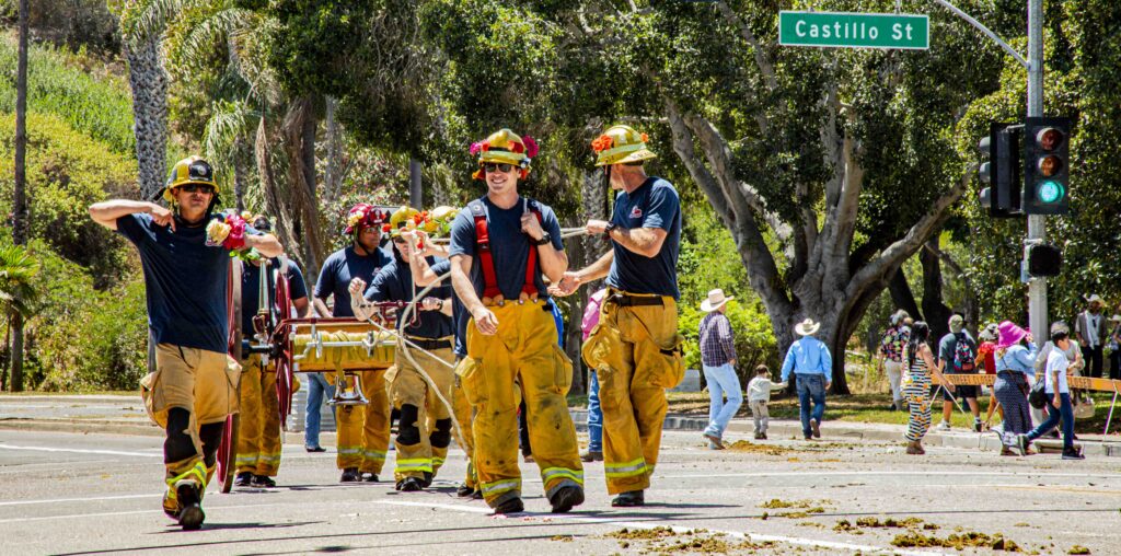
The big miracle that happened was the wind that came up at 6 am. We had over 9,000 fire personnel from across all western states – and as far away as New Zealand. The fire team’s shift change was at 6 am. Thus 300+ fire engines came at that hour of danger to replace fire engines that had been there all night long.
But nobody left their post. Thus, two teams were there as the fire conditions dramatically worsened. Perhaps because of that, only 10 houses were lost or damaged. That was an absolute miracle. Watching from down here, I’d expected all Upper Montecito – hundreds of homes – would be gone. I was stunned when I heard the final number. Some real heroism occurred. The fight against the Thomas Fire fight was vicious. Firefighters dealt with low water pressure at times. The most vicious battles involved extinguishing balconies’ flaming eaves and real hand-to-hand combat with this beast.
ALISON JONES Did the Thomas Fire generate its own weather, as is happening today with the Carr Fire in Monterey?
MARCO FARRELL Absolutely. We had many pyro-cumulus clouds and some dry lightning. On the day the fire blew up, it passed by Montecito and went into the upper reaches of our front country to create some terrifying fire tornadoes. Luckily, no lives were lost in that sector of the fire. When up in the wild country, it was uncontrollable for a while, but fortunately it didn’t affect any homes. The fire finally died down, allowing lift evacuations for over 9,000 people.
ALISON JONES That’s basically the entire Montecito population.
MARCO FARRELL Yes. I “sheltered in place” behind police lines to help to the best of my abilities. I shared that I was prepared with the sheriffs and the CHPs (Coastal Highway Patrol officers) who manned the roadblocks. They needed lights and bodies to make sure no undesirables were entering the neighborhood.
ALISON JONES Marco, you were the right person at the right place. Where did you get your background to be so prepared?
MARCO FARRELL It came from a place of helpfulness. I was never a Boy Scout. I didn’t learn preparedness. I normally show up whenever needed with buckets, baskets and milk crates full of help. I just want to help my community, so I’ve learned how to be prepared. The best way to help, in my opinion, is to get people out of the way of trouble.
ALISON JONES Since I happen to know your parents, I suspect your family background is part of that answer. Your father is a swimmer who knew how to prepare for the Olympics. Your mother is an artist with a special caring soul.
MARCO FARRELL Yes, that is so. I’ve also spent time on boats as deckhand and as captain of my own boat. Those experiences have been vital to my preparedness and to handling unbearable stressors while keeping a calm head. When you’re on a boat with shit hitting the fan, you must focus on the task at hand, solve the problem and remove yourself from that situation. You don’t have a chance to panic.
ALISON JONES Before we get to your experiences in the debris flow, I want to follow this thread of preparedness for those of us without your background and boating experiences. What is your best advice to such people facing crises?
MARCO FARRELL If there is time – and that’s the critical part of my answer – learn everything you can. I watch videos to learn as much as I can about what we may face, especially on YouTube. When we knew a storm would directly hit us, I spent 3 days studying and watching videos on mudflows, debris flows and flash floods. Thus, when I was 3 blocks away from my house and heard structures failing less than a mile away, I immediately knew what it was and that I needed to go home and rescue my parents.
ALISON JONES You took predictions of the risk of a debris flow seriously. In contrast, many said, “It’ll never happen here.” How do those who’ve never experienced anything like this, know when to take predictions seriously?
MARCO FARRELL That’s a loaded question, because I’ve seen what happens when evacuations are put in place, but nothing happens. I’ve studied such reactions on Facebook. It erodes confidence in experts who decide to mandate evacuations. For instance, if I must leave and have 3 cats, 4 dogs, and 6 kids, I’ll need 3 hotels rooms, kennels, this, that, and the other. If nothing happens, it’s a huge stressor and a seemingly wasted expense that makes any of us less likely to evacuate the next time.
ALISON JONES Thus, in the face of possible floods and debris flows, that happened to residents worn down by the recent Thomas Fire evacuations. About 2 weeks later, homeowners faced predictions and preparations for intense rains that could start deadly debris flows from the hills since all stabilizing vegetation had just been burned.
MARCO FARRELL All Montecito residents had 10-14 days to prepare for evacuation as the Thomas Fire approached. But the debris flow evacuation warnings went into place only 3 days before the rains came.
Given these events, we now have a new protocol for evacuation warnings on a hard and fast timeline: 72 hours, 36 hours, 24 hours; and then 12 hours before the event there’s a hard evacuation in which you can’t come and go. Within 3 hours they’ll close the freeway. Different decisions will be triggered by different timelines.
ALISON JONES That evacuation protocol was created by experts, geomorphologists, and weather people who were all worried when the Thomas Fire was still in Ventura.
MARCO FARRELL Right. They made a lot of good decisions. They put in good “mutual aid” staging to help. On January 9th, hundreds of firefighters were here to help seek, rescue and evacuate residents. But, as they admitted a few months after the debris flow, the mistake then was that they planned for a storm that hit Carpinteria.
They didn’t plan for the storm to hit Montecito, nor for such extreme rainfall totals. Had the lesser rains that hit Carpinteria hit us, our upper debris basins would have been impacted; but not necessarily have overflowed or even filled. In that scenario, the only real danger would have been to people living above East Valley Road and from Upper Montecito up to the wildland/urban interface.
“Monday-morning quarterbacking” reveals that it was wrong to use the words “voluntary evacuation.” Many hundreds – maybe thousands – of people didn’t evacuate out of Montecito. We’re moving away from that “voluntary” option, because it has different implications for a first responder or expert versus the public that often responds, “I don’t have to go, so I’m not going to.” Rationales included, “I’m tired,” or “I’m broke;” also, “Insurance hasn’t paid me for the hotel rooms that I just paid for during the fire,” and “ I don’t think there’ll be that much rain.”
ALISON JONES Marco, you’ve survived the hours before, during and after the mudslide. I’ve seen its damage to your lovely home. I want to respect what you’ve gone through, and certainly understand if you don’t want to go through that again.
MARCO FARRELL It’s ok. Since Day One – even during the fire – I’ve made my disaster experience public to help other people understand. Even beforehand, when there was an accident, an incident or fire, I went to take pictures that I’d put online as soon as possible. But once Facebook Live started, I could do citizen reporting. About 4 or 5 years ago, I started staying behind fire lines – not in the way of firemen, but to get to know the firemen. I wasn’t forecasting or sharing my opinion of what happened. I just show what happens.
During the Thomas Fire, people in China on business thanked me for posting on Facebook Live. Seeing that fire on CNN, it seemed the whole town was burning; but they could see my reporting that the fire was in the foothills and thus their parents’ house wasn’t in danger at that moment. I take the role I play very seriously. I don’t prognosticate or tell people what to do. Even firemen don’t do that. That’s up to fire scientists and behavior-ologists.
ALISON JONES That’s been and continues to be a great service to your community. On the night of the debris flow, you were with your parents, reporting from your Olive Mill Road home.
MARCO FARRELL Yes. My parents had evacuated during the fire and were exhausted. Evacuation fatigue, like evacuation denial, was a very serious factor for many people here. As the flood maps are drawn, we’re at a little bit lower elevation than our neighbors across the street, although they are in closer proximity to the creek. Evacuation lines are drawn on the flood zones, so those neighbors were in a flood zone, but we were not. They were evacuated, but we weren’t.
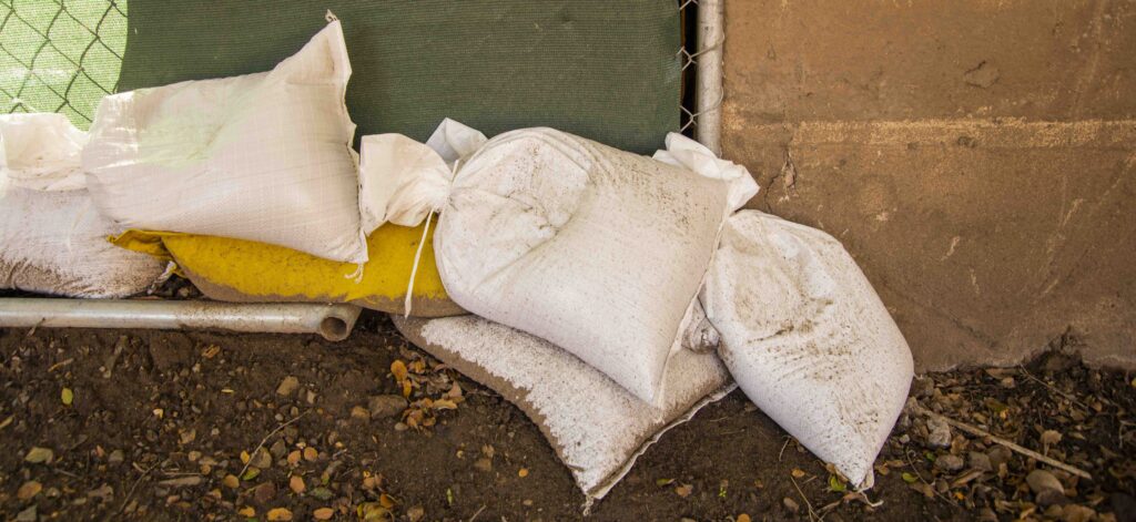
On the morning before the fire blew up, my firefighter friend had texted me a warning, “Fire dragon has awoken. It is coming to ravage our town. Be safe.” Now we had an official 72-hour warning, triggering Fire Departments to open up sandpiles and provide sandbags. I care for our property and 3 neighbors’ properties, so I spent 3 days filling hundreds of heavy sandbags by hand and moving them.
ALISON JONES I’ve sandbagged on the Mississippi and learned to fill them halfway, due to their weight and so they can lay flat, leaving no open pockets for water to leak through.
MARCO FARRELL Right, a seal forms from one sandbag to the next, to the next, to the next. I decided to only pile two sandbags up against water from the street. Anything above that I couldn’t reinforce. If higher than 3, structurally they must be doubled or tripled, basically creating a pyramid. I didn’t have those resources. Plus, if flooding was higher than that, no efforts would be effective. Sadly, that was true.
We thought this would be a water-based, flash flood. Predictions mentioned debris and mud; but the warning was for a “flash flood,” not a “debris flow.” We didn’t have debris flow warnings then. We will now. In fact, there had never even been a mandatory flash flood evacuation.
ALISON JONES Never a flash flood warning here in Montecito or Santa Barbara?
MARCO FARRELL No. It wasn’t a thing, because our creeks handled floods; and if they overflowed, it was just water. Once, a doctor was killed in a Sycamore Canyon flood, but nothing was done to change things.
ALISON JONES That man was home in bed on the 5-point roundabout when I lived here!
MARCO FARRELL Yes. But despite that, there’s never been mandatory flash flood evacuations here. This was new ground. The Fire Department had hundreds, if not thousands, as personnel staged at the fairgrounds and high points around Montecito. They knew how bad this would be.
I watched videos on my breaks from sandbagging. I took my parents out to dinner at dusk, and then filled one last load of sandbags. I have photos and video of my parents sandbagging from 9:00 to 9:30 pm the night of the flow. On a national meteorology channel Skype interview (10:00 or 10:30 pm), I introduced myself and described my preparations. The meteorologist concluded, “Well, it looks like you’ve dodged a bullet. Looks awful dry out there.” My jaw hit the ground.
I said, “No, no, no, no!” It was very awkward, since this supposed expert said everything was okay. But I answered, “These are horrendous conditions. We don’t know what’s out there. It’s a very dry kind of rain now, but there are fingers of clouds that are incredibly, incredibly energetic, full of energy, full of moisture, that will eventually come over us.” I added it was critical that folks listen to first responders and evacuate when told.
My fire department contact messaged me about midnight, saying, “Be careful. If they tell you to leave, you must leave. There will be life and death conditions before dawn.” I told my parents our “evacuation plans” were that if we had 2 inches of water in the house we’d move to the studio which was a bit higher in elevation than the house. If water got up there, I had a tent with sleeping bags up on the hill at a much higher elevation. There, we’d stay dry and warm until dawn. Those plans were based on what we knew the day before.
At 12:20 pm, I was exhausted from 72 hours of intense work. It was time to rest. It was in my head that I’d do battle before dawn. I wrote on Pacific Weather Watch:
The Fire Dragon has left us with burned hills above. Now his cousin, the Water Dragon, is here to menace us. We do what we can to prepare, and then get out of the way for him to do his thing. Not much rain now, just steady on and off since dark, more off than on. But the Water Dragon is swirling in the Pacific. Until dawn begins to chase him away, we will feel his fury. Be safe, my friends. Be aware. No more time to prepare. The southeast winds are beginning to gust. A big cell is offshore headed our way.”
That was a little over three-and-a-half hours before the mountain came down on us.
I went to bed, having laid out my clothes so I could get out of bed and fall into sweats, raingear, and boots. Everything I’d learned in the Thomas Fire came into play. I set up LED lanterns about the house to create light zones. I had headlamps which were critical. My GoPro camera was charged. I went to sleep.
Sure enough, about 3:42 or 3:43 am, I woke up to the most horrendous rain I’d ever felt. It was so hard it shook the house. I run 6 sump-pumps for the 4 properties I manage; so I got up and put on my boots and raingear to check those pumps.
I walked out to a bright orange glow with blue pulses of light! In my exhaustion, I couldn’t figure out why the sun was coming up 2 hours early and 40 degrees from where it should be. It didn’t make sense. It was coming up in front of the mountains. Nothing made sense. I’d never felt such horrendous conditions.
Feeling the energy in the air was critical, I went to my parents’ bedroom to say I was just going to the street to see what the orange glow was about. I promised myself I wouldn’t even go across my sandbags. I walked out; but I couldn’t see what was creating that glow.
The next thing I knew, I’d stepped over the sandbags to go just to the middle of the street. I logged onto Facebook Live to document this orange glow and walked up the street. In the back of my head, I told myself I was walking to my death. It was weird. It was Twilight Zone. I really felt like I was walking to my death. That’s how critical the conditions felt.
ALISON JONES What made you walk that way?
MARCO FARRELL I was a moth to the flame. I had no control—it was almost like an inner dialogue. Yet, using Facebook Live, I walked towards those flames like a zombie saying, “These are horrendous conditions.”
David Pu’u was awake because he knew it would hit any minute. He saw me logging onto Facebook and yelled at me on his phone, “Get out of there! The mudflow’s coming!” He knew that orange glow was a ruptured gas main created by fire, at about a 5-mile higher elevation. It crossed the creek right below the San Ysidro Ranch, just below a critical debris basin.
ALISON JONES I just photographed remnants of a Montecito home burned by that fire, with only its chimneys left.
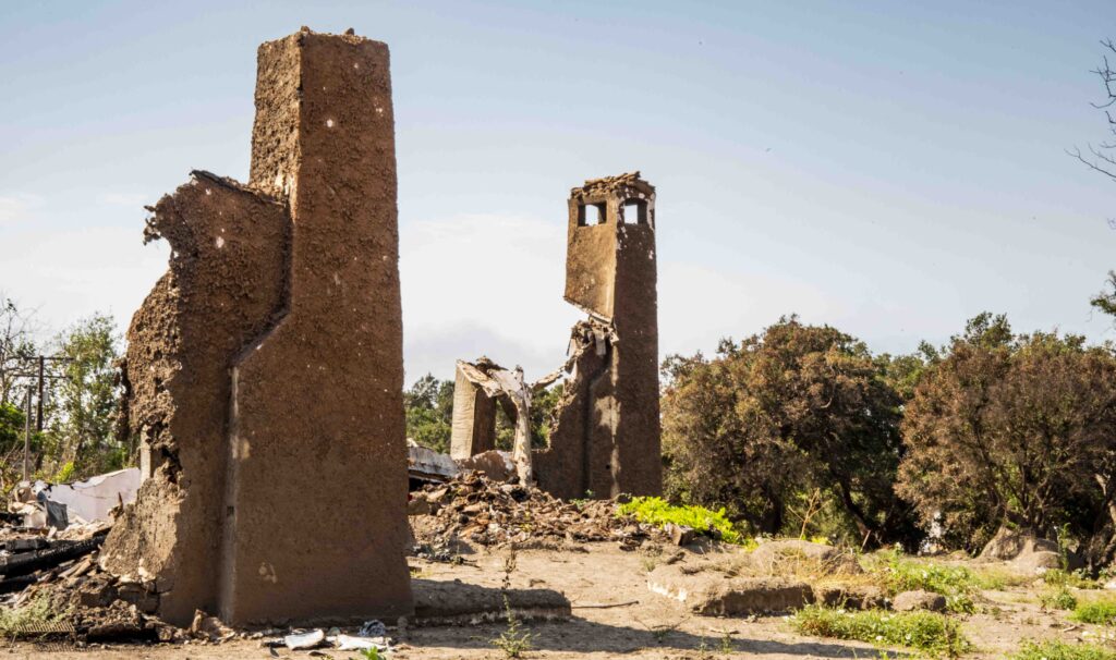
MARCO FARRELL That’s right above that destroyed bridge they’re now rebuilding. There are several bare building pads left that held homes either burned or incredibly damaged. One house had 23 boulders come through the roof, opening holes while someone was in the house. I’ve heard those homes had flames that were 300-400’ high.
ALISON JONES There you were, mesmerized by a fire as the debris was headed your way….
MARCO FARRELL Yes, I joined Mark Olson, good friend and neighbor ½ mile away. We roamed around behind evacuation lines to get better photographic views. Whenever something bad happens, we get together to go try to help people. He’d called, interrupting my Facebook Live. I said, “Dammit, Mark, I’m on Facebook Live!” He warned, “There’s fire in the hills and I’m coming to get you.”
I know he’s hard-headed and wouldn’t listen, so I said, “Please be careful. These are the most horrendous conditions I’ve ever seen. Please, please, please be careful.” Then, the mudflow hit me and stopped transmission. Mark thought I’d died. He said to his wife, “Marco’s gone.”
I kept walking up the street to get eyes on where this flame was so I could decide whether I should evacuate my parents away from potential fire. This was the most torrential rain I’ve ever felt; yet fire was lighting up the whole neighborhood as clear as day. On the periphery of my vision, people were walking like zombies down their driveways doing what I was doing — just looking up.
Then I heard it.
The best way I describe that moment is to invoke the sound of a trash dumpster upside down and being dragged along on asphalt or concrete. It was the metallic groan of a structure failing. Because I’d spent so much time watching mudslide videos, I knew exactly what was happening. Even though I didn’t hear the flow for another 20-30 seconds, I knew what would happen.
I sprinted home as fast as I could to get my parents, yelling, “Flash flood! Flash flood!” I tried to alert anyone near me and wake people up. I was about a block-and-a-half away from home when I first heard the mudflow’s rumble. I was terrified that I couldn’t cross Olive Mill Road to get home; but there was barely any water in the street, even though the rain was torrential. I ran across the street. Looking back up the street, I could see all the way up. There was nothing there. Then, suddenly I saw headlights on a black-and-white law enforcement vehicle bearing down the street.
It’s interesting how the mind works…. For almost 2 months afterwards, I thought I had run all the way home, just making eye contact as the officer went by. But I was sprinting home when their dash-cam came on. Two CHP (Coastal Highway Patrolmen) drove onto the mudflow, floated around in a total miracle, got traction again with their wheels facing the correct direction, and drove off the mudflow. That’s when they saw me.
The mudflow was a few hundred yards behind them, and they were accelerating. Although I really thought I had run all the way home, the video shows me walking. Seeing that video triggered me into remembering my decision that if I ran, they might not stop to tell me what was happening. But if I walked, they’d tell me what’s happening. So, I did make eye contact with the CHP.
The car came from behind and passed me. They slowed down a little bit, and with eyes locked on me, the CHP reached down for his microphone and yelled, “Go, go! Don’t stop! Go, go, go.” Then they were gone,. I was a house-and-a-half away from my home. My mom was in the driveway. I yelled to her to get inside.
The mud was coming. I used my phone as a camera. I wanted to see what was coming and maybe film it. It all happened so fast. As I looked down the street, I saw headlights of a white van. Mark was driving towards the mudflow and literally met me in front of my house. He pulled up a few seconds before the mud came to my property.
The whole time I yelled, “Get out of here. Get out of here. Go, go. It’s right there!” Looking at me through his car window, he couldn’t hear me. He couldn’t see because of the rain. He was wondering why I was so frenetic. Finally, it dawned on him. He put his car in reverse and mashed on the pedal. In maybe less than 2 seconds, the mud hit.
I escaped into the house with no time to spare. One second later, the flow would have cut me off from the house and killed me. Fortunately, I got into the house and slammed the door shut.
That began the third phase of this disaster.
I woke up Dad. I yelled at my mom to wake up, as I tried figure out how we’d survive. This was “Go!” time. This was the battle. Mud splashed against the house. I decided not to open the front door and instead opened our back door onto our back yard. That ended up being the decision that saved our lives.
A big, long wall about ½ mile above our house failed. Those tile blocks were square and about twice as thick as a cinderblock. They broke down our kitchen door. Mud then flowed throughout the house. Having put lanterns in the kitchen, on our dining room table and in the piano room, I didn’t have to leave my little “safety zone” to assess what was happening in the house.
The mud rose from knee-high to thigh-high. I went into survival mode to keep my parents alive – and my dog. Many things went right for us to survive. Tiny factors and little decisions made days before played huge parts in our survival.
A few years before, we’d replaced our old TV with a big-screen TV. The new TV’s box was out in the driveway to be picked up. It was full of that Styrofoam we all hate. A couple weeks earlier, after the fire, I said, “I don’t want anything combustible anywhere near our property.” I arranged for a large-waste pickup and put that foam-filled TV box out in the driveway. Unbeknownst to me, just before the mudflow, my mom snuck it back inside because it didn’t look nice. She put it in that hallway. When the mud hit it, the box flopped over, and became a raft! I was able to put our old, 3-legged Border Collie on it so we didn’t have to worry about him.
Just an absolute miracle. I could then just focus on our survival.
There were 3 distinctive flows. each with a different sound. The street sound was very mechanical, with sounds of grinding, of cars being mangled, of telephone poles breaking, shattering and moving. A different flow came down from driveways above us. Things were hitting our uphill garage wall and the house. The house was shuddering and moving. Everything was deafeningly loud as trees, logs, big debris hit the house. I mostly feared a structural failure with us trapped inside.
Behind the house – opposite from the side attacked by the flow – there was much less debris noise. Instead, there were wet garden noises, as if you smacked a palm frond down onto water. It was the sound of all my mom’s landscaping being destroyed.
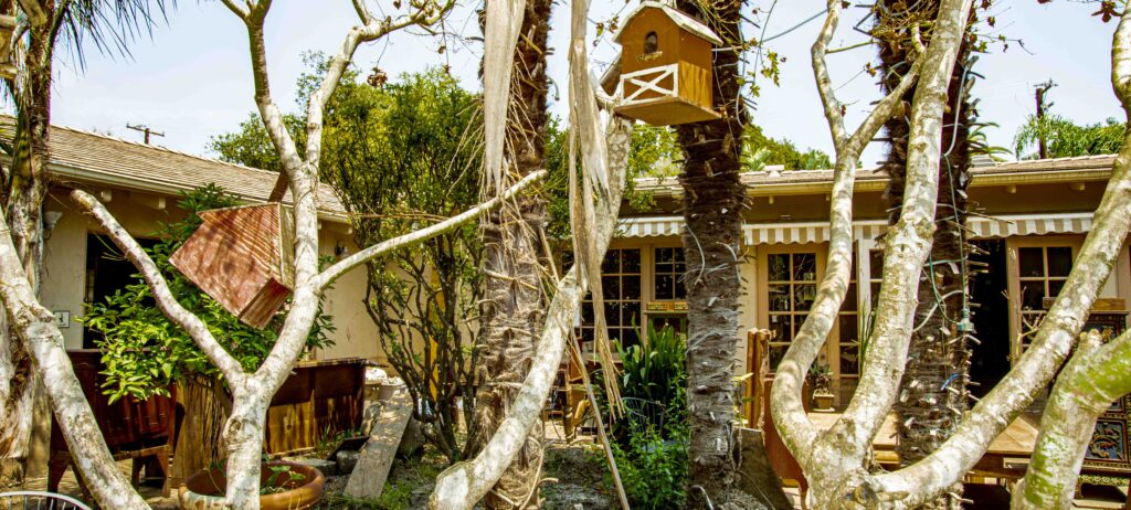
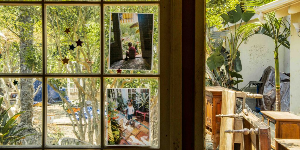
ALISON JONES Oh, that backyard held your mother’s magical garden of winding paths, hidden reading nooks, and tea tables tucked under exotic leaves and blooms.
MARCO FARRELL Yes, there were 100 palms here. Maybe 18 or 20 survived, including 2 that a tree trimmer was due to cut down the next day. We’d also booked a floor guy to refinish our floors and our kitchen cabinets. Little did we know that we would be doing both those tasks, but at a much different pace and much later.
Back to the moment …. the mud level went up quickly. It went over the kitchen counters. Debris stacked up between the kitchen and our dining room and created a waterfall that I video-ed.
ALISON JONES Where did you shelter?
MARCO FARRELL We stayed in a hallway to the master bedroom. No structure failed in the master bedroom. Mud flowed in through the kitchen door and our garage, right past me and out the back door. Had I not left the kitchen door opened inwardly, the mudflow would have built up pressure, and a catastrophic failure somewhere would have sucked us all out. As well, we might have had structural failures. That open kitchen door was lifesaving.
MARCO FARRELL The height of the mud went down, but the flow in the back continued for the entire time of the debris flow on the street. I went out back when the rain let up for a ½ hour or so. Then it started falling heavily again. I worried we’d get a secondary flow that could kill us. We’d survived the first one; but we might need to get to higher ground if there was another. Looking through the open kitchen door, I saw my neighbors pacing around in their driveway, as if bored. It was the weirdest time.
ALISON JONES They are closer to the creek, but higher than you in elevation?
MARCO FARRELL Yes, they’re a few feet higher than us. It just didn’t make sense, because if the flow was just water, they’d be flooded as well, but flowing mud doesn’t act like water.
ALISON JONES Is where we are now on Olive Mill Road the original creek bed?
MARCO FARRELL Yes. I’ve always been told it was an ancient creek bed.
ALISON JONES Did FEMA ever call it that?
MARCO FARRELL No. I just had heard it from older people in the neighborhood. I think it was a 98-year-old neighbor who’s since passed. who said this was an ancient creek bed. I think they diverted the creek to accommodate the Hidden Oaks neighborhood.
ALISON JONES Where is the Hidden Oaks neighborhood?
MARCO FARRELL It’s across the street and up from us – where I went that night and then ran back from. It’s a cul-de-sac development connected by Santa Elena Lane, San Benito Way and Santo Tomas Lane.
I’ve also heard that the creek originally met the shore of the Santa Barbara Channel where the Coral Casino and the Biltmore are now. Geologically, that makes sense because the creek has to flow there due to the hill behind us. My understanding is that when they put in the 101 Freeway and surrounding development, they diverted that creek. It makes sense because today the creek turns away from its naturally-formed downhill path and goes into a partially concrete channel. I also have anecdotal evidence.
ALISON JONES So that’s why it currently flows down via a concrete channel.
MARCO FARRELL Yes. Before the mudflow, part of my preparation after the fire was to drive around and note hazards. I took Dad on a 2-hour drive around our wildland-urban interface identifying key issues, noting the 90% and 100% burn rates of vegetation in most of our canyons. There was nothing left on those slopes – no twigs, no trees, no stumps. There was nothing left – only huge, exposed boulders. I saw them as potential energy, just sitting there. I sensed it wouldn’t take much for them to roll downhill.
After considering that scenario, my dad and I visited the Hot Springs Road bridge over Montecito Creek about half a mile above us. It turns a bit left and then goes into a short bridge. I said to Dad, “This is where a heavy downstream flow will fail. The energy will come screaming down the hill and face this dogleg. But it’s just going to want to go straight.” Sure enough, that was the failure point. But I was thinking of just water and maybe some logs.
Neighbors on the other side of the street from where we then stood were saved by escaping to their home’s second story. They said the creek never filled up, as did volunteer first responders communicating via walkie-talkie as this happened. Given the intense rainfall, they were stunned that the creek was dry. “What the hell is happening? The creek is dry. The creek is dry!”
Suddenly, a small drain that feeds into the creek became a mudflow across the creek against the other side. The first responders could tell something massive was happening. They left their station by the creek and evacuated. I timestamped that mud hitting my house at 4:01 a.m. It seems we evacuated out the front door to the street between 5:30 and 5:34. A state firetruck from Santa Maria took us to my office, a few blocks away.
ALISON JONES In your warnings and efforts to raise awareness, do you face the fine line between scaremongering like the boy who cried wolf too many times versus sensible advice?
MARCO FARRELL Yes, but I must share what I see and must advise, “If you can evacuate, go, go, go, go. If you stay and survive, you’ll realize a hotel room’s price is worth nothing compared to the trauma. Just go.” What my parents and I went through was not worth any hotel costs. I’m a huge proponent of getting out.
We had a yellow-and-red map of different risk levels. Then one of the volunteer First Responders came out with a great, humorous map to get folks to evacuate. He stated, “If you are in the red or the yellow zone, get the fuck out.” His funny “Get-the-fuck-out Map” went viral, served the purpose of telling people to get out when warned.
ALISON JONES I hear Senator Salud Carbajal has underlined the need for helping the elderly through fire and mudslide events. Would you get your parents out next time?
MARCO FARRELL Absolutely – and yes, we had collateral damage with the elderly due to the mudslide. I’ve heard from 9 to 17 residents from the Casa Dorinda retirement home didn’t survive the fire or mudflow evacuations. They just were so weak or traumatized that they couldn’t survive moving to a different care facility.
This touches the fact that fire evacuation is different from flash-flood evacuation. The warnings are different. With fire you can see the smoke. You can see it coming, so they put early warnings for the elderly, the slow-moving, the large animals, the people with 12 cats, the woman with the donkey…. Those communities are now factored into the voluntary evacuation phase, typically 48 to 72 hours before the fire risk is near.
ALISON JONES You can see and smell fire and coming, but unfortunately not mudslides or unusually intense “rain bombs,” as Al Gore has named these intense rain events.
MARCO FARRELL Right. This rainstorm brought a little over 4 inches if I remember correctly. The problem that it happened in such a short period of time. It was a “bombogenesis.” I don’t know if that is the same as a “rain bomb,” but the few rates of rain that were able to be measured were absolutely “off the scale.”
We had just over half an inch of rain in five minutes at an elevation of 100 feet. That was a half-mile from my house. The valleys and mountains above us typically get at least twice – if not 3 or 4 times – as much rain. This time, it may have been 6 times that amount of rainfall just 4 miles from here – due to orographic lift. [Editor’s Note: An “orographic lift” occurs when a cloud is forced against a mountain and moves upwards in altitude. Those functions squeeze more moisture out of a given raincloud than if it had just stayed at the same altitude.]
MARCO FARRELL It was so scary and so traumatic. We lost 23 people, dear members of our community, neighbors and family members.
ALISON JONES Yes, and I know that in documenting your eyewitness account of the disasters you faced, you are honoring those losses and others’ lasting traumatic impacts. I hope that sharing your assessments increases awareness of the impacts of drought-driven wildfires and increasingly destructive weather events.
The more we all know, the better prepared we can be. The mission of FEMA (Federal Emergency Management Agency) has been to create new map with hazard zones for 100-year storms. Has FEMA published the anticipated June “recovery map” here?
MARCO FARRELL Yes. And to clarify, the bombogenesis we faced that precipitated the mudslide is no longer called a 100-Year Storm. It’s a “1% Storm.” It may seem to be semantics, but its an to improve how people consider the terms’ implications.
If we call it a 100-Year Storm, without accompanying scientific or statistical knowledge, people will say, “Well, we had one this year, so we won’t have another one for another 99 years and won’t to evacuate anymore.” Thus, scientists changed that term to a “1% Storm,” meaning there’s a 1% chance it will happen again. Terminology offers important distinctions to improve the general public’s grasp of risks and dangers at hand.
Thus, terminology changes can help make sure mistakes don’t recur. We’re all facing new ground, not just the general public. Those in power used to say to do something – and we did it. Then that no longer worked in certain circumstances, and mistakes were made.
For instance, in the Fire Department or law enforcement culture, it used to be you did what you were told – almost a military-type situation. You didn’t question the chief because he knew more than you did. But the culture has changed. Now we review incidents; discuss mistakes made and why; and we can question decisions made. Good questions are encouraged.
ALISON JONES So on-the-spot decisions that counter previous instructions are now encouraged?
MARCO FARRELL Exactly. An open frame of mind allows responses to differing or rapidly changing climatic conditions. We understand weather patterns as well as we used to; but weather conditions have changed.
ALISON JONES And our weather patterns are different due to climate change?
MARCO FARRELL Yes. California’s expenditures for wildfires were in the dozens of millions. Then, about 1990, I believe, it went up to $147 million, and it’s never dropped. Now it’s about $500 million per year.
ALISON JONES I understand FEMA maps now sets its flood elevations based on new topography. On average, how much higher are the new elevations?
MARCO FARRELL There’s no average increase. It depends where you are. Generally, they want you to build 2 finished floor levels, with the first floor 2’ above new base flood elevations.
ALISON JONES What does “2’ above the new base flood elevation” imply for Montecito?
MARCO FARRELL That’s a complex question. My base flood elevation runs between 82-86 feet from one side of the property to the other, so we must build 2’ above that. But I don’t know how high we are right now. I get different elevations from different apps and other sources, so we need to get a survey. It’s likely we’ll need to go up 3-5 feet for our finished floor level.
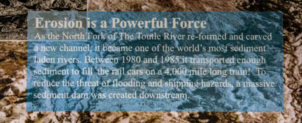
ALISON JONES Tom Dunne has lectured on the mudflow and studied the hydro-morphology of Montecito and the San Ynez Mountains. He’s also an expert on the Mount St. Helens’ Toutle River debris flow after the volcano blew. [Editor’s Note: Washington State’s Toutle River flows into the Cowlitz River, a tributary to the Columbia River in the Pacific Northwest.] His talk reminded me of my documentation of the Toutle River’s changes due to the Mount St. Helens eruption. That entire area is now St. Helens National Volcanic Monument, a park with an interpretive center, signage and docents explaining the volcanic flow and its impacts.
That park is a much bigger area than your village; but it seems to me there could be a similar educational zone dedicated here. Montecito’s flooded San Ysidro Ranch cottages are already being rebuilt right on same creek’s edge. That seems crazy to me. Wouldn’t it be great if instead that little area became an educational riverside preserve, with signage noting the power of nature and debris flows and a dedication to those lost in the debris flow. Haves there been any suggestion for a buffer area and interpretive signs there, using wider creek setbacks?
MARCO FARRELL You’re touching on several factors.
ALISON JONES Yes: protecting lives and homeowners’ investments; open space for the public; environmental restoration with native vegetation; acceptance of weather extremes and climate change; and education.
MARCO FARRELL If those damages had hit average homeowners, there might be a different response. But folks in Montecito can easily afford to rebuild and will. FEMA isn’t needed there.
ALISON JONES I understand. On the East Coast, many suffered huge damages from Superstorm Sandy. I’ve talked with some rebuilding their Jersey Shore homes that were wiped to the sea. They tell me, “Yeah probably another Superstorm Sandy will come by in 5 years, but I want 5 years of more fun on my own beach.” That’s fine for them, but we all pay for FEMA to insure those homes and give them funds to rebuild. Also, those homeowners endanger first responders trying to rescue those folks.
MARCO FARRELL We face a losing battle when dealing with ego, businesses, and big bankrolls. FEMA unofficially indicated that if your property is red tagged in an uninhabitable zone, they’ll give you 75% of your property’s pre-flow value. But Santa Barbara County and FEMA are trying to turn such areas into a public-use parks to be deeded non-buildable for eternity.
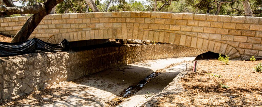
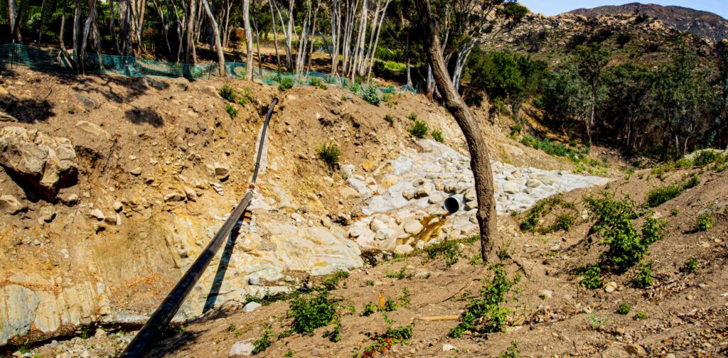
ALISON JONES You mentioned the Upper Debris Basin. Walking up along San Ysidro Creek, I saw what seems to be a new spillway dam and a pipe downstream that it crosses. What is that?
MARCO FARRELL That’s not new infrastructure. It’s a debris basin built to catch big boulders that line the parking area above. Probably originally built between 1930-1950, it allows water and fluid to continue down the water course, because since there’s a bridge there, fallen trees can’t pass and thus clog the river laterally. In a nutshell, that’s how a debris basin works.
The Army Corps of Engineers came in after the 1964 Coyote Fire to address that debris basin and put in a few others, including the one in Carpinteria.
We moved here in 1980, and I read the Army Corps of Engineers’ report on the 1969 flood after the 1964 Coyote Fire. It has a picture of our driveway full of mud and debris and there’s a picture of a big, bent gas line. That gas line didn’t blow, but it did bend. History has repeated itself.
The Japanese have weathered storms, earthquakes, and tsunamis since the beginning of their time. They have placed “tsunami stones” up to 20 feet high, above tsunami highwater marks. The stones pass on that history with survivors’ names and quotes such as, “To have a long and happy life, build above this spot.” Their wisdom is that it takes 3 generations to forget a disaster. I know this mudflow. My 4-year-old niece knows this mudflow because she saw our house filled with mud. Her kids will hear about the mudflow. But it will be ancient history for her kids’ kids.
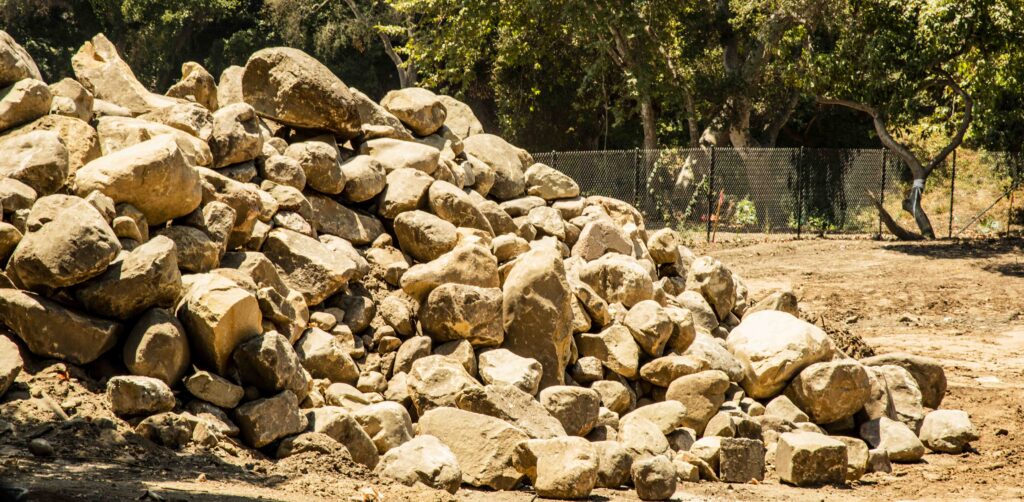
Santa Barbara is built on the debris from mudflow after mudflow after mudflow since the beginning of time. We used to have a big pile of rocks, because every time Mom wanted to plant a big tree, there were always rocks the size of grapefruits, watermelons and pumpkins in the way. These rocks fed into our knowledge that we were in ancient creek bed. That’s true everywhere in Montecito, I’m thinking of now using 40 big rocks, up to the size of a small cow, as our new decorative landscaping.
ALISON JONES Marco, if you rebuild 4’ higher here and have insurance, will you be safe in a similar future flood?
MARCO FARRELL Yes, because I won’t be here. We will evacuate.
ALISON JONES But you will invest in rebuilding your home right here?
MARCO FARRELL Absolutely. This is home. This is sacred ground for my family. Now I realize what “sacred tribal ground” means to Indigenous People. This is sacred ground to us. We want to rebuild, with proper preventions and new knowledge. Maybe we’ll put our yoga studio up on our hill to which we can evacuate. As I wrote that day, you do what you can to prepare, and then you get out of the way. Whether it’s here or the Nile Delta, home is home.
ALISON JONES I guess that “big picture” comment is the perfect conclusion to our chat. Looking around your garden, I see yellow daisies blooming. Where did they come from?
MARCO FARRELL We don’t know. They weren’t here before.
ALISON JONES I remember so well, the magical beauty of this garden with little twinkling lights your mother strung throughout, and the surprise of finding a boule court in the back.
MARCO FARRELL Shangri-La.
ALISON JONES Yes, it was a Shangri-La in Montecito that you mother created. How much of the reason that this is now just random yellow daisies on dried mud is due to climate change?
MARCO FARRELL I’m not attacking the environmental movement; but many of its policy changes aren’t based on science, but instead what we want, or think is right for ourselves for now.
Last year, environmental groups 25 miles from here didn’t want a fire road cut or maintained. How much of the responsibility for fires that we’re experiencing now is due to that? There’s no right or wrong answer. There are many variables. We fought to save the spotted owl by stopping logging. We’ve prevented fires with prescribed burns. Now we have a forest density that’s not even conducive to the spotted owl. We’ve created conditions conducive to the bark beetle, and now we have hundreds of millions of dead pine trees.
Climate change is a huge part of all this; but so is policy change. We’re removing people from the forest. We are preventing and closing logging roads and fire roads. We’re preventing people from living in the forest who’ve lived there for generations in ecologically sound ways that make sense for that area. It’s hard to ask that question and not sound like an NRA gun-running soldier who hates all environmentalists. These are difficult questions. But I think we all need to look at unintended consequences. That’s the key term.
ALISON JONES Yes, we need to open doors for each other in order to stop future disasters.
ALISON JONES Back to the role of climate-change droughts and extreme heat in causing today’s fires…. Right now, California is fighting the Carr Fire in Monterey and the Ferguson Fire in Yosemite. Monterey firefighters told me, “This is about extreme heat and climate change, and we’d better start discussing that.”
MARCO FARRELL Firefighters’ battles have changed, as have their job description. I don’t know if they’d choose their careers today, knowing the intensity of battles they now face. It’s much more like warfare now, instead of putting out a fire.
ALISON JONES The Santa Barbara News Press quotes fire experts saying “It’s not about weather. It’s about climate change.” If this is the new norm, how must we change?
MARCO FARRELL This is no longer “the new normal.” This is “the normal.”
ALISON JONES Normal is climate change, drought, dryness, no water, no life. Vegetation dries up and dies. Fire comes. Homes burn.
MARCO FARRELL Yes. Looking further back, I see the Chumash Indians here burning 25% of the hills every year to reduce the fuel load. We have folks today who a very well versed in local plants, plant restoration and invasive species which the Chumash didn’t have to deal with. But the Chumash knew which seeds only germinate when heated or burned.
ALISON JONES Santa Barbara County firemen say prescribed burns remove the chaparral, and that today’s invasive grasses that move in to replace chaparral lack its deep roots. Certainly, that speeds up erosion and intensifies the probability of more debris flows….
MARCO FARRELL That’s been observed in the San Ysidro Watershed. But the chaparral will come back and overtake these new grasses. I think not having prescribed burns plays a huge factor in this. We need to remember we live in a semi-arid desert.
Another issue is we’re building closer and closer to areas that traditionally burn, but we’re not taking proper preparations. That has only made this situation worse. We must create proper fuel roads, proper prescribed burns and proper fuel management.
ALISON JONES And there are fewer prescribed burns due to encroaching urbanization into that wildland-urban interface.
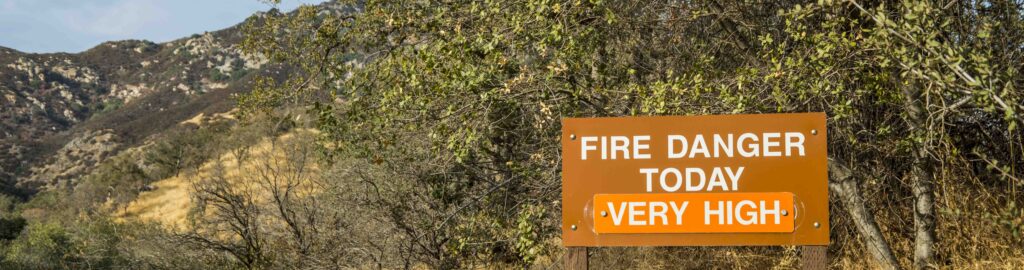
MARCO FARRELL Yes. Another issue is greater evaporation in the non-fire season creating fire season 12 months a year now. It used to be only 6-8 months long. In the “off-time,” we licked our wounds, repaired equipment, sought funding for new equipment, trained, and set prescribed burns. Now, we have no time for any of that.
Growing up, we never have thought we’d have a raging fire the week before Thanksgiving. We’d never have thought I’d be on a boat in the ocean on May 5th watching our city burn. May is the end of rainy season, when grass was green. Things are changing.
ALISON JONES Climate change has made fire a national issue – and you are at Ground Zero.
MARCO FARRELL Change is everywhere. Who’d imagine huge fires in Kansas?
ALISON JONES We just had a waterspout in Brooklyn NY. In that rain bomb, I saw sewage come up through run-off drains onto streets due to NYC’s outdated combined storm-sewer overflow infrastructure.
MARCO FARRELL I saw a YouTube film of a snow “bombogenesis” across Santa Barbara’s foothills last August that almost killed 2 people on the beach as winds went from 0-80 mph.
We’re certainly facing warmer waters. There was a near-Category1 hurricane that sputtered 100 miles offshore. We’ve never had a hurricane in California; but last week, water in Orange County was 81º, increasing the likelihood of hurricanes hitting California now.
ALISON JONES You don’t need that after all you’ve been through!
What is next for you and your family?
MARCO FARRELL We need to present information to our insurance and wait for the FEMA map to tell us how high we need to go. Then we can estimate costs. The process churns very slowly, then speeds up.
ALISON JONES Will you need to take down and rebuild your home? Are its walls too weak?
MARCO FARRELL I don’t know. There are new slumps in the roof I didn’t notice a week ago. So, structurally, we may not be able to save it.
ALISON JONES Marco, I hope for the best for you and your parents. I respect your knowledge, concern for others, and experience. I greatly admire your resilience. This fascinating conversation will be valuable in many ways. I give you a big thank you.
This No Water No Life conversation with Marco Farrell is posted with greatest respect for the 23 members of Montecito’s community, neighborhoods and families lost to the debris flow, and honors them and those who will always mourn them.
– Alison M Jones, NWNL Director
Posted by NWNL on March 9, 2024.
Transcription edited and condensed for clarity by Alison M. Jones.
All images © Alison M. Jones, unless otherwise noted. All rights reserved.