
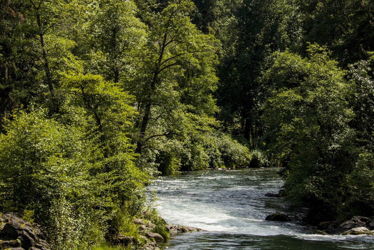
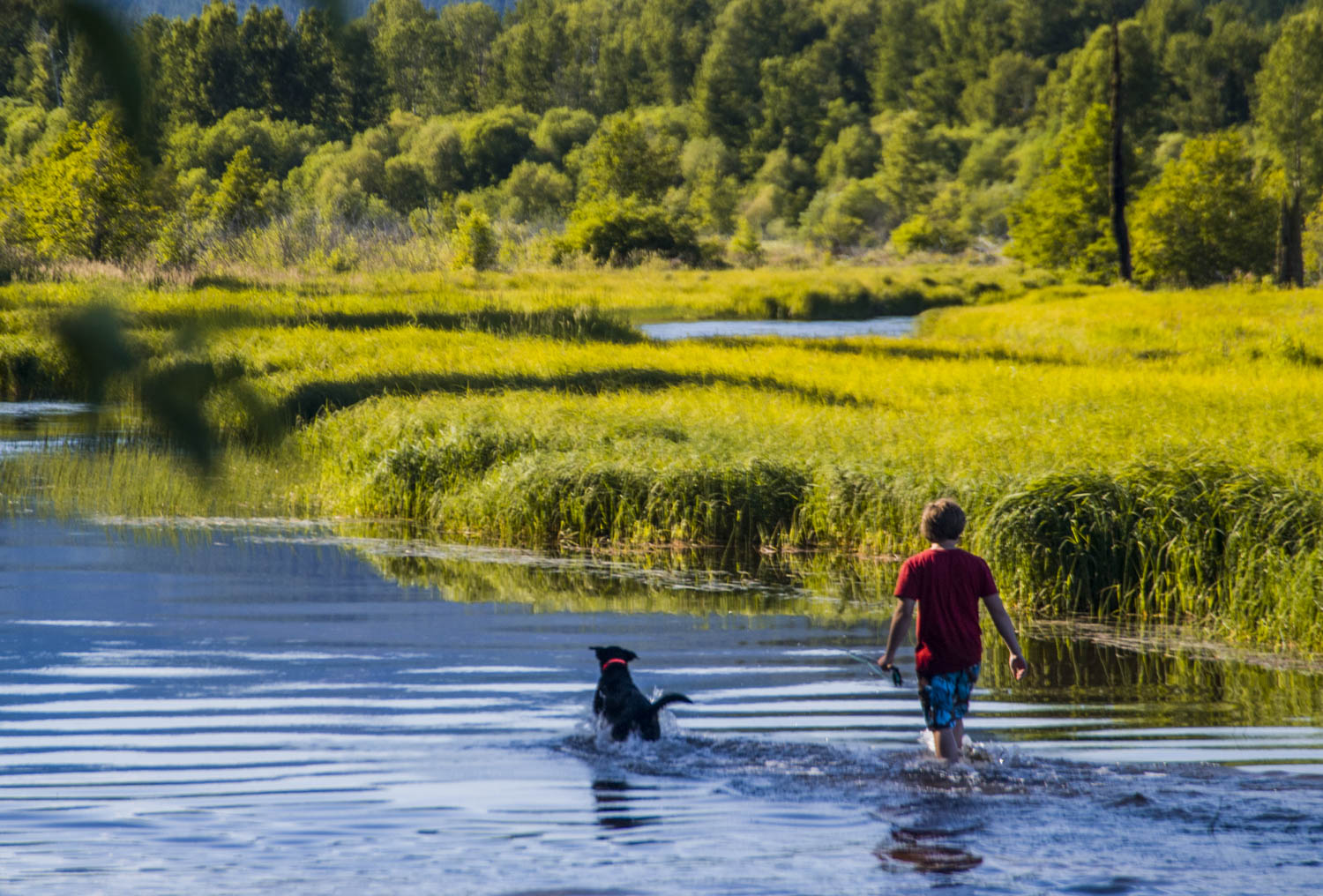
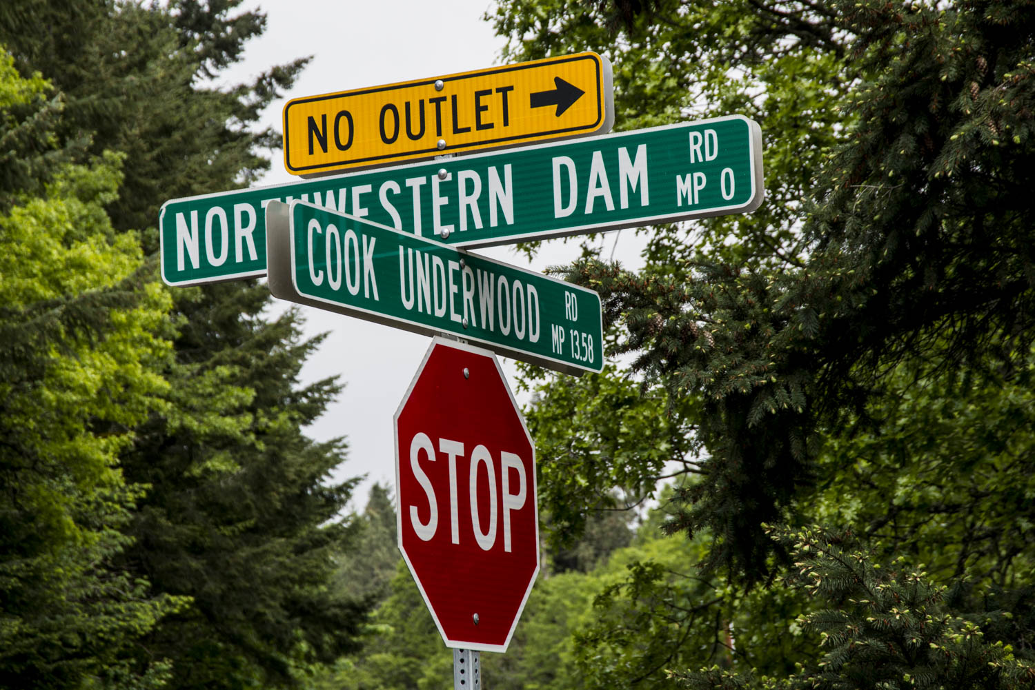
White Salmon River
Columbia River Basin
|
NEW ESRI StoryMaps: What's On Our Shelves & NWNL Song Library & No Water No Life ESRI |
Columbia River Basin
Pat Arnold
Friends of The White Salmon River, Pres.
Jim Wells
AmeriCorps, Local Director
Alison M. Jones
NWNL Director and Photographer
The White Salmon River Basin
The Condit Dam: Its Condition & Future
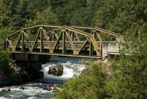
Husum Falls: Rafting & Salmon
Climate Change: Glacial Recession
The Value of These Wetlands
Grassroots Stewardship
The Value of This River
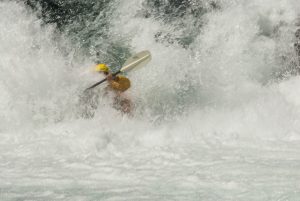
A Kayaker’s View – Jim Wells
Addendum: After The Condit Dam, 2014
All images © Alison M. Jones. All rights reserved.
In 2007, we met Pat Arnold and Jim Wells on the White Salmon River, 3 months after a report on removing the century-old Condit Dam.
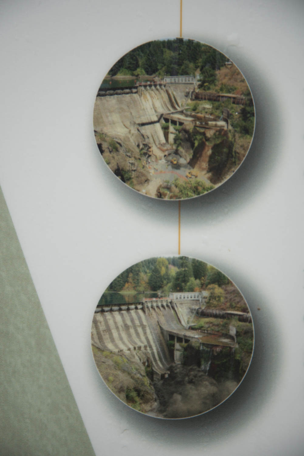
In 2011, 700 tons of dynamite released the dam’s sediment and waters from Northwest Lake. American River’s clip shows 38 secs. of this explosion. Pacific Power’s 17-min. clip includes the dam’s history. Columbia Riverkeeper’s 9-min. clip has aerial and ground footage.
In 2014, NWNL visited the White Salmon River to see the restoration in Northwestern Park and a free-running river where salmon, steelhead and lamprey can again migrate upstream to spawn. Photos from our 2014 visit are at the end of this interview.
NWNL Hello, Pat. Thank you for meeting us here, about 3 miles above the confluence of the White Salmon and Columbia Rivers. How would you describe The White Salmon River Valley?
PAT ARNOLD This is a rural, agricultural, timber and resource-based valley. We log and we farm. They are our traditional industries. In this voting precinct there are about 500–600 people. Upstream in Trout Lake, there may be 700–800. Downstream in White Salmon, there might be 3,000–4,000.
NWNL What is the source of this White Salmon River tributary to the Columbia River?
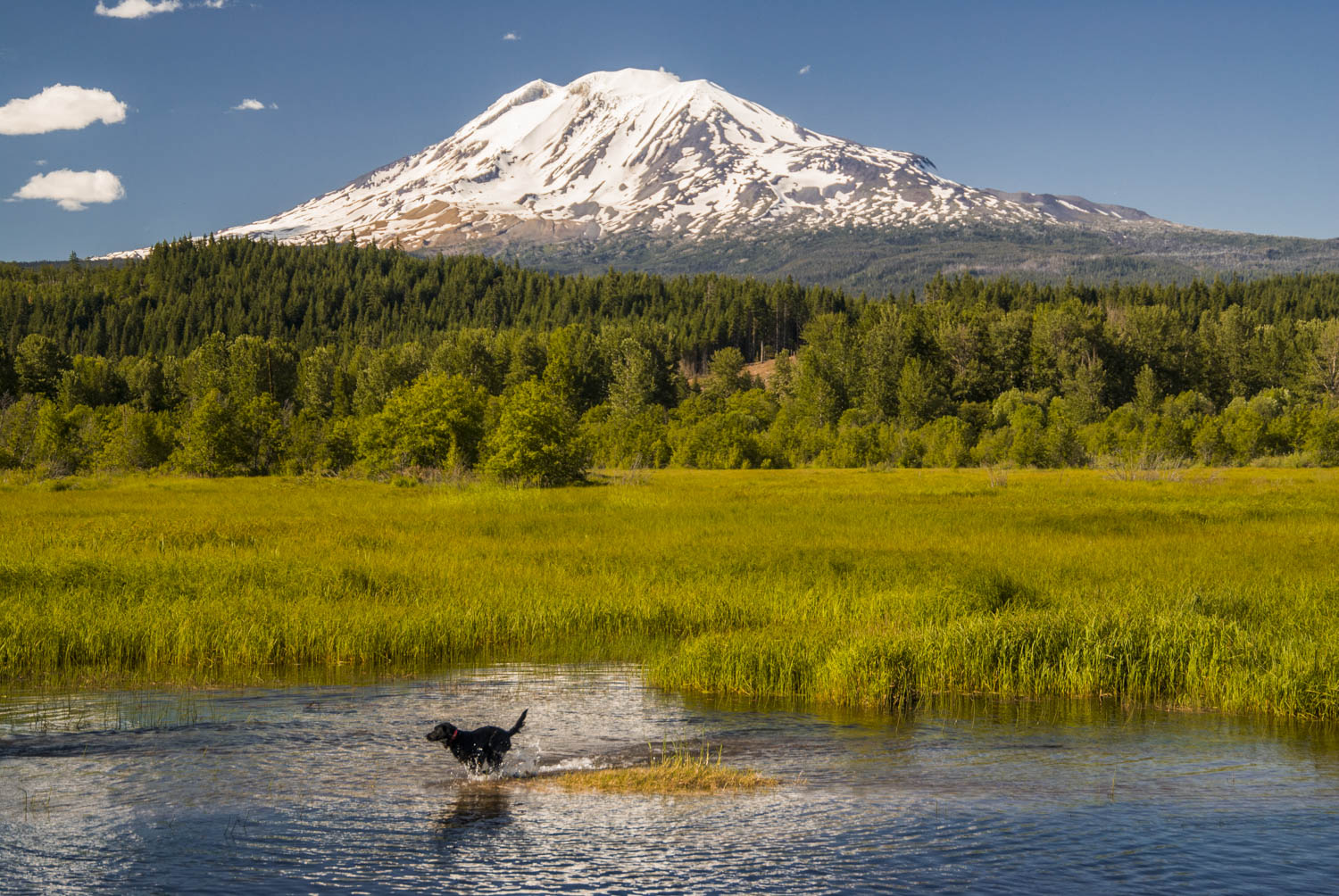
PAT ARNOLD The White Salmon River has glacial origins, with springs that essentially come from glaciers. The river today feels the effects of reduced glaciers on Mt Adams. A recent conference, put on by a local mountain-climbing group, focused on the disappearance of a local glacier.

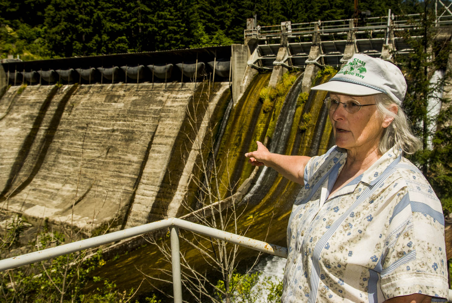
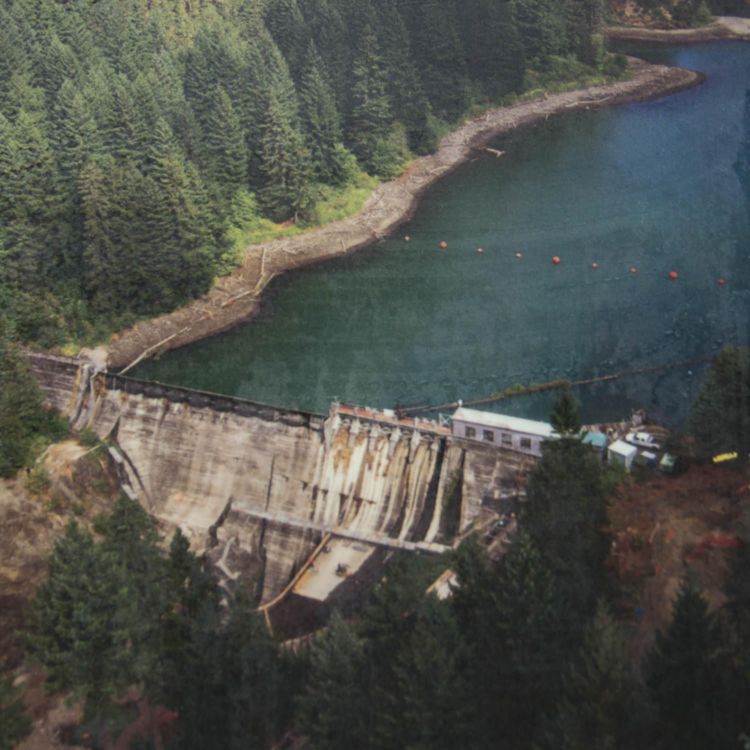
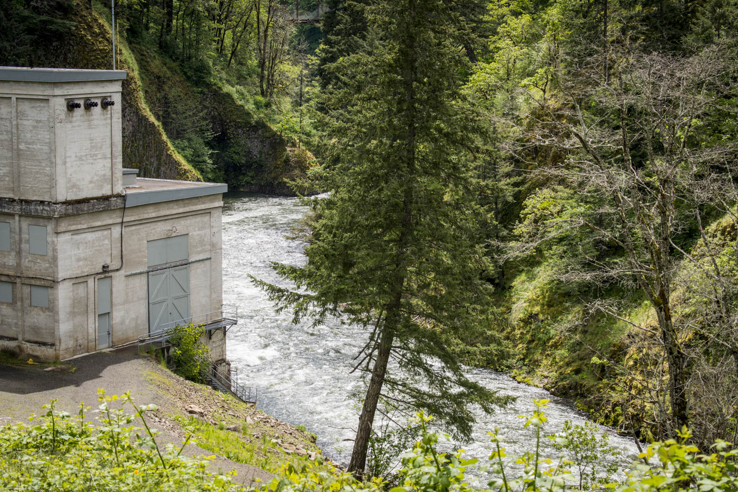
NWNL We are on Northwestern Lake, a reservoir created by the 100-year-old Condit Dam, owned and managed by PacifiCorp. What would the community lose if the dam is removed and the lake is drained?
PAT ARNOLD Since the Condit Dam was built, Northwestern Lake has been an important recreational resource to people here. This water storage reservoir includes a public take-out where people put boats in to fish and swim. Rafters also put in and take out there. The fishing here is popular. Since PacifiCorp owns the land here on both sides of the river, it is currently protected from development.
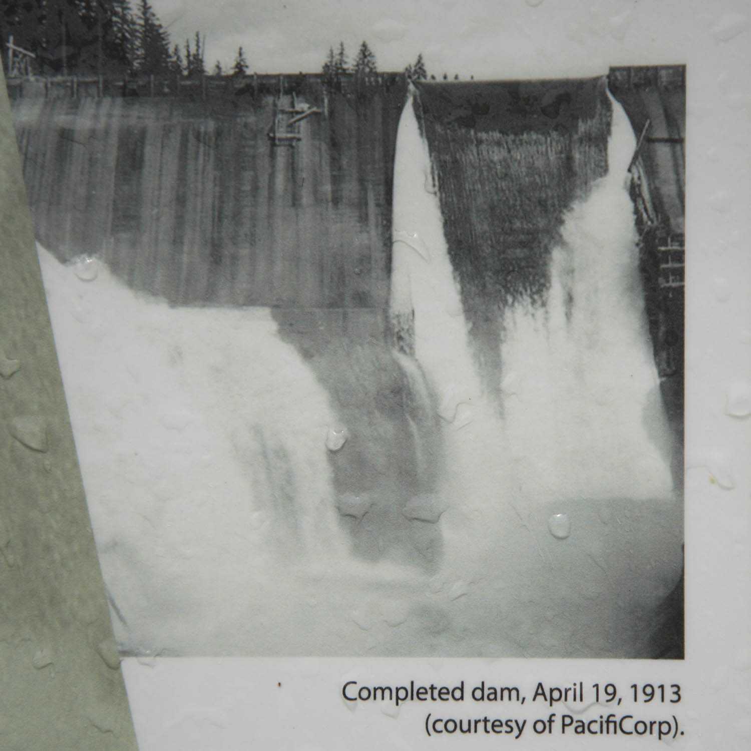
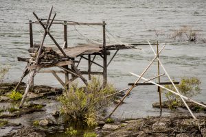
Archival Photos on interpretive signs of the dam and its construction from PacifiCorp
PAT ARNOLD The dam used to store water in the winter and release it in the summer. But now the reservoir is so silted – I think 60% silted – that this is basically a “run-of-the-river dam,” meaning they can produce electricity only from the river run. They are now required to leave a certain amount of water in the river below the dam. So in the summer, hydro capacity for PacifiCorp is pretty limited.
NWNL What about the residential development we see around the lake?
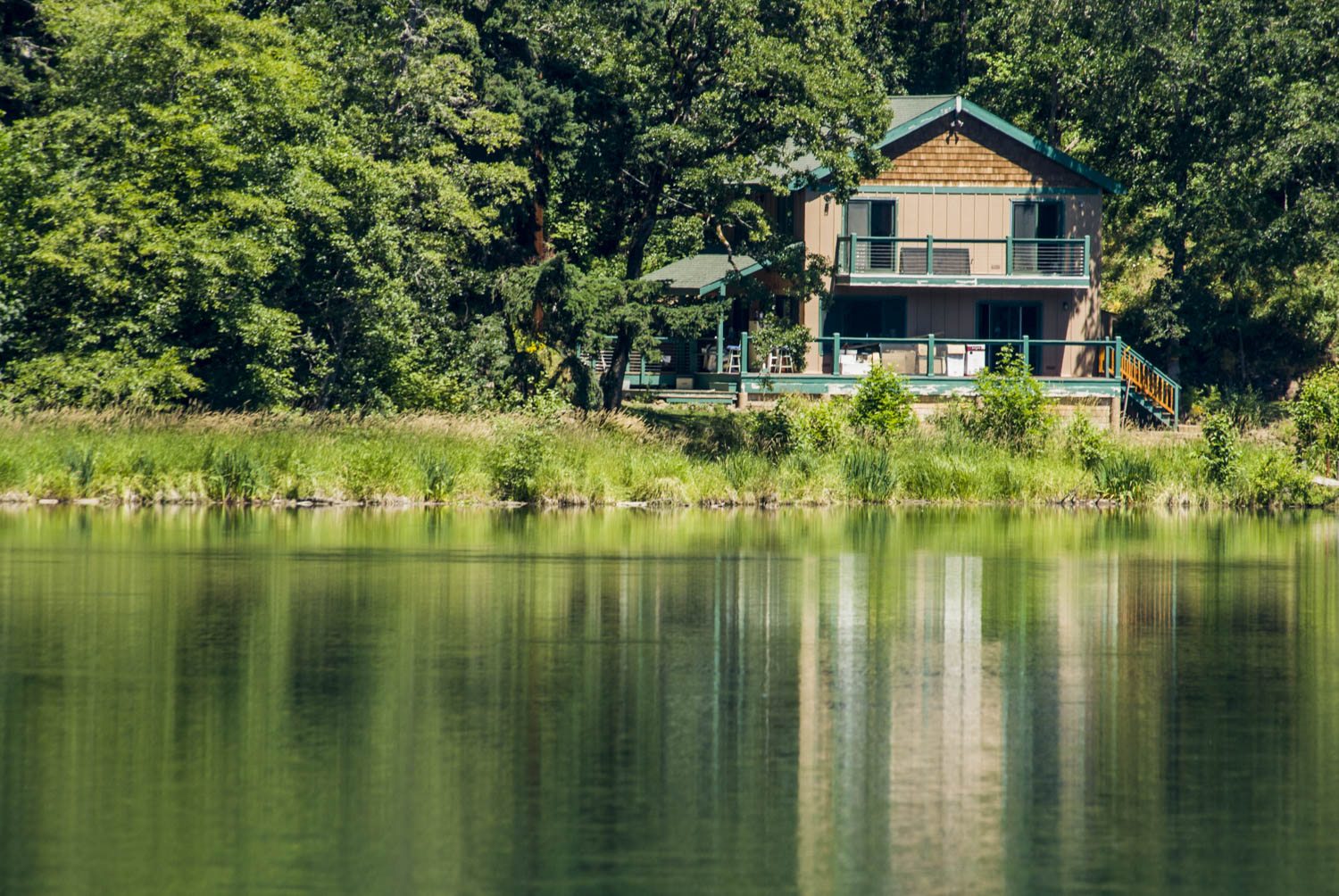
PAT ARNOLD Most of the cabins are leased as vacation cabins. Over the years some have turned into year-round homes. Residents are very upset about the thought of having the dam removed. Lots of them have boats and they are used to their lakeside existence.
Steve Sempley who lives here, has a huge library of pictures of where the gorge was and the construction of the dam. It was built very, very fast and very efficiently. I have a lot of respect for the engineering and technical ability that built these dams. But if we can build this, we ought to be able to build something that’s kinder to nature.
NWNL What is the likelihood of the Condit Dam coming down at this point?
PAT ARNOLD I think there is a very high likelihood that it will come down, sooner or later.
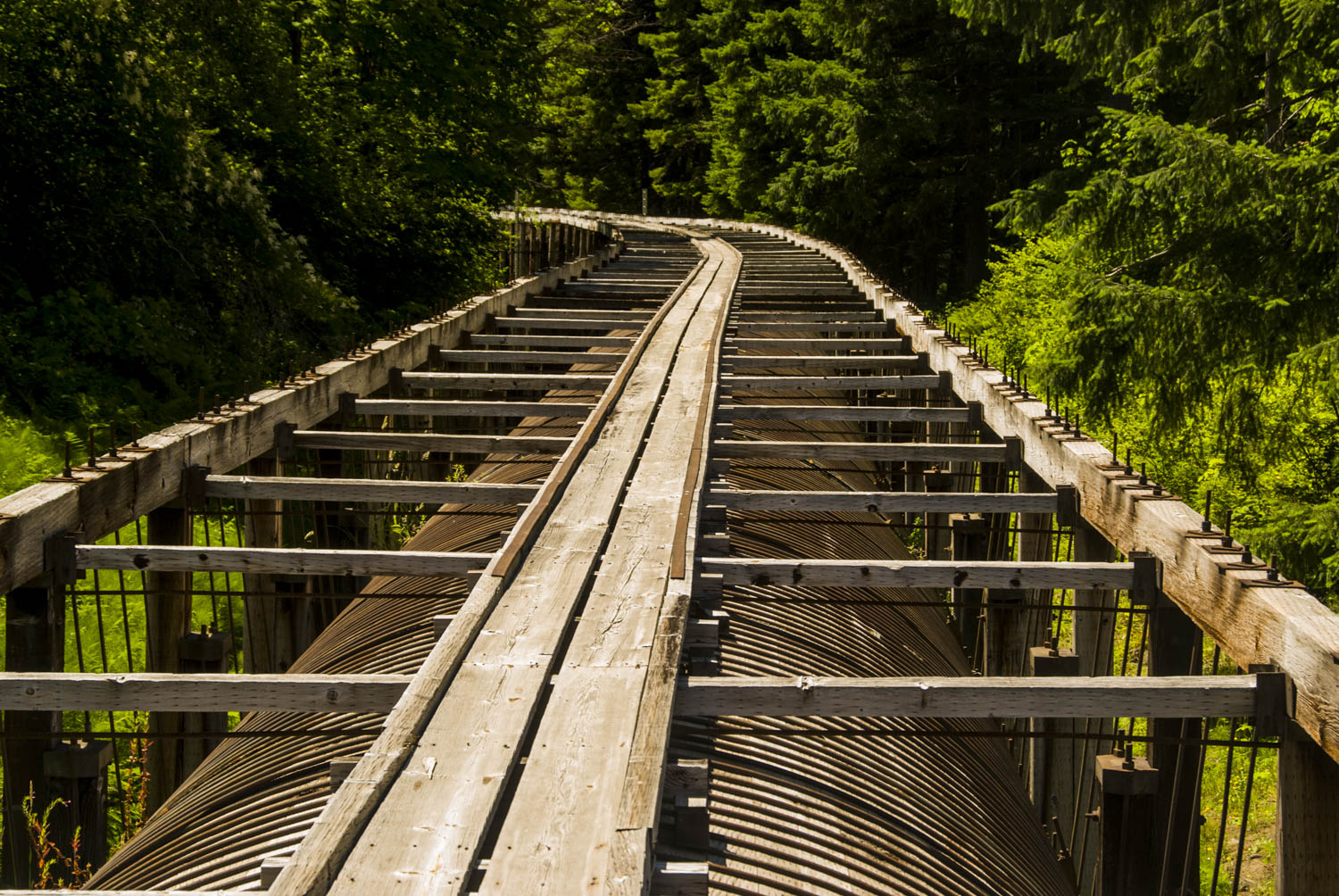
NWNL Do you think this 100-year-old, mile-long trestle we’re walking on is structurally sound?
PAT ARNOLD That’s what the engineers say. The pipe below takes water from the dam to the powerhouse. This trestle has been rebuilt a couple of times.
The reason I think the dam will come out eventually is because a fish passage has to be provided here. The dam cannot be relicensed unless fish passage is provided. Building and maintaining fish ladders to go up that height and keeping them functional is fiscally prohibitive. The dam does not produce enough electricity to justify that, as determined by PacifiCorp’s analysis.
NWNL Where does pressure come from for a fish ladder?
PAT ARNOLD To relicense the dam, the Federal Energy Regulatory Commission [FERC] requires Environmental Assessment approval that meets a mid-90’s ruling saying fish have to be able to go around, over or through this dam. The only way to meet that ruling economically is to remove that dam, since both fish-ladders and trapping and hauling fish are extremely expensive
NWNL What are the thoughts of those who’ll be affected by the dam’s removal?
PAT ARNOLD The people who primarily would be affected are those who rent land from PacifiCorp for their vacation cabins. There are about forty cabins. A few are year-round residents, but most are part-time vacationers who are used to having lakefront property where they can keep their boats.
NWNL Are there other stakeholders beside landowners who would be affected?
PAT ARNOLD The rafting industry would be affected. If fish return to the river, there will be restrictions against diminishing or disturbing their habitats. However PacifiCorp has already planned allowances for rafters’ “take-outs” that are fish-friendly.
Husum Falls
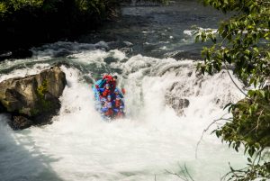
NWNL Husum Falls is 12 feet high. As such, it is the nation’s tallest commercially raft-able waterfall. How much rafting occurs here, and how is it managed?
PAT ARNOLD White Salmon River is a “Wild and Scenic River,” thus the US Forest Service has management responsibility for issuing licenses and registering rafters. Last year they registered 25,000 rafters and kayakers here. That number is 4,000 more people than live in this county. There are whitewater-rafting contests and world rafting games. Also,the rafting companies portage the rafts around Husum Falls so rafters can jump off that bridge back into the river.
NWNL Can migratory fish swim up these falls?
PAT ARNOLD There is controversy about whether the fish could get over them. Some people say no. Most people agree that at least steelheads would get over these falls to spawn.
Among known Native American cultural sites around this area and Rattlesnake Creek, this is where they had fishing platforms. Thus, this could be a spot where they have fishing rights.
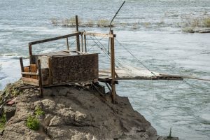
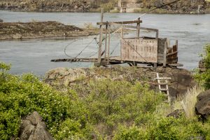
Native American Fishing Platforms, The Dalles 2014
NWNL What would revived Native American fishing rights do to the rafting business? Could these rapids accommodate both interests if salmon return to this river?
PAT ARNOLD That remains to be seen. Every three minutes a raft comes by, so there would be a management issue. The Forest Service and the Yakima and Klickitat Nations would have to work out a system allowing both activities. It’s a great river for rafting and rafters are an important part of our community. Yet Native American fishing went on here for many, many years. It was an important economic and cultural thing for them – and the rest of us too. I think an agreement could be done and should be done.
NWNL What is the maximum height that salmon can breach?
PAT ARNOLD I think steelhead can jump 12 to 15 feet. BZ Falls is upstream, and some fish will get over that. Then Big Brother Falls is about 17 feet. Pretty much everybody thinks no fish will get over that.
NWNL If salmon can’t get over Big Brother Falls, are there other tributaries they can follow?
PAT ARNOLD Rattlesnake Creek is one of the major salmon habitats. It has 13 miles of habitat, so a lot of fish go that way. There’s Indian Creek, and Blood Creek before you come to Husum Falls. As you go upstream, Gilmore Creek comes in at BZ Corners and Trout Creek at Trout Lake.
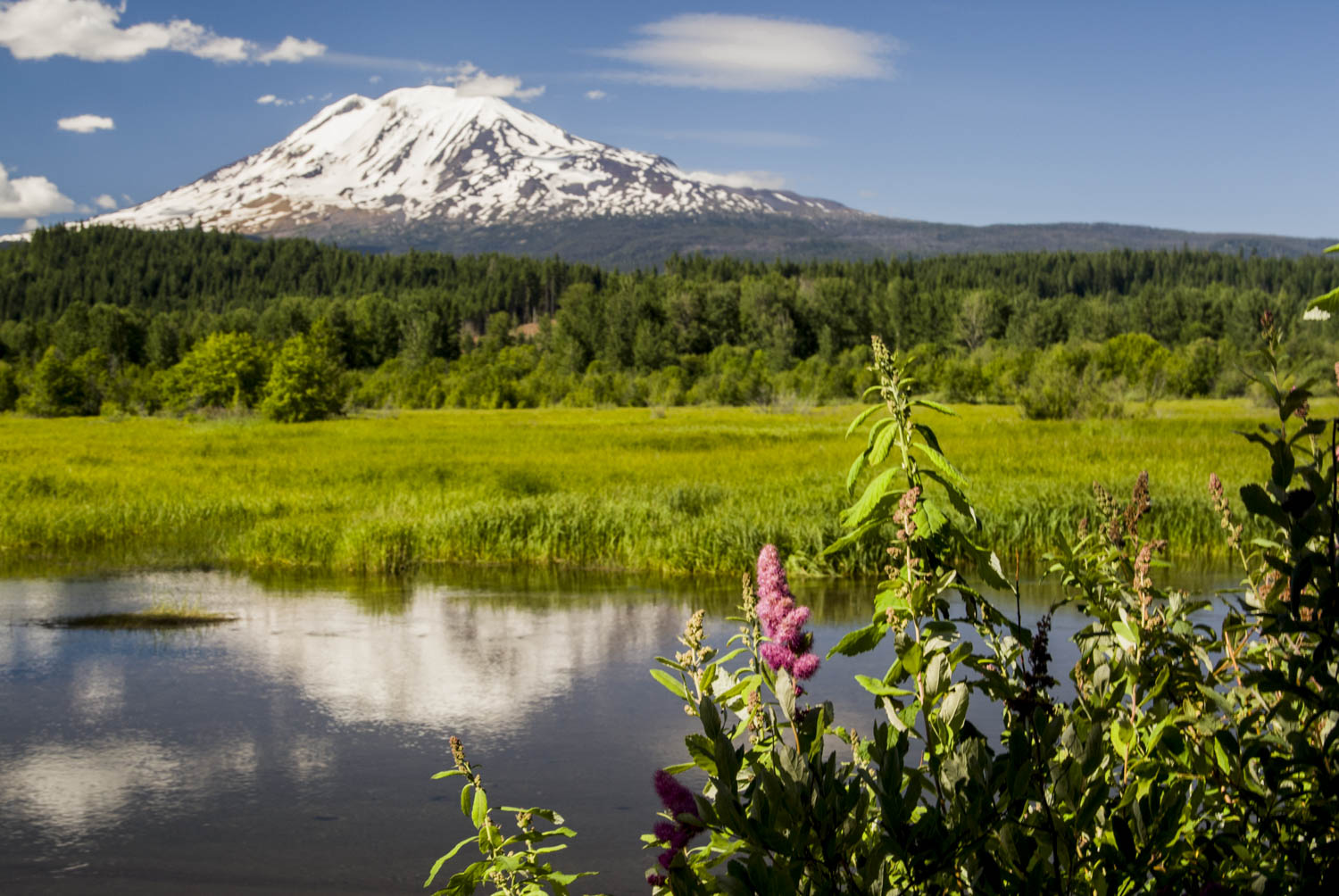
NWNL The White Salmon River is fed by glaciers and glacial-fed springs. Are you concerned about glacial recession?
PAT ARNOLD Oh, I have a substantial concern about the disappearance of the glaciers. If they go, we’ll all be moving, because basically we won’t have any water. It’s a major, major concern. We can do everything possible to maintain the health of the river, to preserve the water that we have, to use it wisely, to keep it clean, to make it last as long as we can. We can do many things individually. We can have a huge impact on policies and practices that help maintain a healthy river. But there’s not too much that we can do about glacial melting.
NWNL Have there been measurements on Mt. Adams that indicate glacial recession?
PAT ARNOLD There is a photographic history that shows the glaciers over time. People periodically take photographs and so we can see diminishment of the glaciers – yes, indeed. There are also measurements of the river’s water flow for 80 years, so we can track daily measurements of water flow. You can also see historic trends. Real-time facts and figures are on the U.S. Geological Survey website. That allows us to print various reports over a span of 80 years.
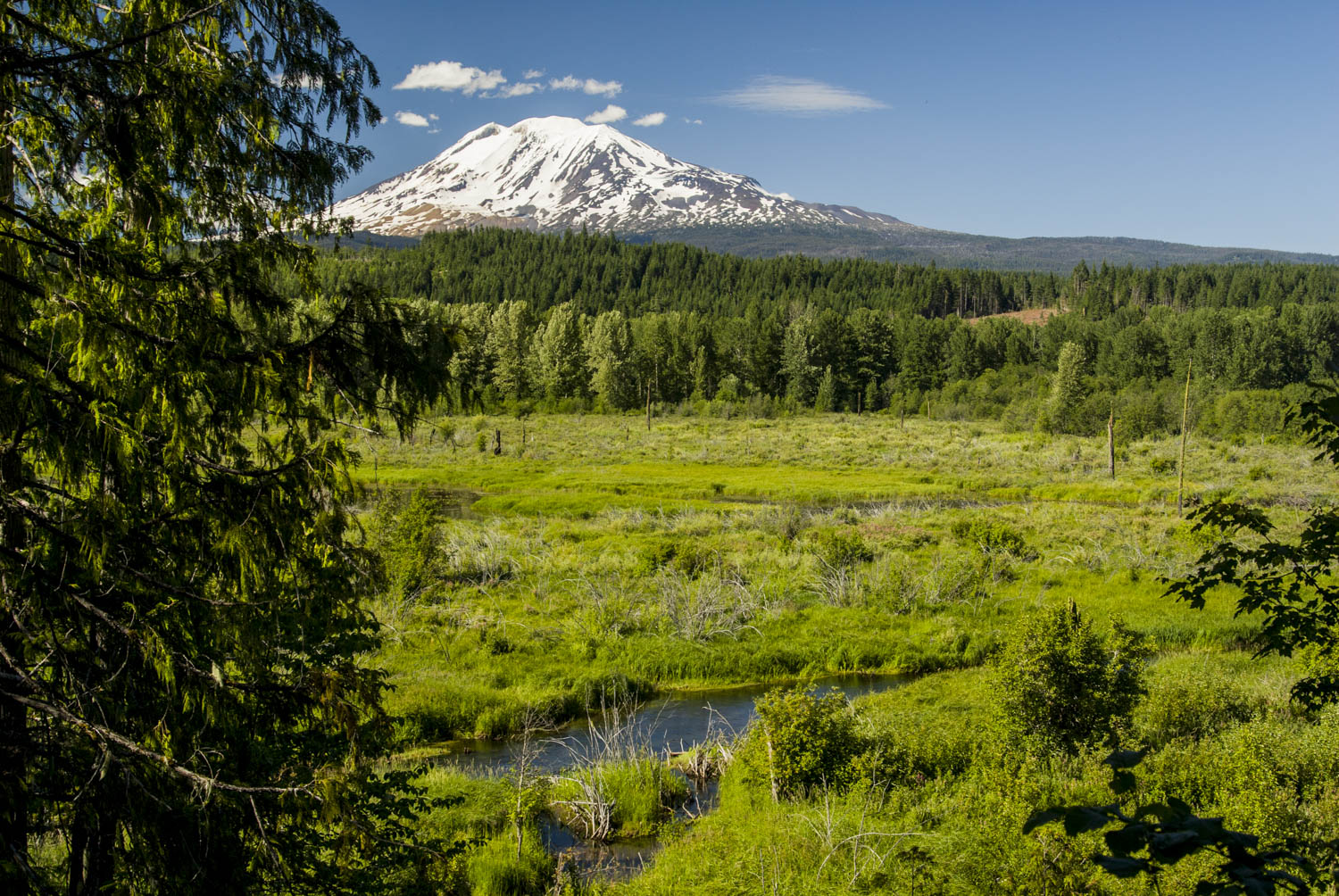
NWNL How significant are the wetlands in this valley?
PAT ARNOLD In the winter our wetlands absorb water when there is a lot of rain and snow, just like a sponge. If there are no wetlands and the river banks are controlled, the water has no place to go, especially when there’s a lot of rain and snowfall. So water and snowmelt just whir down the river in a big flood. When wetlands, tributaries and streams function properly, they slow down those floods and prevent disaster.
In the summer, as things dry out, wetlands slowly release the saved water. They’re also critical in helping keep the water temperature correct in this river if we are going to reintroduce fish. There are places in the river and some tributaries where water temperatures are too high for fish, due to lack of shade and wetlands that would keep the water cool and release it slowly.
NWNL How does Friends of White Salmon help protect local wetlands and riparian banks?
PAT ARNOLD As a political action group, we work with communities, stakeholders and people who care about the river to come to consensus about what needs to be done, including legal action. We have many future plans. I’d like to start having nature walks into the headwaters of the river, cleanups and restoration activities with the “Natural Area Preserve” on Trout Lake.
Our county rarely enforces the shoreline’s protection. They grant variance after variance. They are about to zone all riverfront land between Husum Falls and the edge of the scenic area into two-acre zoning. That would make shoreline protection much more difficult. It’s easier to work with one landowner who owns 1,000 feet, than to work with ten or twelve landowners who each own 200 feet. The larger the parcels, the easier it is to do protection. We want shoreline protection to be taken seriously and we work in the political arena to try to get that to happen.
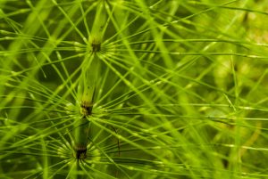
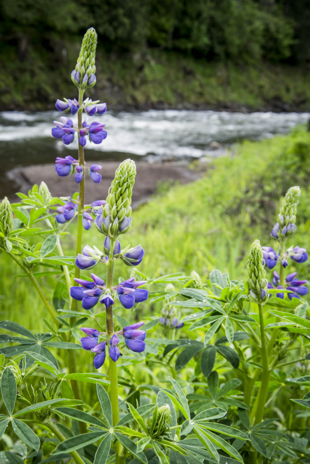
Riverine Vegetation
NWNL What’s the history of stewardship here?
PAT ARNOLD The Friends of the White Salmon River was formed in 1980s, when the PUD [Public Utilities Department] proposed seven additional dams on the Upper White Salmon River, upstream of BZ Corners. People didn’t want that, so they formed The Friends of the White Salmon River and actually got the PUD to back down.
Since then, Friends has tackled a lot of issues up and down the river, primarily land issues. One of our current missions is to restore former fish runs to the White Salmon. So as a local group, we are signatories for the removal of the Condit Dam.
NWNL We’ve met with many grassroots groups on the Columbia River that get the ball rolling. But support from state or larger groups helps. Do you have any such connections?
PAT ARNOLD We work cooperatively with American Rivers. They and Columbia RiverKeeper do a great job and are our good friends. But there’s no official organizational tie with anybody. We just do our thing out here in the boonies. When you know the lay of the land and understand the local issues, you get a good perspective. Friends of the Gorge does a great job, being on the ground every day, where the perspective is just a little bit different.
NWNL How would you describe the White Salmon River in a nutshell?
PAT ARNOLD What you see here is the main stem of the river. It is like the trunk of the tree, but the river is more than just a main stem. All the tributaries, the little streams, the smaller streams that only run in the winter, spread out like the top of a tree. The tributaries are where the three-inch fish live and where, in the spring, you might get your toes wet if you walk in the wetlands. This “trunk” exists because its branches exist, and together they are the life of this valley.
NWNL How has local appreciation for this river motivated its stewardship?
PAT ARNOLD This is a beautiful, clean, healthy river compared to many. We need to keep it this way. We need to preserve the wetlands and the shore lands. We need to guard the river’s temperature.
People and a lot of other creatures live here. We need to live together and conduct ourselves in a way that maintains the health and the beauty of this river for everything and all who live here. The ones of us that can talk and the ones that can’t.
This river is so relatively unspoiled that I’m willing to fight pretty hard, as a lot of people are, to keep it as clean and beautiful as it is. It would be a shame to see it degraded.
NWNL What is the sentiment of the other 5,000 people who live and work here?
PAT ARNOLD The White Salmon River is extremely important to us all. It’s our lifeblood. It’s what connects us all and makes the valley. Over the years, the river has served many different purposes. Years ago, they used to run logs down it. The main economic use of the river now is for irrigation and rafting. It’s a thing of beauty and a spiritual resource for people. But, you know, it’s also our water.
NWNL And if you didn’t have the river?
PAT ARNOLD It wouldn’t be the same place. We are the White Salmon River Valley. That’s who we are.
NWNL Thank you, Pat. It has been lovely to visit. I hope we can return when the dam is gone.
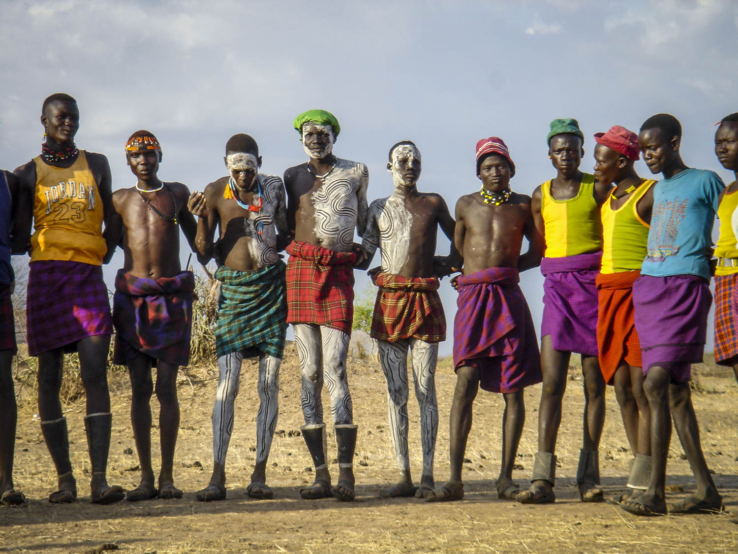
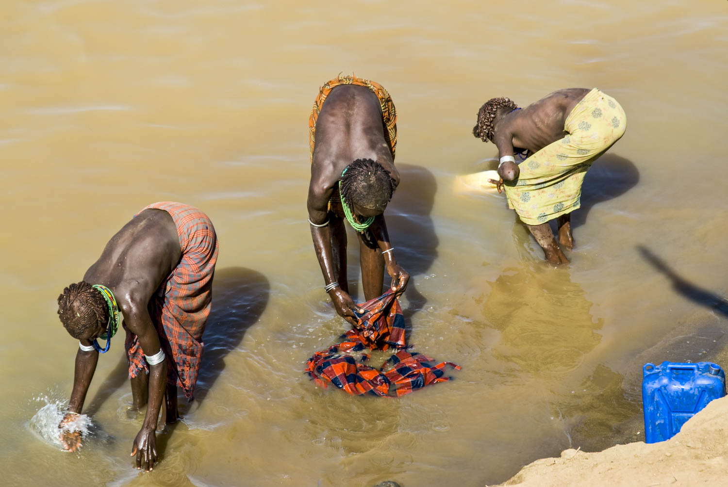
NWNL Hi Jim, What fun to meet a kayaker from Trout Lake who knows about NWNL’s coverage of Ethiopia’s Omo River. To divert from Husum to Africa for a moment, what were your impressions of the Omo Basin?
JIM WELLS When I went to Ethiopia last winter, I realized it is the Roof of Africa. Then I wondered where all that water went. I visited the Omo River and learned about the indigenous peoples that have lived there for years. I’d say this is probably the deepest backwater anywhere in the world. Edward Abbey would say it’s “the back of the beyond.” As one of the major rivers of Africa, brings life to people and all the animals there. But I don’t think many people know about this river.
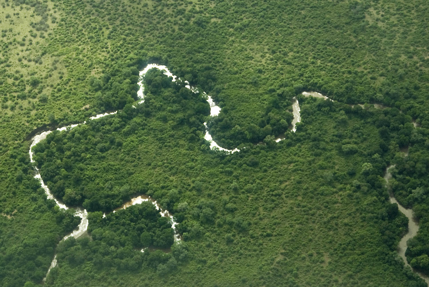
Omo River Basin, Ethiopia
NWNL Did you boat down the Omo River?
JIM WELLS I went via Land Rover with a photographer, a couple of other folks, and a guide to study the indigenous peoples living there. I now dream about boating the Omo River someday.
NWNL Well, let us know if you do! Meanwhile, back to the White Salmon River, how long have you lived in this watershed?
JIM WELLS Thirty years, or more. Originally, I came out to college in Portland. From then on, there was no turning back. So I split my time between here and Alaska. I’m here to stay and am raising my family in this great, beautiful area.
NWNL What does the White Salmon River mean to you?
JIM WELLS Well, it means a lot of things. Today it offer the ability to get my son connected with the natural world. It seems life goes so fast that you don’t have any time to do that. But it’s important to me for him to understand the values I have. Beyond that, this river – like all Columbia River tributaries – is a nursery for young fish, birds, and other animals that thrive here because of the food source. It’s an ecosystem where life can emerge.
JIM WELLS Rivers to me are the liquid of life. Our basic needs are here: air, water, soil and water. This is probably one of the most pristine rivers in the whole Pacific Northwest region. People come from all over to raft and to see this river. It’s an incredible habitat with unbelievable scenic values. I think of it as one of our national treasures. When you think about the jewels of our country, clearly this is one of them.
NWNL How much time do you spend on this river?
JIM WELLS I spend several days of the summer here rafting. But I also am a Director of the AmeriCorps Program. As such, I spend days and weeks restoring habitats of White Salmon River and all its tributaries. We’ve been doing this for over seven years now.
NWNL What actions is AmeriCorps involved in here?
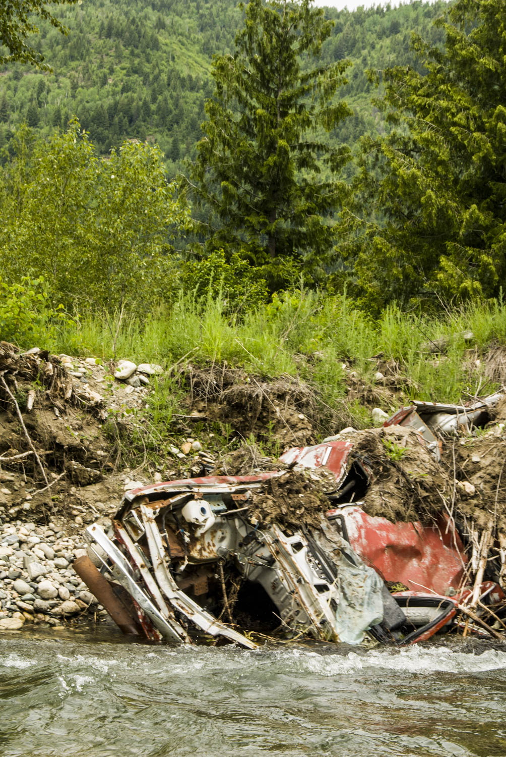
JIM WELLS We make exclusion fences to keep cattle from intruding into sensitive riparian zones buffering each side of the river. We look at structures for passageways for salmon and other fish, especially in spring low water conditions such as we’ve recently encountered. We also do big river cleanups. Our crews haul everything from 55-gallon drums to old cars out of these rivers on an ongoing basis. We choose degraded areas along the edges of the river for erosion control, planting vegetation that will stabilize the banks.

NWNL What causes the low-water levels you mentioned?
JIM WELLS I’ll let the scientists answer that, rather than go off myself on the global warming thing. I don’t have enough data to back it up, other than to say see Al Gore’s film. I think there are many potential factors. Walking in rivers causes shifts in sedimentation that may cause the flows to change. Over my thirty years here, there’s been less snowpack and smaller glaciers on Mt. Adams, the source of this river. We have seen this decline over the years, since historic pictures from early 1990s until now show the decline of snowfields and glaciers on the mountain.
NWNL How can this low-water issue be best addressed?
JIM WELLS In terms of global warming of the ice pack, or the fact that Alaskan native villages being submerged now and having to move because of change in the climate… [shrug]. My answer is to start with education. We have got to start with the kids.
Honestly, it really comes down to your value system. If you don’t have values that relate to preserving and protecting the environment, then it’s lost. So where better to instill those values than in our children as they are growing up? I bring the AmeriCorps kids here because if they like it, they’ll take care of it. If they have a love affair with the river, they’ll fight for its protection.
NWNL Jim, thank you for pausing to chat before taking off down your favorite river.

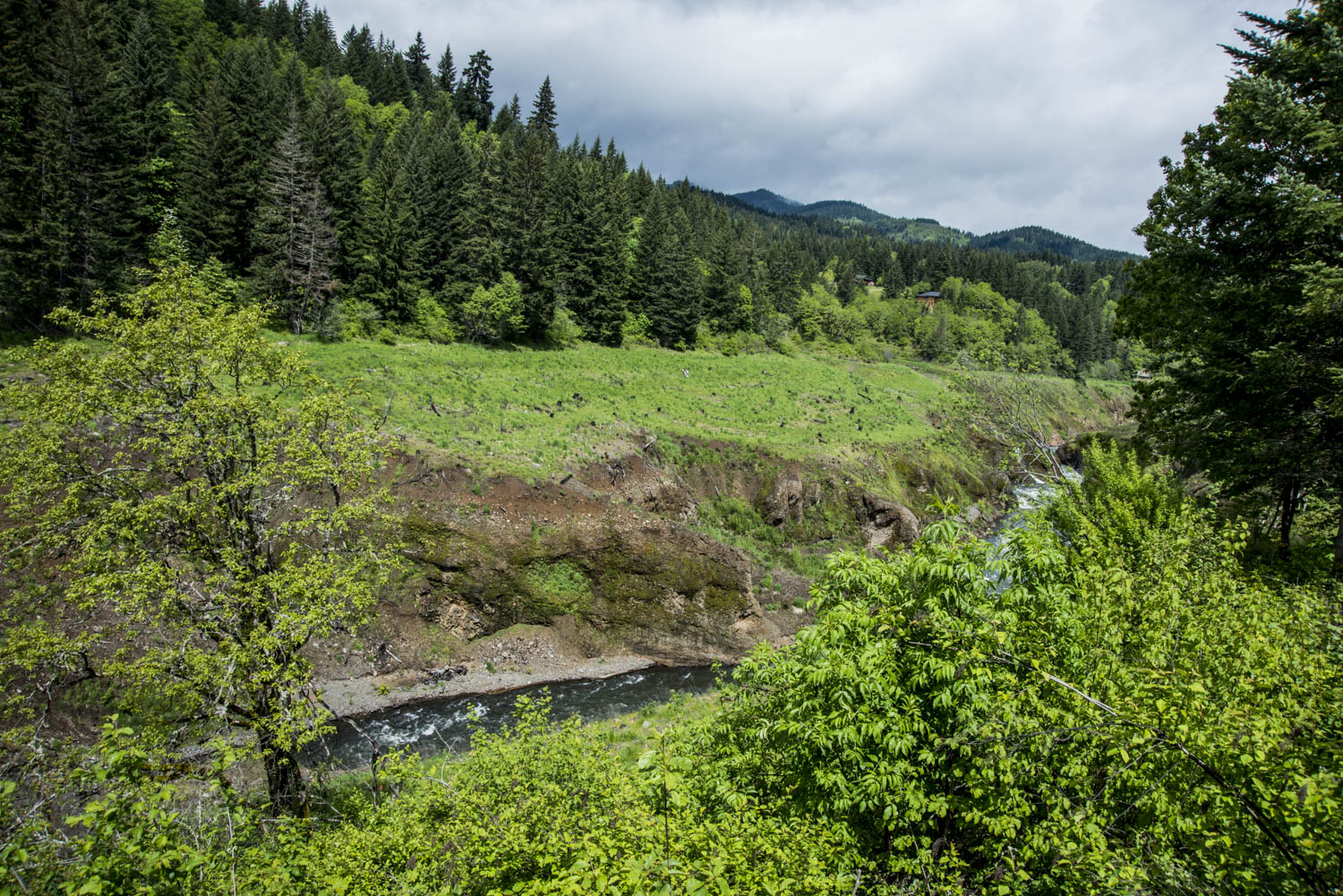
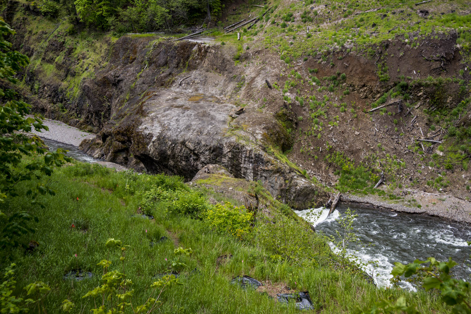

Where the dam was
2015 Analysis of Dam Removal Benefits The river is restoring itself faster than anyone thought. Its removal opened about 33 miles of new spawning and nursery grounds for steelhead and 15 miles of new habitat for salmon in the White Salmon River Basin. “The White Salmon Working Group, which is a consortium of Yakama Nation, federal, state, and PacifiCorp biologists, has estimated the White Salmon River [now] has enough spawning grounds to accommodate more than 600 steelhead spawners and 1,200 fall chinook. Bull trout, coho, lamprey and spring chinook could also benefit from a reconnected river.” (The Columbia Basin Bulletin)
Below are NWNL photos of reforestation and restoration by the White Salmon Working Group. They were taken during a NWNL 2014 visit to the Condit Dam site, now renamed Northwest Park.


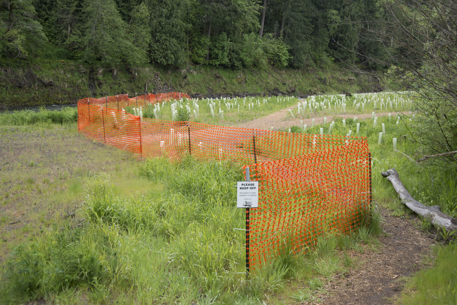
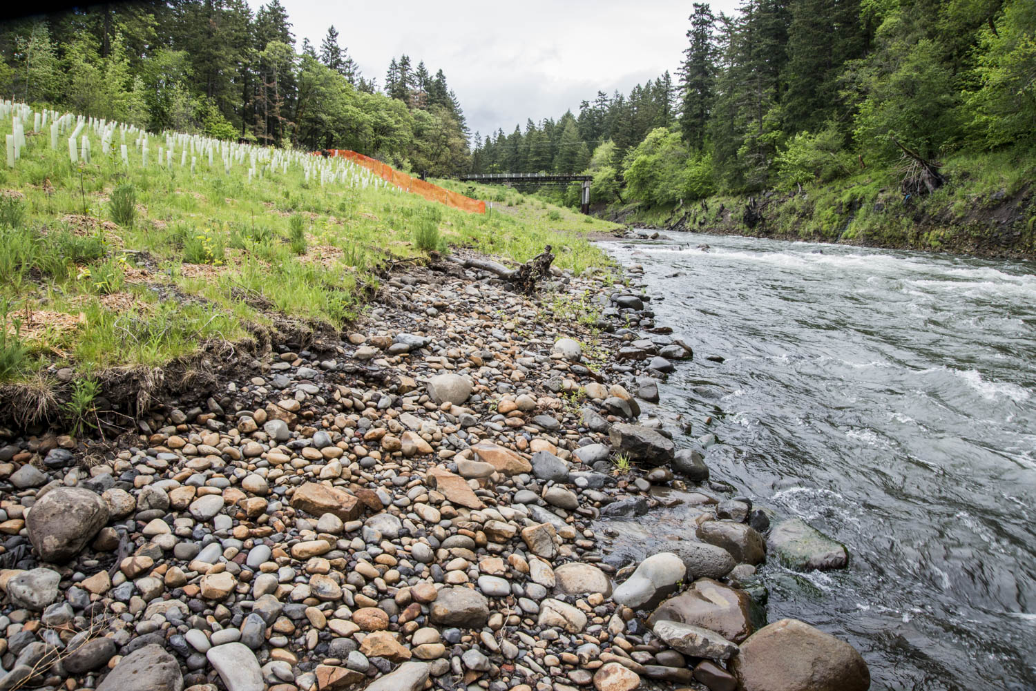
From Lake Bed to Native Riverine Vegetation
Posted by NWNL on July 26, 2017.
Transcription edited and condensed for clarity by Alison M. Jones, NWNL Director.
All images © Alison M. Jones. All rights reserved.