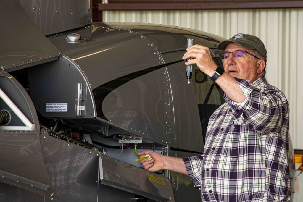
Dr. Randy Tillman practices medicine in Natchez MS and across the Mississippi River in Vidalia LA. As a helicopter owner and pilot, he uses those same precise, methodical skills needed in medicine. Randy graciously took NWNL aloft in his helicopter to view of one of the Lower Mississippi River’s highest recorded spring floods. His narrative highlighted flood impacts north of Natchez; across the Mississippi to Waterproof LA; down around the USACE’s Morganza Floodway; and then across to the east banks at St Francisville and back north to Natchez.
Randy’s pre-flight check
Outline
A Route Plan Pre-Tour Musing on Flood Impacts Flood Protection Infrastructure
NWNL Randy, before we go to your helicopter, let‘s look at this Mississippi chart.
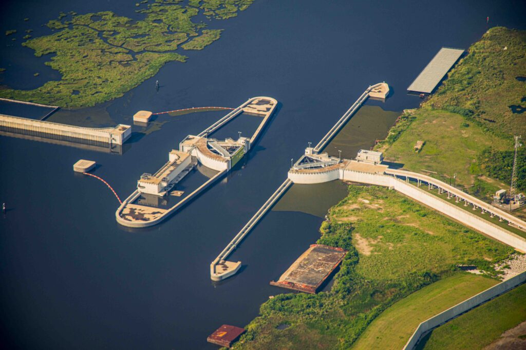
DR RANDY TILLMAN Yes, Here’s Giles Island cutoff. Going north and east of this, the Mississippi bluff meanders away up near Rodney. Much of this area is flooded now, so I think we’ll take off northwards toward Rodney. Then we’ll fly down the track of the river past Natchez down to the Morganza Spillway. I’ve got Morganza clicked so you can film it as I turn, bank, and give you a more direct view of it.
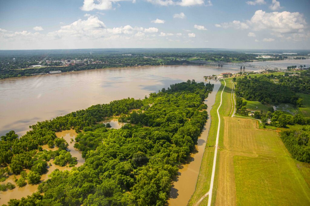
West bank (Bottom to Top): Waverly Pt, Vidalia & bridge to Natchez
Then we’ll fly over to this eastern side just above St Francisville. We’ll see St. Catherine Wildlife Refuge, which is now flooded entirely. In flight, you can say twe need to go higher, go lower or circle around. But – we have just 3 hours of fuel, and my bladder won’t last longer than that.
Pre-Tour Musing on Flood Impacts
NWNL Randy, I’m thrilled to have a helicopter tour with you today of the flooding Mississippi. There’s nothing like a pilot’s grasp of a river basin and its attributes – especially when it is flooding. I look forward to flying over the Mississippi’s meanders during today’s floods.
RANDY TILLMANWhen a lot of flooding occurs, most of Mississippi is protected by the bluff; although where those bluffs pull away from the river, it does flood. Louisiana is protected by levees; but similarly, where those levees work away from the edge, it does flood. So, on the river side of the Louisiana levees there is no farming – only hunting camps – since it floods often.
Bridge from Vidalia LA levee to Natchez MS bluffs
NWNL You’re talking about the batture – that unprotected land between the levee and the river.
DR RANDY TILLMAN Yes. And we’ll overfly Giles Island, where you put in your kayak. Interestingly, it’s on the Louisiana side of the river, but it is part of the State of Mississippi. During the 1920s and 1930s, the WPA/Work Progress Administration created Giles’ Cutoff just north of Natchez for boats from Giles Island to access the east shore, on the Natchez side.
But “Natchez Under the Hill” (which was wide enough to have a racetrack) faces the force of water that runs directly at the foot of that bluff and eroded almost all that land. Now there’s just a narrow residual shore on this side. But beyond that strip, there’s the river! Despite that river, Giles Island, even though cut off from Mississippi, it is part of the state of Mississippi. There are other such islands where that’s been done north of here.
NWNL The ever-changing meanders of the Mississippi are indeed fascinating.
Flood Protection Infrastructure
DR RANDY TILLMAN Lake Pontchartrain was where the Mississippi used to empty into Lake Maurepas. It’s now moved further west and goes out past New Orleans and empties out to Venice, Louisiana’s “South Pass,” “East Pass” and several other passes that the current of the river is sent through.
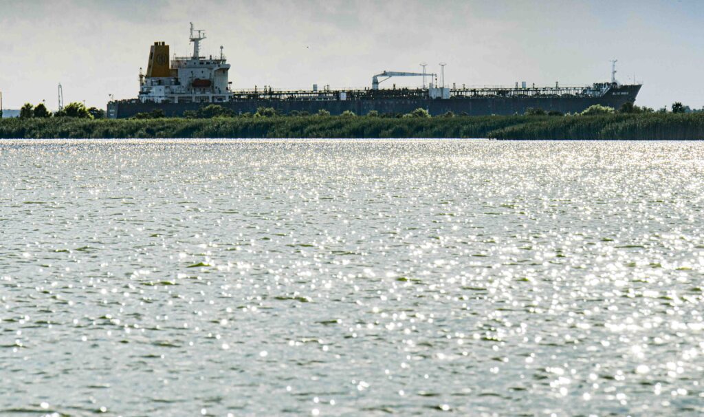
Oil tanker passing east of Mississippi levee and bayous near Venice en route to the Gulf
There used to be a channel called MRGO, the Mississippi River Gulf Outlet. It ran straight to make it much easier for cruise chips, barges and ships to go straight out. But because of the potential for hurricane storm surges to come up through MRGO, they put up a rock wall that blocked it.
They could have put a gate so it could still have been used. It makes it hell to go down there to try to fish, because you must go through almost a foot-and-a-half of deep water to get around the rock wall. Finally, you get into the channel and head down. A lot of fishing is still done there; but it’s hard to get in and out through that massive brick and crushed rock.
PEGGY PIERREPONTHurricane Katrina made people get rid of MRGO.
DR RANDY TILLMAN That’s right. That’s exactly what it was.
NWNL What about the new seawall for surge protection?
Aerial of Lake Borgne Surge Protection Barrier, courtesy SouthWings
DR RANDY TILLMAN Right! We call it the “Great Wall of Chalmette,” because it’s built in Chalmette, Louisiana. It must hold billions of dollars’ worth of concrete. It’s a vast sight from the water when you’re fishing. It has a gate onto the Intercoastal Waterway. It opens and closes depending on whether or not they expect storm surge. But there’s a lot of good redfish caught around the gate – at least I’ve caught a lot around the gate.
NWNL I’ve heard that the government gave billions of dollars to New Orleans right after Katrina to build that wall, but the caveat was there was a time limit for its completion. So, they rushed it; and as a result, it apparently was poorly built and might not withstand a major storm.
DR RANDY TILLMAN I beg to differ. It’s a massive piece of work, and there doesn’t look to be any flaws in it, unless there’s something wrong with the way it’s set on the ground. I can’t envision any storm of any type that could come through that wall.
NWNL I think I heard that in a lecture by General Honoré of the Green Army who said that it was a rushed job.
DR RANDY TILLMAN Well, it’s impressive from a layperson’s point of view. If something’s coming through that, I’d like to see what it is. Katrina couldn’t have come through that because it wasn’t that big a storm.
NWNL Let’s hope for the best – and now, let’s go hop into your helicopter!
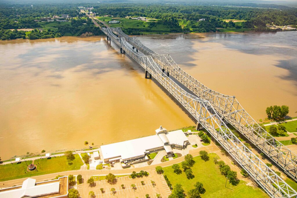
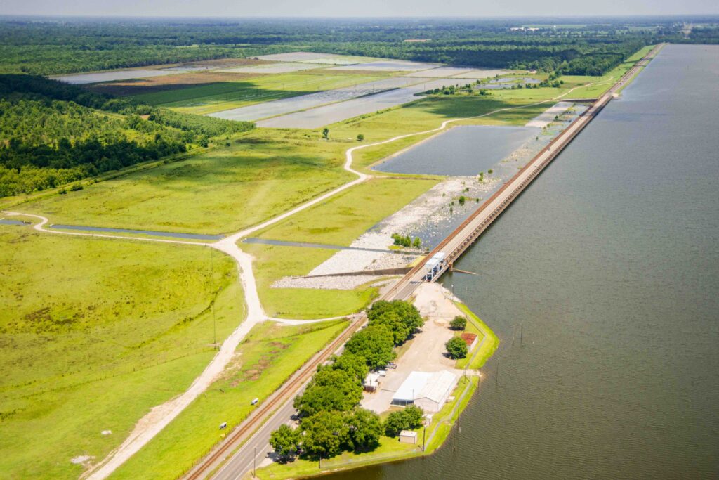
Morganza Spillway Control Structure, Pointe Coupee Pariosh on west bank of Mississippi River
Posted by NWNL on November 25, 2023. Transcription edited and condensed for clarity by Alison M. Jones, NWNL Director.