
Managing Omo National Park
Omo River Basin
|
NEW ESRI StoryMaps: What's On Our Shelves & NWNL Song Library & No Water No Life ESRI |
Omo River Basin
Ian Stevenson
African Parks Director of Omo National Park
Alison M. Jones
NWNL Director and Photographer
All images © Alison M. Jones. All rights reserved.
While NWNL was unable to visit the Mago or Omo National Parks during its Omo River Basin expeditions, NWNL has closely followed the rights of local indigenous cultures in the vicinity of these two parks. This interview provided a fortuitous opportunity to discuss difficult management issues, especially deadly impacts of water-driven conflicts and various flood-water changes expected upon completion of the Gibe 3 Dam and due to climate change.
NWNL Hello, Ian. I am happy to meet to discuss the management challenges you face in Omo National Park, set within the Cradle of Humankind. Having written a Management Plan for Ethiopia’s Nech Sar National Park and having helped establish improved management approaches for Kenya’s Mara Conservancy, I am interested to hear your issues. But first let’s discuss the unique characteristics of Omo National Park.
IAN STEVENSON I was hired to work for African Parks Management Project in the Omo National Park, which covers 1,571 square miles (4,000 sq kms) on the west bank of the Omo River, 540 miles (870 km) southwest of Addis Ababa. This national park is known as Ethiopia’s “most remote” park, despite Mago National Park being just across the Omo River.
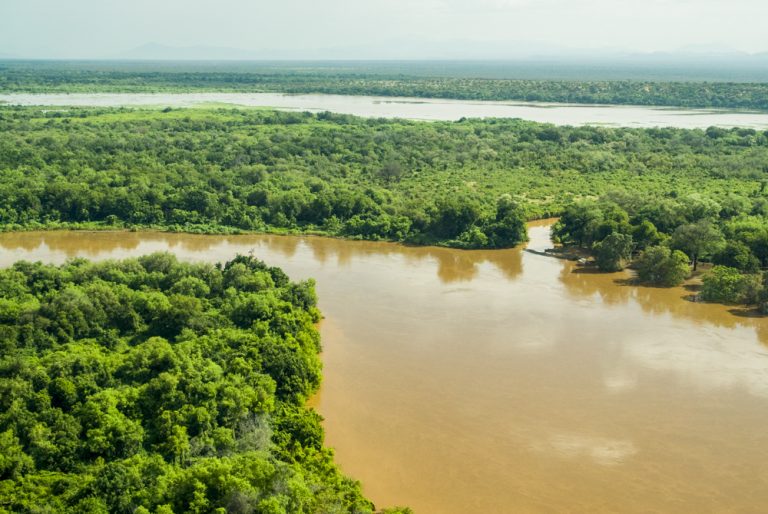
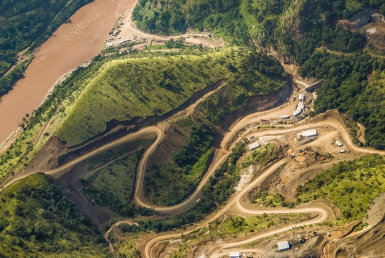
Management of this park is mandated to be contained only within the park. This makes it difficult because of external influences on the park, particularly the surrounding communities and wildlife’s seasonal movements in and out of the park. We are trying to incorporate an area between 3,860 to 5,790 square miles [10,000 to 15,000 sq kms]. This is quite a large area, with the Omo River forming 62 miles (100 kms) of the park’s eastern boundary. So, you see, the Omo River is quite an influential part of the park.
NWNL How would you describe the communities around your park?
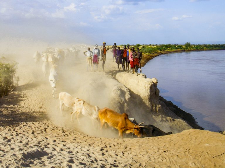
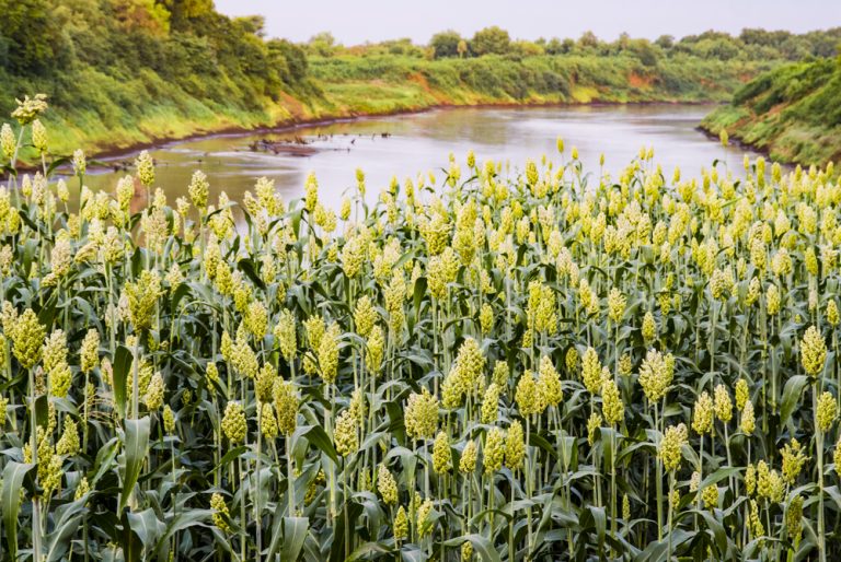
IAN STEVENSON The local communities are mainly semi-nomadic communities and move as agro-pastoralists. Even though their focus is pastoralism, they rely heavily on crop cultivation, utilizing the Omo for “receding floodplain cultivation.” In other words, “flood-recession agriculture” occurs as the river goes down. Its sediment is deposited on low-lying land each year from the erosion in Ethiopia’s highlands. Those deposits of rich soil are where Omo farmers grow their crops in their dry season.
NWNL What happens during the wet season?
IAN STEVENSON When the floods come, the people move away from the river. That’s because with the floods come malaria, all the insects, and everything else, so it’s not a particularly nice place to live during that season. The local communities stay there until or through only the beginning of the rains. Their main focus is on the low-water season of the Omo River – not so much rainy season or non-rainy seasons. It varies a bit, but they usually are in the park from October until sometime in March, depending on when the rains come.
NWNL Who are these people? Do they farm along the whole river?
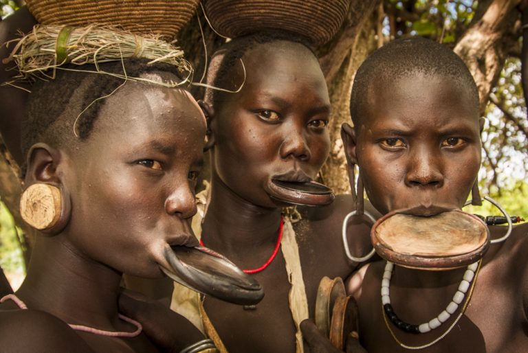
IAN STEVENSON There are about eight ethnic groups that utilize Omo National Park, of which I think six utilize the Omo River and rely heavily on crop cultivation, although a couple of the groups rely upon fishing. Further and further south down the Omo River, I think the communities utilize the river and the flooded areas of the river even more than they do where we are. Our riverbanks are quite steep, which allows Omo communities to utilize the banks and small islands of sediment that are left on the river. Further down, the river breaks its banks annually, which creates big pasture lands for cattle.
NWNL So sedimentary islands appear in the river at low-water season?
IAN STEVENSON Yes, but it’s hard to say whether these islands are from sediment build-up, or whether there would be islands without that. These islands have no vegetation on them. Since the river runs brown the whole year, these islands might normally be sand or a shallow-earth islands that are then covered with flood sediments.
NWNL I’ve heard reports that the Omo River used to be clear 50 years ago.
IAN STEVENSON Yes. But now the tributaries that run into the Omo are not clear; thus the Omo never runs clear. I think it’s fairly well accepted that the erosion and deforestation in the highlands causes this turbidity.
NWNL What is the drop from the river’s highest flood level to the river’s lowest level?
IAN STEVENSON It depends on the width of the river where you measure. We are measuring a spot in our area where we want to put a pontoon across the river. We expect the river to come up about 15 feet (4.5 m) there, which is quite a substantial over a wide river. The river where we measured is over 650 feet (200 m) wide. That’s quite wide. In the center, the river’s only about 8 feet (2.5 m) deep and it stays fairly flat. Then it will rise to about 19-22 feet (6-7 m) deep in flood season. But the speed of the river also changes a lot.
NWNL I heard that downstream at Lumale this fall, the Omo was really high – higher than Halewijn Scheuerman has ever seen it. Judging only by eye last week, I’d guess that from September to now, the Omo could have dropped 45 feet (13.5 m) at that point.
NWNL Is the Omo river used for transportation at all?
IAN STEVENSON Very little, surprisingly. Where we are, the Omo people are not a river people. They are pastoralists, who are also cultivating their fields. They do make canoes, but they don’t like to use them very often. It’s not their tradition to fish. They will hunt crocodiles for food because of the threat they pose when in the fields. Hippos however are not hunted, because they don’t conflict with the people’s cultivation. However, further down toward the Omo Delta, people do use canoes and they do use the river for transport.
NWNL What about the health of the river for human consumption? You said it was brown and turbid.
IAN STEVENSON People do drink straight out of the river, but I don’t know if that means it’s healthy or not. I don’t know of any tests along the Omo where we are, but I would say the sediment wouldn’t be unhealthy. The local people collect water and then use different traditional plants to get the sediment to settle. So, the water they drink becomes clear.
NWNL In your section of the Omo River Basin do you see problems associated with water accessibility, water resource degradation, or water conflicts?
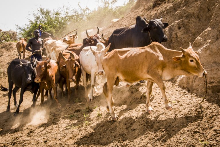
IAN STEVENSON There’s a whole vista of problems and challenges in the area. The probable background of any of today’s problems is the increase in both human and livestock populations here. The population increase is quite heavy. From all our data indicators, the increase in livestock in particular is very heavy.
NWNL How do you get data on those issues?
IAN STEVENSON Mostly, it’s informal. We have formal surveys and such, and we can look back at past data. Cattle numbers and things like that come mainly through government surveys. But, for example, if you speak to Nyangatom tribal people, they might say that while 20 years ago the average family had a certain number of cattle, now they have many more cattle. Those differences are quite large.
NWNL Are those cattle numbers doubled?
IAN STEVENSON No – the increases are much greater than that. Cattle increases over the last 20 or 30 years are about tenfold. That’s a relatively short time. While some pastoralist communities have drifted away from keeping cattle, for the majority of big groups like the Bodi, Mursi and Nyangatom, their whole life is the cattle. And their herd numbers are going up and up. That puts more pressure on the grasslands creates more erosion and causes the rivers to flood more.
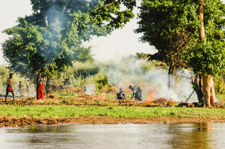
There’s also a lot more cutting down of the river-edge forests for cultivation. When you see heavily populated areas, you’ll see the river with no forests – unlike areas that are not as accessible. And there may be forests on the park side since people don’t use them as much. A riverine forest has much healthier vegetation. When there’s nothing on the banks, they start to erode, and the river’s oxbows create meanders.
NWNL Does climate change cause more flooding?
IAN STEVENSON Climate change does have a great impact in the Omo River having lower low levels and higher high levels. But I don’t think erosion is connected directly with climate change. Rather, increasing erosion and flood levels are more connected to population growth and deforestation. And to be clear, most erosion is upriver. Around Omo National Park, the vegetation is relatively intact.
Erosion can be managed. The type of cultivation used with flood-recession agricultural practices used here is not bad topical cultivation. It’s not damaging to the vegetation. However, as more and more people come in and move back to the river after flooding, they need bigger areas and they need them further away from the river. Cutting further into the forest is damaging the environment. A whole ecosystem disappears. When you cut that down, insects go away, the birds go away, and your soil is not replenished by decomposing vegetation. So, the region becomes less fertile for the people.
NWNL When I first considered bank erosion, I wondered 1) if high flood waters spreading out further would help the pastoralists because more land surface would be flooded; and 2) if more sediment would further enrich the soil. But, as you said, I see that the flip side of that coin is loss of biodiversity and loss of soil replenishment, despite some nutrient replenishment from the annual floods.
IAN STEVENSON And furthermore, if the Gibe 3 Dam is built on the Omo’s Gibe River tributary, annual water supplies that now come downriver will instead remain within the dam’s reservoir. Additionally, we would no longer have flood waters. While the sediment in the river increases as upriver deforestation upriver increases, this dam means there’ll be less sediment downriver. I don’t know how all that’s going to affect the fertility of the soil for people’s crops.
NWNL Are there other potential effects of the Gibe 3 Dam, now under construction? When Gibe 3 is operational, will the Omo River level remain constant, or continue to flood and recede with annual monsoonal rain seasons?
IAN STEVENSON Environmental impact studies have been done by an Italian firm and some folks contacted me for discussions. I think resulting regulations depend on where the money comes from, maybe the World Bank which requires both Cultural and Environmental Impact studies. They did interviews on environmental impacts only just recently – in the last two months.
NWNL So basically, they are only just informing local stakeholders of what will happen, instead of studying the impacts before beginning the dam-building?
IAN STEVENSON I was told – and you’d have to clarify this – that a more basic Impact Study was done before the dam was designed and built. Now these dam-building people are back to try to find solutions for repairing damages the dam might do downriver. They have certain suggestions, and I asked who would implement these. Given the responsibility of the Ethiopian government, I asked where they’d get the funding to help all these people. No one seems to be able to answer this.
This dam will have a huge impact on downstream communities. Tribes like the Mursi rely heavily on the river. About 35% of their income is generated from cultivation on their riverbanks. They rely heavily on cattle and wildlife, both of which drink from the river. I’ve been told they probably will lose annual flooding of their cultivation sites, and now get just a small fluctuation from the other main tributary to the Omo. That would be a minor impact further downstream since longer would low-water levels occur that far.
I have specific figures, but not with me. I think the floods will be about four times higher. However, the flow rate will be merely four times the former low flow rate — and the high rate will be a lot, lot less than its former high rate which has been thousands of times higher than low flow rates. That will be quite a big change.
The impact on the communities is what’s unknown to me, but I have discussed the issues with them. I don’t think there’ll be much impact on the wildlife, because they will still be able to access the river. Furthermore, if fewer communities will be using the river due to the dam’s impacts, that might benefit the wildlife. But the dam probably will interfere with the riverine forests that rely on the floodplain, on its flood-water levels, and on high season flooding. So, will the riverine forest survive?
Also, as many small tributaries flow into the river, little oxbow lakes have formed and are fed by annual flooding. But, they won’t get flooded anymore and so will dry up. We will also probably lose the tributary habitats, aquatic species and fish. These tributaries are normally fed annually by backwater flooding extending outwards by 1 to 2 miles (2 to 3 kms). I would say the lack of flooding will change sediment and water in those tributaries and thus cause a loss of biodiversity. We already have a loss of Omo River biodiversity due to increased sediment, since certain fish rely on water clarity and photosynthesis. Whether the species lost will come back or not, I don’t know.
There are also certain birds that nest along the rivers, or in the sand or muds of the rivers. They won’t know where to nest anymore if there’s no natural flooding. Crocodiles lay their eggs at just the right time of the year; but the dam will change the sites they normally use. There are many other different potential impacts. How realistic or critical are they? Will they artificially flood the Omo River at a natural time? Who knows?
NWNL Have dam managers or the government discussed artificial flooding or pulses?
IAN STEVENSON I don’t know. I asked if that was an option; but I know the whole idea of the dam is power. They have to keep their money in the bank. So to expect them to flood the river artificially…, not likely. I’ve worked on the Zambezi, and I’ve seen they don’t artificially flood that river. As a result, that riverine ecosystem has changed significantly.
NWNL How do you sense climate change might affect the Omo Valley?
IAN STEVENSON I don’t know enough to say how it’s affecting the Omo National Park or the Omo River. I’m sure climate change will impact the highlands of Ethiopia; but I don’t really know how it will affect the environment within the Omo Valley or away from the river.
NWNL A closely associated and overlapping term is “climate variability,” reflecting a situation where former patterns aren’t staying the same….
IAN STEVENSON We are seeing that right now as we collect rainfall data and temperature data. But can we make assumptions from that data yet? These last years, we had a huge change in rainfall, but is that because of climate change or is that just part of a cycle of differences? I think we need to look over a longer period of time. Omo National Park records for temperature and rain are from only the last ten years. That’s a very small period of time in the big realm of things.
NWNL What day-to-day tribal conflicts do you deal with in your area of the Omo River Basin, such as access to water, land needed for cattle, or ability to get cattle to water daily. Do you see existing or possible conflicts growing over water availability or usage among the eight tribes living in the vicinity of Omo National Park?
IAN STEVENSON Water and grass are probably the two biggest resources that impact Omo communities. Inter-ethnic conflict among these groups are mostly fights over resources in this very remote area. There’s very little road access into the area; and thus, very little aid goes into that area because access is too difficult. People there can’t be described as “primitive.” Their society is actually highly developed; and these people are incredibly intelligent. But there still is ongoing conflict between them for critical resources. I ask where the trouble starts, and usually hear it has started from this or that area’s cattle raid. It’s retaliation from the one before that, which is retaliation for the first, and it’s been going on for centuries and centuries.
Much of the conflict is over land access, which governs rights to resources in that area – especially water. For example, the Nyangatom fight the Mursi for land they want to cultivate. Or perhaps they want that land in order to graze their cattle right next to the river. These conflicts can be deadly. They kill each other regularly: sometimes one person, sometimes huge numbers of people, get killed in these raids. The basic causes for these deadly conflicts are water and grass resources.
NWNL It seems these deadly Omo conflicts over water and grass (which itself requires water) are micro-examples of what could happen in the Nile River Basin. There, eleven riparian nations are trying to solve water-usage allotments, hopefully in a peaceful way. Whereas Omo competition for water results deadly conflicts, hopefully the Nile River Basin will find a peaceful way to hammer out an agreement. Do you see a way for Omo communities to find peaceful solutions?
IAN STEVENSON Today, the Omo’s ethnic groups are now more sedentary and are witnessing their populations growing. The answer to land conflicts focuses on resolving “perceived” boundaries that change over time. Such “perceived” boundaries may be a river, mountain range or a plain, where for instance, stay on this side of the plain and you stay on that side of the plain, etc. As well, six or eight ethnic groups can claim a piece of land was theirs at one time in the past
There’s great initiative to cooperate because there is not a lot of room. There is a bit of initiative starting as different organizations try to bring groups together to discuss a peace process. Groups are starting to sit down; but maintaining peace will be difficult. They may agree to peace or to watering their cattle at a certain point, or moving their cattl to a community grazing land. But then something goes wrong; conflict flairs up again; and they go back to what happened in the past.
Peace takes time. I think good work is being done. Traditional meetings for conflict resolution are being used to try to address these problems now. People are optimistic. I think they need to get going, especially regarding access to areas of conflict as development grows.
NWNL In closing, let’s discuss the parameters and viability of Mago and Omo National Parks. The perceived notion of a national park is to set aside a portion of land for wildlife where people don’t live. However, there are many groups of people in your park.
IAN STEVENSON Yes, that is definitely our greatest challenge. There’s no question the wildlife is declining. There are already two species extinct in the par: rhino and zebra. These losses are almost certainly due to hunting by the communities in the park. Elephants are now down to a very few. Additionally, i’ve identified 5 species that are almost on the brink of extinction in the park – due to human pressure in the area.
The other problem we faced as we moved into the Omo, is that these people have used this land for centuries and centuries. They still see it as their land. The Government of Ethiopia intended to put aside this park with no people in it. I understand its philosophy to protect this area for the future. But, in reality, we must work with the people who are in there right now. There, there are many issues regarding agricultural land. There is very little of it in the park – just a bit in the north that the Mursi utilize for agriculture. But if we can work with the communities on how to manage that, the park does have a future.
Omo National Park has massive grass plains for grazing. Since the wildlife is so depleted right now, some areas are actually under-grazed, as opposed to over-grazed. But there are also areas in the park utilized heavily by the communities, overgrazed and being overtaken by invasive species now because of this pressure on the land. The park’s future is a matter of sharing management with the communities. It’s not to stop indigenous communities from coming in.
We need core areas for wildlife species that intrude on the communities in the park. The philosophy we take and the vision we have is the park should be designed with “core areas” and “multiple-use areas” that may be for grazing but probably not so much for agriculture. The exception to multiple-use areas that exclude crops may be that the banks of the Omo River can be used by the people who rely so heavily on that resource and eons-old practice of flood-recession agriculture.
If we go into the park and kick everyone out, we’ll have a war zone on our hands. We’ll never be able to do that. Instead, we’ve put management efforts and focus over the last two years into building relationships with the community and establishing communication systems. We want to develop this park so that it will be utilized by both native wildlife and native communities.
NWNL Ian, what a great conclusion to this discussion. Each community and each ecosystem require their own assessment and management guidelines. I wish you luck in this very special corner of the world and hope to visit Omo National Park soon.
Posted by NWNL on January 31, 2020.
Transcription edited and condensed for clarity by Alison M. Jones.
All images © Alison M. Jones. All rights reserved.