Richard is a Vietnam veteran who was celebrating his birthday when I had the chance to chat with him. He grew up in Simmesport, LA on the Atchafalaya River, a Mississippi River distributary that flows through Cajun swampland down into the Mississippi River Delta. More recently, he has had the opportunity to observe the Mississippi River from many angles, as he is often seen on ladders around Natchez painting its famed Antebellum homes.
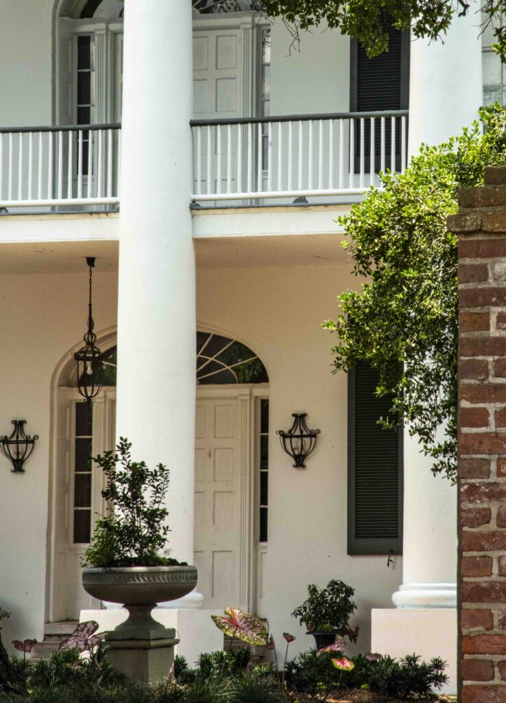
Natchez MS Antebellum porch
Outline
Local Backroads Knowledge A Southern Mississippi Basin Youth Flooding and Flood Control Current Basin Issues Riverine Wildlife River Dynamics The Spillways
NWNL Hello Richard. Our mutual friend Peggy Pierpont has told me about your local roots in the Mississippi Basin and so I look forward to hearing your tales and thoughts. My NWNL interviews focus on science and stakeholder knowledge, so I like to talk to people like yourself, to help spread the word about the value of our watersheds and their vulnerability.
RICHARD HESS You’re like Jacques Cousteau who came here and said this is the most polluted body of water he’s ever been in. And that’s because they made the river into a ditch and cleared all the land. When I got back from Vietnam in 1969, I almost couldn’t recognize the place, because they’d cleared so much land for soybeans, and I could see all this sediment going into the river. Dredge boats were working the river all the time to dig a channel that’s now filled in.
I was born in 1947 on the Atchafalaya River, 60 miles south of here. I am now a painter living in Natchez, Mississippi. It concerns me that if I take a water glass down to the Mississippi River; scoop up its water; and let it sit overnight – the next day it’ll be clear, but with almost half an inch of sediment at the bottom.
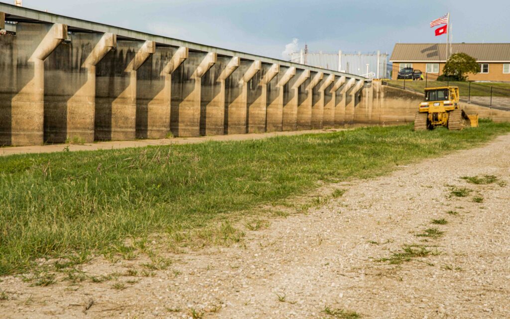
Bonnet Carre Spillway near Norco LA
RICHARD HESSYou’re here today because we’re in the midst of a serious Mississippi River flood. The New Orleans Bonnet Carre Spillway is open to mitigate this flood, but the US Corps of Engineers won’t open the Morganza Spillway. Have you visited the Morganza spillway?
NWNL Yes, but it was summertime, so the gates were raised for maintenance. I saw a grassy plain beyond the gates and a bit of wetlands behind me.
RICHARD HESS Do you know how the Mississippi has migrated back and forth?
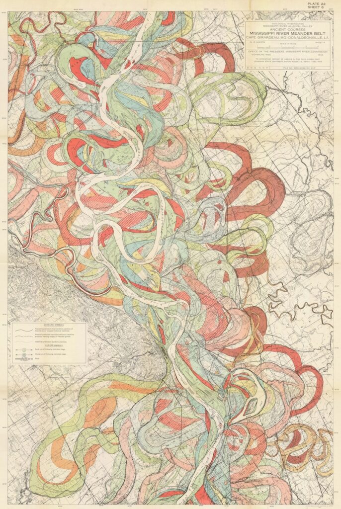
NWNL Oh yes! I even have a t-shirt with the famous map showing eons of the many courses the Lower Mississippi has taken – each in a different color to show the centuries of changing bends, bayous and oxbows. It’s a great map!
1944 map by Harold Fisk of Mississippi meanders over time, Courtesy of USACE
A Southern Mississippi Basin Youth
NWNL I hear you have a tale about your mother being born in 1927…
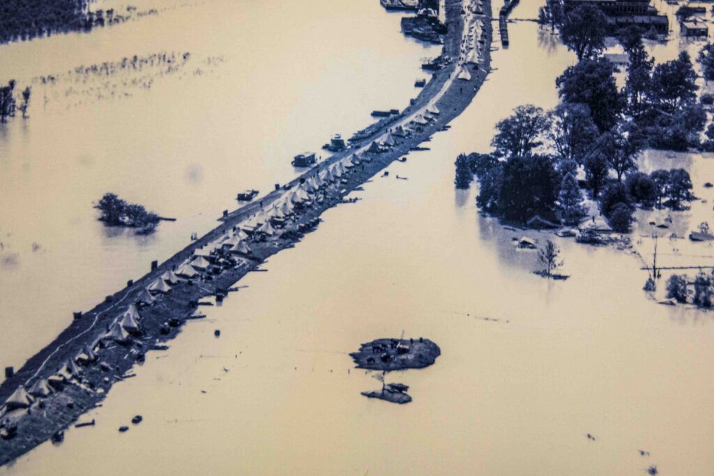
RICHARD HESS I think mother was the youngest of all the girls. They lived on Yellow Bayou. The levees weren’t as tall as they are now and the river wasn’t as confined; but that 1927 flood was unprecedented. It started raining spring or summer of ’26, or late summer of ’26, or maybe early fall of ’26. Finally, they took refuge on the levee, the only high ground.
NWNL They camped out there and your mother was born there?
Mississippi River levee tents for those with houses lost in the 1927 Flood (Photo courtesy, Delta Cultural Center exhibit, Helena Ark.)
RICHARD HESS Yes, that’s where people took refuge. Avoyelles Parish is real low. If you go west from there, you come to what we call the prairie. That’s where Marksville is – the parish seat. My parents settled there because their wagon wheel broke. So that’s they staked as theirs – the soil down there would grow anything. It was unbelievable. I picked cotton as a kid for 2 cents a pound. I remember picking cotton, growing up with just the blacks, lined up with them picking cotton, with a cotton sack on my shoulder.
Mama told me about hoeing cotton. At one point, she said she’d never hoe again. She was done hoeing. She was staunch about that. What scared her was when she was hoeing with my Papa, Lionel P. Voiselle. She didn’t see, but he saw the snake and got to her before the snake did. It scared her, and she didn’t do that anymore.
Helena, Arkansas, mural on city building showing child watching women pick cotton
NWNL I don’t blame her. I don’t like snakes either.
RICHARD HESS There only four poisonous snakes here. Rattlesnakes, water moccasins, copperheads, and corals.
NWNL You have coral snakes here?
RICHARD HESS Uh-huh. “Black on yellow, it’ll kill a fellow. Black on red, a friend of Fred.” A coral is not very big. I read an article on boys canoeing last year in the Atchafalaya Basin. Before my daddy died, I’d go fishing with him there in 600,000 acres of pristine water. In summer, thunderstorms down here can get really strong. These two canoeists took refuge by pulling up on the bank of a bayou. They leaned up against a tree, stretched out, and a coral snake bit one boy on the hand and he died. Look at the snakes: red on yellow, red on black, black on red, a friend of Fred – or something like that. You got to remember that!
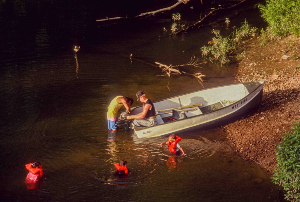
Children river-boating with their father in the Ozarks in 1993
Flooding and Flood Control
NWNL Forgetting snakes, what are your thoughts about Mississippi River floods and flood control?
RICHARD HESS ’73 and ’75 were big floods, but ’73 stayed a long time, but little happened? What they’re afraid of now…? The river changing course is the big to-do.
NWNL You’re talking about the use of flood diversion?
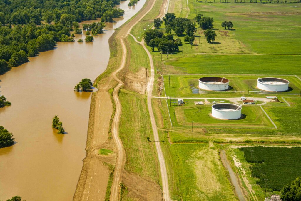
RICHARD HESS Just 45 miles south of here are four structures. One is the Sydney Murray Hydroelectric Powerplant, built maybe 20 years ago to divert water into the Red River. There was a deal that had been made about a century ago over a 300- or 400-mile log jam there. Captain Shreve straightened out the Red River to clear up that problem, and Shreveport was named for him. The logs and water moved, but the channel changed.
The Red River is 16 feet lower than the Mississippi. That difference can generate great water power, so its where the first hydraulic powerplant is. The next one is the Old River Control Structure, a spillway just like Morganza. It’s closed right now, but the seepage going through it is unbelievable. You can hardly hear yourself talk. Very impressive; and there’s nothing else there.
USACE’s Old River Low-Sill Control Structure in the Atchafalaya Basin
Right across the river from that is Lake Mary, which is a Mississippi oxbow lake. Then around a little curve there’s a diversion structure that nearly collapsed in ’73. So near there, they built a new water diversion structure to distribute equal water amounts on each side of that structure so it can’t collapse. That’s the Old River Control Structure – 15 or 18 miles from the Morganza Spillway. Right there, two out of three drops of water in the United States pass and fall. It’s incredible.
Current Basin Issues
PEGGY Hey! It snowed six inches in Wyoming just the other day and is still snowing. Perhaps goes to the Rio Grande, but it’s an indicator of more water coming here.
RICHARD HESS Think about this: the faster the water moves, the less sediment is going to fall out, and the less dredging is needed. So, in New Orleans, the government contracted two guys to keep that channel clear and keep clearing it to enable ships from Europe to come up to New Orleans.
Then, over the years, the US Army Corps of Engineers said, “Instead of letting water meander, we’ll just bring more in and clear the land.” Where you drove across the river in Louisiana, all the soil is alluvial; where soil here in Natchez on the Mississippi side is wind-blown deposits – totally different. When they tried to farm here, they failed.
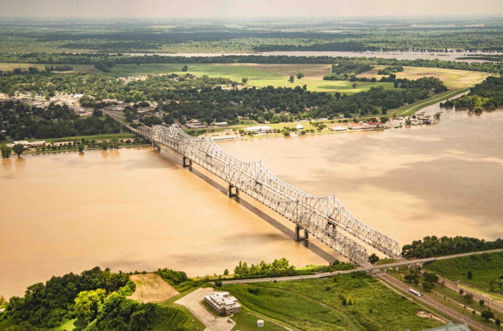
Low Louisiana fields above and Mississippi bluffs below the Mississippi River, and the Natchez-Vidalia bridge
NWNL Because Natchez only has six inches on the top of red clay!
RICHARD HESS Right. But anything grows over there in Louisiana, and that’s why those farmers came. From mid to late 1960’s, Russia had five years of bad weather and crop failures, so we sold them soybeans. Soybeans that were $3 and $4 a bushel went to $18 or $19 a bushel. Every farmer cleared all land and we gave them 3% loans to do it. Now we give them money to replant those cleared trees. What I have seen in my 50 years here – regarding ecological damage – is absolutely phenomenal. Plus, you can’t catch fish anymore. I used to be in a fishing club. At first, the limit was 15 fish. A couple of years later, it went to 12. Bass fishing; went to a ten-fish limit. Now you can weigh in with five fish – if you can catch five. It’ll be three soon. Now they want to reforest since there’s no place for people to go and recreate. I saw them clear the wildlife and fisheries just below us. They badly wanted to clear St. Catherine Creek National Wildlife Refuge where there are ancient cypress stumps in some of the bottom areas twice the size of this 5-foot table.
St. Catherine Creek NWR, between Louisiana border and Doloroso
Can you imagine a tree with an 8-10 foot base? They cut them all down. Then the government gave in, and Ducks Unlimited got involved, trying to bring back wildlife. The only thing the forest really produces now is bottom-land hardwood nut trees. They replant nuttall, a tree that bears nuts. Pine trees won’t grow in lowlands. Sadly, the absolutely beautiful, blackish tannic-acid water in these bayous are now muddy after a little rain. And what happens? I always keep a push-pole in my boat when I fish in tournaments and in the fine, fine sediment, you can feel that stuff with your push-pull. For five or six feet, there’s nothing but fine, fine silt – just like sifted flour.
Its now sad when fish spawn. She drops the eggs and he protects them. You can see them on the beds. But that sediment falls on the eggs, so the percent of eggs that make it to maturity are less and less.
NWNL Will tree replanting help stabilize the sediment?
RICHARD HESS Well, there’d be less runoff. When man wants the water off his land, he’s going to run it into a ditch. If we each have 100 acres with the bayou running through and we cut some trees, it allows water to go into the bayou. Suddenly all that sediment that has piled up then washes away, muddying and dirtying the water. That tannic acid, beautiful water – it’s no longer there because there are no trees.
Riverine Wildlife
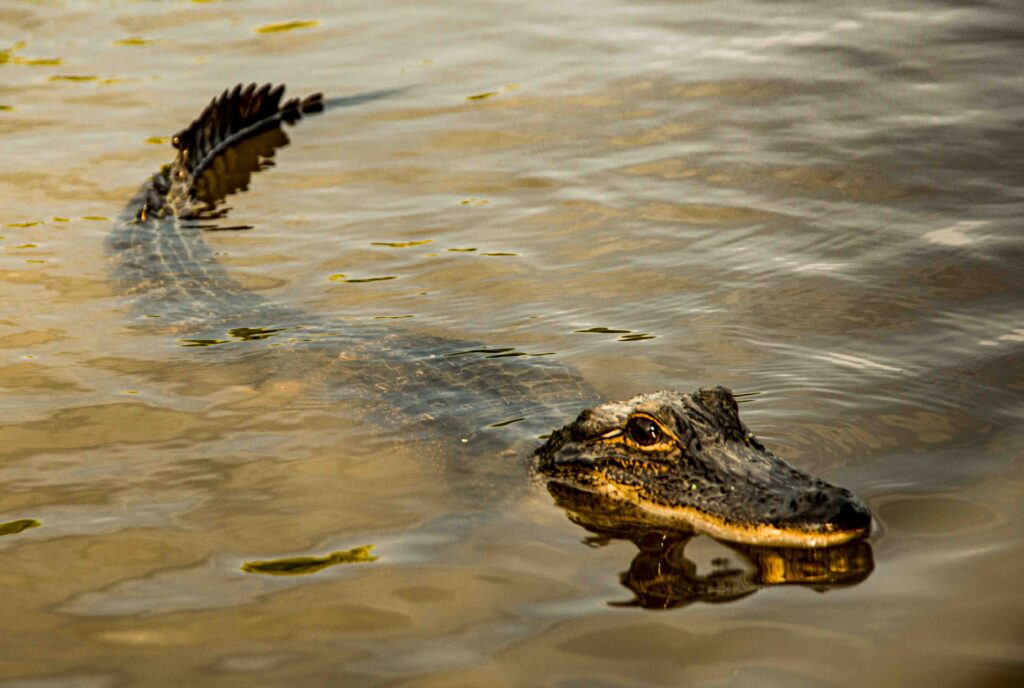
NWNL I saw 3 alligators today.
RICHARD HESS Alligators mate in May and June. They can’t mate in the water, so they’re up on the levees.
Louisiana alligator in shallow water
If I take my dog through there and the grass is high, I can’t let him pee or poop. Last year I took him way back on Long Bayou to see what the water looked like. I left my truck. My dog got out and went up to the bayou.
He wouldn’t go in, wouldn’t drink. That was unusual. I said, “Move your ass and get some water. I’m not going to wait.” He walked to the side, but barely went in. Instantly, there were three huge alligators. If he’d gotten in and jumped around, I’d have never seen him again. They would have eaten him just like that. He sensed that!
PEGGY Yesterday, near Gale’s shop, there was an alligator in the slipstream going fast, fast. We walked to the road-closed sign, but he’d gone into that little place where you’d wait for the bus to the old casino. I thought, hmmm…. there’ll be a couple of drunk guys out there wandering around and… Well, I’m not walking my little dogs there anymore.
River Dynamics
NWNL The engineers must be worried about the integrity of the levees today after eight months or so of their being inundated.
RICHARD HESS I’m sure some in the Corps of Engineers are having sleepless nights. Ouachita River is full, the Red River is coming from one side; the Mississippi from another. In between, the Tensas. They meet in one spot. That’s where it’s critical!
In ’73, I’ve never saw so damn many sand boils in my life. Now there’s water in Vidalia and water off the side of the street. There’s seepage because the levee isn’t connected.
NWNL So I was stupid to be driving on those levees today near Delta?
Levee below Waterproof LA that I drove on during 2019 spring flood
RICHARD HESS You were treading water there – but if it were really super dangerous, they’d have closed the road.
NWNL There were no warning signs, and no water up against it. So let’s discuss reverse wells that lessen levee damage by relieving the pressure on sand boils?
RICHARD HESS They used to use bags of concrete for weight on the backside.
NWNL This is different. They drill down on the water side of the levee now.
RICHARD HESS They’ve got new technology then. And remember, a sand boil is okay, if the water is clear as it comes out. If it’s muddy, it’s connected to the river.
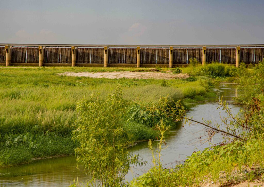
The Spillways
Bonnet Carre Spillway with its gates closed in Sept. 2014
RICHARD HESS There are three spillways: Old River Spillway just 40 miles south of here; the Morganza Spillway; and Bonnet Carre. Old River and Morganza are west of the Mississippi River, Bonnet Carre is east sending overflow into Lake Pontchartrain and going out via MRGO past New Orleans to the Gulf. Bonnet Carre is open for the second time this year which is unprecedented. It’s fascinating that we’re right in the midst of something that could be catastrophic.
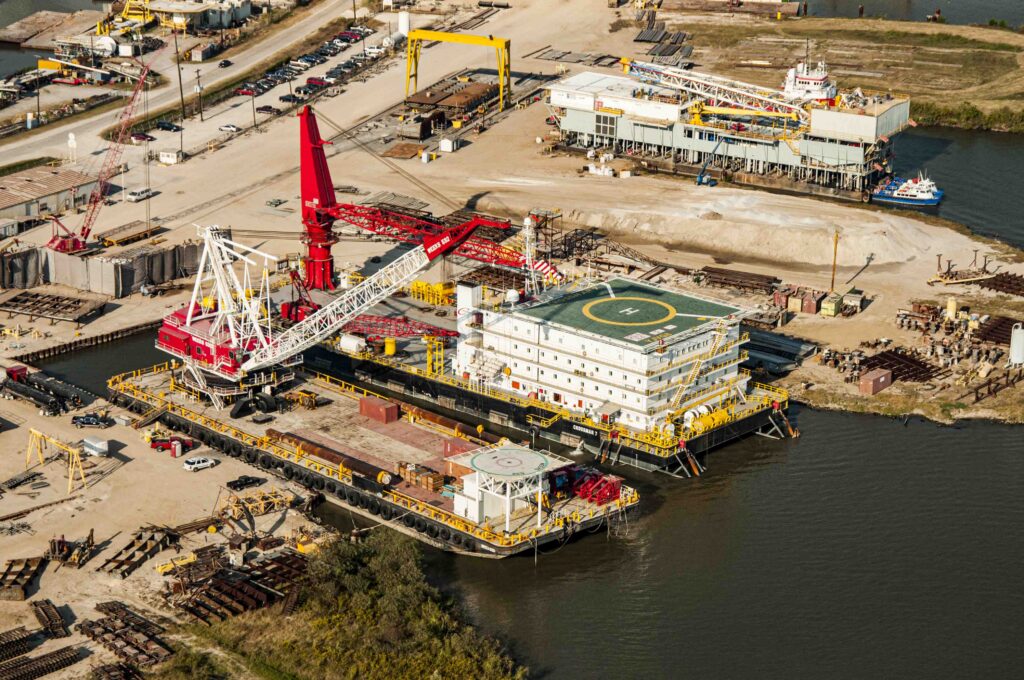
When you open the Morganza Spillway, it goes right into the Atchafalaya Basin.. So, they’re hesitant right now to open the Morganza because so many people are now down in the Atchafalaya Basin, including those moved off storm-damaged islands in the Gulf. As well, Morgan City is there, as the nucleus for offshore oil production; and they keep fighting opening the Morganza.
Morgan City heli pads & boats serve Gulf oil rigs via the Atchafalaya River
My buddy sent me news recently from the Red River Landing Gauge at Torres that was washed away in 1918. The river turns right there like a 90-degree corner. So if you can imagine, all that pressure right there washed away Torres. This old boy is worried to death and wants them to open the damn Morganza – now! They won’t, because too many people are down there – and too many houses.
NWNL But that’s what the spillways are meant to do.
RICHARD HESS That’s right. They paid those people years ago. In 2011, they opened it, and there wasn’t much to it. That flood was big, but not big as now. Even though it’s high now, there’s still too many other waters that would be impacted if they opened the Morganza, including the Red River, the Arkansas River and the Ouachita now. In 2011, they had no water, so they opened Morganza Spillway for a little trickle, about ankle-high. But they’re afraid to do that now, since other waters are filling up.
NWNL They’ve put it off now indefinitely.
RICHARD HESS And they probably won’t open it, especially since a levee collapsed in Arkansas, and as those waters spilled it was in some way a relief valve.
The Mississippi doesn’t usually go over today’s levees. It just weakens them. But a terrorist wanting to do harm could blow up a levee and change the river. That would be economic disaster for Baton Rouge and New Orleans. There’d be no water. Boats couldn’t come up. They’d all go to Morgan City, but that would be wiped out. Saltwater intrusion would ruin the fresh water. It would be a big, big to-do.
NWNL That is the stuff of horror films – hopefully not reality. Richard, I’ve enjoyed your talks and thank you for taking time with me on your birthday to discuss the Mighty Mississippi! Here’s to a Happy Birthday!
Posted by NWNL on September 1, 2023 Transcription edited and condensed for clarity by Alison M. Jones.