
Hydrology & Impacts of Ethiopia’s Dams
Omo River Basin
|
NEW ESRI StoryMaps: What's On Our Shelves & NWNL Song Library & No Water No Life ESRI |
Omo River Basin
Sean Avery
World Bank Hydrologist and Chartered Environmentalist
Alison M. Jones
NWNL Director & Photographer
Impacts of Ethiopia’s Dam Building
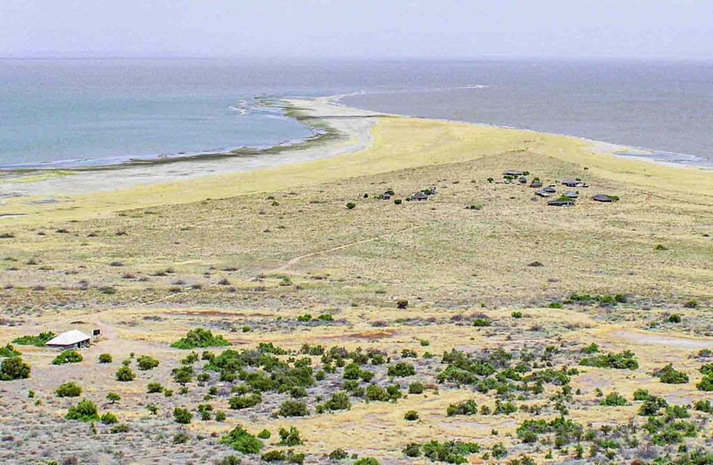
Lake Turkana Water Issues
The Past of Lake Turkana & Omo River
Gibe III Dam Impacts
Solutions to Gibe III Dam Impacts
Water Needs of New Sugar & Cotton Crops
Mitigation Strategies
NEXT: Gibe IV & Gibe V Dams
All images © Alison M Jones. All rights reserved.
NWNL Hello Sean! I’ve closely followed your papers on the impacts of Ethiopia’s construction of the Gibe III Dam on its Lower Omo River and Lake Turkana. This watershed in southwest Ethiopia is one of six No Water No Life case study watersheds. My documentary expeditions to the Omo Basin left me concerned over impacts of new hydro-dams Ethiopia is building on the Gibe River, a major Omo River tributary. Thus, I appreciate this introduction by James Robertson, a NWNL Advisor and great friend in Kenya.
SEAN AVERY Alison, I’m very interested in your trips into Omo River Basin because I’ve not visited that area since working professionally on Lake Turkana. When on an African Development Bank project 5 or 6 years ago, I drove from Addis Ababa to Konso and Lalibela and then to Omorati on the Lower Omo River.
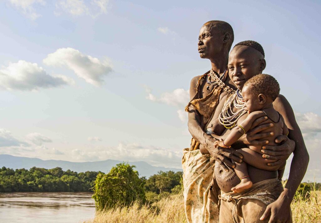
SEAN AVERY I worry about the current status quo of the Omo River Basin. where I believe people are being displaced and forcibly pushed into villages. Ethiopians don’t have a village-ization policy; but around the big hydro scheme in Gambella, they’re pushing people into villages. They say the government can more effectively provide infrastructure for people if assembled in villages rather than scattered all over the countryside. Is that happening in the Lower Omo? If so, how many people are affected?
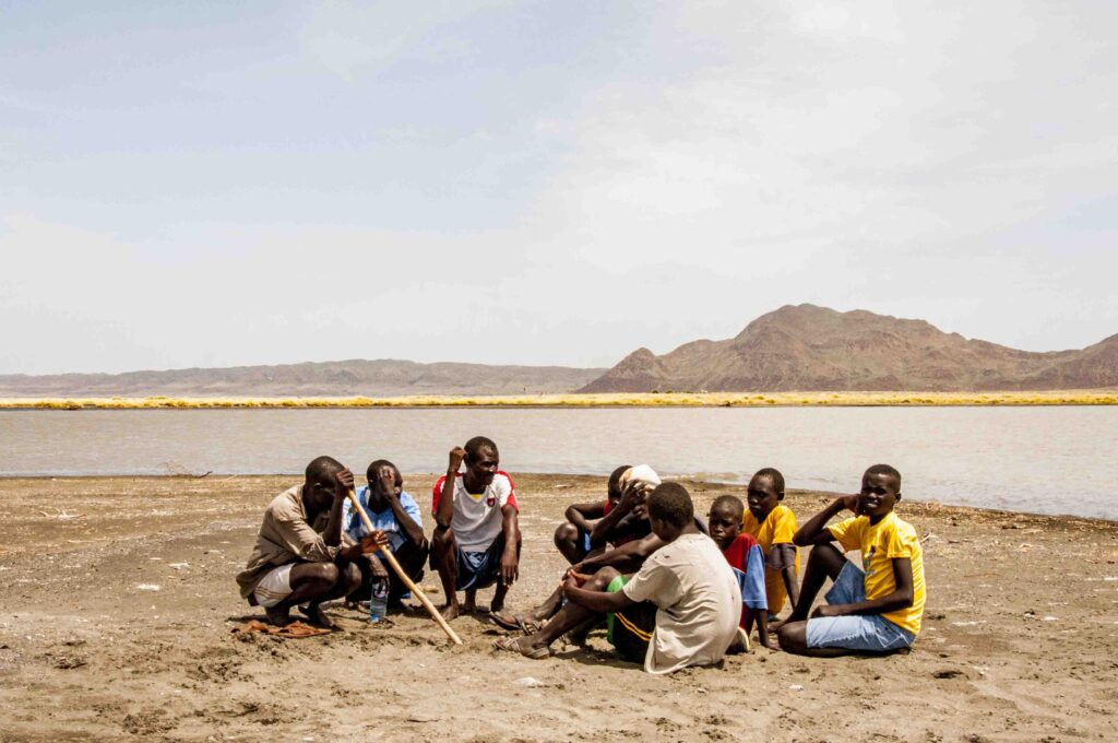
They say about 200,000 indigenous people live in the Lower Omo. and about 300,000 people live around Lake Turkana. Verifying that is one thing I’ll do in my present studies. To put those numbers into perspective, the United Nations database for the whole Omo Basin population is close to 8 or 9 million people.
NWNL That must include the Upper Omo, right?
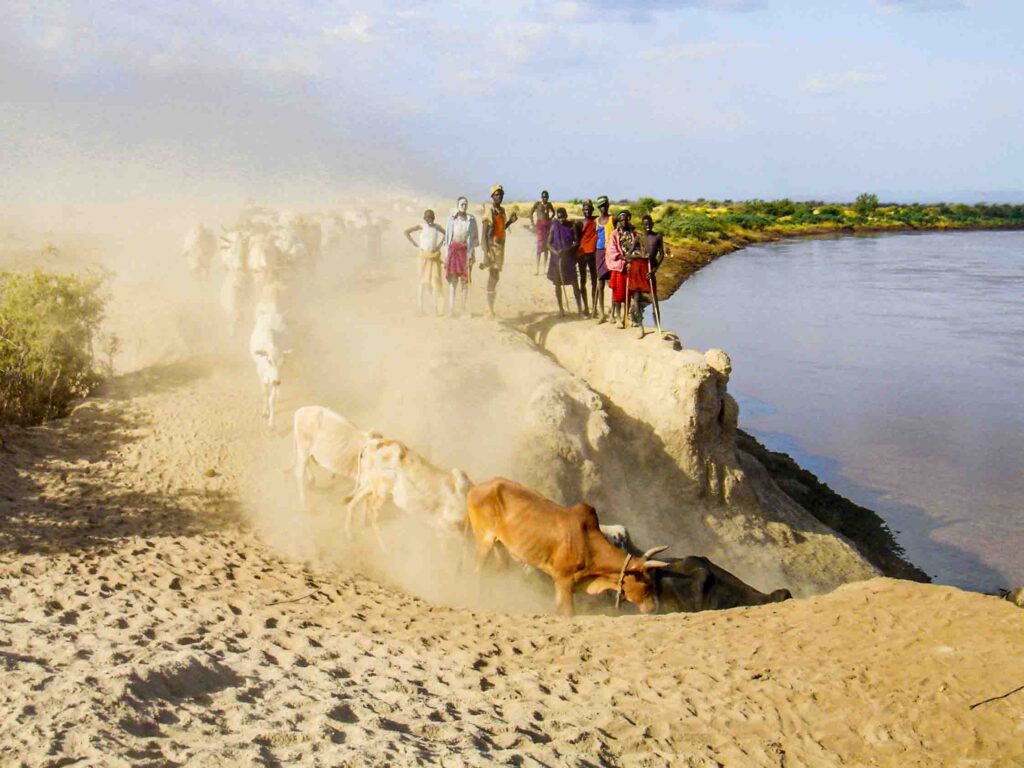
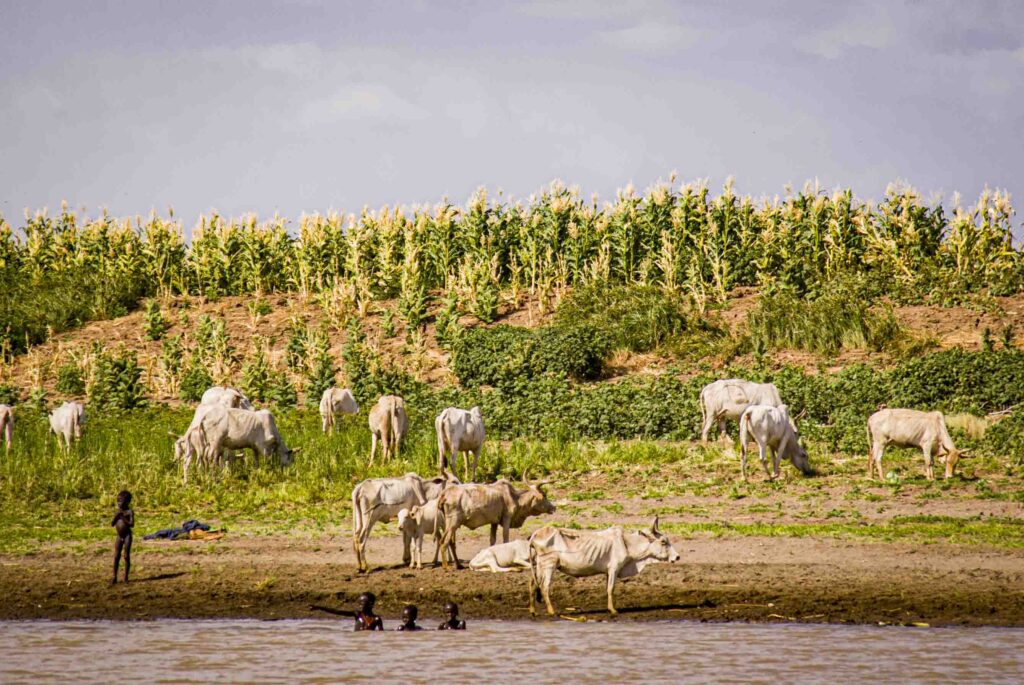
SEAN AVERY Yes. Clearly, the Lower Omo population is relatively small compared to the number of Ethiopians now affected by food scarcity. [ NWNL Note: Tribal villages in the Lower Omo were self-sufficient for 6,000 years – until their traditional flood-recession agriculture ended as the Gibe III Dam changed flows in the Omo River.]
NWNL How did you get involved in studying the Gibe Dams?
SEAN AVERY I’m a civil engineer by training involved in developing projects. In my report – to produce a balanced view regarding the Omo Basin – I emphasized that the Gibe III Dam Project is consistent with what the international donor community was urging the Ethiopians to do. A 2004 World Bank paper stated that Ethiopia needed to utilize its dry lands in the south and put in irrigation schemes. That’s exactly what they’re doing! Water in Ethiopia is what oil is to Arabs. It’s their greatest resource. So, after 8 years, they’re now developing that region.
The problem is in how it’s being done. The way local people are being treated is incompatible with established international procedures for environmental and social impact assessments. Unfortunately, they are missing. For Gibe III Dam, there were no environmental or social impact studies when they started its construction. Those studies were an afterthought — and unfortunately stopped at the border. Consultants visited the Ethiopia-Kenya border, but didn’t consider dam impacts on Kenya’s Lake Turkana.
Thus, African Development Bank brought me in to study effects of Ethiopia’s new dams on Lake Turkana. Sadly, the project has been a series of reactive phases for issues needing study. Their studies didn’t sufficiently detail or properly assess those long-term impacts needed before the dam’s construction was permitted.
NWNL What was missing in the recent environmental impact studies, compared to those done two years ago?
SEAN AVERY Those recent studies didn’t include Lake Turkana. They drew the line at the border and thus didn’t cover the dam project’s full impact! My opinion, particularly on hydrological changes on the ecology, is that the evaluation of Gibe III Dam impacts lacked needed science. Their studies were relatively superficial and likely based on opinions of consultants doing that work. Thus, we lack a scientific basis for mitigation measures.
The other big question raised on the Internet is how can we be sure mitigation measures will be implemented?’ Furthermore, while studies mention Gibe III mitigation measures to protect people downstream and Lake Turkana’s ecology, they don’t discuss impacts of Gibe IV and V Dams. I haven’t seen those downstream studies yet. We all need to know the ultimate impacts of Gibe III, IV and V hydro-schemes meant to serve irrigation development. In terms of water volume, hydropower mainly redistributes the water. It holds water back, stores it and then releases it back into the river system. That assumes no significant losses as a consequence of those high dams.
NWNL But isn’t there always loss due to evaporation of the reservoir behind the dam?
SEAN AVERY Yes, there’s evaporation from the reservoir and vegetation formerly in the reservoir that transpires into the atmosphere. But in my mind, that’s not a major issue.
While losses due to the dam are widely talked about in the media; I’ve not yet seen technical studies supporting such losses. Consultants for the dam came up with geological studies suggesting losses would be minor and insufficient to soak up immediate geology.
I’d like to see more extensive technical studies to establish if the losses significance. Some argue that even if there are losses from the dam, the losses will stay contained in the Omo Basin since there are no other places for water to run. But the main issue is the new sugar plantations will take 19% of the Omo River’s flow into Lake Turkana. Those abstractions will have a significant effect.
NWNL You raise points I haven’t heard before! Regarding how many Turkana people will be affected, International Rivers says 300,000. Nigel Pavitt told me those affected would be “less than 200,000.” An International Lake Environment Committee article titled “Promoting Sustainable Management of the World’s Lakes and Reservoirs” said 230,000. Nigel said to check with Lodwar Mission’s Catholic bishop who’s been there a number of years. And I’ve read there are many more people in the Upper Omo – perhaps in the UN database you mentioned.
Lake Turkana Water Issues
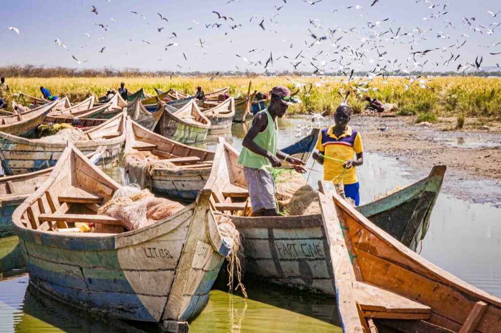
SEAN AVERY To grasp Lake Turkana’s population profile, bear in mind that until the 1960’s, it was not utilized by people in any way. Rather, it formed a physical barrier between Nilotic and Cushitic people. Some locals fear that if that lake dries up so would that physical barrier between two very different ethnic cultures. In the 1960’s, fishing was not a major livelihood there, apart from El Molo people’s minor amount. Nor was it for the Turkana people originally, but now they are the major fishers.
Everybody studies the “immediate lake zone” to assess how many people fish and benefit from the lake. I’d be interested to see exact numbers. Perhaps they’re less than people think. But considering the impact that lake-side zone has on the lake’s general economy, remember that many not living right on the lake depend on the fishermen.
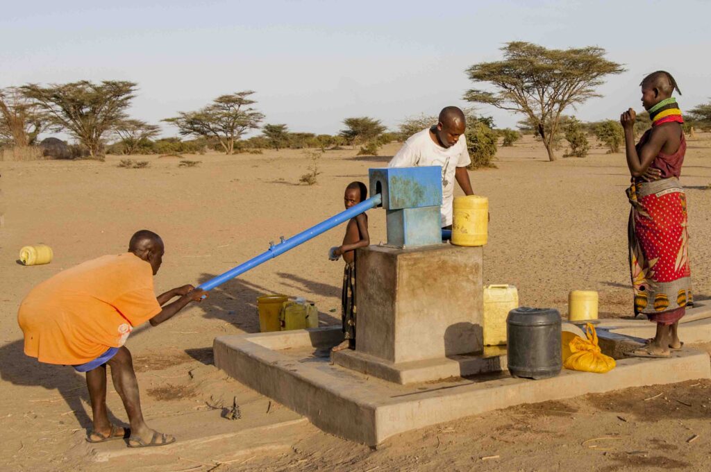
Many focus on water used for drinking; but that lake water is not potable. Local people drink it – but shouldn’t. Around the lake you see crippling skeletal fluorosis in people’s bent spines, due to their bones becoming brittle. If the water became a little more saline, it would really exacerbate that problem. Additionally, dental fluorosis is from drinking the water and from eating the fish. Today’s focus should be on providing alternative water resources.
NWNL Can you further explain fluorosis?
SEAN AVERY Fluoride is a chemical often found in water from volcanic sequences. Many Kenyans have stained teeth from fluoride affecting bone formations when young. In advanced phases, that condition can affect our skeletal structure. In Turkana people have bowlegs, swollen knees and problems with their spines. These debilitating conditions are a giant consequence of drinking water with excessive levels of fluoride. In small qualities it’s good for your teeth. Limits specified by World Health Organization are about 1.5 milligrams per liter. Yet levels in Turkana are about 10 milligrams per liter. That’s critically high for childhood development; but for adults taking casual quantities, it’s not an issue.
NWNL In addition to humans’ dependence on Lake Turkana waters, livestock are also in jeopardy. Furthermore, Nigel Pavitt explained another domino effect. He claims that among other ecological consequences of lower water levels in the lake, less frequent rains will create a drier Sahel.
SEAN AVERY Yes, Lake Turkana is an evaporation basin. The entire flow of the Omo River goes into that lake and then evaporates. Thus, some argue that it’s better to utilize the water in the upper reaches, rather than waste it to evaporation in Lake Turkana. Indeed, lake water goes into the atmosphere and is carried by prevailing winds into the southern Sudan. This causes microclimate effects. But, to my knowledge, they are not quantified, nor being studied.
NWNL Nigel also shared that as water resources drop, there’ll be more long-term climatic impacts than immediate effects. With less water in the lake, the air will be hotter and drier. In the larger surrounding area, there will be less rain. The drier climate, specifically around the Sahel, could be additionally exacerbated by global warming. Do you think climate changes plus a shrinking Lake Turkana will affect the future water table?
SEAN AVERY It’s very difficult to isolate impacts of one link in the chain from the others we are experiencing. The Omo Basin has already seen considerable change. Its human activity over many years has affected and perhaps increased hydrological runoffs. Plus, when it rains, more water runs off. The lake is in a rising phase and higher now than in its low points in the ‘40s, ‘50s, the late ‘80s. Various changes are taking place as runoff patterns within the Omo Basin have changed the amount of water coming into the lake. There are other associated consequences.
As you say, the lake contributes to a microclimate we don’t properly understand. Prevailing winds tend to push moisture into South Sudan which is well-endowed with water. I think changes from these developments are likely to be noticeable, but still within ranges not very different from natural cycles. There will be reduction in lake levels; but we know this lake has been through huge changes in its history.
The Past of Lake Turkana & Omo River
SEAN AVERY In the past, Lake Turkana was virtually two ponds. The paleo-history of Lake Turkana is a very good example of climate change over thousands and millions of years. For instance, Lake Turkana was 80 meters higher 7,500 years ago. Also, it was connected to the Nile system! So, considering changes that led to water levels down by 80 meters, we’ve already realized huge climate changes there.
NWNL How long ago was today’s Lake Turkana actually two ponds?
SEAN AVERY I don’t have specific figures. The lake has existed for about 4 million years. Per assembled paleo data, it’s been through many phases. Lake Turkana was once just a river flowing down to the Indian Ocean. We have fossil records including a species of stingray that came up from the Indian Ocean all the way to the “Turkana River” very close to today’s Lake Turkana. Can you believe that?
Also, the Omo River once flowed to the Indian Ocean, passing straight through the area of today’s Lake Turkana. Later, there were formations of small and large lakes. Eventually the Omo System started to overflow into the Nile system. So, looking at the records from over 4 million years, this system has gone through huge changes.
NWNL I’ve read some of that with fascination, but hadn’t heard about two ponds. The fascinating connection of Omo-Turkana system with the Nile River Basin allows NWNL to claim that, at one point, our 3 African case study watersheds were all linked together in one big loop!
Moving forward to the 20th century, Nigel Pavitt discussed his experiences at Fort Wilkinson up on Lake Turkana’s northwest corner. He shared a 1957 photograph of the fort with the lake in the background, having risen after a couple of El Nino years.
SEAN AVERY Didn’t Nigel work up there?
NWNL Yes. He was stationed there and used shoot whistling ducks from its turrets as they flew along the edge of the lake that was then right up by the fort.
SEAN AVERY Regarding the two ponds, somebody named Churling in a US university has studied isotopes identifying sources of waters from those two ponds. The northern pond was fed by the Omo, which enjoys rainfall from the Atlantic. The southern pond fed by the Kerio/Turkwell systems, was also fed by water from the Indian Ocean. So, there’s a lot of interesting research being done showing historic stages the lake has been through.
NWNL In 2003, I flew with Halewijn Scheuerman from Lobolo across Lake Turkana to Koobi Fora on the lake’s northeast corner. Halewijn has found fossils there that include algae and vegetation indicating Turkana’s northeast lakeshore used to be a lush, wet region at the time of early humans.
SEAN AVERY In Alia Bay’s petrified forest nearby, there are tree trunks very large in diameter. They could only have grown that much in a very moist era. And there’s proof of fantastic variability. Evidence around Koobi Fora is incredible and well preserved. After rains, you can walk down erosion gullies that are fossil beds with fossils sticking out of the ground.
Gibe III Dam Impacts
NWNL The Omo-Turkana Basin history is awesome. But now it’s filled with so many people who could be affected by changes in Omo River flows and Lake Turkana water levels. I’ve read differing assessments of water-level impacts and flows by you and reports by ADB, Friends of Lake Turkana and the Ethiopian government’s Gibe III website. The Gibe III website quotes you saying, “The maximum water level on Lake Turkana will be limited to a 0.6-meter rise after the construction of the Gibe III.” Your own report says, “Filling the dam would reduce the water level by two meters.” A Friends of Turkana report stated it could reduce lake levels by as many as ten meters.
What are today’s estimates for reduced fluctuations of the Lower Omo? They are of existential concern for ancient tribal communities reliant on fluctuations needed for their traditional flood-recession agriculture. What will happen to Lake Turkana as the reservoir behind Gibe III is filled and then on an ongoing basis afterwards? Then what will happen to the lake as river water is extracted by cotton and sugar plantations to be established along the Lower Omo River?
SEAN AVERY Gibe III Dam creates a hydro scheme that doesn’t consume water. Once operational, it won’t remove water from the Omo River, or reduce levels in Lake Turkana. But the huge reservoir behind the 240-meter-high Gibe III Dam must be filled with water for the scheme to operate. That is the initial concern because filling the dam reservoir will reduce the lake level by two meters.
A document titled “TURKANA, 1993-2008 – Gibe III Filling” was presented at the 14th Lake Conference I attended last year in Texas. Its graph shows natural lake sequences since 1992 and impacts expected as they fill Gibe III Dam. The lake would drop by two meters; and then slowly recover to original levels. When you take water out of a system like that, the lake’s level will lessen, and then reach its former stability.
NWNL How will these changes the Lower Omo River ecology and water resources that support tribes that have lived there for thousands of years?
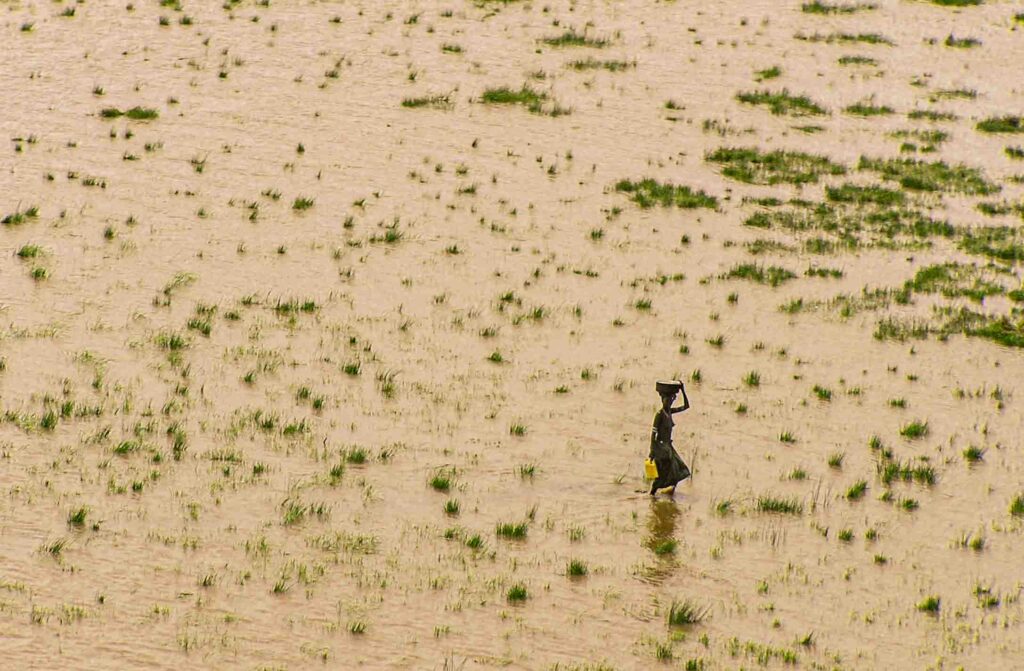
SEAN AVERY Ecological concern is that a hydro scheme, by definition, will regulate and determine downstream flows. Up until now [for the last 6,000 years], local people used the Omo’s varying flows for flood-recession agriculture. Now those floods potentially will be contained and then released downstream as a constant discharge. These constant discharges will change the system and end any possible flood-recession agriculture. It’s difficult to decide if that’s good or a bad, since floods are becoming bigger and more frequent.
Although people like to blame everything on climate change, many flood-height increases are a direct consequence of land degradation, poor agricultural practices, reduction in forest cover, and particularly the tendency to cultivate adjacent to the water holes. Flood models of well-drained soils show that the main contribution to flood peaks is in the 10% of a catchment immediately adjacent to the water holes. Where human cultivation and activity occurs close to rivers, many of these rivers are having much larger floods.
From an ecological point of view, variability leads to diversity. Without that variability, we’ll reduce the ecological diversity. Many wetlands will be impacted since they are completely dependent on floods. Studies I’ve seen haven’t carefully detailed the extent of natural wetlands, their annual inundation, or flood impacts on wetland diversity. Loss of diversity will be a consequence of these schemes.
Flow Changes due to Sugar & Cotton Crops
NWNL It seems these dams will control flows to support foreign investors’ sugar and cotton plantations, that are also dispersing the self-sufficient indigenous communities from their territory the banks of the Lower Omo?
SEAN AVERY Bear in mind that in 2004 World Bank supported and promoted the sort of development now taking place. Plus, I’ve suspected that without Gibe III Dam, Omo floods would peak higher, and engineering solutions to prevent catastrophic flood damage has been dams. I’ve been recreating the last 20-30 years of natural Omo River flood sequences to see how human activity has affected current significant hydrological changes. Gibe III Dam will smooth out future increased flood discharges. If this ends the practice of flood-recession agriculture, people will have to use small-scale alternatives, such as pumped irrigation, to take water out of the system. As well, there’s still a significant catch downstream to contribute to former natural flood cycles.
NWNL And what about the Gibe Dams’ impacts on Lake Turkana?
SEAN AVERY Long term, the hydro scheme itself won’t reduce the volume of water coming into the lake. It will eliminate seasonal flooding cycles, but not take water out. Ethiopia says water taken out for new extensive crop irrigation along the Omo once those sugar schemes are operating will near 19% of former flows. Lake Turkana will see water level variations, but no more than those being experienced naturally now.
On a permanent basis, this will reduce lake levels by about 10 meters. As the hydro scheme smooths out the flows, irrigation schemes will remove water from the Omo reducing its levels and the lake’s inflow. That will cause lake levels to drop and end cyclical changes beneficial to both the lake’s ecology and its fisheries dependent on flood cycles to stimulating the breeding of fish. One mitigating measure in the Gibe hydro-scheme is that every year they’ll release artificial floods for 10 days from the dam into the lake. This effort, simulating what used to happen, is intended to maintain fisheries’ status quo. Yet I’ve not seen any technical basis for such a flood.
NWNL This is why there should have been an environmental impact study on the Gibe III Dam! Has Ethiopia acknowledged the lake will drop ten meters because of the sugar cane plantations? Has it addressed its responsibility regarding these trans-boundary issues?
SEAN AVERY I’ve not seen any technical documents or environmental impact assessment relating to the scheme. My estimation of dropping levels is based on their estimate of the reduced inflow to the lake.
NWNL That’s based on Ethiopia’s acknowledgement there’ll be a 19% extraction from the Omo River to irrigate new sugar cane plantations?
SEAN AVERY Yes. A journalist published Ethiopia’s prediction on the Internet after he collected information by visiting their irrigation scheme and was given the volume of water that the scheme would need. That figure coincides with my estimates. Some of my professional colleagues who are experts in irrigation made the same estimates of the amount of water needed for 150,000 hectares of sugar. So, Ethiopia’s government provided what I think are accurate figures. They’ve not withheld that information.
NWNL How are other governments involved reacting to this reduced water flow to Lake Turkana?
SEAN AVERY Regarding Lake Turkana, world bankers in 2004 didn’t see the lake as significant resource, despite it basically being an arid zone. Opinion then was that any negative consequences of such a dam would be compensated for by benefits from the dam’s power and the improved security. The Kenyan government signed a Memorandum of Understanding with Ethiopia to buy power from Ethiopia with support of donors like the World Bank. Others supporting the ongoing development route are building transmission lines from Ethiopia into Kenya. So, the principle of Gibe Dam’s development is being promoted by the international community. Their general feeling is that Turkana is a desert lake; its waters are not that important; and any impacts will be offset by benefits derived from the power and the food.
NWNL What’s your opinion as a hydrologist?
SEAN AVERY As long as we have rapidly increasing population levels, sugar cane will be increasingly important. From an engineering point of view, utilizing Omo River water for food may be a priority in the present environment. Population levels in these areas are growing at unsustainable levels. But that’s a topic most people don’t want to talk about.
Mitigation Strategies
SEAN AVERY I promoted in my report that we need to properly understand the science and ecology of the lake. Rather than speculate and wildly suggest what’s going to happen, we need proper scientific studies of the lake’s ecology, fisheries and all its controlling factors. If we can properly understand those, we can process proposing mitigation measures to minimize ecological impacts. We don’t want to destroy our ecological diversity that if we don’t have to.
NWNL Existing flood patterns in Lake Turkana have supported spawning grounds in the Omo Delta and Ferguson’s Gulf. Can you discuss why mitigating damage to these fisheries is important? Who could oversee that these fisheries are protected in this region where governments are not completely trusted?
SEAN AVERY This challenge is being talked about very openly in this country. I think this ultimately will happen. If these projects have any form of international government support, then donor support mechanisms will require that international committees are set up between the countries to manage trans-boundary impacts, measure, and make sure mitigation measures are implemented. This is a challenge and pure speculation to say that it can’t work. Past experiences suggest these measures tend to get swept aside when economics of mitigation measures are faced.
NWNL How critical is immediate pressure from international donors to follow through with mitigation measures? Once the dam is built, they’ve lost their leverage. They’ve contributed funding for the dam, and now there is no strong arming or tactics left.
SEAN AVERY I think the leverage of international data continues. It’s a bit like a bank loan: repayment of these schemes takes a number of years. In that time, conditions exist by which the borrower must abide. Donors have active interests in their projects. Of course, with Gibe III, it’s different because ongoing work was picked up by the Chinese. I don’t know what checks and balances are in place for their contributions. We’d all like to know that. I was very enthusiastic when the African Development Bank was involved because I felt there was a much stronger chance that guidelines and concerns we had would be addressed by international organizations due to this strong stakeholder base. But now, a whole mixture of things is happening. Gibe is being dealt with through the Chinese. International donors are involved in building transmission lines. I feel the broader picture is more important than small, individual components of the scheme. The international community must continue to watch overall impacts of development even if projects they’re financing aren’t causing a problem.
NEXT: Gibe IV & Gibe V Dams
NWNL Looking ahead, Gibe IV and V are planned. Are there any impact studies for them?
SEAN AVERY We don’t have the full picture on impacts of the cascade of Gibe III, Gibe IV, Gibe V. Those studies are ongoing and should take into account cumulative impacts and proposed mitigation measures. There are many other precedents to what’s going on in Ethiopia, including dams on Kenya’s Tana River. What’s happening on the Omo is happening in many places in the world, because burgeoning populations need power… but from where? There are inevitable impacts; and compromising is a normal process of development. Still missing are detailed studies on managing the impacts on the indigenous peoples. This hasn’t yet attracted much international concern.
NWNL I see this happening also in the deforested Mau Forest. Reforestation is needed, but international attention focuses on evictees in these Mau Forest relocation camps that lack sanitation or enough food. People who don’t have a voice need more attention.
Between developed and developing nations, it seems there is a contradictory pattern. This fall I attended the decommissioning the Olympic Peninsula’s Elwha Dam in Washington State. It’s the largest US dam breached so far. Shortly after, the Condit Dam came down on Washington’s Salmon River tributary to the Columbia. There is also much decommissioning of small, Colonial-era dams throughout New England. So, US dams are coming down, while Africa is building big hydro schemes.
SEAN AVERY 80% of Kenya is arid. Water that exists is not equitably distributed. In the arid zones, any water just rushes off and disappears. We need to capture and utilize that water. People need water. We can’t just let it fall and disappear. There is an increasing emphasis on storage. Even the World Bank, which has had its fingers burnt over water storage schemes, avoids them now. There are so many consequences of dams that cause controversy, particularly involving resettlement. World Bank is seriously looking at Kenya’s resources, its need for water storage, and flood mitigation measures in Kenya’s basins where floods are an annual problem to minimize and store floodwaters to then release more safely.
Water storage in Africa is critical. Countries like Zimbabwe, with climates like Kenya’s, successfully manage water with traditional storage dams that support their farmers. Certainly, storage is necessary if rainfall is concentrated in short seasons, if river systems are variable due to uneven rain distribution, and if water is needed year-round.
NWNL Sean, thank you so much for your research and environmental activism. And thank you for clarifying the complicated forces at play these days in the Omo River/Lake Turkana watershed – which intersected eons ago with the Nile River watershed!
Posted by NWNL on October 26, 2023.
Transcription edited and condensed for clarity by Alison M. Jones.
All images © Alison M. Jones, unless otherwise noted. All rights reserved.