
Interviewee
Dr Alan Rice DScE
Professor of geophysics, geology, sustainability issues, oceanography, physics, engineering
Interviewers
Alison M Jones
NWNL Director & Photographer
New York City, 2017
Introductory Note
NY’s Hudson River Basin isn’t a NWNL case study watershed, but it merges with NJ’s Raritan River, which is a NWNL case-study river. We chose to study the Raritan over the Hudson since I grew up there and wanted to “Think Globally and Act Locally!”
Both rivers mix and flow into the Atlantic via the New York Bight. Each contributed to the early progress of US commerce. Centuries later, RiverKeepers’ cleanup of a very polluted Hudson River became a model for stewarding many other US waterways.
Dr. Rice worked on an oceanographic vessel out of Nyack NY that plied a then-filthy Hudson River – ducking to avoid its polluted waters. He also worked for an oceanographic vessel on the Hudson out of Nyack NY. He applauds Mayor Lindsay’s early clean-up efforts and continuing anti-pollution efforts of many others.

Outline
DEFINING the HUDSON
A RIVER of MANY NAMES
FAULTS, FOLDS & FORMATIONS
AN UNUSUAL WATERWAY
A RIVERINE FOOD PYRAMID
HUMANS & the HUDSON
EARLY HUDSON INHABITANTS
EUROPEANS in the HUDSON BASIN
INDUSTRY & FERRIES
A RIVER TO SPAWN ARTISTS
THREATS to the HUDSON
SEISMIC ISSUES & FRACKING
GLACIERS & SEA LEVEL RISE
WANING STEWARDSHIP
PCBs in the HUDSON
THE RARITAN BAY
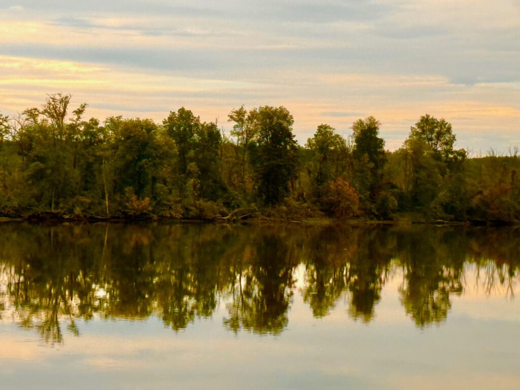
Key Quote From Albany NY to the sea, Hudson River is mostly a saltwater estuary, having grown greatly from its smaller upstream reaches and then mixing with seawater. As the Lower Hudson’s salt-water tides flow back and forth – upstream and downstream, it becomes more like a fjord than a river! – Alan Rice
All images © Alison M. Jones, unless otherwise noted. All rights reserved.
A RIVER of MANY NAMES
ALAN RICE When we speak of the Hudson River, we’re speaking of one river with many names. Up near the Hudson’s top headwaters, Native American names of those waterways included “The River of the Mountains” and “The River of Steep Hills.” The Lenape lived on the west banks of the Hudson River, in what is today New Jersey. Further upstream in what is now upstate New York, Mohawk members of the Iroquois Confederacy also lived along the Hudson’s western banks where today’s Mohawk River flowed into the Hudson – north of today’s Albany NY. The people on the east side of the Hudson River were Mohicans. The Mohican Nation (aka “Muhheconeew’) also lived in that western Hudson River Vally from Lake Champlain south to Newburgh and even parts of Pennsylvania and New Jersey. As well, Mohicans spread eastward across the Hudson into western Massachusetts and the Connecticut River Basin.
Many, if not all, of the Indian names for their rivers referred to how a river flowed – forwards or backwards or both – which is what the Hudson does – a conundrum I’ll explain shortly. The river’s European names included the Nassau River and the Orange River, since the Netherlands was also known as the Orange State. As well, the great Hudson River was once named the Manhattan. Another name was the North River, derived from the Dutch name, Noord River. The name North River is still used today – 400 years later – by any tugboat or vessel that works this river, daily going back and forth. Yet today, most of us know it as the Hudson River.
FAULTS, FOLDS & FORMATIONS
Glaciation is partly responsible for the formation of the Hudson River. Ice sheets covered New York City all the way to the New York Bight. It extended down into the Great Lakes and overrode Manhattan. Long Island is a glacial moraine – material that had been bulldozed and dumped at the front of the glaciers over the years. When the glaciers retreated, initially a lake formed and ran all the way up to Albany, down the Mohawk River and over towards Pennsylvania. It was eventually dumped when the glacial moraine was broken through forming Lake Passaic, Lake Hudson, Lake Hackensack, Lake Flushing, and all around the lowlands of Manhattan.
There was a time when land went another 150 miles out to the shore, but that has all disappeared due to sea level rise caused by global warming. What’s left now is the Hudson River Canyon, which runs out about 150 miles, where from 100-300 feet of water over the Continental Shelf, it suddenly dumps into 15,000 feet of water. Since there was land out to about 150 miles, there are still mastodon teeth found in the seafloor, as well as tree trunks. “Otterdoor trawlers” snag and pull up those trees and teeth all the time. They have 2 planks that go down to form sort of a mouth, into which they also scoop up bottom fish.
The geology of New York is complex. You would not think so just looking at all the buildings that bury everything. But you can get a whiff of it in New York City’s Central Park region.
There are glacial striations from the glaciers that scraped along metamorphic rock, that was squeezed as well at that time. It’s worth taking a geology course that can teach you a great deal just by walking through Central Park if a geologist can fill things in for you.
The east side of the Hudson River is about 400 million years old. The Hudson River Palisades on the west side is 200 million years old. It is a basalt type of volcanic material that was injected into the earth. That makes the west side is much younger than the east side.
ALISON JONES Why?
ALAN RICE I don’t know. The literature reports that 400 million years ago there was a mountain chain right over New York City. The Appalachians are just mere remnants of that chain, and they are reported as high as the Himalayas. They were formed by continental collisions of sets of islands, like those just off China, Japan, where there is now intense volcanism. There was a great deal of volcanism back in those days 400 million years ago.
New England’s western boundary is right on the east side of the Hudson and doesn’t go any further. The east side rocks are known as the Taconic Allochthon, formed from about 530 million years ago up to 465 million years ago. The geology is quite interesting, and I encourage you to ride up the Hudson River on those tours that explain the geology. It’s worth it!
So, the Hudson area came from a great deal of volcanic and geological activity over the years, bringing us what we finally have today. On the west side of the Hudson, there were mountains, that were squeezed by continental drift forming islands offshore and creating the mountain ranges that stood over New York so many years ago. The whole thing is quite interesting — and can be seen in the twists and turns found on rocks in Central Park. The folds you see in those rocks were not originally folded. They were horizontal sheets; but then, during all the forcing of plate tectonics, they got bent into pieces.
AN UNUSUAL WATERWAY
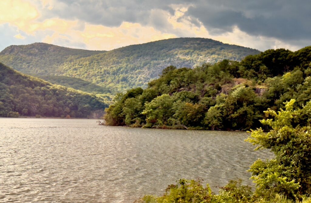
ALAN RICE The Hudson River starts as a small stream in the Adirondacks. From there it gathers water from northern New York’s upstream reaches as it continues its 315-mile flow to the Atlantic Ocean. The steep bluffs on the west side of the Hudson River were initially carved, deepened and widened by a glacier. Then much of that was drowned with the rise of sea level due to the melting of the great North American ice sheet.
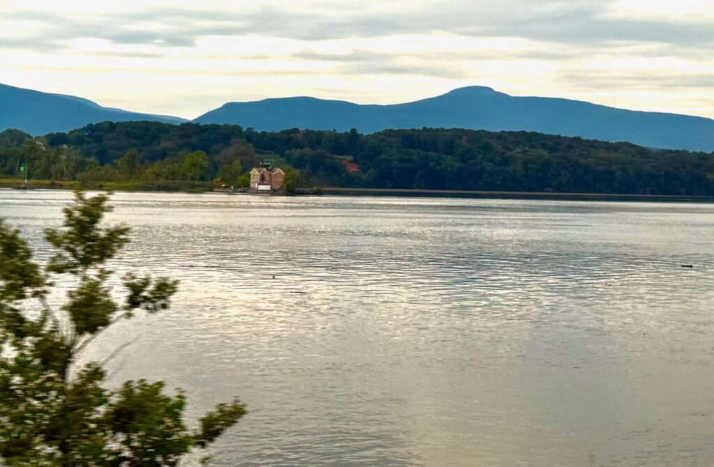
From Albany NY – where the river’s elevation is only 2’ above sea level – to the sea, the Hudson River is mostly a saltwater estuary, having grown greatly from its smaller upstream reaches. As the Hudson River flows south past Manhattan – leaving Wall Street on its east side and the Palisades and inner Raritan Bay on its west side – it is mixed with seawater. Its final reach is more like a fjord than a river, as it is enriched by the ocean’s saltwater tides that flow back and forth – upstream and downstream! The Hudson’s tidal flow reverses itself 4 times a day. The average range of the tide throughout the whole area is 4 feet. That includes the flow of the East River into Jamaica Bay and out along the southern shore of Long Island.
The Lower Hudson is dredged to maintain a depth of 32 feet to allow it to carry commercial maritime traffic up and down the Hudson River. The Hudson’s waters then extend out to the Atlantic Ocean for another 150 miles. In so doing, they cut a channel into the Continental Shelf and fall off into the Hudson Canyon and abyssal depths of the Atlantic.
So the Hudson River is mostly a salt wedge estuary, full of seawater. And it doesn’t have much of a watershed. As freshwater flows down the river, the heavier saline seawater runs along the bottom and forms a little eddy at the bottom. That tends to assist the growth of all sorts of biological material by the mixing of the nutrients found in the estuary.
The tides are diurnal – twice a day. That means the river changes course twice a day. Therefore, salinity then changes because as the tide goes out, fresh water moves in. So, the Hudson River’s lower reaches are brackish, which oysters love. They’re not really a pure saltwater type of “beastie:” they much prefer brackish waters.
As the summer comes, the temperature of the Hudson rises, and side-scan sonar details have revealed that there are sand waves all along the bottom of the Hudson, and they are dynamic: they move. Some of these reach a height of 3 meters – about 10 feet. Before they attempted to clean up the Hudson, the water was so toxic that wooden pilings did not need treatment. They did not need to be creosoted to prevent marine wood bores from attacking them. Since they’ve cleaned up the river, there’s been a return of the “gribbles” — nematodes that chew on the wood. That’s why all the old wooden pilings in the Hudson are slowly disappearing.
The New York State Barge Canal – today known as the Erie Canal – connects the Hudson River with Lake Erie, Lake Ontario and Lake Champlain. Putting in the Erie Canal opened easy transportation from New York to Chicago and then down the Mississippi. That access connecting the East Coast to the US West via the Mississippi and Missouri Rivers really opened access to the US West. It probably makes the Hudson the most important watershed in the United States, because it connects the Mississippi River to New York City. Additionally, the Hudson River made New York the great port it became and the easiest access into the rest of the continental United States. Simply put – the Hudson River really made America what it is today.
A RIVERINE FOOD PYRAMID
The Hudson River – like the Lower Raritan River – used to be loaded with herring, eels, bay anchovy and white fish, plus stripers and sturgeon. The herring and alewives must be coming back, because stripers are in both the Hudson Estuary and the Raritan Bay. Stripers consume alewives. They herd them into corners and feast on them. Since stripers are back now, I’ll bet alewives are also back in those bays. Some species of sturgeon live in the river all year long. Others migrate out to sea and then come back to spawn [such as, salmon and lamprey on both Pacific and Atlantic Coasts]. White perch, blue gills and other freshwater fish are found further upstream where there’s less salinity.
The Hudson River sturgeon — while not seen in former numbers for quite a while – were at one time called “Albany beef” because there were so many of them. Some weighed close to a ton – and they are coming back! The caviar and meat of the adult female has sold for as much as $2,000. But the capture and sale of Atlantic sturgeon was banned in 1996.
Shad is a major fin species that’s harvested from the Hudson River every year. It’s known and called by some as “shad bush.” Local farmers learned that when the white flowers of the shad bush bloomed along the Hudson River, it was time to harvest, smoke and bake the shad – a major contributor to the Hudson Basin’s fisheries industry. And buyer beware! There are Hudson River fish sold in local New York State restaurants as “Chilean sea bass…;” but that’s New York!
ALAN RICE Now all these fish need food. That means there needs to be a food pyramid with the fish at the top—
ALISON JONES Ah, a trophic cascade!
ALAN RICE Yes, shad are the top of the Hudson River’s food pyramid. They’re primary chewers of everything else that starts at the very bottom in the form of bugs. There are also some micro-species along the Hudson River. Robert Dussault at the American Museum of Natural History noted species change as you move downriver. The main component to feeding everything up the food pyramid starts with a peculiar type of plant. Some of these species at the bottom are mobile and have chlorophyll (even though they’re really plants).
Species at the bottom of the pyramid change sunlight into cellular material. They’re quite beautiful, but an unending host of species, including crabs, feed upon them – as do the crab larva. Even young students study them under the microscope after netting and pulling those things in to observe them while they’re still moving around. If lucky, they can see one eat the other. Most children love that; although some say “Yuck!” But that’s all part of nature.
Today, there are many reserves on the Hudson River protecting flora. Iona Island Reserve contains many native plants and trees: red oak; chestnut oak; hickory; etc. Its fauna includes deer, many bird species, snapping turtles, blue-claw crab, and rare animals such as bald eagles and osprey. All these species are coming back. Peregrine falcons are now in New York City where they “work for the city” to help cut down on the pigeon population.
EARLY HUDSON INHABITANTS
The first non-European humans came into the area as the glaciers retreated at the end of the last Ice Age – probably 15,000 to 12,000 years ago. Apparently they arrived concurrent with mass extinctions of the large land mammals at the beginning of our current Holocene Epoch that’s lasted about 10,000 years. Why the large animals died off and small ones didn’t are topics for another discussion.
Today, some wonder if the Indian cultures facing the melt-off of the glaciers bear any similarity to modern humans living near the ocean facing today’s sea level rise. Unfortunately, they may give a hint of what may occur to us. David Thomas, with the American Museum of Natural History, discovered remnants of Indian villages and middens 60 miles offshore of South Carolina. The Vikings even inhabited Newfoundland for a period. There have been many population shifts. Their causes for disappearing can be debated. The Hudson River was loaded with oysters, but they disappeared from the Hudson River environment in the late 1940s. Were those causes related to climate shifts – or were over-consumption & pollution contributing factors as well?
EUROPEANS in the HUDSON BASIN
Henry Hudson entered the Hudson River while working for the Dutch East India Company. Thus, the river is named after him. His mission was to sail around Russia to find a short channel as an easier way to get to the Far East – rather than going around the Cape of Good Hope, around Africa and across the Indian Ocean.
Hudson was never able to find that dreamed-of route. Nobody has until recently; and that success is only because global warming finally shrank the ice pack sufficiently so that we can push through. Back to Hudson – he did not have an easy time. His crew mutinied; put Hudson and others in a small boat; and left them in James Bay. Fifteen years later, the Dutch arrived. One hundred years later, Giovanni Verrazzano, sailing for the French, momentarily put into the same area.
The Dutch East India Company then took on developing commercial interests mainly for the fur trade and established themselves in what is now New York. There was also a Dutch West India Company. The Dutch East India Company was the first company to issue a stock; paying an 12% dividend for close to 200 years. It then went bankrupt and sank under corruption. The Dutch who came and settled in the Hudson Valley were met by the Indians and much fighting ensued. Today, few understand that the Indian Wars in eastern United States were as brutal as any in the 1870’s in the US Far West.
INDUSTRY & FERRIES
The Industrial Revolution immediately changed the world, within just 100 years. Farmers moved into town to take on steady work in the factories. The Hudson River was a major contributor, especially during the Civil War’s manufacturing of muskets and such. Companies made concrete for the city and used clay for making bricks.
The Hudson River is touted to have supported the invention of Robert Fulton’s North River Steamboat, also known as the Clermont. That accelerated the Industrial Age because in 1807 Fulton used the Clermont’s steam propulsion to travel 300 nautical miles on a round trip from New York City to Albany and back in 62 hours. Whereas, under sail, it could take 2 weeks to get to Albany via the Hudson River. Using steamboats for commercial transportation and canals changed transportation – particularly the Hudson River Basin’s Erie Canal.
The first American steamboat, built in 1785, sailed the Delaware River, which the Dutch called the South River. That’s much earlier than Robert Fulton, whose demo steamboat ran to New York City in 1796. There was also a twin-screw vessel that crossed the Hudson as a ferry, and 15 such ferries on the Hudson for more than 20 years before Fulton’s Clermont steamboat.
Fulton took the honor of being the first to invent the steamboat. It doesn’t belong to him at all, but he married the daughter of a very powerful New York State Senator who oversaw licenses for all ferries. Over 100 ferries – starting in 1700 and spanning 300 years – ran from Weehawken NJ to Manhattan NY for 15 minutes to 3 hours, depending on the wind. In 1927, 27 million passengers were carried between New Jersey and Manhattan by mostly railroad company ferries. Dobbs Ferry and Sneden’s Landing’s ferries operated from 1698-1955. Those towns still exist. Sneden’s Landing is right underneath Palisades, New York and Dobbs Ferry is just south of the Tappan Zee Bridge, now re-named the Governor Mario M. Cuomo Bridge.
The Industrial Age brought pollution; but now, politicians and stewardship groups are making major efforts to clean up the river. Side-scan sonars of the bottom of the Hudson River from Piermont to Haverstraw, NY, indicate the presence of oyster beds and a healthier river. Data has been collected by Lamont-Doherty Earth Observatory in conjunction with others cleaning up the Hudson from General Electric’s toxic spills into the river.
A RIVER to SPAWN ARTISTS
For centuries the Hudson River has struck many as a classic example of the beauty of nature — from the day the Europeans first arrived and launched the Hudson River School of Art. These painters who became major contributors to American art include George Catlin (known for his paintings of Native Americans), Frederic Edwin Church, Albert Bierstadt, Asher B Durand, John F. Kensett and Thomas Cole.
The river also inspired American authors who rose in the environment of the Hudson River – including Washington Irving’s Sleepy Hollow stories and James Fenimore Cooper’s The Last of the Mohicans. Other classic Hudson River authors – including John Burroughs, Edith Wharton, Edna St. Vincent Millay, T.C. Boyle, Peter Lorre and Edgar Allen Poe – set a tradition fto be ollowed by 20th- & 21st-century authors or artists. Alexander Hamilton and Benedict Arnold were early Hudson River Basin politicians.
There were also poets who were friends of local painters and artists. Billy the Kid came from New York’s Hudson River Basin. Bat Masterson ended up in New York as a sports reporter. Folksinger Pete Seeger crooned praises of American rivers and supported the launch of Riverkeepers.
SEISMIC ISSUES & FRACKING
ALISON JONES We’ve talked a little bit about seismic issues; and I’ve read of scientists’ concerns over possible occurrence of a big earthquake here on the East Coast with impacts possibly greater than those on the West Coast.
ALAN RICE It’s true that those major concerns exist. They don’t boot it around much, because there’s no way to rebuild everything in Manhattan to be earthquake-proof. Economically, that is out of the question. Cost-wise, it would be much easier to launch ten missions to Mars. Thus, we’re just monitoring so we can better understand seismic events.
The big problem east of the Mississippi is that here we sit on a solid-rock-foundation basement. The basement in United States west of the Mississippi is all broken up, because of the movement of mountain-building activities coming from California across to Colorado. What has happened is that hydrofracking and drilling in places like Oklahoma and Colorado has initiated many small earthquakes.
ALISON JONES So back to the Hudson River Basin, what about fracking in New York State?
ALAN RICE Fracking in New York State is new. It has taken 30 years for the effects of fracking and drilling well-ways down into the ground to manifest, but nothing has shown up yet. But if they continue fracking in western New York State, what’s going on out West and in Oklahoma could eventually occur in New York.
ALISON JONES Regarding seismic volcanic issues, I recall that bridges in San Francisco Bay and elsewhere have been refitted and made as earthquake-proof as they can – and we all know California’s building codes address earthquake guidelines. Do building codes in the East include any earthquake regulations? They continue building high-rises and skyscrapers in New York City – and a replacement for the Tappan Zee Bridge which crosses the Hudson north of Manhattan!
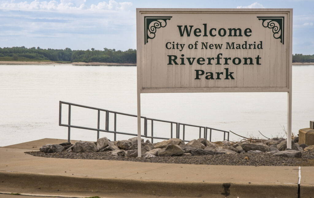
ALAN RICE It’s an important point. It was never in the plans for old high buildings like the Empire State Building or the Chrysler Building, because earthquakes were never thought to be a threat – and may not be for another 1,000 years. The problem is that since New York City is set upon a solid basement of rock, if you hit one end of it, it rings like a bell – as Missouri’s New Madrid quake demonstrated in the early 1800s when it caused Boston’s church bells to ring.
ALISON JONES Yes, I’ve documented that southeastern tip of Missouri, just south of Cape Girardeau, Missouri. As the epicenter of the 1811-1812 series of earthquakes, New Madrid is on the Mississippi River’s west bank. On the north end of its U-turn creation of an ox-bow bend, New Madrid spans the Mississippi just across from the Kentucky-Tennessee border on the river’s east bank. Scientists expect that eventually that ox-bow will create an island in the Mississippi River, as it cuts across the neck of the oxbow.
[Editor’s Note: The first two of the New Madrid quakes were magnitude 7.2-8.2 in Dec 1811, with a 7.4 aftershock. The next 2 quakes followed in January 1812. They’ve been the most powerful quakes in the contiguous United States, east of the Rockies. They formed Kentucky’s Reelfoot Lake and were felt in Boston MA. That New Madrid seismic zone (NMSZ) extends down into Arkansas and into Kentucky, an area currently considered at high risk.]
ALAN RICE Back to the eastern US, where there are very few earthquakes, your question is “Are we are building structures that could suddenly be released in a very violent 8 or 9 magnitude earthquake?”
Well, at this moment, there seems little concern that that could be the case. But the 1800’s New Madrid quakes caused damage, even in Boston. So, yes, because the Hudson River Basin’s New York City area was not earthquake-proofed, there is concern. But that concern is now folded into every effort they make now in building new freeways and other infrastructure of that nature.
ALISON JONES So that segues into my next question about the ferry service that has existed across the Hudson River’s lower estuary into Manhattan with amazing numbers of passengers. Did you say 27 million? Do you see passenger ferries continuing, or maybe even growing again today? Would that be good for the community? Would it bring people back out to the water; remembering that they are, indeed, on an island; appreciating this estuary; perhaps a better substitute than having to worry about how to build earthquake-proof bridges; and perhaps a commitment to keeping their waterways clean?
ALAN RICE Well, certainly a percentage of the population would enjoy ferry commutes. But at the end of the day, people just want to get home; don’t want to look at anything other than the newspaper; and are just bracing themselves for another day in the rat race. I don’t know if most of them would look out and say, “Thank God for this!” But there are those dreamers, saints and others who would be delighted to commute by boat. It would refresh them and bring them into town in better spirits. Certainly, it would me!
GLACIERS & SEA LEVEL RISE
ALISON JONES Let’s talk more about parallels of today’s rising sea levels with the rise in the last Ice Age 10,000 to 15,000 years ago as glaciers melted. How might that earlier occurrence model what could happen today due to global warming?
ALAN RICE Well, there are sure signs that we’re still melting Earth’s glaciers in Antarctica and Greenland – and that we’re looking at a much larger sea level rise yet to possibly occur. But the response of a good part of humanity is to bury its head in the sand. “I don’t want to know about it;” or “It won’t happen in my lifetime;” or “Don’t mention it, because it may ruin our property values.” Sadly, there’s little community spirit or commitment to pull together to address these issues.
ALISON JONES Going beyond acceptance or community spirit, there are groups assessing US estuaries in this country — including San Francisco’s Bay and Philadelphia’s Delaware River and Bay. Those cities are trying to “green” their cities and absorb excess water by creating more natural shorelines – in lieu of the collapsing bulkheads we have here along New York City’s Hudson River! As a scientist , you’ve worked with Lamont-Doherty up on the Hudson River bluffs; and you have an office in New York’s American Museum of Natural History. Do your fellow scientists in those great national research institutions talk about environmental threats and solutions here in New York?
ALAN RICE Well, yeah. There are certainly people concerned about those things. People worried about the condition of Jamaica Bay, east of Manhattan and under JFK Airport . New York City’s Department of Environmental Protection runs a survey boat called The Osprey that checks on dissolved oxygen, E. coli, and other issues to assess contamination of Jamaica Bay, for instance.
There are ongoing efforts to rectify situations, including major efforts to reestablish the oyster beds that were here. A bucket of oysters used to cost 5 cents. Their abundance here is long gone. [Editor’s Recommendation for history, impacts and disappearance of oyster beds in the Hudson and greater New York City area: The Big Oyster: History on the Half Shell by Mark Kurlansky] Oysters in the Hudson are long gone now. And what seems to be growing is a listlessness or blasé attitude like, “Oh, I don’t want to get up and do anything about it.” It’s particularly frustrating to hear from those who have influence and access to monetary resources. Their resources are not substantially being put into cleaning up our environmental messes.
ALISON JONES What about people like NYC Mayor Michael Bloomberg who proposed a barricade across the Hudson Estuary to protect his city from another Super-Storm Sandy or rising sea levels. The US Government built its “Mr Go” infrastructure downstream of New Orleans to block storm surges from engulfing that city. That may or may not work in extreme situations, but it seems to be effective thus far.
ALAN RICE Yes; and the Dutch know how to do that. They’re the “aces” at that. We ought to bring the Dutch back to New York! They could save Manhattan. Look, the problem is immense. I don’t know how they’ll find a solution, other than a big seawall put up down at the Battery with gates that you can close. The Dutch would do something like that, but I don’t see any such efforts here.
ALISON JONES I flew over their sea well protecting Amsterdam. It’s amazing! So yes, the Dutch should come back to Manhattan — New Amsterdam as they called it!
WANING STEWARDSHIP
ALISON JONES You did a great job of describing the values of the Hudson River. What about today’s pollution in the Hudson River? You mentioned some more cleanup of PCBs is needed. Are there currently other threats?
ALAN RICE I think threats now are political – especially if new, incoming politicians try to stop today’s remedial efforts and return to the days when folks poisoned and polluted these rivers. The biggest threat now is if we don’t sustain current cleanup efforts.
ALISON JONES Are you aware of any grassroots support to keep the politicians from undoing such current efforts to clean up our rivers?
ALAN RICE Absolutely there was grass roots support; but I fear that support is fading.
ALISON JONES Do you see any good stewardship groups cropping up on either side of the Hudson?
ALAN RICE Yes, there are many, including the NRDC, the Hudson River Foundation, Pete Seeger’s efforts with the Clearwater and the New York Maritime Education Society. Many individuals and groups are out there seeking a cleaner Hudson and pushing for it. Over the years it seemed there was a grand hope rising out of the ashes. But now there’s a sustained effort to beat them back down so industry can resort to their old practices and not spend any money to ensure a healthy river — and thus, insure better health for local inhabitants.

PCBs in the HUDSON
ALISON JONES Let’s discuss something that may be a bit simpler, or maybe not! Manmade chemicals that don’t easily break down called PCBs (Polychlorinated biphenyls) are still in the Hudson. Although they are now banned, they can accumulate and last for dozens of years remaining toxic to apex predators like humans, eagles and orcas. Is it wise to dredge and stir up the benthos to remove them – or do we “let sleeping dogs lie” and not mess with PCBs lying at the bottoms of our rivers since that would just spread them further?
ALAN RICE That’s an ongoing debate, to which I’ve not been able to form a firm opinion. There are issues on both sides. If you stir up PCBs, then what’s it going to do? Just go on downriver and get buried someplace else?
But they went in to do that anyway. I don’t know why they went in to dig out PCB’s because disturbing certainly will distribute some downstream. Maybe what finally drove the PCB removals is some pork barrel. I don’t know. It costs money to dig them out. I don’t know how much GE is paying for their dumping PCBs in the Hudson. Nor do I know what the government’s share is to help rectify the situation.
ALISON JONES Significant.
ALAN RICE I think in the early days when GE and others were conveniently dumping PCBs into nearby tributaries and major rivers, they had no idea how dangerous they were. Their fault was their continued denial when they knew, when they found out, when they just kept their mouths shut and the company kept dumping. If individuals did that, they’d get the chair.
ALISON JONES Do you know what the final impacts were to the benthos or quality of the main stem of the Hudson River and its macro-invertebrates when they finally started digging for the new Tappan Zee Bridge, to be named for former Gov. Mario Cuomo? I heard hey were extensive. There was much debate over that, and the building of the new bridge was slowed by the many impact studies required before its construction. Have you heard any word of what, indeed, the impact has been?
ALAN RICE I don’t know. Certainly, it would have disturbed the riverbed, but then they have been disturbed over time. It would have been nothing as bad as when the glacial moraine broke through. As well, the recovery is generally quick; and they are making ongoing studies. They didn’t do that when they put in the first Tappan Zee Bridge. I would expect that they’ve rectified many of the issues that might have attended the disruptions caused by the first bridge.
THE RARITAN BAY
ALISON JONES Do you hear anything about the quality of the Raritan Bay?
ALAN RICE No, not until you brought it up. But I think it would be good for New Jersey to invest in protecting it and ensuring clean waters. It could bring in needed income. But it seems that now people are less interested in long-term investments. We’re living in a culture of quarterly returns. If you were to clean up the whole Raritan Bay, it might be 10 to 20 years before any profits appeared – instead of by the end of the week.
ALISON JONES How would you promote the value of such a clean-up? Let’s say I’m one of these naysayers, and I don’t want to throw any money at the Raritan Bay, since I think it’s a lost cause. How would you convince me to care? Why should I want to clean up the Raritan Bay?
ALAN RICE Well, some people don’t even want to clean up their room. But I’d like to see it cleaned up. It would be a much healthier situation for everybody. It’d cut down on disease. You’d be able to start a fishing industry in the Bay so long as you didn’t fish it all out. For some nations like Canada, all the scallop boats off Nova Scotia have government-assigned portions of the seabed in which to scallop. Canadians treat that like a farmer would to make sure that the scallops keep going there. Not in the US. The attitude is to take them all out and leave.
ALISON JONES The flipside is like giving a child responsibility. You say to the child, who wants a boat, “Here’s your dinghy, but you’re responsible for washing it and taking care of it. If you don’t, it will be taken away from you.” So, they work at keeping their little dinghy “ship-shape.” That should have been obvious to the grown-up scallopers you mentioned.
ALAN RICE They’re really sophisticated up there. They have maps of the bottom of their fishing grounds. They know where know where they’ve fished before and not to return there. That information comes right up on their big bathymetry charts – very much like a Google Earth display. They can see every little nook and cranny down on the seafloor. And they have computers that show their location. They can press a button, program it, and just stand away from the wheel.
ALISON JONES Technology helps. Alan, thank you very much for spending this time to share your prepared talk – and answer my questions along the way. I learned much this afternoon.
ALAN RICE It was my pleasure; and here’s to hope for the Earth.
ALISON JONES I’ll second that! Thank you.
Posted by NWNL on November 14, 2024.
Transcription edited and condensed for clarity by Alison M. Jones.
All images © Alison M. Jones, unless otherwise noted. All rights reserved.