
Geology of the Lake Turkana Basin
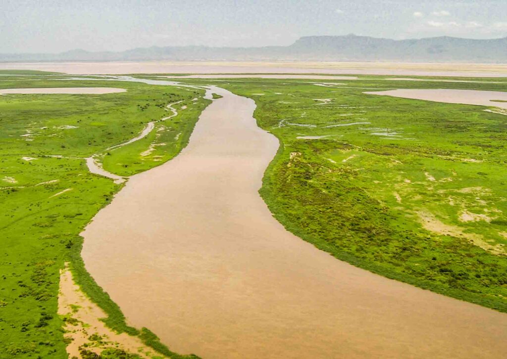
Omo River Basin
|
NEW ESRI StoryMaps: What's On Our Shelves & NWNL Song Library & No Water No Life ESRI |
Omo River Basin
Dr. Abigail Church
Geologist
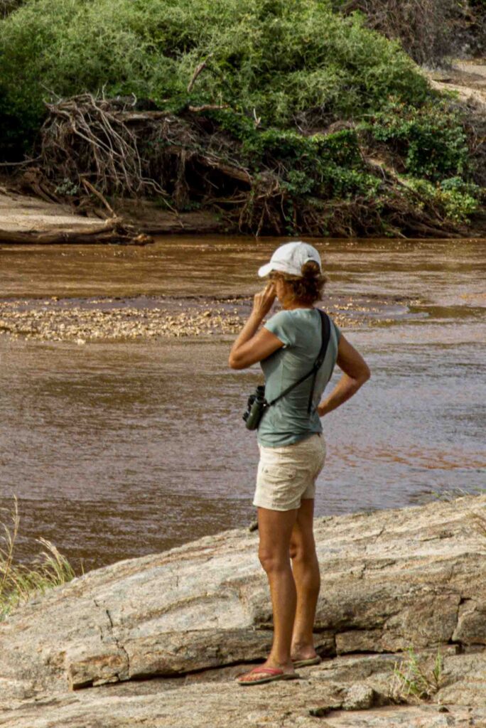
Alison M. Jones
NWNL Director and Photographer
Abigail Church is a geologist in Kenya focused on igneous petrology, the study of rocks and the conditions under which they form. She received a PhD from London’s University College, and another PhD from London’s Natural History Museum. Living outside Nairobi at the time of this interview, Abigail since moved to Kenya’s Tsavo region, where she informally teaches geology to those involved in the safari business in which she is involved.
HOW OIL FORMED in the LAKE TURKANA BASIN
DID the OMO RIVER GO INTO the INDIAN OCEAN?
LOCAL IMPACTS of DRILLING FOR OIL
IMPACTS of INJECTED DRILLING FLUIDS
ENERGY ASSETS’ ADVANTAGES & DISADVANTAGE
KENYA’S ENERGY OPTIONS
Key Quote There are unique concerns about drilling in Lake Turkana, as it has no water outflow. Even fine clay used in drilling processes creates turbidity that affects lake fisheries. Drilling chemicals, such as cesium, are heavy metals [also affecting the lake]… As an alternative, geothermal energy is a Turkana resource that’s both clean and water-efficient. — Abigail Church
All images © Alison M. Jones, unless otherwise noted. All rights reserved.
NWNL Abigail, thank you making time for this conversation on Lake Turkana, the terminus of our NWNL Omo River casestudy. Your background as a geologist is a great resource as we study possible impacts of recent discoveries there of large oil deposits in and around the Lake Turkana. As you know, the Omo River affects two countries, as it runs through Ethiopia’s southwest corner and the transboundary Omo Delta into Kenya’s Lake Turkana.
I have many questions, starting with why there is oil in Kenya’s Lake Turkana region. What impacts will drilling have in this Kenya basin? How deep does that oil go? How is that oil being accessed today and what are those impacts? How did the lake’s algal remains lead to oil being there, and do they give Lake Turkana that distinctive color that causes many to call it “The Jade Sea?” But let’s start by discussing the Rift Valley geology, before the discovery of its oil.
ABIGAIL CHURCH There are two oil and gas provinces in northern Kenya. The older one is in the Anza Trough, which extends from Kenya’s coastal region on the Indian Ocean to Sudan, running roughly southeast to northwest. This trough – approximately 15 million years old – was formed by continental spreading via the same process that created our current Rift Valley, but much earlier. It formed when Madagascar separated from Africa, approximately when South America was separating from Africa.
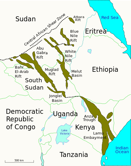
This ancient East African Trough is completely buried now. We can’t see it, since it’s been covered over by more recent sediments. But it is those sediments that basically host oil and gas. And that’s what’s being looked at now in Kenya’s Chalbi Desert where there are now exploration wells looking for oil and gas.
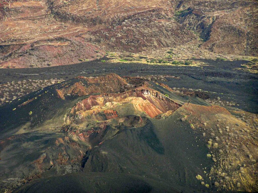
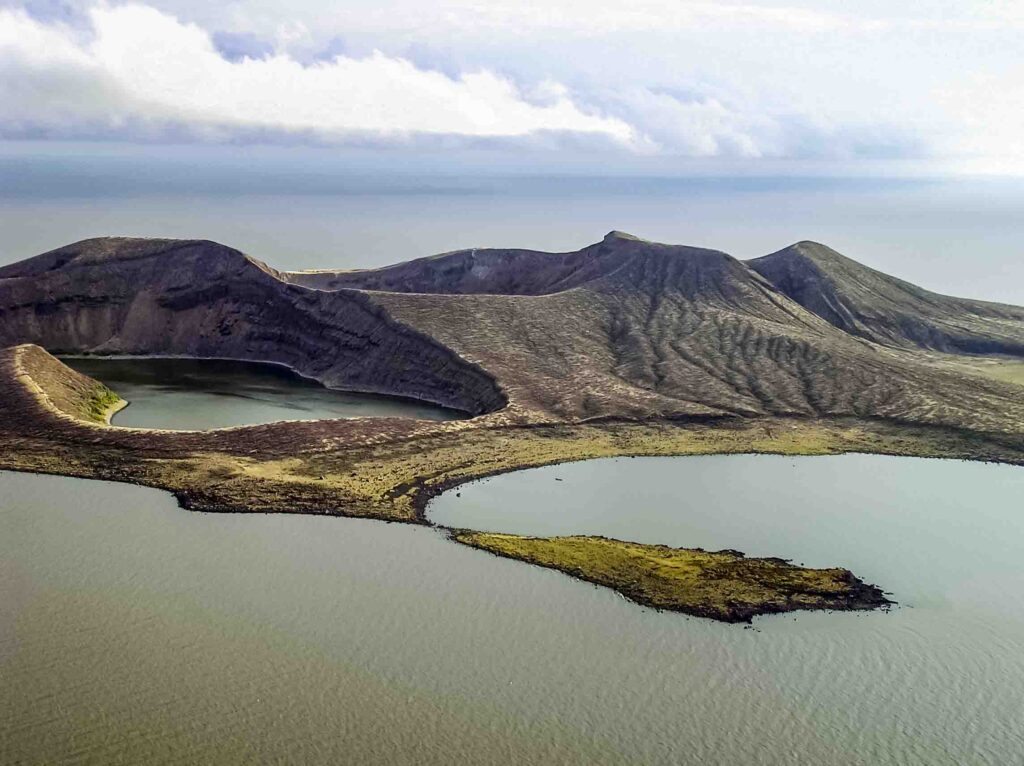
The Turkana Depression is a much younger rift, only around 20 million years old. It’s currently spreading, but not very fast. During its relatively early stages of developmental stages, there was a “half-graben” forming on the Turkana Rift’s western side, instead of the usual “full graben.” (A half-graben is where two pieces of crust split; the center section falls; and there is more of a one-sided drop.) Then, the climate was much wetter and more humid than now; and there were many many rivers flowing east to west and carrying lots of sediments into that trough. The climate being wetter that it is now, a lake extended north-south across what is now Lokichar.
That lake was shallow because it was even hotter and more humid than now. These were perfect conditions for huge algal blooms, and little skeleton remains of algae would fall to the lake floor. The rift continued to drop faster than the lake could fill with sediments. That created a net sinking effect. With that, an anoxic water condition existed in this lake, quite similar to today’s very deep Rift Valley lakes in Tanzania and Malawi that lack oxygen, thus encouraging decay at the bottom of those lakes.
In the Lokichar area, gazillions of bodies of dead algae accumulated on the floor of this lake. After that, sediments washed in over the top, burying those algal remains. The lake was heated then by a big magma chamber lying underneath the Rift Valley which was full of all the ingredients for making hydrocarbons. Thus, the lake had organic algal bodies and anoxic conditions, so nothing oxidized and all stayed as hydrocarbons. There was the heat as well and the burial. The final thing needed for an oil deposit is a place where oil can be stored. When oil is liquid, it raises and migrates into what becomes the host rock for oil. Also needed is layers of exactly the right kind of sandstone above that very rich organic material. That’s where the oil is sitting today – a bit less than 3,000 meters deep, in various sort of pockets!
Diagrams explain what constitutes half-grabens: the edge of a rift, a fault, a basement, and many sediments built up against the rift wall. Much faulting is involved, as the rift still spreads. That disrupts the continual layers of sandstone and organic rich shale and traps the oil in little pockets, that are depicted in seismographs. So right now, the Chinese are laying seismic lines to see down through the horizons of rock and pick up the oil deposits.
NWNL This happened 20 million years ago during the formation of the East African Rift?
ABIGAIL CHURCH That’s right.
NWNL Is that also the when the Lake Turkana Depression was formed?
ABIGAIL CHURCH Yes, that whole area dropped at that time. But the size and shape of Turkana varied enormously over millions of years. At times, it was about 150 meters deeper than it is now and truly enormous. It spread from Lake Baringo up into Ethiopia. Now it’s relatively small. There also have been times when it completely dried up. The lake has been changing the whole time.
NWNL Some have told me that Lake Turkana wasn’t always the terminus of the Omo River. Did the Omo once go beyond the area of the Turkana Depression and finally spill into the Indian Ocean? And if so, did the depression drop when Omo stopped going to the sea – or vice versa?
ABIGAIL CHURCH Yes, as the eastern shore of the rift dropped, the water flowed into that area. But I haven’t read anywhere about different flows or routes that the Omo River has taken.
NWNL You have mentioned a “lacustrine organic red soil” that existed where the oils were laid down? Could you further explain that comment?
ABIGAIL CHURCH “Lacustrine” refers to lake environments. “Type 1 source rocks” (formed on land) are results of algal blooms found in a lake. [In petroleum geology,“source rock” refers to rocks from which hydrocarbons have been generated, or are capable of being generated. They form one of the necessary elements of a working petroleum system. They are organic-rich sediments that may have been deposited in a variety of environments, including deep water marine, lacustrine and deltaic. Oil shale can be regarded as an organic-rich but immature source rock from which little or no oil has been generated and expelled. http://www.oilfieldwiki.com/wiki/Source_rock]
ABIGAIL CHURCH There are many examples of this. Oil and gas in this Anza Trough have that source rock and were formed that way. By African standards, Sudan’s oil reserve is huge, with estimates of 9 billion barrels of oil in Sudan, and about 2 million in the Albertine Rift (mostly in Uganda). They reckon there could be 2-1/2 billion barrel in Kenya, valued around $250 billion. Currently, Kenya’s annual GDP is $36 billion, so that estimate of oil reserves would be massive for Kenya. We’ve never had any other sizeable find of mineral or metal, so this is big news for us! Kenya’s wealth is mostly in its agricultural land, rather than in its natural sources.
NWNL You mentioned that these Type 1 rocks that are under stress in deep, anoxic lakes produce a waxy crude oil. Does “waxy” oil represent a different quality than that of other oil, such as oil from the Nigerian Delta or the Gulf of Mexico?
ABIGAIL CHURCH Yes, I think so. Hydrocarbons derived from algae have different proteins to those that are formed by squashing vegetation. So, Turkana’s oil would require a different type of processing before being used as diesel or petrol. I don’t know whether it’s a particularly good type of oil that requires less processing than others. I would think in many ways it’s probably purer because it’s formed from algal bodies which have no branches, leaves or other matter. Thus, it could be potentially a higher quality and more valuable. But I am not an oil geologist.
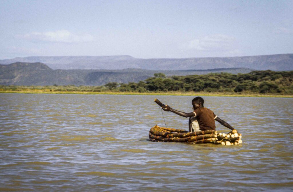
NWNL Is it the algae in Lake Turkana now that gives the lake its wonderful color, leading those who are poetically inclined to call it “The Jade Sea”?
ABIGAIL CHURCH Well, we know that the deep lakes like Lake Tanganyika and Malawi are not alkaline – they are very fresh lakes. Lake Turkana has a slight alkalinity to it because it has relatively little outflow. It is closed basins like Turkana that become evaporating systems, and that raise the PH and turning them alkaline.
NWNL Let’s discuss the drilling process and disruptive pressures drilling might create, since you mentioned drilling into earthquakes. I wonder what seismic effects drilling might present. Are precautions taken? Is such drilling monitored to determine any problems?
ABIGAIL CHURCH The risks involved in drilling in a seismically active area are basically cost risks, because any core sent down and affected by an earthquake could break. That would negate all the investment put into creating the pipe.
The other effect is that the number of faults that go through California is massive. Thus, every time you send down a drill core approaching the fault, there’ll be a sudden change in geology which can be confusing. The material that comes up is basically an upside-down log of what’s underneath, so results can easily get mixed up. Repeated sequences going across the fault line can be very disconcerting for a geologist expecting sand/shale/bedrock. If it instead came up as sand/shale/sand/shale/bedrock, the succession of locations and location of oil would be confusing. Thus, the biggest risk really is in cost, because if confused about where you are in relation to the oil, the risk of breaking the core is quite high.
But regarding triggering earthquakes, anything that we do are just “scratches the surface.” They can’t possibly affect that massive “conveyor belt” system on the crust of this planet. Our plate tectonics – the mechanism for moving rocks around the planet – are why we have earthquakes, volcanoes, and moving mountain chains for billions of years on such a huge scale. Drilling holes to find oil is totally insignificant.
NWNL Can drillers minimalize expensive equipment damage from earthquakes?
ABIGAIL CHURCH I’m not sure if their equipment is strong enough to withstand the region’s small earthquakes. I read there are 11 micro-earthquakes per day in the Turkana region that cause small and repeated stress-release movements, but no massive movements. Such movements are small because the Rift Valley is still spreading, but only by a few millimeters a year. That’s a minimal net movement, but maybe enough to make it quite expensive to drill there.
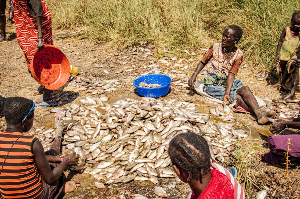
NWNL To mitigate the issue of pressure when drilling, they use a special fluid. Are there toxins dangerous to the lake’s fish in that drilling fluid, or in additives you mentioned, such as the salt-saturated solutions and synthetic oil-based fluids?
ABIGAIL CHURCH Probably, yes! In the removal of rocks when drilling, small little pieces of rock would be pumped out as the core goes down the pipe. To facilitate removal of that material, driller’s mud is used. It’s a thick, pasty substance normally derived from barite, a natural product. [Barium sulfite is a mined mineral used as a lubricant to compensate for the high pressure and reduce damage to drilling tools.] They use other natural types of clay as well, and also synthetic additives which may be cheaper, more easily available or with better properties for getting rid of certain types of rock within the column. You’d have to drill through a fair amount of volcanic rock to get to these oil deposits beneath the Lokichar area. It’s difficult to drill there and would require a lot of expensive diamond drill bits. It’s possible they’d use different types of driller’s mud for different rock that they drill through.
NWNL Do these materials impact the lake’s fish populations?
ABIGAIL CHURCH I imagine that driller’s mud is not good for fish. I don’t see how it can be, because even a very fine clay in water holds itself in suspension, reducing clarity of the water. Cesium and any other nasty heavy metals involved also aren’t good in a water system.
NWNL What’s the chance that these drilling fluids could leak or seep into Lake Turkana’s water?
ABIGAIL CHURCH If drilling in the lake itself, I would think it would be quite high. I don’t know what safety measures they use in lakes or in the ocean, but an oil spill in those conditions isn’t a big worry, because oil floats to the surface. But I think leaks of driller’s mud and things like that would just stick to the bottom.
In the area west of Turkana, the deposits all go eastwards. I know they are running seismic lines across the lake. The oil deposits against that western fault are in the much thicker sediments and well away from the lake. The sediments thin as you go eastwards and under the lake; thus there’s less chance of finding oil under the lake.
It could be that they’re now running seismic lines just to better grasp the underneath structure, rather than to find oil. Or, maybe it’s to help them to verify how the deposit continues eastwards – and maybe what happens with the Anza Rift and Turkana Depression at the very northern end of Turkana. At that point, there are two different ages of oil and gas in different depths of sediment that potentially cross over each other. I suppose the older oil and gas could migrate up into the same sort of sediments in the lake’s northern end.
NWNL Back to the pressure-balance need. If not addressed, could that lead to what you call a “kick” that has effects that could potentially cause a blowout?
ABIGAIL CHURCH Because the oil is at pressure when it’s buried deep – as is the gas, it has the weight of rock on top of it. If you sank a shaft down to meet it, the oil would all squeeze out like toothpaste out of a tube, but much more dramatically. So, instead, they pump in this fluid at high pressure, equalizing the pressure of the oil with the pressure of the mud.
That is a much safer process. But, if you get it wrong, it goes all over the place. I guess it can fracture underground as well. Like a shape of a carrot, as you come up at lower pressures the expansion becomes greater and greater, enlarging the area of fracture when close to the surface. Then, it’s just a hell of a mess. It blows apart and that’s not good because you lose everything: your oil, your driller’s mud, all the equipment put down there – and your lovely diamond drill core bit that cuts though all the rock! So yes, a very expensive mistake.
NWNL And when fractures are in a lake, can oil seep into the water.
ABIGAIL CHURCH Yes. There must be many different safety precautions to prevent that from happening. There must be huge casings on the pipes as they reach the surface.
NWNL The term “blowout” makes me think of those that occurred in the Gulf of Mexico. A Tullow Oil employee told me that they’re looking for the high points in the lakebed because the oil and or the gas flow to the top.
ABIGAIL CHURCH But they don’t have the seismic data yet. That’s what they are doing now by running seismic lines to better understand the rock structure beneath the lake. Seismics are really the only way to do it.
NWNL But seismics involve noise. People are becoming aware of the noise and its effects on aquatic life. California is now addressing causes of that seismic noise.
ABIGAIL CHURCH The seismograph is the paper they produce; the seismometer is the machine they use to measure waves, Basically, a very high, strong sound wave is sent through the rock and bounces back as layers with different properties. Depending on the density of the rock, different patterns come back in the seismograph. It will tell you first whether there is liquid oil or gas under there, and it can indicate solid volcanic rock or sandstone from the velocity of the sound wave passing through it. The seismograph creates a funny picture in which you can see everything: rocks, faults, different layers of rocks with different properties. From this, you can draw a quite accurate 3-dimensional image of what’s under the surface.
That seismic noise you mentioned is just a sound wave probably caused by a small charge of dynamite that comes back up from the layers of rock to be measured and plotted on the seismograph. Because sound travels effectively through water, I imagine that would be pretty disturbing to fish. Basically, it would be like throwing dynamite into the lake.
NWNL Having answered my technical questions, how do you assess Turkana’s energy options?
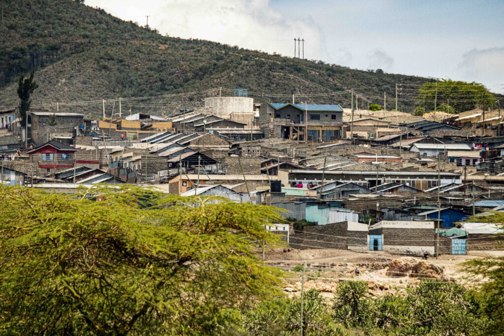
ABIGAIL CHURCH The reality is that the oil in Lake Turkana could cover15 years of our GDP. Kenya’s never had anything like this before. Also, Turkana is a region in northern Kenya which is terribly poor with barely any employment there, so one hopes that whoever starts exploring and ultimately producing oil will think seriously about employing people in the local community. They desperately need it, and they are excited by the fact that oil has been found. They are expecting benefits, such as improved health, education and infrastructure. They expect their businesses to grow; and that’s what any decent oil-drilling company should support. They should put some money back into the community, and not just walk off with all the profits.
NWNL There are two things going on. There’s the effort to investigate drilling impacts on land, and they seem to be acceptable. Then there’s the new seismic exploration of the lake regarding possibilities of drilling there. Some Kenyans say “Ok, let them drill on land, because it will be very beneficial for Kenya. But let’s not drill in the lake. We must not disturb the lake.” Do you think there is a chance of stopping drilling in the lake?
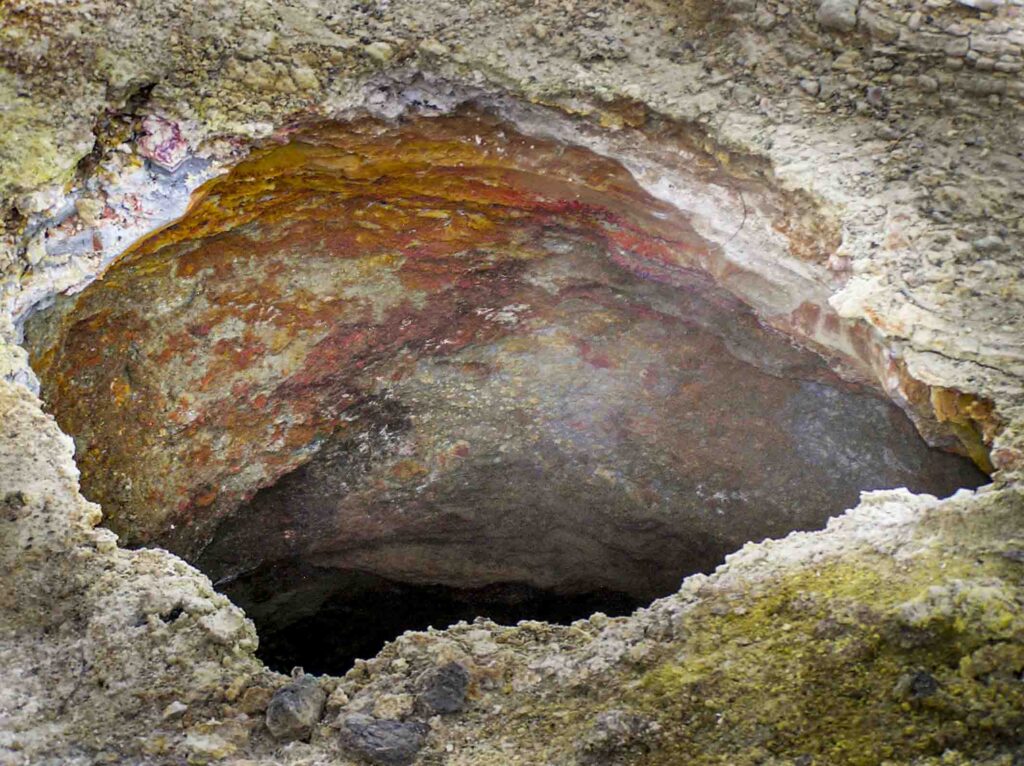
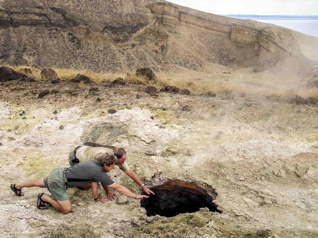
ABIGAIL CHURCH I do. Community pressure may be strong enough to prevent drilling within the lake. However, Kenyans now see Turkana as an energy hub. Not only does Turkana have oil and gas, it also has geothermal and wind energy. This wind project is by far the biggest investment Kenya has made. It’s absolutely enormous, and hundreds and hundreds millions of dollars have been spent on that. Our geothermal resource is potentially good. Even the lake is volcanically active, so the possibility of developing geothermal power there is probably quite high.It would be pretty ugly, but it’s the cheapest form of generating power ever invented. There’s plenty of geothermal activity there and enough water to run steam turbines.
Turkana is now a focus of many people’s attention. If we generate enormous amounts of wind and geothermal power and drill for oil and gas, it’s possible that enough money will go to the community so they can buy food without having to fish. That’s one way of looking at it. It’s not ideal to destroy a culture many thousands of years old, but that may be what happens.
NWNL You said geothermal is “ugly.” What does geothermal look like?
ABIGAIL CHURCH First, let’s discuss geothermal energy’s impact on the environment, because it needs lots of water. It pumps water deep into the ground and comes out as steam to turn turbines that generate power. It’s just a giant steam engine, and basically limitless as well.
But geothermal doesn’t burn any hydrocarbons. Plus, the water it uses turns to steam and then condenses back into water again – with no net loss of water. So, although geothermal uses water for steam, it becomes water again; and thus is a recycling no-net-loss.
But putting geothermal stations on Lake Turkana islands would be ugly. Geothermal is not quite as ugly as nuclear power stations that cover hundreds of acres with ugly grey lumps of metal and big buildings. But to put geothermal energy into the grid needs big pylons marching across the countryside to connect to distribute its power. Wind power also needs those sam lines of pylons.
Power is essential for Kenya’s development. We’re now importing oil from the Gulf at huge cost. This slows down our development. Oil has been expensive in this country. But if we can be self-sufficient and perhaps even export power ourselves, it would help this country develop.
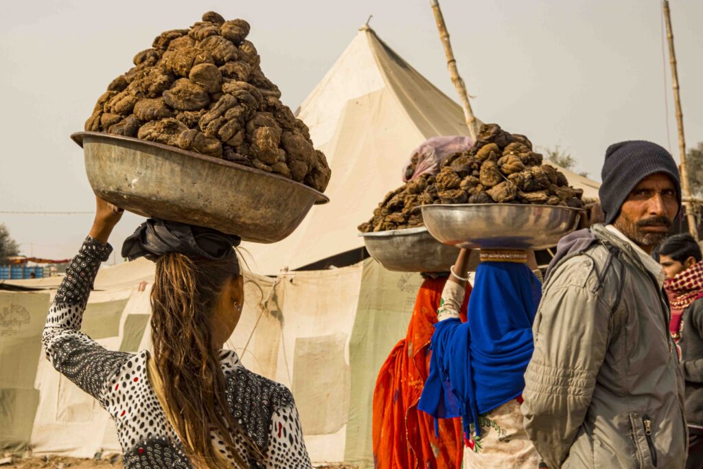
Charcoal is the #1 source of cooking fuel in this country. There’s no piped gas and no oil used in people’s homes. They cook on gas, wood or charcoal. Charcoal use means that thousands and thousands of acres of trees are lost from our forests every single. Alison, you’ve flown over and driven through the Mau Forest and other parts of this country. So you’ve seen that even skinny little shrubby trees have been turned into charcoal. Charcoal is one of the biggest industries in this country. Any other option for cooking with cheap and easily available fuel would be better that cutting down our forest. Gas is one suggestion, but it needs to be taken into people’s homes in big canisters. Other developing countries, like India, burn manure. They have lots of cows and lots of trees. They dry the cow manure into little patties to burn for cooking so they can keep their trees. Why can’t we do the same?
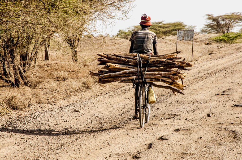
The Maasai have mounds and mounds of cow manure. Why don’t they burn it for cooking. They’ve only ever used wood. This would require massive shift in their mind set, but I really hope for the future of this country’s forests and bush, that that could happen. It’s a much better option than cutting tropical rainforest and acacia commiphora. In very dry bush our acacia is what holds the soil in place. These very fragile, marginal areas become terribly degraded if their trees are cut. So, we really need to do what we can to stop people using charcoal.
NWNL As well, deforestation must stop, since the water retention services provided by the roots of these trees is critical.
Abigail, thank you for sharing your scientific expertise and clarifying technical issues concerning Kenya’s various energy sources currently being explored and exploited. And, thank you for sharing your insights and concerns to help motivate us all to be more conscious of the impacts of our energy usage on our vulnerable but valuable ecosystems.
Posted by NWNL on December 26, 2023.
Transcription edited and condensed for clarity by Alison M. Jones.
All images © Alison M. Jones, unless otherwise noted. All rights reserved.