
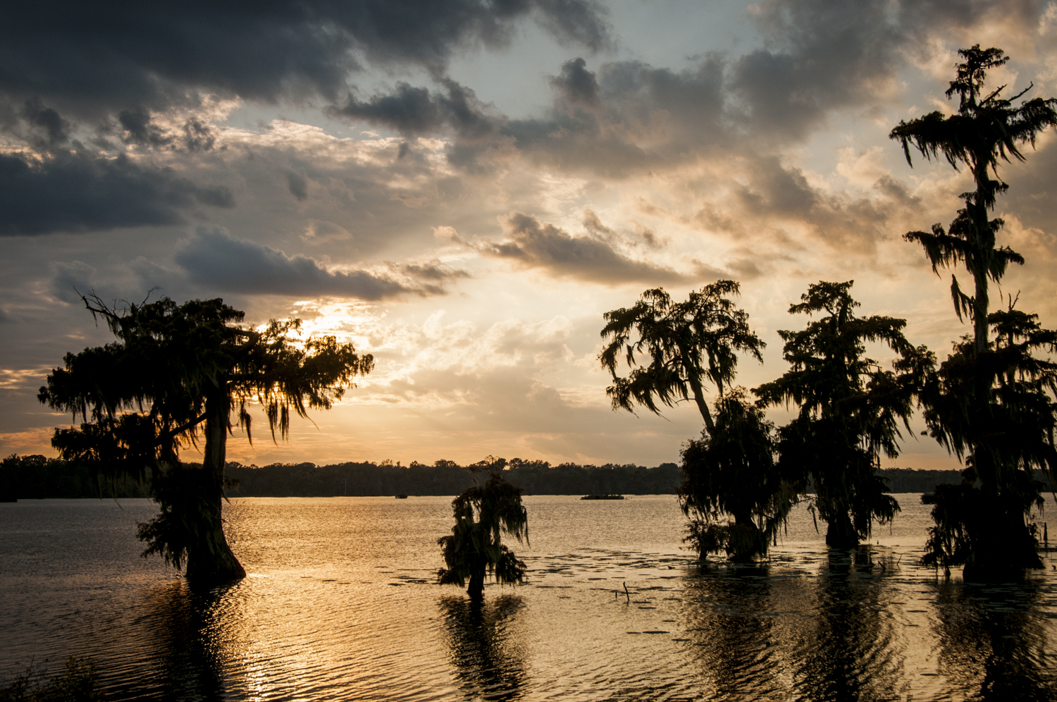
Mississippi Flyway & Delta
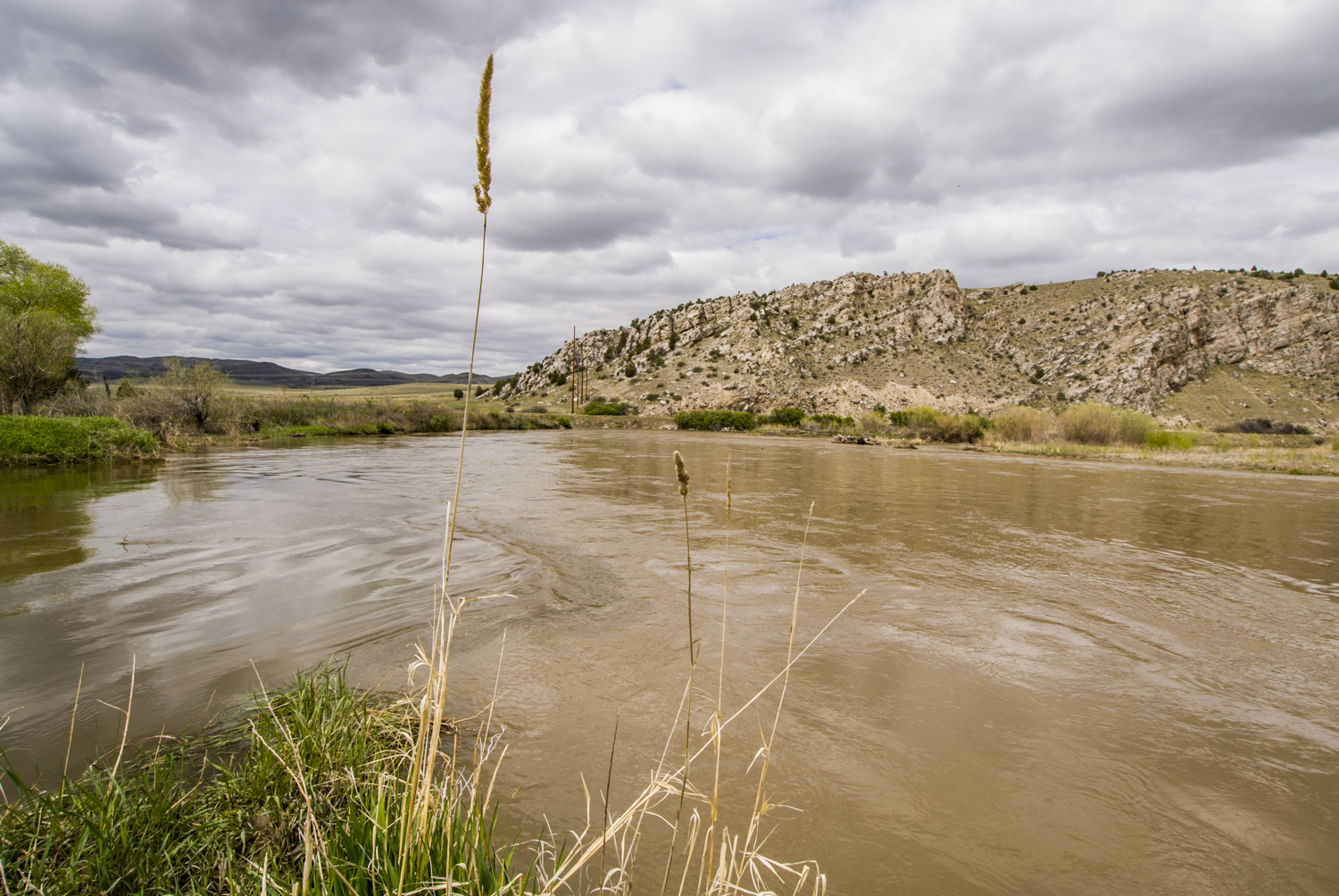
Mississippi River Basin
|
NEW ESRI StoryMaps: What's On Our Shelves & NWNL Song Library & No Water No Life ESRI |
Mississippi River Basin
Paul Kemp, Ph. D.
National Audubon Society, Vice President & Geologist
Alison M. Jones
NWNL Director and Photographer
Waiting for things to break and then fix them is expensive and wasteful. With hurricanes, flood disasters, or oil disasters, the modus operandi is to get from one disaster – or media cycle - to the next.. There's no big commitment to long-term solutions. --Paul Kemp, Ph. D.: Geologist, VP of National Audubon Society of LA
All images © Alison M. Jones. All rights reserved.
NWNL Hi Paul. Would you describe your background and your current position?
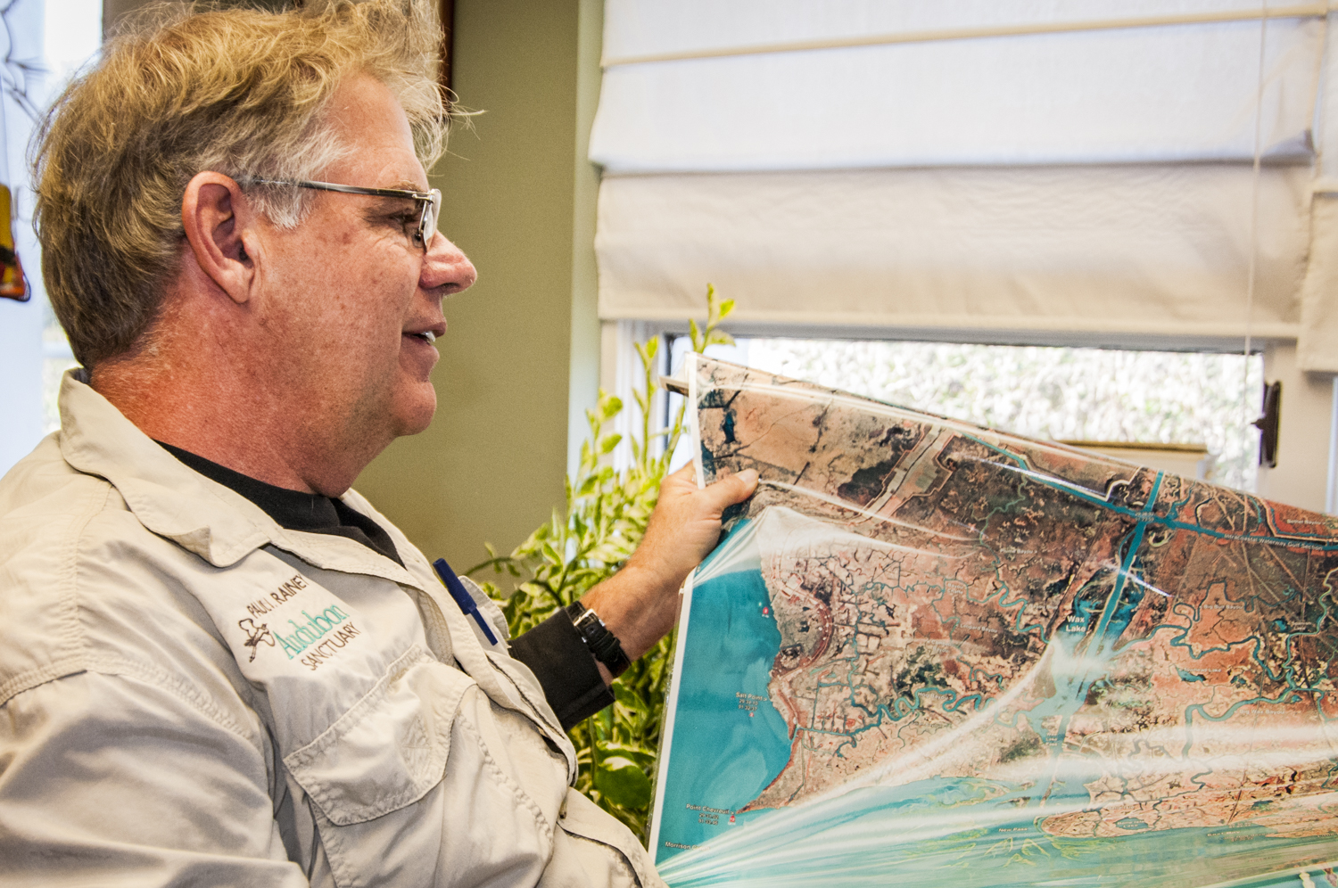
PAUL KEMP I’m a geologist, oceanographer, and learning to be a bird person. As a Vice President for the National Audubon Society, I’ve set up an office in Baton Rouge primarily to work on coastal restoration. As a geologist, I’ve been fascinated by the Mississippi River Delta for over thirty years.
NWNL What are the compelling and unique elements of the geology of the Lower Mississippi River?
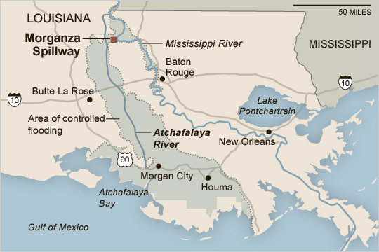
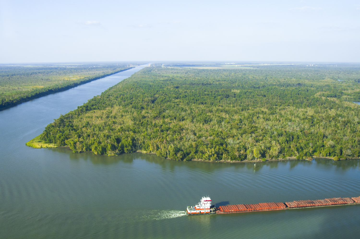
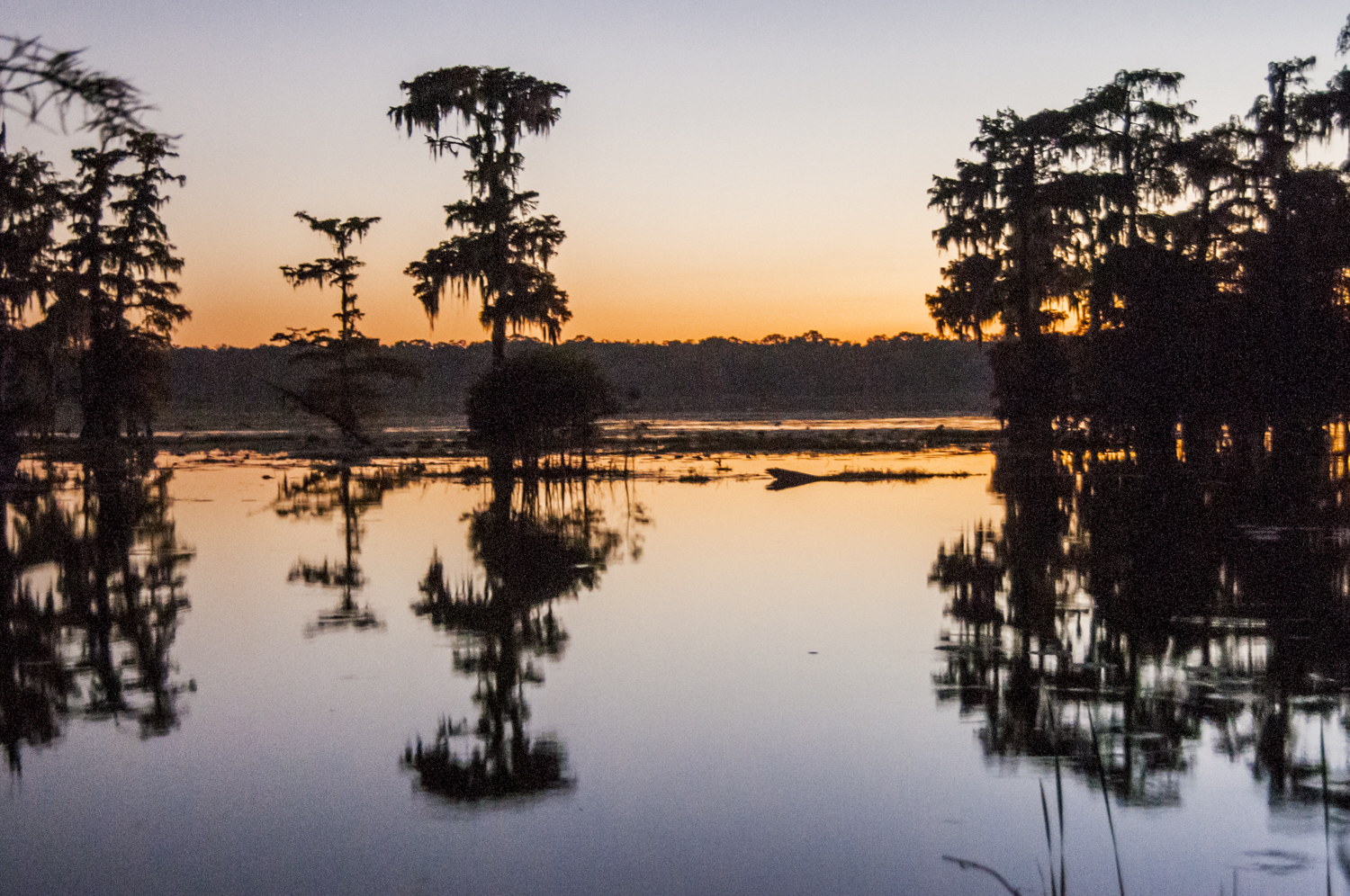
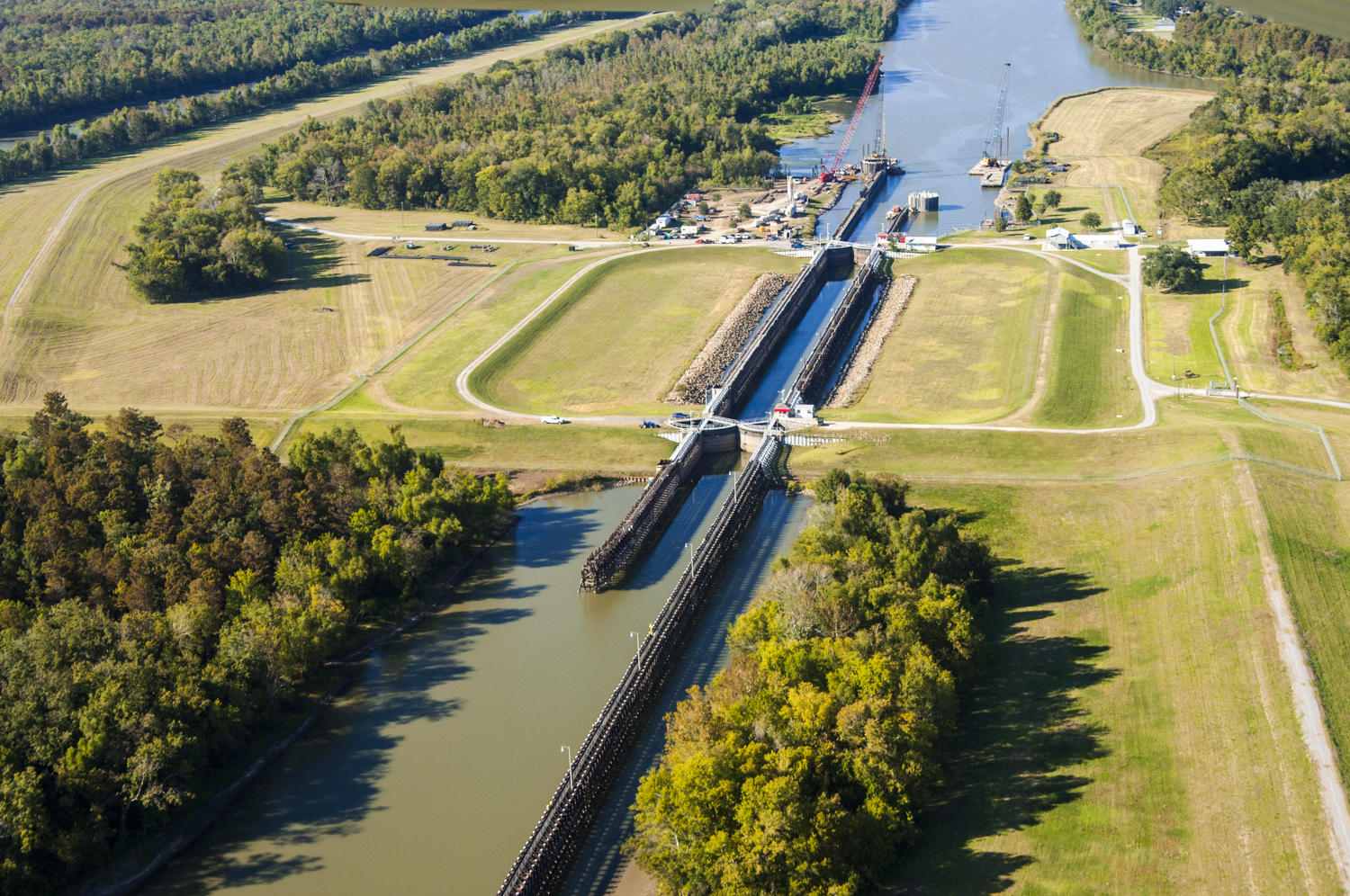
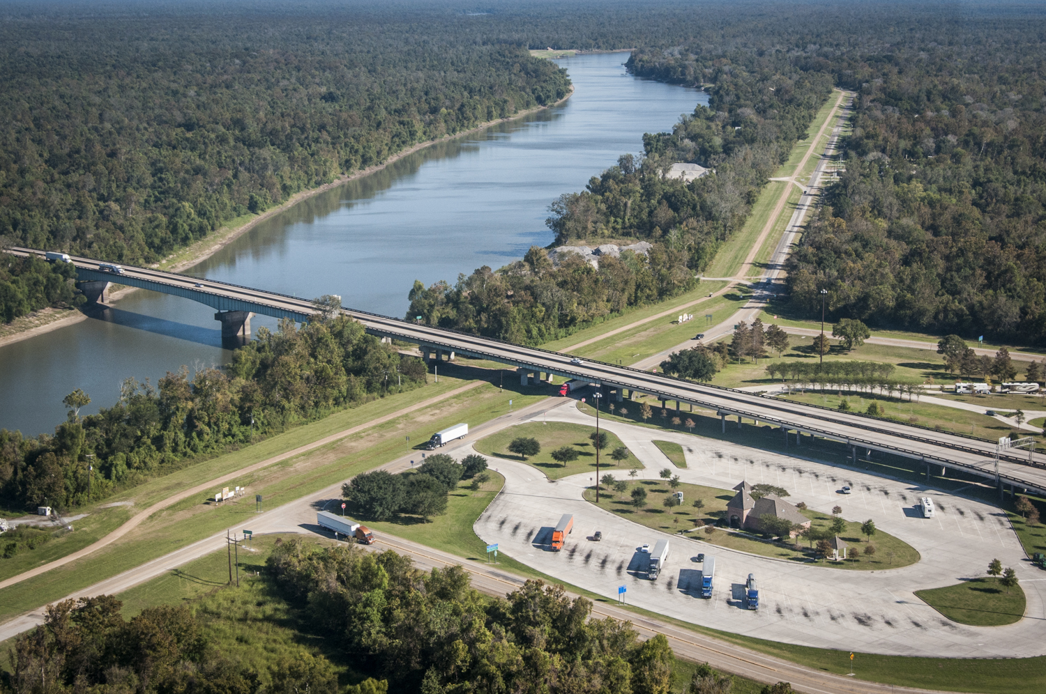
PAUL KEMP In this deltaic part of the Mississippi River System, we have distributaries, instead of the tributaries found further upstream. These distributaries are the channels that leave the river’s main stream, carrying water, sediment and nutrients out to the Gulf of Mexico. The first Mississippi River distributary begins north of Baton Rouge at Old River, which is the beginning of the Atchafalaya River. This distributary river is only about a hundred miles long, but it’s probably the first, second or third largest river in North America when measured by volume. This river is the western-most outlet of the Mississippi. For various reasons – primarily for flood control – the Atchafalaya Basin has been saved from development since the early 1930’s.
NWNL How does the Atchafalaya River distributary help with flood control, and has the infrastructure and its management changed the Basin?
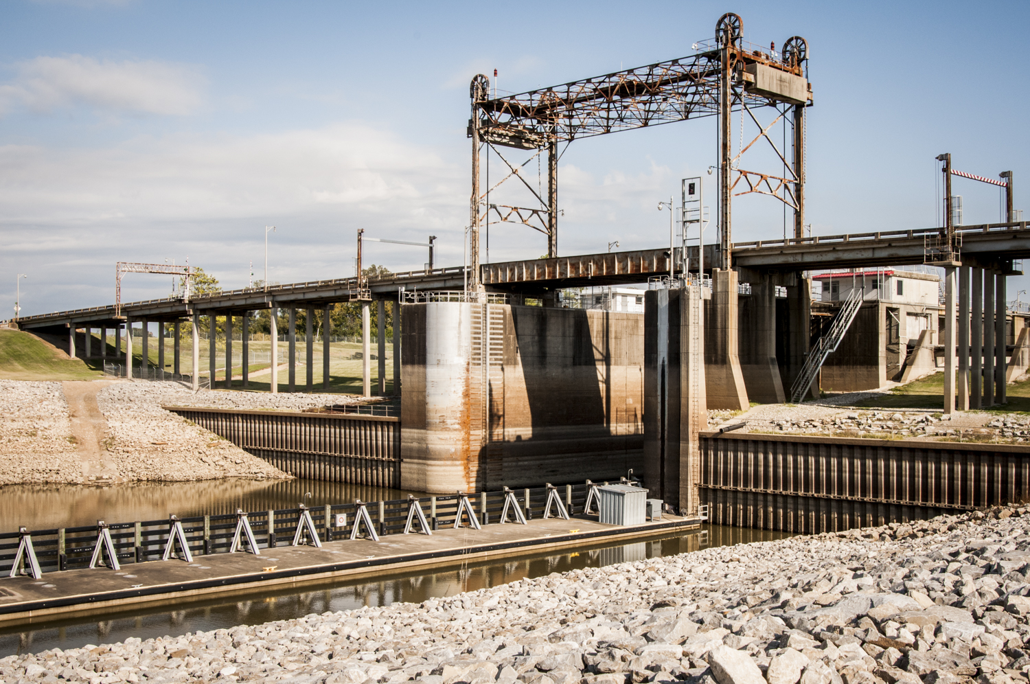
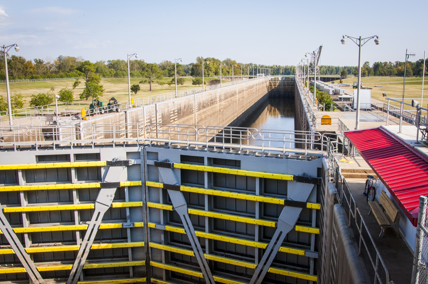
PAUL KEMP The United States Army Corps of Engineers [hereafter, USACE] built a dam at the top of Old River to regulate the amount of flow into the Atchafalaya Basin [after the disastrous flood of 1927]. In the process of this engineering project, the development and residents in the basin’s alluvial valley were forced out so that this 30-mile-wide basin could be free to accommodate about half of the Mississippi River’s flow.
NWNL Has this infrastructure provided effective flood prevention? Are there any other means to divert floodwaters that threaten the levees and city of New Orleans?
PAUL KEMP This spring [2011], we had about a million cubic feet per second [cfs] going through there during “peak discharge” in May. But below at Baton Rouge, we still had about 1.4 million cfs, so the Bonnet Carré Spillway [12 miles west of New Orleans] was opened as a flood-relief route into Lake Pontchartrain, sending approximately another 300,000 cfs of water away from the Mississippi River to the north, bypassing New Orleans and going on the Gulf. Because 2011 was a record flood, we employed all these ways of spreading the flow…, except for our river diversions.
NWNL Why didn’t they use the downstream river diversions in 2011?
PAUL KEMP The few river diversions that we have below New Orleans were shut because people were concerned about continuing problems for oyster growers from 2010. To keep the BP’s spilled oil out, we kept those diversions open much more than usual. That flushing of fresh water killed off a lot of the oysters that depend on a certain balance of fresh and saline conditions. So there was a reluctance to open up those structures during the Spring 2011 flood, despite my urging otherwise. But all the other flood-control structures were opened up and even so, we still had record flow past Baton Rouge and New Orleans.
NWNL Were there any notable geologic changes as a result of 2011’s historic high waters?
PAUL KEMP We’ve just discovered in the last month or so, as the water’s receded, that the 2011 flood built a lot of new land as a result of river diversions. We’re finding a lot of new land in the Atchafalaya Delta and in the Atchafalaya Basin – and also near the mouth of the Mississippi River where the USACE built an artificial diversion downstream of Venice, just above “The Bird’s Foot.”
NWNL How do these USACE river diversions work? Are they “the magic bullet” that that will protect the Mississippi River Delta?
PAUL KEMP That West Bay Diversion has been open for 8 years, but had built no land until this year. Then, after the 2011 flood, it created about four square kilometers of new land. So it’s obvious that we can build land, even with ongoing sea-level rise and subsidence.
We’re still discovering all the ins and outs of how the river builds up delta land. It’s not as simple as might be thought. At West Bay, the USACE had dredged the channel at an awkward angle. Thus it took a long time, but the river actually turned that diversion around about 60 degrees in 2011 and then started successfully conveying a lot of sand.
So the question for us is how long can we wait? There were people with expectations that the diversion would create land the year after it was built. Well, it doesn’t happen like that. A diversion’s success in building new land takes a lot of things happening below the water before things happen above the water.
NWNL It seems you, as a geologist, work with many unknowns.
PAUL KEMP Well, it’s an exciting time for our work here because we’re seeing some things pay off. It’s also frustrating because not everything is moving in the right direction. We continue to be beset by difficulties like the Macondo Well blowout disaster and BP Oil spill last year. That of course was one of the many things that “couldn’t happen,” but did – like Katrina’s flooding New Orleans. However, geologists are used to those kinds of things. The history of this Delta really has been written via a series of “unexpected” but expected events that are pretty common in geologic records.
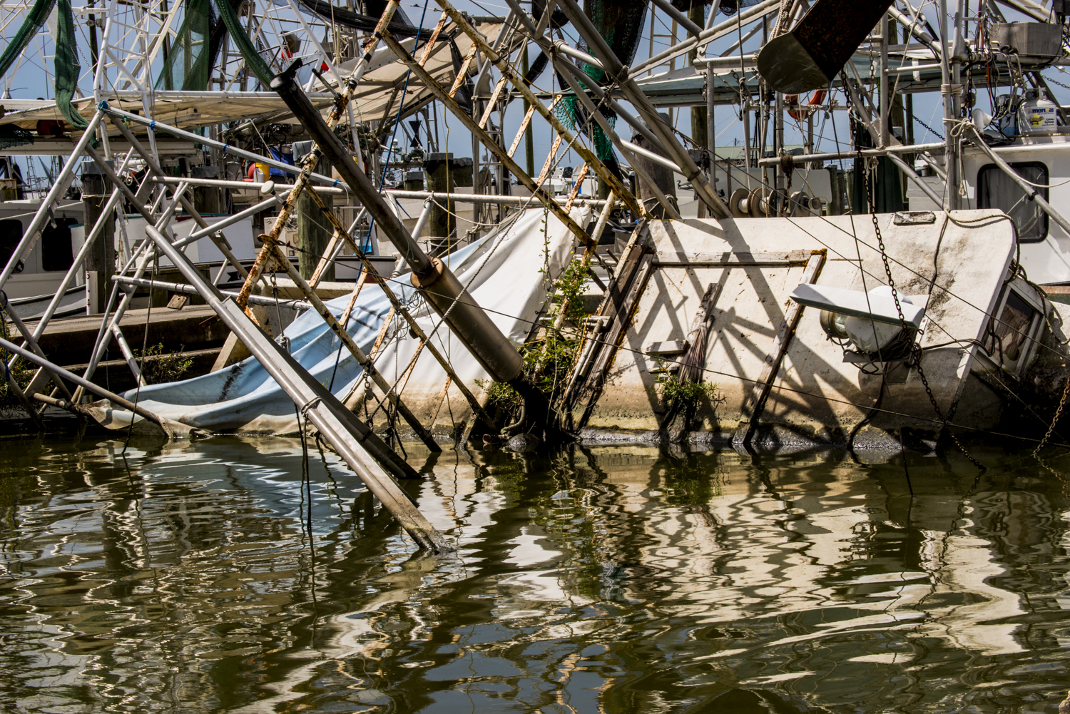
In this part of the Louisiana coast, you’ll see a lot of downed trees. In the past six years, since 2005, we’ve had 4 major hurricanes come through here. They came in 2 pairs that were less than a month apart. They each were 100-year storms, or bigger. Katrina and Rita, and then Gustav and Ike, were pairs that came only a month apart. For those enamored of statistics, that’s a little sobering.
NWNL Your comments on the sobering nature of “the unexpected” brings up John McPhee’s “Control of Nature” article [in The New Yorker Magazine, 1989]. He questioned whether Mother Nature or the USACE gets to rule the geologic structure of the Lower Mississippi River.
PAUL KEMP Yes, McPhee talks about the control of nature; but control of nature is always a temporary thing because it takes a huge amount of energy to work against nature. You can control nature only as long as you’re willing to put that same amount of energy into it. What we’re trying to do is set up a system that can be sustained without huge inputs of fossil fuel energy, because we won’t have it 20, 30 years from now. So we must use energy now that doesn’t rely on fossil fuels.

PAUL KEMP That cleaner energy can to work for the sustainability of the ecosystem as well as our navigation needs. What I’m doing through Audubon is trying to have nature teach us. If we learn what nature will do for us if we let it, we can then try to apply good engineering – and tweak it so nature can also work for the people who have lived here for thousands of years.
Right now we’re at “the edge of sustainability” with sea-level rise being what it is and having lost 2,000 square miles of marsh over the last 70 years. We are on the edge of a precipice. We no longer have that big expanse of wetlands out in front of us that saves us from storms. So in New Orleans, we were forced after the disaster of Katrina in 2005 to spend $15 billion on new levees that supposedly would buy us protection against 100-year hurricane. But a 100-year storm protection is not enough for any city to prosper.

NWNL What examples are there of ways nature can sustainably help us do this job?
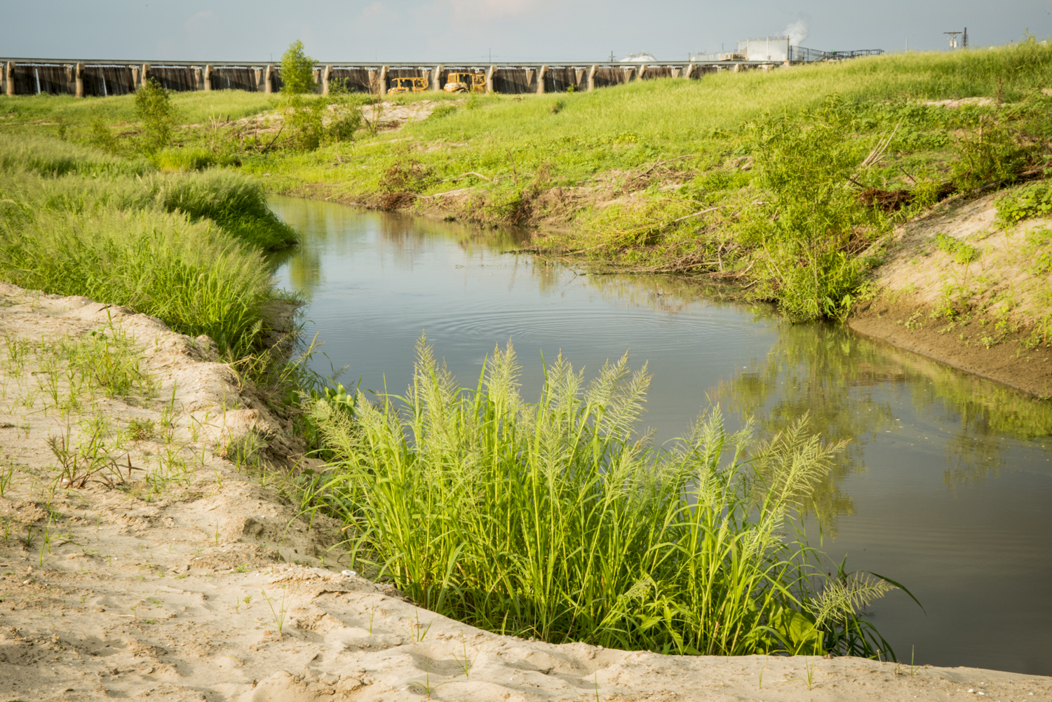
PAUL KEMP We’re studying how to raise that protection level much higher by restoring the lands out in front of the levees. This year we have seen what has happened with the active deltas that we’ve been monitoring in the Atchafalaya Basin. Since those deltas, channels and bayous are not as manipulated as they are south of New Orleans. We’re seeing huge amounts of land building in the Wax Lake Outlet. There we’re seeing a lot of new sand islands and extensions of old islands We’re also seeing some over in the Atchafalaya Delta, which is a dredged system where there’s not as much natural deposition. And in the West Bay area, downstream of Venice, we’re seeing deltas that we’ve never seen before developing in the main mouth of the Mississippi River into the Gulf of Mexico.
NWNL Here we are amongst the bottomland hardwoods of Bluebonnet Swamp Nature Center. I look forward to your pointing out some of the bird life here, Paul. Meanwhile, let’s talk about the power of nature, now that we are actually outdoors.
PAUL KEMP I think that when John McPhee wrote his essay on the control of nature, he should have put his title in quotes, because there is always a time element to the “control of nature.” We may control it for this period or that period, but I think the idea that we control nature forever is really not true.
NWNL Can nature continue to function and support healthy ecosystems despite human intrusions?
PAUL KEMP The good news in Louisiana is that we have not destroyed nature entirely. We have a lot of natural processes that continue to function here. This is a pretty resilient system. We have long, drawn-out spring, summer and fall seasons. We have a lot of material that comes through here via our rivers. So, given a chance, Louisiana’s portion of the Mississippi River Basin is a self-healing system. While very heavily exploited, this system has managed to do what other creatures have done for many, many years. They take advantage of the huge perfusion of productivity and abundance that occurs when a river the size of the Mississippi reaches its outlet – in this case, the Gulf of Mexico.

NWNL Can the current management of existing infrastructure remain as it is without harm to vital natural systems?
PAUL KEMP No. We can’t continue managing it the same way we have for the last one hundred years or so. We know that. We would be taking a long walk off a short pier. The question is whether we can come up with a new strategy that builds on the 1930’s-era system we have today. Going forward, we need a system that recognizes the strengths of that system and also its disadvantages. We need to get in front of many unnatural trends: sea-level rise, subsidence, the movement of oil and gas industry offshore, the retreat of people off the coast, and the changes in the way the coast is used. Can we get in front of these things to create a sustainable future for the coast – and also for man?

NWNL Does local management of the Gulf Coast and the Delta relate to other connected regions?
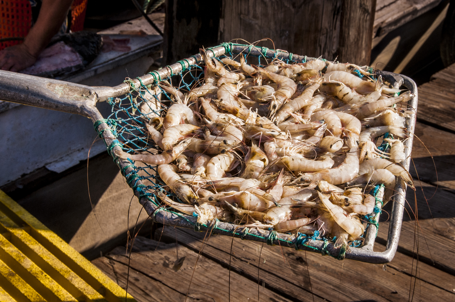
PAUL KEMP This Mississippi River Delta is actually the engine that nurtures fish, crabs and shrimp throughout the whole northern Gulf of Mexico. Without the Delta, the entire Gulf would be made much poorer. So, yes, we have a regional responsibility to manage the river for the benefit of the whole Gulf. I think that whole message was very powerfully driven home during the response to the Macondo Well blowout. Louisiana was most affected, but suddenly other states nearby were feeling the disaster – sometimes in the same way, sometimes in different ways. So, we are all in that boat. People from birders to shrimpers, from Pensacola FL to Corpus Christi TX, depend on the Mississippi River Delta in ways that they are just now starting to understand.
PAUL KEMP The Mississippi River Delta is the great nursery ground, offering great productivity for all those birds nesting here on those precarious shores. Many birds nest on exposed islands on the edge of the wetlands where the food is, so they don’t have to travel too far for food. They can’t do that now in the populations that traditionally were here. And they can’t do that anywhere else in the Gulf because there isn’t the concentration of productivity that the river provides.
Ah, right now you can hear a great blue heron nearby. Yeah, he’s up in that tree up there.
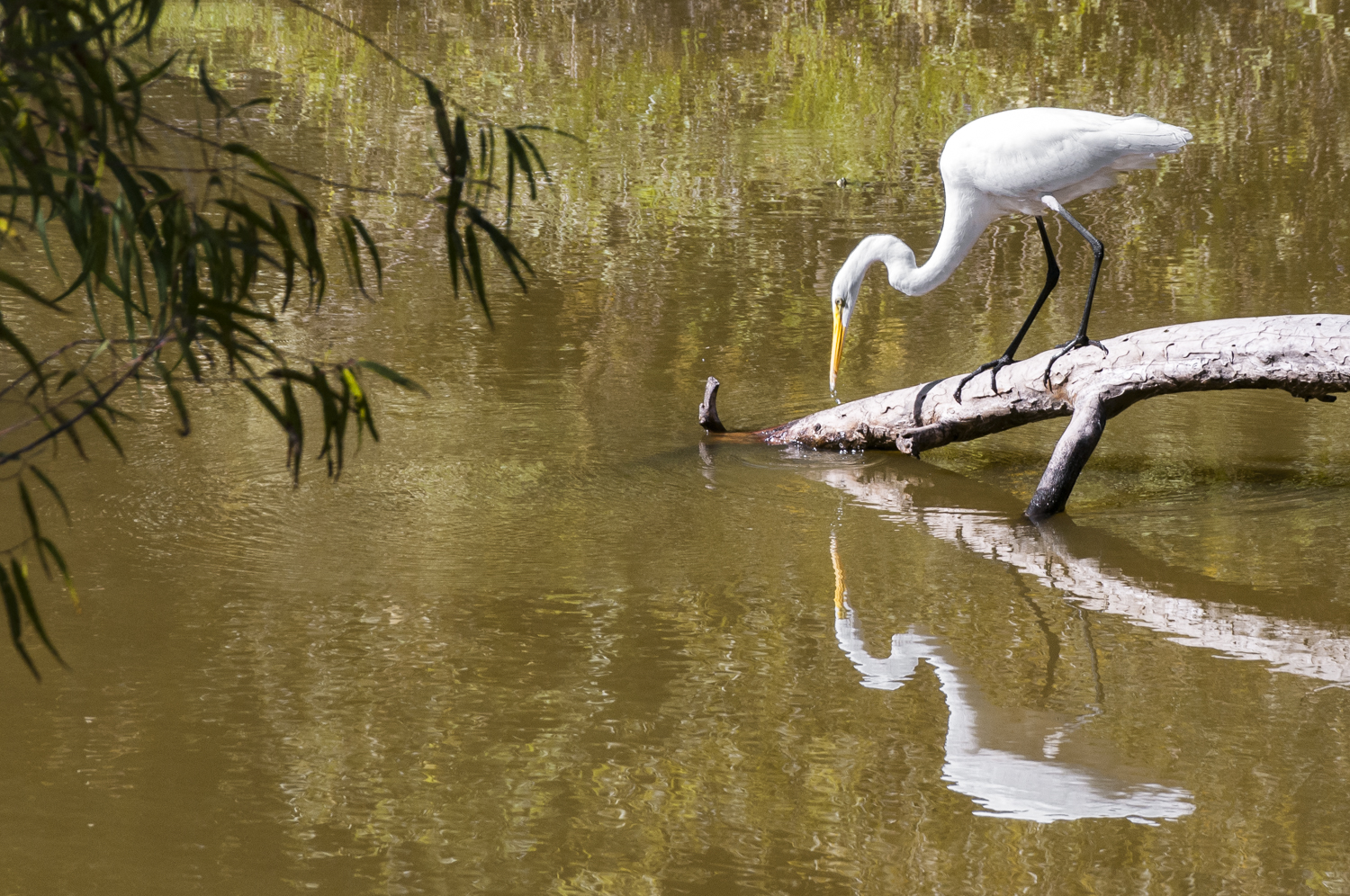
NWNL Oh, I didn’t see the heron, but I just saw a white egret.
PAUL KEMP There is a great blue also.
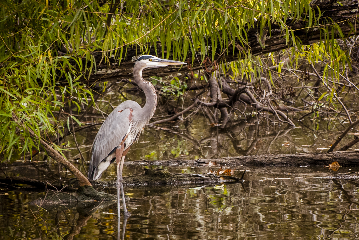
NWNL The Atchafalaya and Lower Mississippi Rivers are full of herons and egrets. Paul, while we keep an eye on these great icons of this watershed, can you tell us why Audubon is involved in the Mississippi River system as a whole? It seems that Audubon’s vision is that this vital birding corridor, or “flyway” as some call it, is a part of that larger, intricately-connected system you’ve been describing.
PAUL KEMP Yes. I was hired by Audubon to work on the whole Mississippi River system. It was an opportunity that I was looking forward to because I had worked on the mouth of the river and the coastal issues. I saw a plenty of smart people and dedicated folks trying to save the coast. But there really wasn’t anyone working on restoring the river itself – a key environmental need for our country.
PAUL KEMP In fact, when you talk to people, they don’t think of the Mississippi River as really in trouble from an ecological standpoint. They think that the water is polluted. But they don’t see the detachment of the river from its flood plain is also an issue for concern. Only during major floods, like that the one this year, do they start to “get” why the river has a floodplain and that if we levee it off like we have, we drive the flood stages up higher.
NWNL How does the Atchafalaya Basin fit into the Mississippi River flyway?
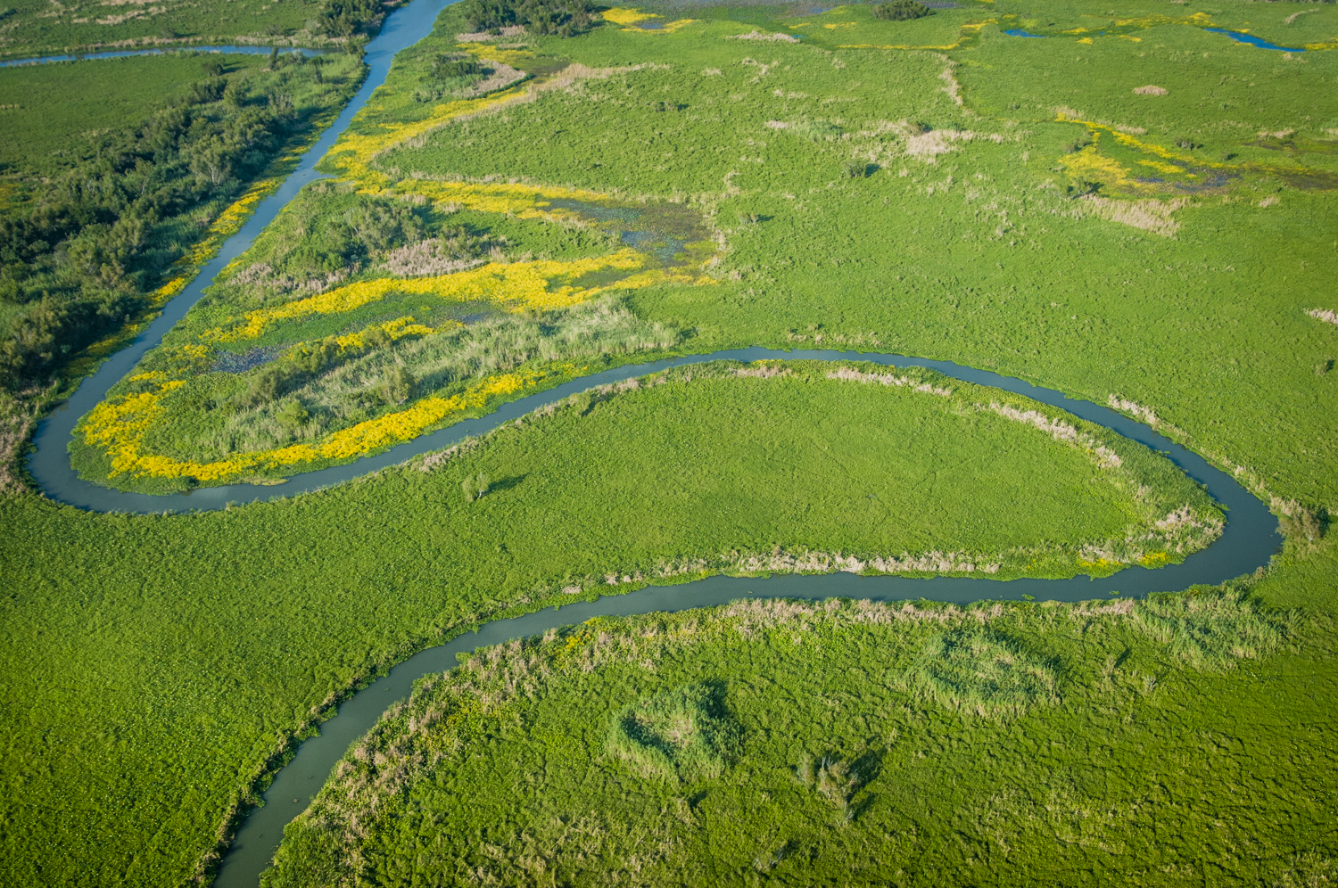
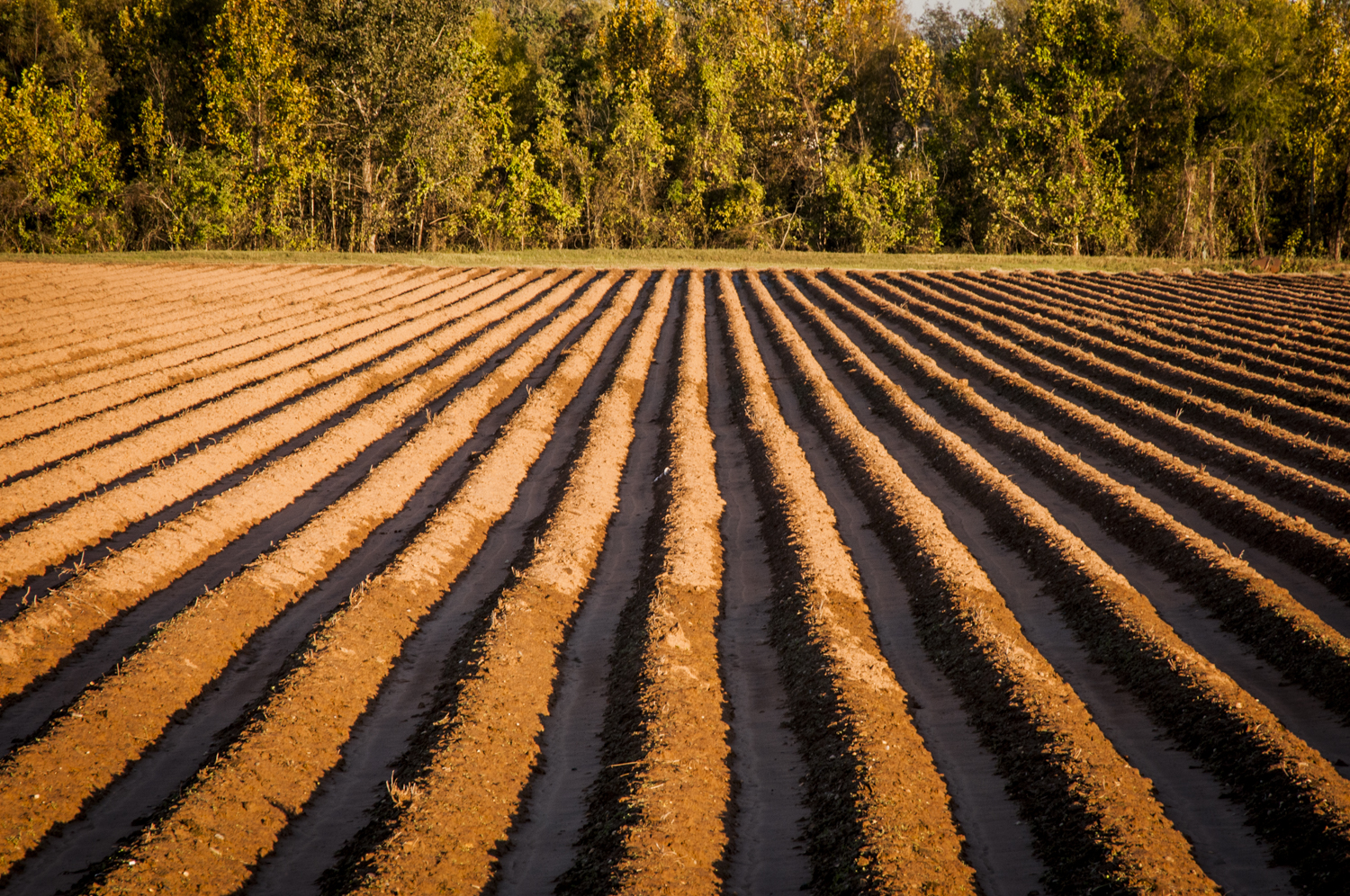
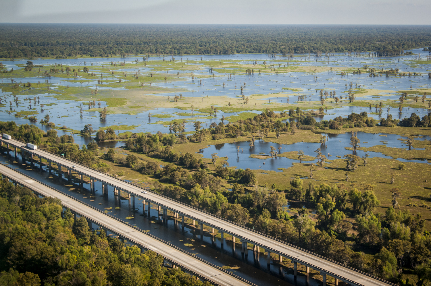
PAUL KEMP Birds breed and pass through the Atchafalaya Basin, which is the largest, intact, forested wetland in the country. They cluster in that forest because they don’t have a lot of other places to go. As they move up the river, many of the former bottomland hardwood forest and swamp areas that occurred along the main channel of the Mississippi and its tributaries are now soybean fields, converted to agriculture many years ago. Ninety percent of that type of habitat is gone. Fortunately, various conservation programs have brought some of those lands back and forests are being replanted. But we have a long, long way to go. We’re now studying how to raise that protection level much higher by restoring the lands out in front of the levees.
The Atchafalaya is so valuable because it is an intact system. It’s not a pristine system in any sense, but the fact that so much river swamp habitat is still there causes birds’ radar screens to really light up during the spring and fall migrations. So these remaining areas are increasingly important to bird populations because they don’t have a lot of other alternatives.

NWNL What vision do you have for improving this issue of floodplain connectivity to the Mississippi River?
PAUL KEMP I am looking upriver to better understand what we can do to connect those floodplains to the river. There are a lot of efforts around the country to bring rivers back to some of their functionality that they had before with dam removals. Except for the Old River Control Structure’s floodgate system, the main stem of the Mississippi doesn’t have many dams on it until you get up to St Louis.
Prior to the last century, the Missouri River was the main supply of sediment to the Lower Mississippi River and floodplains. The longest river in the United States, the Missouri is also one of the most storied if you think of Lewis and Clark, coming all the way from the Great Divide with Sacagawea for thousands of miles. But that major tributary now has seven dams on it, mostly built in the 1950s. We have disastrously transformed the Missouri River into a series of lakes that capture about half the sediment that used to come down here. As the lakes fill up, the dams are losing their functionality. That’s a problem for folks up there, but down here we consider that to be Louisiana’s sediment behind those dams.
So, much of what I’ll be working on in the future is getting that sediment down here. That would solve a problem for them and a problem for us. If we had that sediment, we could build a lot more land. And that would also restore some of the riverine functionality of the Missouri River. It is quite probable that eventually the Missouri will return to be more of a free-flowing stream in the future, now that navigation is no longer much of an issue. But, that’s another hill to climb in terms of conservation and nobody is working on that – that I’m aware of.

NWNL So you propose we remove the Missouri River dams? Isn’t that a rather radical idea?
PAUL KEMP Well, there are all kinds of issues. We are completely out of step with where we are going. In some ways, we are already in the dying days of our “taming the rivers” effort that started with the colonization of America. We now realize that approach really is not in alignment with what we want to do today with rivers. We’ve seen the drawbacks of that approach. It has taken time to show up the 2,000 square miles of loss in the Mississippi Delta. In the Delta, many people have seen this happening in front of their eyes. It is not taking many generations.
NWNL Given North America’s growing awareness of the negative impacts of dams, can you explain developing nations’ growing interest in hydropower? I understand they need irrigation water, but they don’t seem to be focusing on the ecological lessons you mention. For instance Ethiopia’s Gibe Hydro-dams, now being built on the Omo River, will deplete and “kill” Kenya’s Lake Turkana and its vast fisheries that supply protein to many in Kenya.
PAUL KEMP Hydropower is actually a form of solar energy, because it’s the sun that evaporates and “lifts” water up to the highlands so dams can extract power from rapid downstream flows. But dams are run by very centralized management approaches that can devastate river ecosystems and also, in some cases, populations dependent on free-flowing rivers for their subsistence. In North America, many dams were placed in unpopulated areas, so they were seen as all to the good. At one time, it was thought there was no downside to dams.
NWNL How are fish and aquatic populations affected when dams change a free-flowing river into a series of lakes?
PAUL KEMP Well, we are trying to teach Missouri River pallid sturgeon how to live in dammed lakes, but they just are not getting it. Quite a few of them went into the Atchafalaya where they have a wonderful place to swim around and breed, yet their breeding is not successful. That’s because they need more than the Atchafalaya River’s hundred miles for their larvae to grow. By the time larvae in the Atchafalaya develop, they are already out of the relatively safe river and in the Gulf.
We have one of the larger populations of this pallid sturgeon and yet some of them are weird. Hatchery fish from Missouri turn up in the Atchafalaya, but after they come through the floodgates of Old River they cannot get back into the Mississippi River. So the shorter Atchafalaya River becomes sort of a holding sink for the breeding population. Anytime we want to catch sturgeon, we can go there and find them. They live well in the Atchafalaya River, but they can’t reproduce well there. These fish are meant to live in pretty fast-moving deep rivers. Lakes are just not the same thing. They are also not the habitat to which many mussels, birds and cranes are adapted.
NWNL The Mississippi River is a critical navigation route with international significance. So given that, don’t we need the existing locks and dams to enable access to the Upper Mississippi?
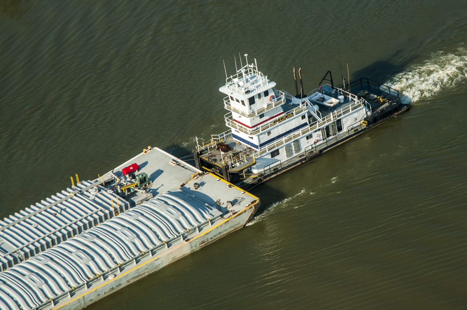
PAUL KEMP For a time, rivers were really the only transportation highways in the country. That is why the Upper Mississippi, from St. Louis to Minneapolis-St. Paul, is a stepping-stone of lock-and-dam, lock-and-dam, lock-and-dam. One day I was looking for the fastest transit records up the river. I wondered why all the records were from the 1920s. Then I realized, “Oh! After we put the dams in, we made travel much slower.”
Before 1920, we adapted our vessels to our rivers. After 1920, we adapted our rivers to the vessels we wanted to build. The downside was that river travel became much slower because of the necessary passage through these locks and dams.
Well, perhaps, we can learn to adapt our navigation on the rivers. There are only about two weeks of “low water.” Yet the whole management of the river is wrapped around that axle. In places where rivers are icebound for a part of the year, they have other things they can use – and maybe that also could be true for low water. Maybe spending so much money to allow a few barges to go through “low water” for just two weeks a year is not the most productive thing to do. These are decisions that society makes, but the decision-makers need to understand what they are giving up when they do that.
NWNL Many ask, “If Audubon is a birding group, why is it involved in restoring Mississippi River ecosystems?”

PAUL KEMP Well, some people might ask why I, as a recovering oceanographer, am working with National Audubon. Something that I’ve come to understand is that a lot of times humans often connect with habitat and the environment through curiosity and an interest in bird life that they see around them.
NWNL People’s fascination with birds is the theme of the recent movie “The Big Year,” starring Steve Martin. This month’s cover article in Delta Airlines magazine was on this movie, with other articles on birding and Important Bird Areas. The magazine mentioned that people go birding to connect with nature. People go birding to disconnect from technology. People go birding because they love little details like how feathers work. People go birding because they love the challenge adding to their “life list.” And people are becoming interested in birds as environmental indicators.
PAUL KEMP At least since the time of John James Audubon, people have connected with their surroundings through birds. Birds are a very approachable and engaging part of the natural history around them. They are kind of hard to ignore, because they are often loud, and they’re brightly colored. And they usually have either disturbing or engaging behavior, so people are naturally drawn to them.
NWNL Does an interest in birding then carry over to create an interest in conservation and protection of our waterways?
PAUL KEMP Birds integrate many processes of the environment, whether that of a river flowing out of the Artic or one ending up in the Gulf of Mexico. U. S. East Coast birds follow migrations of horseshoe crabs up the coast. They follow food sources and ancient breeding trails. People find these things fascinating and once they start becoming interested in that, then the outdoors takes on a whole new brilliance and a living character that calls people back again and again. Birders may be trying to get a longer life list than their friends. Or they may just be fascinated by birds’ parental behavior, or the cooperative fishing behavior that herons around here show, or the inexplicable migrations some birds make from hemisphere to hemisphere.
But think about it: Migrating birds put us in touch with people thousands of miles away that follow them. Folks who are concerned about bird migrations want to be in touch with birders far away, because it doesn’t do a lot of good just to conserve bird habitats here in Louisiana, or even North America. We have to be aware of what’s happening to birds’ rainforest habitat in equatorial South America. That kind of connectivity is hard to forget once you are in touch with it. That’s probably the secret to why birds are such a good way for people to begin to understand the need for conservation.

NWNL How do you scientifically relate the needs of bird populations to the need to conserve the environment?
PAUL KEMP Audubon’s largest sanctuary has been here in Louisiana since the 1920s. But we didn’t have a Program Office here before 2007. Now we have Louisiana ornithologists identifying what we call “Important Bird Areas” – habitat for birds that are perhaps endangered or declining. We need to pay attention to conservation of these “globally important” habitats to conserve the remaining local stock. According to Birdlife International’s criteria, about one third of Louisiana is “globally important” because of the density here in the concentrations of birds not seen anywhere else in the country. They are here for breeding or over-wintering in sufficiently large numbers that they constitute a significant percentage of the global populations. We see this abundance because of the value of the habitat, and also because there’s not a lot of that habitat left in other places.
NWNL Are birds’ behavior or migratory patterns affected by the levees’ channelization of the Mississippi River, or separation of the river from its floodplains, or loss of deltaic land? If so, how do they indicate those stressors?
PAUL KEMP Well, look at barrier islands. They are normally formed at certain stages in the deltaic cycle; but we don’t have any new barrier islands forming because of the way we have manipulated the river. Our barrier islands were at their largest probably a hundred years ago. They are now mere shoals. And so, what we see is birds that nest on those barrier islands being crowded into a relatively small number of breeding colonies. They don’t have as many options.
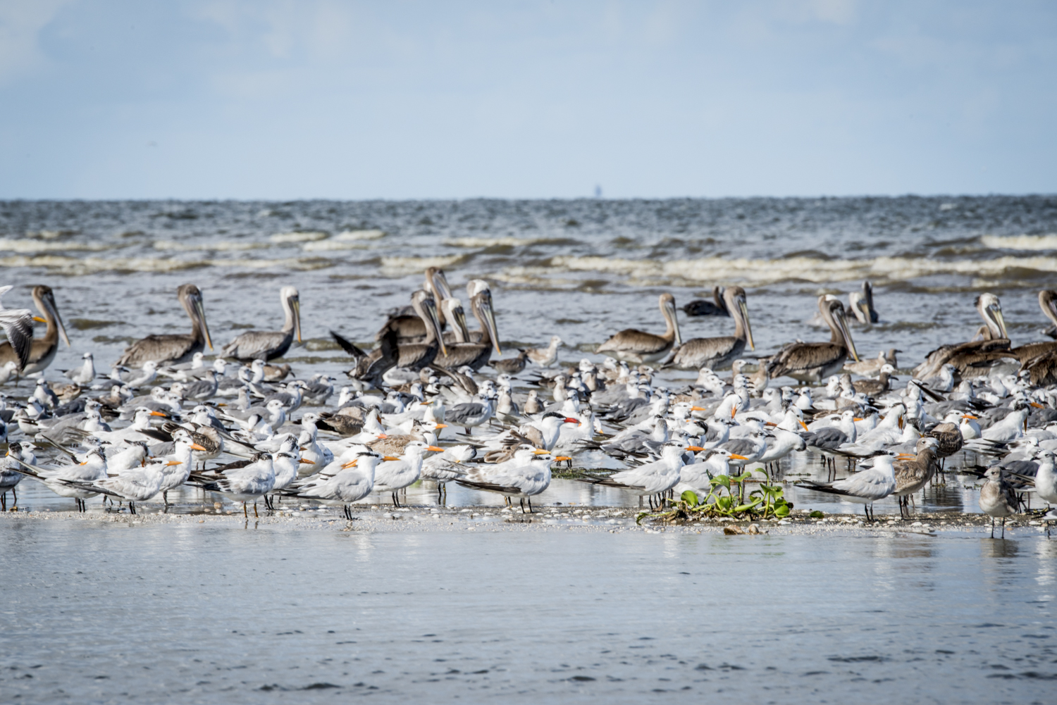
PAUL KEMP Birds have a very strict kind of zonation, but are now in what appear to be just sand bars. There are some that are up a little higher and some around the edges. Some will tolerate some vegetation, but others want nothing but shells. But all those habitats are shrinking, and so the birds are really clustered together, which makes them more vulnerable to oiling and storms. Some of those habitats are really disappearing quickly. Last year during the Macondo Well’s blowout disaster, we got a little sense of how little that habitat really is now. Many of those very-exposed areas saw the heaviest oil.
NWNL Are other bird habitats in the Lower Mississippi River Basin threatened?
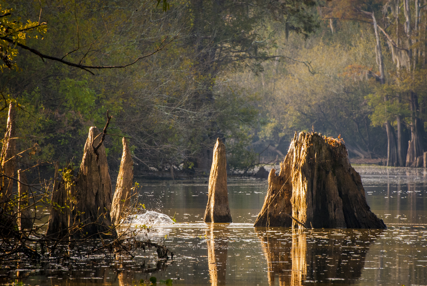
PAUL KEMP Yes, we’ve lost our old-growth forests, for example. We have very little old-growth forests at all in the alluvial valley, because virtually every cypress was cut down before 1930s. So, what’s left is second-growth forests, that are 80 years old. Basically, these are “teenage” trees. The wood of a 500-year-old cypress is different. It has a lot more holes for animals to live in. Many bears are denned in hollowed cypress. So we must protect and allow these trees to get old. We must plant the next generation of cypress swamps back into some of these soybean fields.
NWNL What you would like to see as the future for the Atchafalaya Basin, and how that could happen?
PAUL KEMP Well, I’m very drawn to the Atchafalaya because I think it is a system where small changes in its flow regime could make a huge difference in productivity. Other people talk about changing the flow regime, which is a 30% combined flow of the Mississippi and Red River into the Atchafalaya. The Red River always goes down the Atchafalaya, which has no dam. The engineers make up the rest of the flow into the Atchafalaya with waters from the Mississippi, which are restricted by the Old River Control Structure since the entire Mississippi River would really rather go down the Atchafalaya since it’s 200 miles shorter. Rivers are not interested in traveling any further than necessary to get to sea level. So, the Old River controls maintain flows into the Atchafalaya at a rigidly constant 30% combination of Mississippi and Red River flows.
There’s no agreement in the scientific community that 30% is right for any time of the year – spring or fall. The fact that the mandate is to keep the flow at 30% at all times makes it easy to manage from an engineer’s standpoint. But that doesn’t mean it’s the best way to manage. So, we are trying to make the case for a more enlightened approach – one that actually considers ecosystem values, as well as simplicity.
NWNL So your idea is to vary flows into the Atchafalaya River, rather than have a fixed flow volume? Isn’t that a bit complicated and difficult to assess?
PAUL KEMP You know, we don’t manage our houses for the people who clean it. We choose to make a mess, and then we clean it up later. If we were always managing our house just to make sure no dust ever falls, we would probably never live in it. However, we manage this system for the benefit of bureaucracy, bowing to an unwillingness to make decisions that would undoubtedly be controversial in some way. But in so doing, we are foregoing all the ecosystem benefits that might evolve from actually applying some of the science that we already know. We are trying to embolden bureaucrats to consider the prize that might come from doing things in a more active kind of way, and to accept that the ecosystem benefits might be great enough to outweigh the political difficulties.
NWNL What has been the response to your efforts?
PAUL KEMP Well, we are slowly making progress. The USACE, as an agency, like most very entrenched bureaucracies, is set up for no change. It fights change no matter how illogical the battle seems. It would rather go out of existence than adapt. It’s unfortunate because the USACE doesn’t have many advocates.
Ah, there’s the barn owl. Listen! They are active during the daytime, and they’re talking now.
NWNL It seems that they are talking back and forth. There must be a pair.
PAUL KEMP Yes. One might be right around here.
NWNL Oh, one owl just flew over that way! You have said the Important Bird Areas are measured by global significance, global standards and international standards. That raises a question for which I’ve found no answer. Why hasn’t the Ramsar Convention on Wetlands designated the Atchafalaya River Basin worthy of conservation?
PAUL KEMP Well, to become a Ramsar site, you have to have very dedicated people who advocate for it. The Atchafalaya Basin is not “managed” in any ecological sense. There’s no ecological purpose to the way it is managed. This basin lacks advocates in a bureaucracy that sees it as a conduit, not as an ecosystem. They see it as a pipe. In some ways, the fact that it is an ecosystem is almost a distraction to the bureaucracy. I think John McPhee had some insight into that.
NWNL Should we worry about the future of the Atchafalaya Basin?
PAUL KEMP In Louisiana, the Atchafalaya Basin is considered sort of a “working coast” in which the environment is pretty much taken for granted. In the beginning of the last century, the Basin had more than 6,000 square miles of wetlands. No one could imagine that we would be arguing for its continuance 100 years later. It was inconceivable. Historic records describe the ecosystem as profligate with sediment, nutrients, water and vast numbers of fish and birds. Human management has also been profligate. Only recently that we have become aware that this could all go away.

NWNL Do you foresee someone, some state group, or another sort of agency willing to work for that Ramsar designation for the Atchafalaya Basin?
PAUL KEMP Probably in ten years we’ll have some of these areas designated as Ramsar “Wetlands of International Importance.” The focus right now is to get an expansion of that designation for Caddo Lake in northern Louisiana. While you have to have critical habitat and environment, you also need really dedicated landowners and advocates for a Ramsar site designation.
Many wonderful places in the world that would be valid Ramsar sites are not, just because they don’t have the advocacy around them. We do not have that advocacy community yet, but I think it will come. I see signs that it is coming. If you talk to people in state conservation agencies, you see a new kind of an interest and awareness in conservation that you never saw before. Many of them are coming out of the same education programs. Many of them I taught. They are coming of age in a different world.

NWNL In 2007 NWNL interviewed Dr. Robert Sanborn, a Canadian glaciologist with the UN’s Water for Life program. I asked him what it would take for this country, North America, or the world to understand that we need to address climate change? That was in 2007, fairly soon after Katrina. He answered, “Unfortunately, for people to get it it’s going to take several more Katrinas – but even bigger.”
PAUL KEMP The problem is that waiting for things to break and then trying to fix them is actually a really, really wasteful and expensive way to do things. Recently, we have had hurricanes, flood disasters, and the BP oil disaster. The next crisis could be some kind of navigation disaster at the mouth of the river, because we can’t maintain that channel. Maybe a collision, or something like that. That would spur a lot of thinking about what can we do better. But by that time, millions – if not billions – of dollars will have be wasted in remedial measures and hasty efforts to patch things together.
The current modus operandi is to get from one disaster to the next – or at least get from one media cycle to the next. There is no big commitment to having things work in the long term. We see a lot of failures of built infrastructure, such as levees, navigation channels, and things like bridges. Our ecosystem infrastructure is in a pretty bad state.
PAUL KEMP We’ve taken on some responsibility for it and we’ve set out to manage the ecosystem; but we really haven’t taken on the commitment to maintain and sustain it. These systems need help in becoming sustainable. They need to be managed so they can continue in a low-energy future when they can to provide us with a lot of benefits, as long as we don’t continue to obstruct them.
Look, you can see a squirrel. And we can hear some barn owls and a barred owl. They are big owls. It was a real discovery for me when I came to Louisiana from the East that the owls here are very vocal and active during the day. You see them flying around in the day here.
But look at this swamp. Like many of our swamps here, it is sinking. This swamp is being buried.
NWNL Buried?
PAUL KEMP Yes, because all of the development around. All of a sudden a lot more sediment is coming in. We used to have sheet flows of water across here. Now there is actually a little channel that has developed with grassy banks. The whole channel is crud.
We don’t have 1927 flood measurements for Bluebonnet Swamp, but flood stages here were certainly were not as high then, because flood stages go up with levees. If you want to drive the stages up, put in a levee. Based on 1973 flood data comparisons, flow lines are going up. The system is changing and adapting.
NWNL How did this Baton Rouge area fare in the 2011 spring floods?
PAUL KEMP The USACE says everything worked well during the flood of 2011; but they want $2 billion to fix a system where supposedly nothing broke. Go figure. It’s just that the higher you build the levee, the more fragile it becomes, and the more inevitable it becomes that there will be more failures as time goes on.
We assumed that the USACE was taking care of its business, and that levees are being maintained. But it turns out they weren’t. The people we were counting on were asleep at the wheel. Worse than that, they were also not raising any alarms. So, I raised some alarm to my colleagues. Of course that’s usually not good for your career – but at least I don’t have trouble going to sleep at night.
NWNL We don’t have to include that last part if you prefer.
PAUL KEMP Oh, no, no. I’m not going to worry.
NWNL Let’s stop here in the shade then and have you to talk about what shape you think the levees are in right now, if another Katrina hit.
PAUL KEMP You know, an event like Katrina flooding New Orleans really gave many people a new awareness of how much they depend on levees and pumps in their everyday life. Many who were flooded out of New Orleans never gave it a thought before the levees failed. I had been working on simulating hurricane surges to be used in public-safety work. It was amazing to me that we had not anticipated a lot of engineering failures. The system was clearly more papier mâché than reality. You know, papier mâché works fine for years; but, uh….
So, that got me to thinking that we really need to all get involved in public safety and environmental issues, which are often tied together. We can’t be sure that government agencies that are expected to look after these things are really on top of them. In the case of Katrina, they were nowhere near on top of things. Now they’ve re-built the levees again.
NWNL How secure do you feel with the new levees around New Orleans?
PAUL KEMP I now serve on the Southeast Louisiana Flood Protection Authority – East. So I actually have some responsibility for maintaining them and making sure they operate properly. I take that very seriously. But the longer that we go from the Katrina disaster, I suspect our guard will be let down again. It’s really up to the next generation to not accept assurances without carefully looking at whether there’s something there to back them.
NWNL Is there any way to assess the new levees? Or does New Orleans have to wait until the next hurricane to find out how effective the new levee system is now?
PAUL KEMP Well, it is much better than it was. Before Katrina, we didn’t know how bad it was. We found out. Since then there has certainly been a lot more scrutiny, and of course, a lot more money put into the system we have today around New Orleans. But in terms of population, New Orleans is a smaller city than it was. So it is not clear that our tax base can actually maintain a system this complex that continues to be exposed to subsidence and other coastal issues that erode it.
We got the federal government to rebuild the system like that once. But it’s probably not going to do it again 15 years from now. The lesson really is that local cities and residents have to take a bigger role in these things. They can’t rely on external government, or particular federal government agencies, to provide them with unlimited protection. One thing we know for sure is, that whatever protection there is, it is limited. It certainly is not the kind of protection that is made available in other developed countries.
NWNL Thank you, Paul. It was wonderful to talk with you both in your office as well as out here in the Bluebonnet Swamp Nature Center.
Posted by NWNL on Oct. 21, 2014.
Transcription edited and condensed for clarity by Alison M. Jones, NWNL Director.
All images © Alison M. Jones. All rights reserved.