
Boat Tour of the Sacramento-San Joaquin Delta
California Megadrought
|
NEW ESRI StoryMaps: What's On Our Shelves & NWNL Song Library & No Water No Life ESRI |
California Megadrought
Sacramento-San Joaquin Delta, California
Mike Chotkowski
USGS Regional Director and Science Coordinator for the Pacific Region, focused on the Delta’s collapsing ecologic food supplies [NB: USGS scientists help ensure health and functions of the San Francisco Bay and Sacramento-San Joaquin Delta system. -- USGS website.]
Ryan Sabalow
Reporter, Sacramento Bee
Lauren Sommer
Science Reporter, San Francisco NPR
Curt Schmutte
Delta Researcher, USGS Regional Dir.
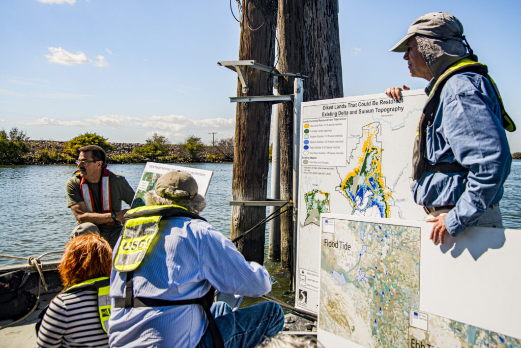
The 2016 annual Society of Environmental Journalists conference was held in Sacramento CA, during a very impactful drought in California. A sunny-day field trip via a USGS boat, provided environmental journalists a narrated survey of the Sacramento-San Joaquin Delta’s “Lower Tule” and “Project Wetlands” – also known as the “Ground Zero of California’s Water Wars.”
This Delta is the West Coast’s largest estuary and the hub of a vast, but antiquated, water-delivery system. It was created to facilitate the flow of the San Joaquin and Sacramento Rivers into the San Francisco Bay. Recent conflicts over this Delta’s waters have signaled future national conflicts, especially driven by climate change impacts. Conversations on the tour combined opinions of both supporters and detractors of the current controversial plan to re-plumb this critical, yet endangered estuary.
During the tour, USGS guest speaker Mike Chottekowski offered his studied focus on the collapse of the Delta’s ecologic food supply. Unfortunately, due to crowded and noisy conditions on the boat, it was difficult to identify scientists and journalists for attribution. Yet, NWNL feels their rapid-flowing, on-board discussions merit publication, despite the anonymity of speakers and eager journalists.
PART 1: SOLUTIONS NEEDED
NUTRIENT LOADS
NO SILVER BULLET
PART 2: SITES BEING STUDIED
PYGMY MARSH: WHY SO SMALL?
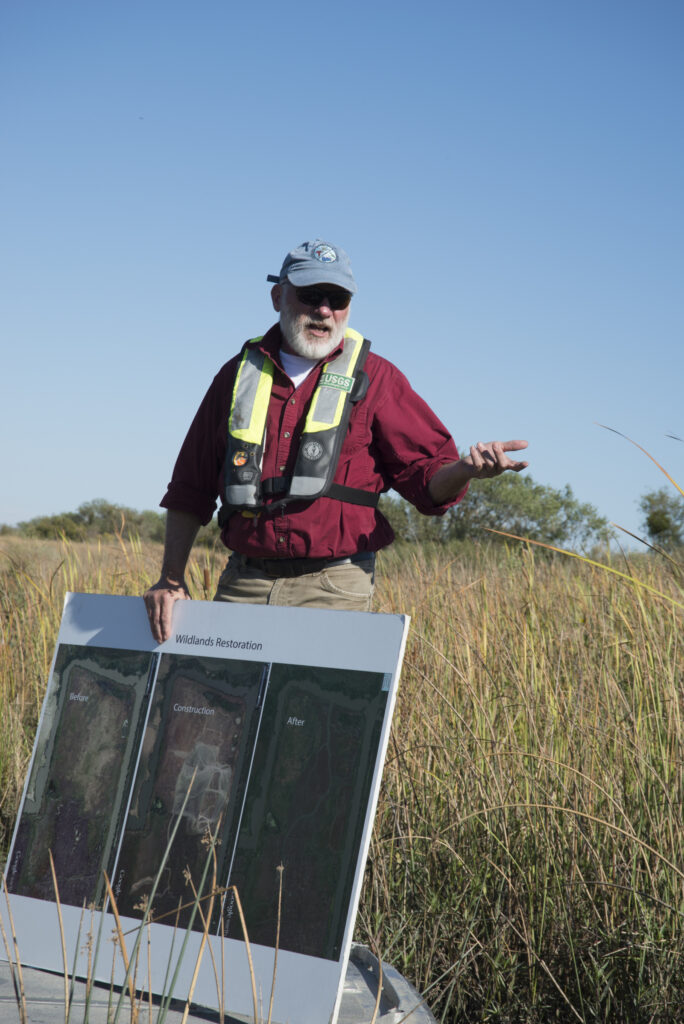
WESTLANDS MARSH: RESTORATION
HISTORY & COMPARISONS of the DELTA
PART 3: THREATS
TWITCHELL ISLAND: SUBSIDENCE & LEVEES
METHANE LOSS & EARTHQUAKES
All images © Alison M Jones. All rights reserved.
Key Quote The increase in population is the biggest pressure on our aquatic ecosystem. So, we must manage for the effects of climate change, but we also need to manage for the effects of land use and population growth…. There might not be one silver bullet; but habitat restoration is one of our best chances to improve these ecosystems. — Mike Chottekowski
MIKE CHOTKOWSKI We’ll go up some very narrow, wild and remote channels, They’re some of the best remaining areas in this Sacramento-San Joaquin Delta. The cool, yellow, weather balloon that just went by carries about $50,000 of equipment – sometimes $100,000 that has been remarkably helpful to us working for USGS. As a Regional Director of USGS, I can state that USGS is committed to measuring climate change.
We’re now near Liberty Island in one of the most productive parts of the Delta that remains. But California is facing impacts of an increased population that is increasing the amount of nutrients that we’re dumping in our system. We’re completely swamping our coasts with nutrients; and it’s killing them. Likewise, this Delta faces major problems with the types of nutrients we have and their amounts. We need to find that “sweet spot” that supplies the amount of nutrients necessary for beneficial alga blooms – but not too much.
Other climatic conditions, such as warm water, also lead to harmful algae blooms. Microcystis is one such type of harmful algae. [Editor’s Note: Microcystis is a cosmopolitan freshwater cyanobacterium, known for forming toxic blooms in eutrophic water bodies. — Google] I saw these algae at Brant Island in the water where we put in. It’s frequently there, but we very rarely see it here at Liberty Island.
Liberty Island is one of the places in the Delta with beneficial algae blooms. They start here; and we’re trying to figure out why, as we focus heavily on nutrients. This is a flooded island that still has its old pumping station. The levee breached in ’93 and ’95, if I recall correctly; and they decided not to fix it. We’re going to visit the other end of the island where it tapers up to an inner tidal zone at that end.
About two-thirds of the water on the island leaves on ebb tides. This is the kind of thing we think about. As we talk about restoring ecologic aquatic ecosystems, we want this to act like a plankton farm. We want water to come here spend a week or two sloshing around, making phytoplankton that will be exported and consumed by the zooplankton. For that process to work, we need phytoplankton of the right size so zooplankton can get into the organisms we’re trying to restore. It is a wickedly hard problem.
In this estuary we’ve lost the phytoplankton bloom. We used to have two major photo-plankton blooms a year. We now have only one very small bloom. We don’t know why, and we argue about that. We are deep in the process of trying to figure out why.
The nutrients in this region come from Sacramento’s regional wastewater plant, largely via the Sacramento River. Some nutrients come as nitrogen, an essential nutrient for living organisms in the form of ammonium, and results in phytoplankton we on’t want. The Sacramento Regional Treatment Plant is now going through a massive upgrade to change the ammonium to nitrate and is changing its treatment process, at the cost of a billion of dollars. That will vastly reduce the amount of nitrogen supplied to this system.
At the same time, we’ll attempt significant wetland restoration in this area. The wastewater turns the dial so low that very little nitrogen will come into the system. One concern is that we’ll have a “phytoplankton desert.” On the East Coast, they’ve seen that happen in some of their estuaries. We need to anticipate and watch for such a process. Plus, we’re deep in discussions with the Wastewater Treatment Plant as we plan and watch for any changes – especially things going awry.
JOURNALIST If we go back to our conference hotel in Sacramento and flush the toilet will we contribute to this problem? We’re now feeling a bit guilty.
MIKE CHOTTEKOWSKI Yes, your flushes do add to the problem – absolutely! And especially if you have kids! The increase in our population is the biggest pressure on our aquatic ecosystem. We projected the Bay Area loads out by 2100. In that study, we saw that in 2050, the nutrient load projectionss in the Bay were up by 40%, depending on the scenario. Then they double by 2100.
So, we must manage for the effects of climate change – but also for the effects of future land use and population growth. This Delta is huge. When one of its huge islands floods, there is dramatic change in this area — not just the hydrogenomics, the things I study. [Editor’s Note: Hydrogenomics is the science of fully utilizing hydrogen.] Such changes impact the future of the Delta’s bio-geochemistry and how this whole place works. Ultimately, the Delta’s future is expected to become a big flooded area.
MIKE CHOTKOWSKI The other important aspect of this region is that it’s wide-open. See all those windmills? You’re here when it isn’t windy, which is typical of the fall. But we get summer sea breezes through here that really crank and create constant wind waves here. As you go further up in the system, the Delta slowly gets more and more shallow. The wind waves generate humidity which the little Delta smelts need and want. Thus, this is a good habitat for Delta smelt. They catch them primarily up here in the Delta because wind, as part of this environment, generates humidity in the system on most days here.
JOURNALIST If you had the “Hand of God,” and could do one thing for California’s water supply, what would make the biggest difference?
MIKE CHOTTEKOWSKI Well, there are some very good stories. For instance, a massive supply of plankton blew in here this spring and lit up the whole system. Many people came here to study that condition. First, we must figure out what made it happen. Then, we must see if we can help recreate that plankton inflow in the spring, as it used to be.
Fortunately, we see this system responding the right way. We also see regional bits of the system responding in beneficial ways which we need to bring up to scale.
From my perspective, the problem is that there is no one magic thing we can do, even if we had all the money in California. We need to do 1,000 things right. Then we need to study our actions and figure which are best. While the answer isn’t one silver bullet, habitat restoration is one of our best chances to make better ecosystems.
MIKE CHOTKOWSKI We call this the Pygmy Marsh because everything about this marsh is small; but we don’t really know why. Again, there’s conflict among scientists over this.
You can see there’s a beautiful dendritic pattern across this area. [Editor’s Note: i.e. branching out like a tree]. We scraped all this and piled up a bunch of dirt over here. As far as we can tell, nobody has ever studied whether this terrestrial marsh has the kind of ecosystem we want. Within aquatic ecosystems, we know that terrestrial ecosystems are problematic because we see with our own eyes that these are small-statured plants. That’s something we should understand if we’re to do a vast restoration in this area.
We have a bunch of solar panels here to do measuring, as well as imaging fish as they go back and forth. This helps us see fish moving on and off in particular weather. We’re trying to develop non-lethal methods to take fish. Right now we can’t get a permit to “drag” in here since we might take a Delta smelt. So, we’ve put in instruments to help us study conditions that determine formations of this “Pigmy Marsh” It could be soil; and it could be elevation.
Another reason our instruments are in these places is to help us conserve many of their features. We try to figure out how these places run mechanically, so we make a little channel here to grade out a little bit so we can produce marshes here that aren’t pigmy marshes. Thus, their functioning will help the aquatic environment.
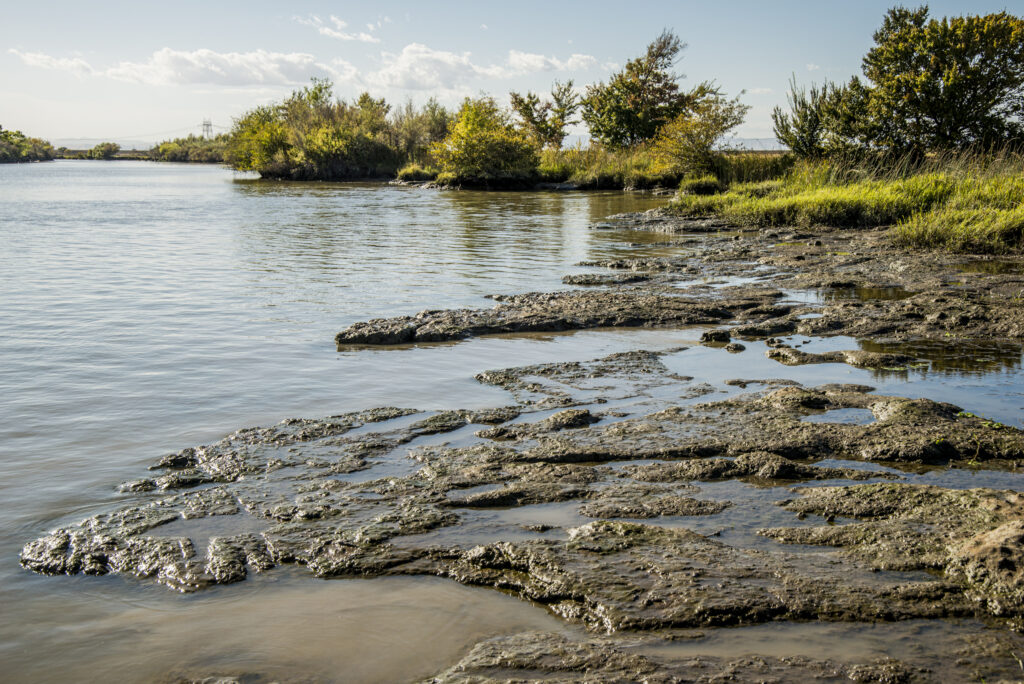
SCIENTIST We call this the Pygmy Marsh. Everything about this marsh is small; and we don’t really know why. Again, there’s conflict among scientists over this.
We sprayed this whole area, and you can see there’s a beautiful dendritic pattern [Editor’s Note: i.e. branching out like a tree]. We have scraped all this and piled up a bunch of dirt over here. As far as we can tell, nobody has ever studied whether this terrestrial marsh has the kind of ecosystem we want. For aquatic ecosystems, we know that terrestrial ecosystems are problematic because we can see with our own eyes that these are small-statured plants. That’s something we should understand if we’re to do a vast amount of restoration in this area.
We have a bunch of solar panels there because we’re not only measuring, but we’re also imaging fish as they go back and forth. Thus, we can see fish as they move on and off in particular weather. We’re trying to develop non-lethal methods to take fish because right now we can’t get a permit to drag in here because we might take a delta smelt. So, we’re putting instruments in here to learn how that works and why it’s a “pigmy marsh.” It could be soils, and it could be elevation.
Another reason we have instruments in all these places is there are many features here that are conservable. We try to figure out how these places run mechanically so we make a little channel here, grade it out a little bit, we can produce marshes here that aren’t pigmy marshes that the way they are functioning will help the aquatic environment.
MIKE CHOTTEKOWSKI For the last 4 years, I managed this 1,700-acre tidal marsh restoration project. It was purchased by one of the large water contractors. You might have heard of Westlands, since it participates with other water-related contractors to create a state and federal contractors’ Water Agency.
I managed the design. We got all the way through an EIR [Environmental Impact Report] and we were working on permits. But, because of internal politics, Westlands pulled back the project. Otherwise, you’d have seen a completed project.
The project plans were simple. We started by investigating via some very large excavations to create some channels – maybe what wild lands did in terms of channels. We then changed course mid-stream to use the natural landscape. We were simply going to come in and breach this berm that captures and stops the higher high tides. That would let nature do what it’s done to create landforms all on its own.
The beauty of this site is that it’s in a floodway, so we get natural flooding plus sediment transport that comes in big floods. And we have expansion from high spring tides, as well as sea level rise here.
This is by far the largest restoration project on the books so far. It will happen. We must get final permits. The original plan was for this to be in construction about two years ago. It was delayed due to political discussions. Hopefully, there will be more of this restoration at various spots around the Delta. It’s in our own self-interest to restore this habitat, because that will yield a more reliable supply of water. Fish populations won’t be struggling as badly and – maybe down the road – it will stop some of the fighting over all this stuff.
MIKE CHOTTEKOWSKI My positive thought is that what you’re seeing here in this Delta is a system that’s gone through many historical ages. It was 750.000 acres of naturally tidal, freshwater habitat. When we Europeans came here, we diked, drained and tried to create a “New Netherlands.” We had a “New Holland” down there, here and there. We transformed the whole landscape. You’re seeing the remnants of that: the levees and subsiding from that era of converting all this region to agriculture.
And, if that wasn’t enough, we converted to freshwater management for delivery to the Bay Area, southern California, and the San Joachin Basin. We got good at that; but then we decided that’s not what we wanted. Now, we want to return to more a native ecosystem. That’s a good, great thing. So, we’re changing our institutions’ way of management, finances and operations.
Yet we don’t understand what to do to reconcile the ecosystem with other things.
If you compare California – as a sort-of Mediterranean climate – with all the other Mediterranean climates in the world, we do a horrible job here. But if you compare it to any other Mediterranean climate in the world in terms of the population supported, the size of the agriculture and the condition of the neo-species, we do well here. It’s hard to find another Mediterranean climate that has as many people, as much economy, as much agriculture and as many native fish as we have here – even though we’re doing a terrible job. I’ll close on that positive note.
CURT SCHMUTTE Subsidence and earthquakes! We are on Twitchell Island, right in the heart of the San Francisco Bay Delta system. For about 30 years we’ve worked here on Twitchell Island with the USGS doing intensive subsidence research. Many years ago, I did subsidence research, funded it and helped direct the work for the USGS.
So, what is subsidence? As you may know, all the surfaces of these Delta islands were at sea level and rising for the last 7,000 years. As sea level has risen during today’s interglacial period, the Delta has been rising with it. During the last 7,000 years, the peat that has formed is about 6 billion cubic meters of highly organic peat soil – and year after year accumulating a few more millimeters. So, starting maybe 130 years ago, mining activity came into the Delta and built levees. First, levees were handmade. Later levees were dredged from the channel to make bigger and bigger levees.
As a result of drying out these highly organic, peat soils, the levees began to subside, oxidize and go down. So, over the last century, these highly organic peat soils became compacted and some blew away. But in the last 100-150 years, these highly organic peat soils mainly oxidized in carbon dioxide, and that goes on today.
Historically, the Delta went down as much as 5-6” per year. Today it is going down, down, down – subsiding from 0-2” per year. Daily, the Delta is releasing as much dirt into the atmosphere as could be carried in 2,300 dump-truck loads. I’ll say again: 2,300 dump-truck loads of dirt leave the Delta every single day, and go into the atmosphere in the form or carbon dioxide. So, the islands continue to go down. I call them “holes.”
Historically, the Delta was about 6 billion cubic meters of highly organic, peat soil. As a result of cultural operations, levee building and de-watering, the Delta has been reduced by about half – i.e., by about 3 billion cubic meters of soil. Thus, we have these “holes” in the Delta, protected 365 days a year by levees – like the one we are standing on.
JOURNALIST Can you explain a bit about why subsidence happens?
CURT SCHMUTTE The Delta’s peat soils already have a lot of nitrogen. Some farmers don’t even have to fertilize, because there’s a lot of nitrogen already here in these peat holes. The other thing here is the tides. Although the Delta is at low tide now, high tide is obviously marked on reeds, showing the difference between high and low tide. Under extreme high tides and high wind situations, these levees are designed so they have 1 foot of freeboard above higher and higher water levels. So, when the growers want to irrigate, they simply find a syphon and let gravity bring water onto the island.
CURT SCHMUTTE Ryan, do you want to talk about methane production?
RYAN SABALOW The reason methane is a concern is it has a much higher global warming potential than CO2. Right now, the amount of CO2 being emitted off this island that is being farmed equals about equal to 1 SUV per acre, per year. Methane emissions are about the same, although they only happen when the water comes up and irrigates the soil surface.
CURT SCHMUTTE So, again, some calculations say the amount of peat soil being lost every day is as much as 80 pounds per acre per day, or 2,300 dump-truck loads. If you amass the emissions coming off the island’s peat since the Delta was reclaimed 150 years ago, some estimates say it could equal 20% of the current annual U.S. production of carbon dioxide. That’s a big number!
Another threat is earthquakes. We are in a seismically active zone right here. There’s an earthquake fault that runs right under Twitchell Island, called the Southern Midland Fault. There are also many faults that run through the San Francisco Bay. Seismologists have indicated there’s a 30% chance of a magnitude 6.7 or greater earthquake here.
The Delta Risk Management Study looked at the probability and consequences in terms of economic damage. Following that plot, there’s a 30% chance of a $30 billion economic loss by 2030. That is because these levees were constructed with sandy materials, and in some cases they are liquefiable. The levee we’re standing on right now would start to slump. Hopefully not right now!
The big concerns in the Delta now are earthquake risks and ongoing subsidence.
Posted by NWNL on August 4, 2025.
Transcription edited and condensed for clarity by Alison M. Jones.
All images © Alison M. Jones, unless otherwise noted. All rights reserved.