
A Paddler’s Perspective
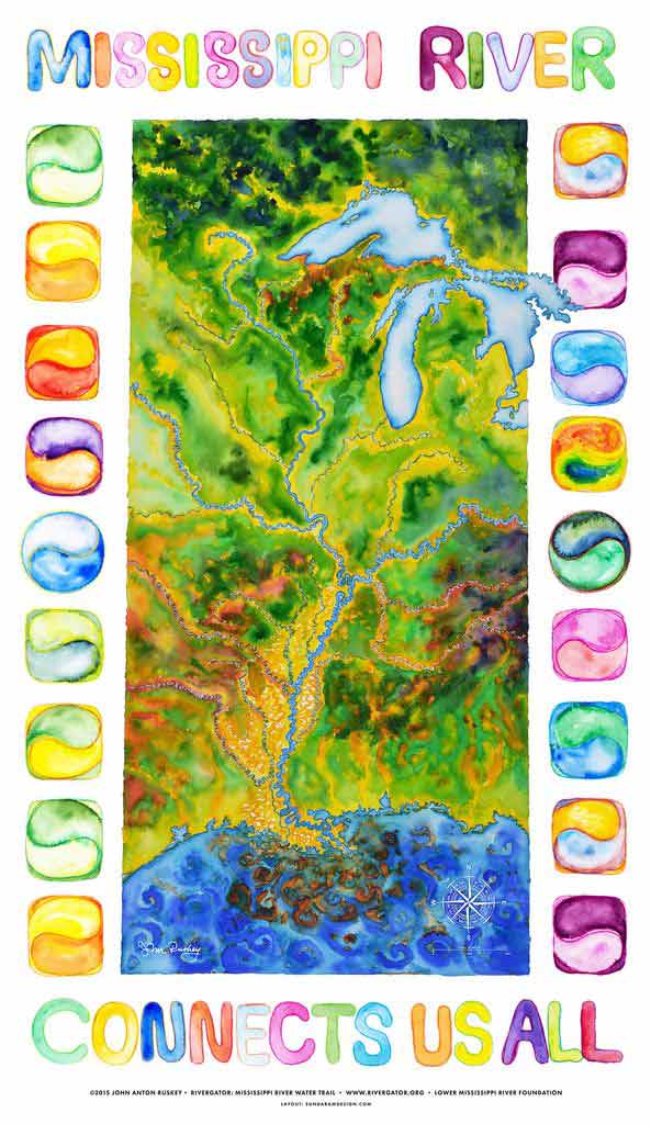
Mississippi River Basin
|
NEW ESRI StoryMaps: What's On Our Shelves & NWNL Song Library & No Water No Life ESRI |
Mississippi River Basin
John Ruskey
Quapaw Canoe Company & Rivergator, Founder
Alison M. Jones
NWNL Director & Photographer
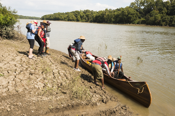
Paddling the Mississippi
A Mighty Youth Program
The Rivergator Project
The Middle & Lower Mississippi
The Arkansas & White Rivers
The Yazoo & Sunflower Rivers
Petrochemical Alley
Grassroots Stewardship
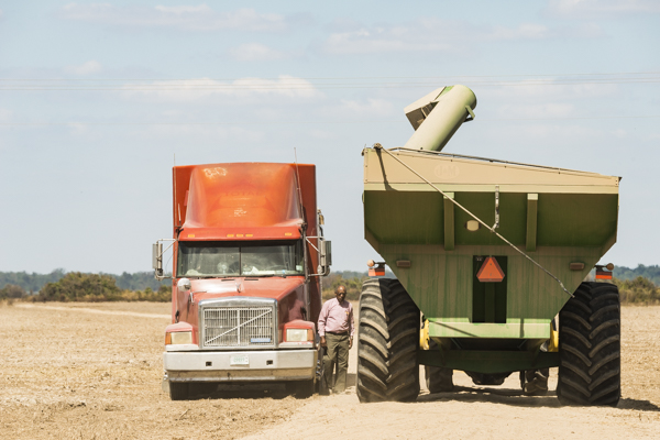
Agricultural Chemicals
Wetlands, Levees & Floodplains
Migratory Corridors
The River and Art
All images © Alison M. Jones. All paintings © John Anton Ruskey. All rights reserved.
As founder of the Quapaw Canoe Company, John Ruskey has been running expeditions from his Yazoo-Mississippi Delta base along the Mississippi River, its backwaters, oxbows and bayous since 1982. In the mentoring style of a Delta Blues musician, John trains his Mighty Quapaws to become tomorrow’s river guides and stewards. Using music, art, poetry and mapmaking, John shares his grasp of the Mississippi River, like a modern Mark Twain. His online “River Rats”essay opens our imagination. John’s Rivergator website is a “Paddlers’ Guide” to the entire river and its wild places. NWNL’s first “Interview with John Ruskey” was in 2008. That and the interview below have led to a fruitful NWNL /Quapaw Canoe Company partnership.
Those people who have a meaningful relation to a body of water — whether as a fisherman, a canoeist, a zoologist, or a logger — speak for the values that the river represents.
—Richard Cartwright Austin, Reclaiming America: Restoring Nature to Culture, 1990
NWNL Hi, John. It’s great to be back with you here on the Sunflower River in Clarksdale – “Home of the Blues”. For those who haven’t read our 2008 interview with you, will you share a quick sketch of your background?
JOHN RUSKEY I first came down the river in 1982 on a homemade 12’ x 24’ raft. People thought I was crazy to get on the Mississippi River on a raft. In 1998 I started Quapaw Canoe Company in Clarksdale. (For your readers, “Quapaw rhymes with “paw-paw.”) Probably 98% of people here would still say, “It’s nuts to get out on that river. You can’t do that. You’re not going to survive another day.” Well, I’m from Colorado. I grew up in the Rocky Mountains where there are a lot more dangerous things than a big river with tour boats.
NWNL In my interview this week, a U.S. Army Corps of Engineers spokesmen said I shouldn’t have kayaked across the Mississippi at Natchez, even though I was with one of your guides.
JOHN RUSKEY The prevailing attitude is that the Mississippi is deadly. The flipside is that no one is on the river doing what the Quapaw Canoe Company does. There are towboats, fishermen, a few hunters and a few long-distance paddlers going all the way down the river. But there aren’t any other river guides in this long stretch of river.
But we’re here. We haven’t lost anybody, or had major medical problems, which certifies that we’ve done things carefully, responsibly. Our badge of certification and “decorative brass” is the mud and smudges on our fingers from starting a fire; the blisters from paddling the canoe; and the fact that we come back from every trip.
EDITORS NOTE Per the Quapaw Canoe Company website, for 10 years Quapaw Canoe Company, underwritten by Lloyd’s of London via Worldwide Outfitters & Guides Assoc., has successfully guided over 10,000 people on the river. All expeditions are outfitted with first-aid kits, rescue ropes, US Coast Guard Type III life preservers, cell communication, and VHF marine radio.
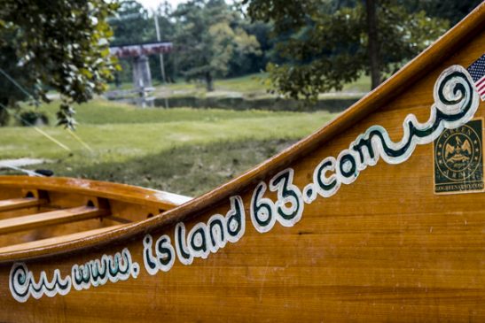
NWNL We’re in “The Cave,” your mostly-underground office on the Sunflower River. There is canoeing gear, a library, paintings, fossils, driftwood and a great desk full of papers. What a creative launching site for your Quapaw Canoe Company.
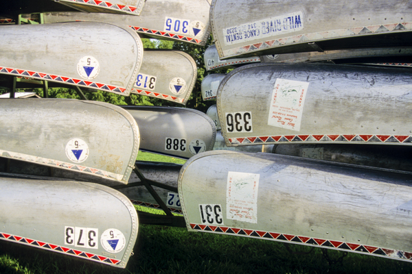
Quapaw Canoes and “The Cave”
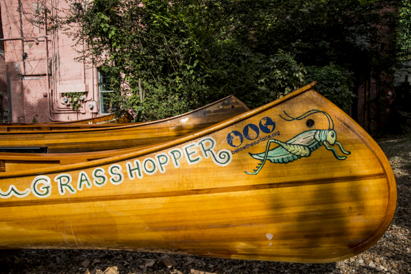
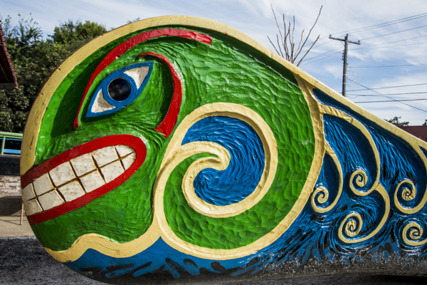
JOHN RUSKEY Yes, we founded the Quapaw Canoe Company to create access to the beauty of the lower Mississippi River – a landscape very few people have seen or enjoyed. We use canoes, human-powered vessels, because they connect us most quickly and significantly to this river-scape.
We’re providing experiences for people who’d normally go to the Rocky Mountains, Alaska or an ocean, but instead come to us to find those same feelings in this surprising place. The middle of this country has long been considered the “Drainage Ditch of America.” We however use the river as a metaphor for finding beauty within – as life-giving veins and arteries of Mother Earth. We’re speaking to all America. The beauty is right here; we don’t have to go anywhere. We just have to recognize it.
NWNL How will paddling change on this river?
JOHN RUSKEY Eventually the river is going to get popular. There’s too much beautiful water, here in the center of the country. Eventually it will be as popular as the Colorado and other rivers; and an organization like American Canoe Association will form a guides association for the Lower Mississippi River. But the ACA has not yet even looked at this river as something that they could regulate.
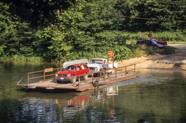
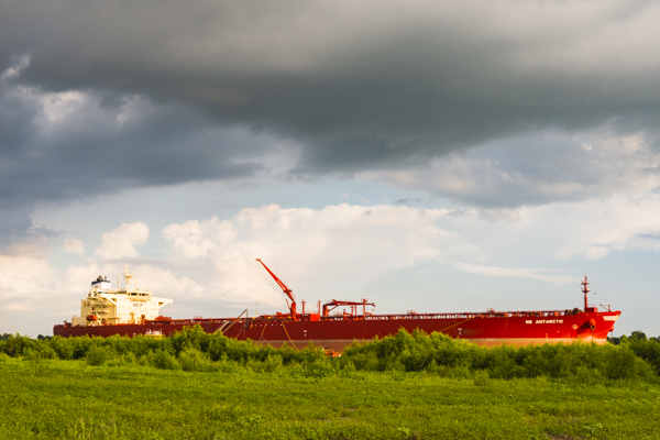
The Mississippi presents challenges not on other waterways. It’s big, long water, doing weird things. Because it is still used by big commercial boats, the Mississippi is like the Hudson and East Rivers around Manhattan; Puget Sound in and out of Seattle; or the St. Lawrence Seaway through Montreal. What is good paddling practice on the Colorado River doesn’t apply here, so that’s partly why this river has few paddlers. But we’re here to get people on the river and show them the beauty.

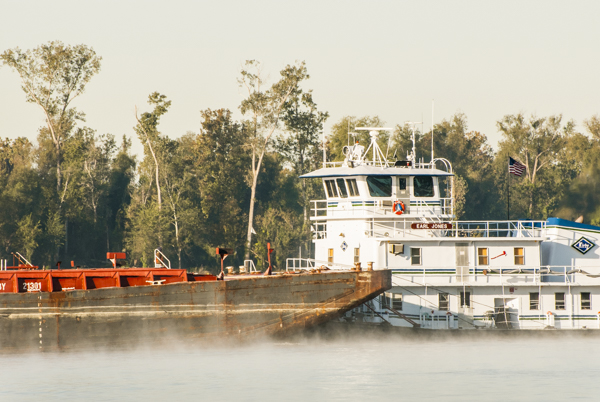
Commercial traffic on the Mississippi
NWNL It seems you have a multi-pronged approach to promoting this river, involving adults and youth.
JOHN RUSKEY To encourage Mississippi and Arkansas youth to appreciate the Mississippi, we have established a Mighty Quapaw Apprenticeship Program after school and in the summer for learning to carve canoes and paddle them on the tributaries, and the Mississippi. We treat learning like rungs on a ladder, using skills that build on each other. The ladder is like a girl becoming a young woman, or a boy becoming a young man.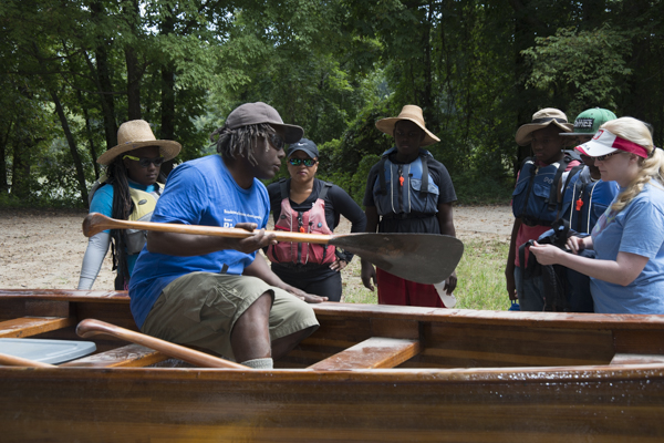
JOHN RUSKEY The process is about teamwork and leadership. Our goal is to create opportunities for our youth to be productive after school; to learn about their environment and the Mississippi River; and for a few of them to become a river guide.
NWNL This reminds me of Kenya’s Koiyaki Wilderness Guiding School for Maasai students in the Mara River Basin. In preparation for entering the tourism business, they learn animal behavior, ecosystem services, and the value of protected lands. How did your program begin and how has it progressed?


Koiyaki Wilderness Guiding School, Kenya
JOHN RUSKEY The Quapaw Apprenticeship Program evolved as the Quapaw Canoe Company started. The carving of our first canoe in 1998 and the swinging of the sharp tools in the sunlight attracted my first apprentices. Kids who participate have to eat right, dress right, and get enough sleep. Their parents have to give consent and support.
Since 1998 we’ve had hundreds of apprentices. Currently we work with about 100 kids after school. We have about 12 former apprentices who are Quapaw Canoe Company guides. Some first came to Quapaw about 8 years ago.
We have no time limit on the program. Apprentices can stay as long as they want. We say, “Here’s the paddle. Here’s the canoe. Go learn to paddle the canoe on the Sunflower River with someone who knows how to paddle. Then jump in the stern seat when you’re ready to steer.” Just naturally these kids go from step A to Z, learning canoeing and survival skills. The whole purpose is to get out to the islands. Once they get there, they learn to build a fire, cook, put up a tent and survive.
The next step is showing other apprentices how to do the backstroke, the J stroke and the C stroke; build a fire; and put up a tent. In those steps an apprentice goes from being a skilled worker to being a teacher. The next step is becoming a Guide: telling strangers what to do, when to paddle, what the animals are, and why the river does this and that, here and there. Guides explain what this ship and that boat is, and why the moon at sunrise is sometimes over here and sometimes over there.
NWNL Since we talked in 2008, you’ve developed another new project.
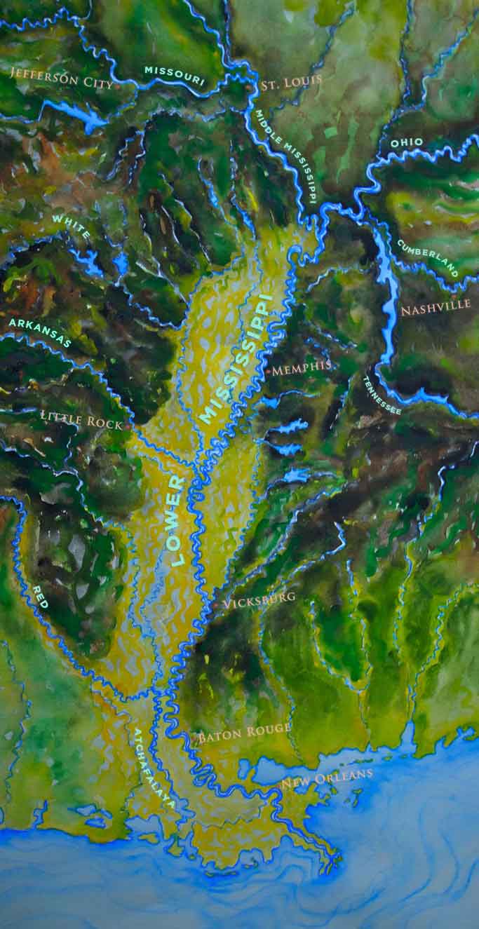
JOHN RUSKEY Yes, it’s called Rivergator. We’re in our third year, going into our fourth year. We paddle the Middle and Lower Mississippi and the Missouri River, spending day after day, after day, after day paddling downstream, meandering through the countryside, and experiencing big forests, big islands, and big water.
If you join us, you’ll see a bridge maybe once every 100 miles and a few power lines. You’ll see a lot of towboats going up and down the river. But after a while, you’ll see mostly big trees and big islands. You’ll get a weird feeling that you are in the depth of an Amazon-sized wilderness. You won’t see anybody for a long time, just more and more woods every day. Long-distance paddlers on this stretch of river between Memphis and Vicksburg think that they’re lost. They think they’ve come to the end of the world.
Most paddlers down here start paddling harder. Most just want to get through because they start getting scared. They worry about running out of water and food and getting lost in the depths of the wilderness. They had no idea when they left Memphis that it would be 300 miles to Vicksburg, the next major city.
But for people who seek the wilderness, this is what we love. This is the experience that we’re after: getting into a place where we are not in control, but where we feel the grandness, beauty and rhythms of nature. There’s no better way to do that than on the water.
NWNL What are your 2015 plans?
JOHN RUSKEY Rivergator is finalizing its guide to the Lower Mississippi River for paddlers. By 2015 we’ll have finally described the entire Middle and Lower Mississippi Rivers, mile by mile, from the confluence of the Missouri River above St. Louis MO, past the confluence of the Ohio at Cairo IL, down 954 miles to Head of Passes and down each of the passes to the Gulf. The project is online now, waiting to be completed. After we complete Rivergator, we will celebrate with a paddle from St. Louis to the Gulf of Mexico.
We’ll also have hand-painted maps that cover four sections of the river, accurately made with artists’ projectors using USGS topographical maps. Our maps will feature the Sunflower, Mississippi, Arkansas and White Rivers. For every stretch of river, our maps are the best maps for these rivers at this level of detail. The next level is the Army Corps of Engineer’s maps, the best for getting down the river.
Google Maps offers the very best level with one qualifying statement – they are photographed at one instant in time, but the river is always changing. So what you see on a Google Map may or may not be what you find on the Mississippi on any given day. There might be a sandbar on Google Maps that could be a beautiful campsite, but when you arrive, the river has risen 20 feet and there’s no island. So we use Google Maps on the website to show exactly what the land looks like, but with that warning.
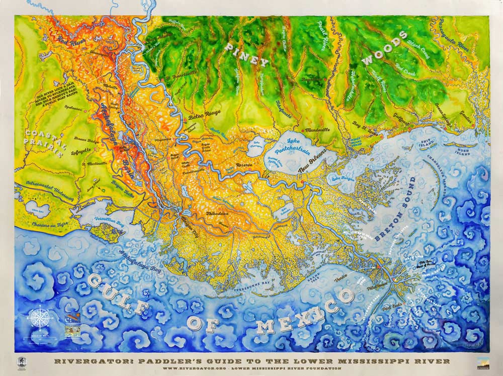
JOHN RUSKEY We’ll also create a few more focused, high-resolution maps, showing specific confluences like that of the nearby Arkansas, White and Mississippi Rivers at Big Island. If any place should be a national park, this is it: a 20,000-acre bottomland, hardwood forest with giant trees that create a strong black bear habitat. A logging company owns it, but there are no bridges across to the mainland. The only way to get there is by boat.
NWNL Are there any proposals to make Big Island a national park?
JOHN RUSKEY No. We’d have to get on the radar of the Department of Interior to create a proposal. Then we’d have to find the money to buy the land from the for-profit logging company.
NWNL Would you describe some of your canoe routes? Starting upstream with Mississippi River confluences north of here, what does Rivergator cover?
JOHN RUSKEY The Upper Mississippi River, originating at Lake Itasca MN, is usually clear, or sometimes kind of tan colored by the tannins of Upper Mississippi forests. Above St. Louis, the Illinois River comes into the Mississippi from Chicago and the Great Lakes. It flows past Hannibal MO (Mark Twain’s hometown) down to the bluffs of Alton, Illinois.
At St. Charles, just below Alton, the Missouri River, as “The Big River of the Western States,” meets the Mississippi. This big tributary comes into the Middle Mississippi stretch like a pack of racehorses. The Missouri is always muddy, so it colors the Mississippi. You can see where they merge. At the confluence, the clear color of the Upper Mississippi is replaced by the color of the Missouri.
The muddy Middle Mississippi River flows from St. Louis down to the next big confluence at the mouth of the Ohio River at Cairo, Illinois – the state’s southern tip. The confluence of the Ohio, which originates in Pittsburgh, marks the end of the Middle Mississippi and the start of the Lower Mississippi. The Ohio River comes in clear and greenish, but even though it brings more volume of water than the other forks, it also becomes muddy. So it seems the mud always wins.
JOHN RUSKEY You also see that on the Amazon River. The great confluence of the Amazon, a big, muddy river coming out of the Andes, with the Rio Negro, a huge black-water river, maybe of equal size. They come together, shake hands, swirl and dance around each other. And, once again, the mud wins. The Amazon does not become a black river. It remains a brown river.
NWNL You’ve said, “Mud is money, catfish and farming.”
JOHN RUSKEY Yes. The Spanish explorer Hernando de Soto [c. 1495–1542] was the first European documented to have crossed the Mississippi River. He was looking for gold, but he should have looked for the brown.
NWNL Continuing our virtual “downstream float,” what happens in the Lower Mississippi Valley as the river passes by you here in Clarksdale?
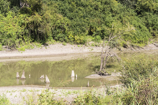
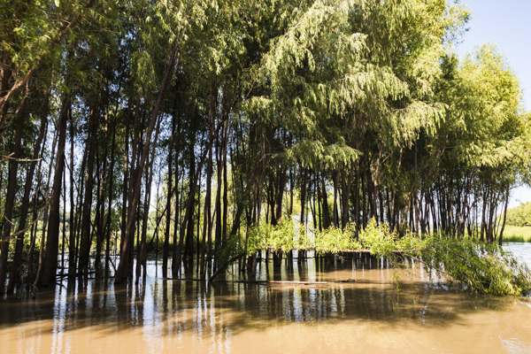
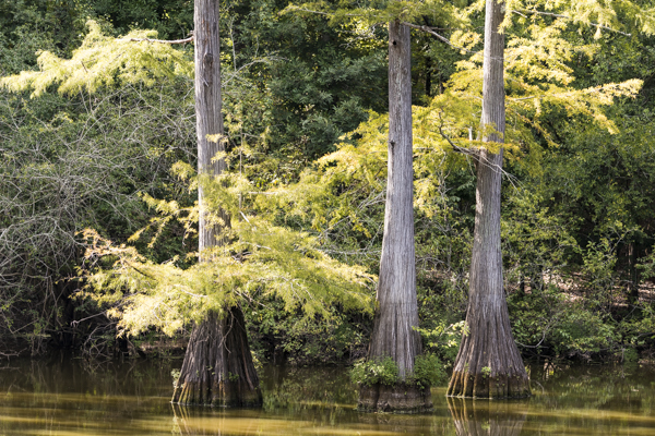
JOHN RUSKEY The Lower Mississippi River flows from Cairo IL past Clarksdale and its Mississippi-Yazoo Delta, Arkansas, Louisiana, and finally past New Orleans to Venice – or the distributaries of the Mississippi River Delta – to the Gulf of Mexico. The big picture of the Lower Mississippi River includes an ancient giant plain that floods annually.
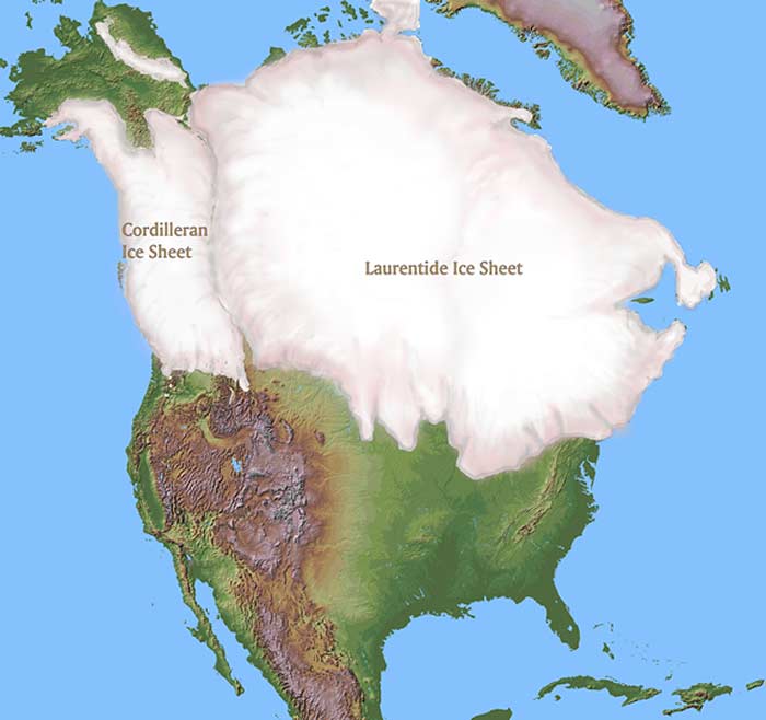
As the large Canadian Ice Fields melted 10,000, 15,000, and 20,000 years ago, they dropped sediments that formed an incredible floodplain and our Yazoo Delta.
There are 22 million acres in the Yazoo Delta that used to be incredible bottomland hardwood forest. In a rainy year like 2011, the Lower Mississippi would change from a long, thin ribbon of water to a wide, meandering inland sea of water. It would fill almost all of this Yazoo Valley, a part of that larger ancient floodplain.
Today the Yazoo Delta is mostly leveed, so the Mississippi River has been cut off. Yet there’s still very rich soil. And, just as the levees were built, the levees can be un-built.
NWNL You say that the Arkansas River, part of this Great Plains drainage, is the fifth longest river in the continental US, after the Missouri, Mississippi, Rio Grande and Colorado Rivers. How does the Arkansas relate to its nearby and almost parallel White River?
JOHN RUSKEY The Arkansas River is the biggest tributary of the Lower Mississippi River. It comes into the Mississippi about halfway through the 1000-mile stretch downstream of the Ohio River confluence at Cairo IL to the Gulf. The Arkansas is unusual because it goes through so many different landscapes. There’s no one word or phrase to describe it, even though we call the Lower Mississippi “The Big Muddy” because it describes almost the whole river.
The Arkansas starts as a Rocky Mountain river, flowing east from the Collegiate Peaks in Colorado’s Sawatch Range. As the highest drainage in the Mississippi Valley, it then becomes a deep canyon river racing through the Royal Gorge into Pueblo CO.
[Geologic Note: The Royal Gorge, also called The Grand Canyon of the Arkansas River, is a spectacularly deep, straight-cliff canyon [1,250 feet (380 m) deep, only 50 feet (15 m) wide at its base]. Similar to West Virginia’s New River (a tributary to the Ohio River), the Arkansas River was a small stream long before the Rocky Mountain uplift (3 million years ago) caused it to wear through granite rock. Scientists think uplift around Royal Gorge rose about 1’ every 2,500 years.]
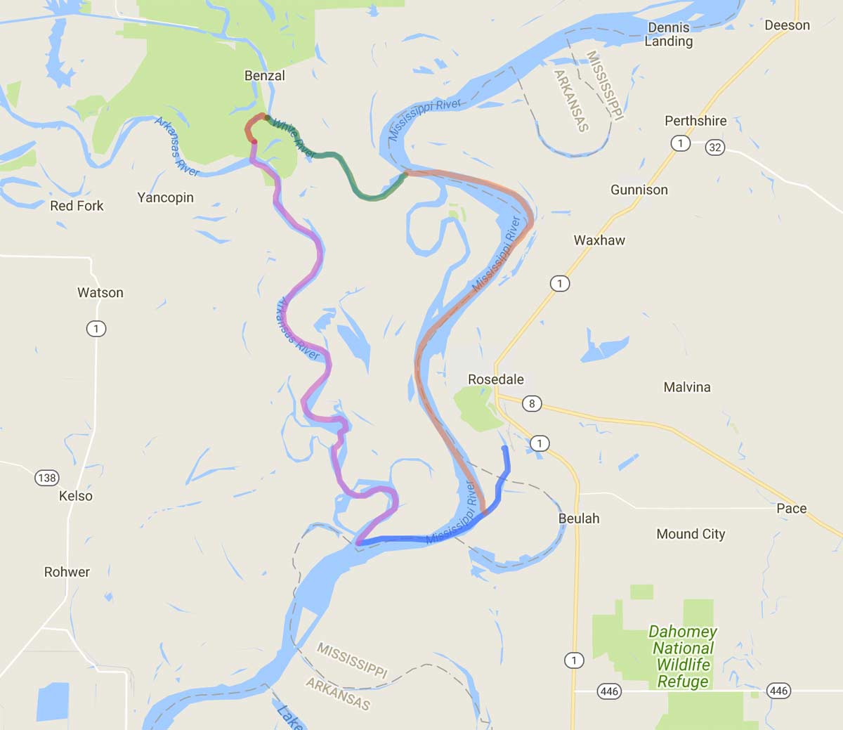
JOHN RUSKEY When the Arkansas River leaves Pueblo it becomes a Great Plains river, gently meandering across Colorado to Wichita, KS. Then it drops into eastern woodlands to become a bottomland river, similar to the Mississippi. As it meanders further, it becomes a wider, bigger-volume river receiving lot more rainfall with tributaries bringing more water. Almost 1,500 miles from its source, the Arkansas finally meets the Mississippi near Rosedale AR, creating one side of Big Island.
The White River is kind of a sister river to the Arkansas, beginning just above the Arkansas, and soon coming within a mile of the Arkansas. Then it swoops away, and Arkansas swoops the other way. Those last 40 miles of the Arkansas are very wild. Above the confluence, lock-and-dams block towboat passage. So barges from the Mississippi enter and leave the Arkansas via the White River and a canal carved through the woods.
Since there’s no commercial traffic on these last 40 miles, it is one of the wildest places I’ve ever known, with more black bears than humans. I’ve seen as much wildlife there as in Alaska: bald eagles, wild pigs, black bear, and fish – fish everywhere. There are big, deep woods and wild waterways.
The Arkansas and White meet the Mississippi separately, but only 25 miles from each other at one of the widest places in the Mississippi floodplain. It’s almost 30 miles from the Arkansas levee to the levee on the Mississippi side. Historically there’s been much crossing back and forth between those two floodplains – especially during high water events, such as the 2011 flood.
NWNL How would you rate water quality and quantity in the Arkansas?
JOHN RUSKEY The water quality in the lower river is pretty good due to a lot of clean streams coming out of the Ozarks and Wichita Mountains. But water quality takes a jolt from Little Rock and farms through the Arkansas Delta.
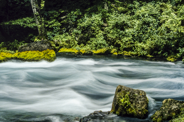
The many moods of the Current River, tributary to the White River
JOHN RUSKEY Upstream in the Great Plains the Arkansas has other kinds of trouble. There was a drought about 4 to 5 years ago when it disappeared coming across Kansas. It literally stopped running. There are endless stockyards as it goes through big cattle country in Kansas, probably its most polluted stretch. In Colorado the river is clean, but heavily used. More people raft between Leadville and Bueno Vista than any stretch of river in America. Something like a million people paddle it every summer!
NWNL What about the health of the White River?
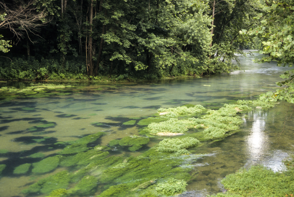
JOHN RUSKEY The White flows over 500 miles after it comes out of the Missouri and Arkansas Ozarks. It’s a beautiful river, and the water is pretty clean compared to other Arkansas Delta waterways, because there are so many freshwater tributaries and big springs that feed into it. The deepest part of the Ozarks drain into the White River, including Buffalo River, America’s first National Wild and Scenic River. The Current, Eleven Point (also a Wild and Scenic River), Black and Spring Rivers also enter the White, The Spring River is fed by Mammoth Springs, one of only 66 first-order springs in North America.
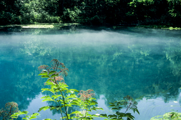
Springs of the Ozarks that feed the White River tributaries
NWNL How do you place the Yazoo River and This Delta into the big picture?
JOHN RUSKEY The Yazoo River is the longest and probably the most worked-over river in the Yazoo-Mississippi Delta. The Sunflower River runs through the center of this Delta. So, a raindrop that falls in the Yazoo Delta probably drains into the Sunflower River on its way to the Mississippi.
The Yazoo defines the perimeter of the Delta. It drains the Hill Country via its tributaries: the Coldwater, the Tallahatchie, Yakina, Yalobusha and other feeder rivers. The Yazoo actually begins at the Yalobusha and Tallahatchie confluence at Greenwood. Today the Yazoo is accessible by towboat up to Greenwood. Yet, while that’s the start of the Yazoo, its tributaries go hundreds of miles back from there.
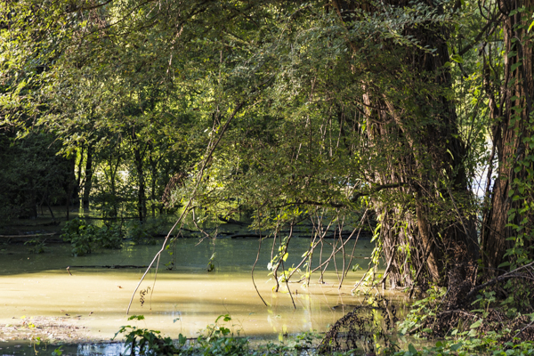
The Yazoo River is very mysterious and has a lot of atmospheric. It makes you feel like you’re in “the heart of darkness.” You really feel like you’re in a foreign land when you’re on the Yazoo. You don’t see anybody. With deep, muddy banks, it’s full of birds, beavers, river otters, alligators and all the land animals. And it’s full of fish.
Different moods of the Yazoo River
NWNL What about infrastructure on these rivers? Is the Yazoo channelized?
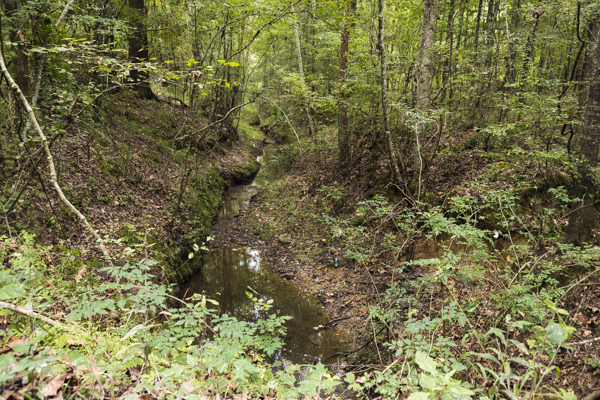
JOHN RUSKEY The control of Hill Country rivers starts in the hills. Each one of those rivers has a big dam and a reservoir on it. Like almost all the rivers around here, they’ve been straightened. There’s the beautiful old channel; and there’s a new channel where water flows in straight lines carved out by machines. The Yazoo gets so big further down in this Delta that it needs its own levee system. Around Yazoo City they made a separate waterway for the Yazoo, as so-called flood prevention.
The Old Yazoo Channel is now dead water that stops just below Yazoo City. From there there is just one natural channel, which I believe is its original course for its last 100 miles or so. It’s very deep and wild as it goes through a portion of Delta National Forest and flows alongside some very important Native American sites.
[Editor’s Note: Delta National Forest is 60,898 acres (246 sq. km.) north of Vicksburg. It is the only bottlom-land, hardwood forest designated as a U.S. National Forest.]
Old Yazoo Channel as it flows through Delta National Forest
NWNL What about the quality of water in the Yazoo?
JOHN RUSKEY The quality of the Yazoo is similar to all rivers around here. It is very affected by the industrial agricultural practices. Agricultural runoff goes into the Yazoo, full of chemicals they use on the fields. One particular chemical processing plant of concern down near Yazoo City dumps questionable stuff down a ditch into the Yazoo.
Otherwise water quality of the Yazoo is pretty good. Fortunately it is a big-volume river, so its fish seem to be clean. As they say, “Dilution is the solution to pollution.”
The channelized Yazoo River lined with sunflowers and pivot irrigation above
NWNL Is the Sunflower River channelized?
JOHN RUSKEY Yes, it is a very controlled river. Modern man has significantly altered recently. Clarksdale is about 225 miles above the end of the Sunflower River, at what’s called “the head of the river,” a term used for transportation usage. The river goes another 25 miles north of here where everything is pretty wild, unaltered and channelized only in a few localized places. Downstream it’s been dredged and snagged, and straightened out in places.
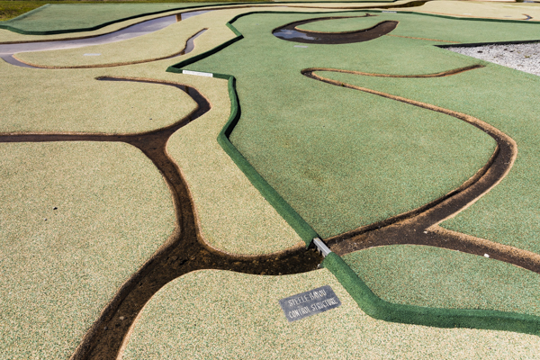
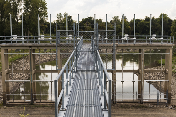
Now the Sunflower is diverted via a long canal to the Steele Bayou. Then together the Sunflower, Steele Bayou and all Delta waters enter the Yazoo through an enormous metal and concrete gateway, called the Steele Bayou Control Structure. It was built so that when the Mississippi rises, floodwater would not back into the Mississippi Delta. Today that gate ends the Sunflower River. Just past those gates the Sunflower’s water enters the Yazoo River, 10 miles above Vicksburg.
NWNL What about the condition of the Sunflower River?
JOHN RUSKEY As far as water quality goes, the Sunflower is similar to the Yazoo, but probably not as good. The Yazoo has the benefit of all that water coming out of the hills, less farms, more woods and wetlands, more rain, and probably more rainwater. Additionally, more acreage drains water into the Yazoo than into the Sunflower. The Sunflower consists of 80%, or maybe 90%, farmed fields. To me it always smells like farm runoff. I’ve never, ever known the Sunflower when it smelled clean and pure.
People do fish in the Sunflower, but not a lot. I swim in it occasionally. But when I do, it feels like I’ve been coated with something that I shouldn’t have on me. I shower after I do, if I can, and even so, sometimes my skin breaks out.
Quapaw Company canoes on the bank of the Sunflower River
JOHN RUSKEY I’ve paddled every mile of the Sunflower from here down to Vicksburg, taking five years to do it. One time on a weeklong expedition on the Sunflower, I got a really strange rash right behind my knee, which probably started as poison ivy. But it got infected, probably from my swimming. I’m a swimmer, and always go barefoot. So it’s difficult for me on Sunflower expeditions, because I want to be in that water, walk in it, and go barefoot. Whenever we do those expeditions, it takes a toll on my body.
NWNL Thinking about the Sunflower River’s name, were sunflowers native?
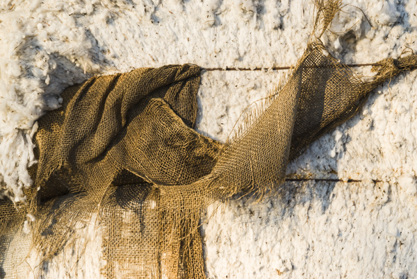
JOHN RUSKEY The name “Sunflower” actually comes from the Choctaw word, “hushpuckena.” The original sunflower was the hushpuckena, also the name of a Sunflower tributary, just south of here. The Hushpuckena and the Sunflower come together at a significant widening of the river, thus steamboats actually used to come up this far back in early cotton days. There was a native sunflower that grew along the banks of this river and all throughout this area – although we don’t see much of it anymore. Sunflowers are not a crop, except for a few hunters who plant them for hunting dove and quail.
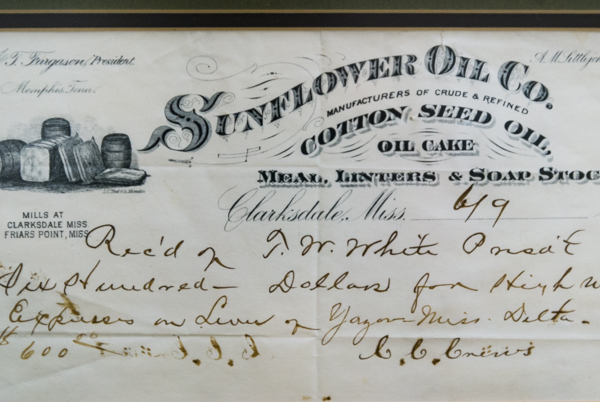
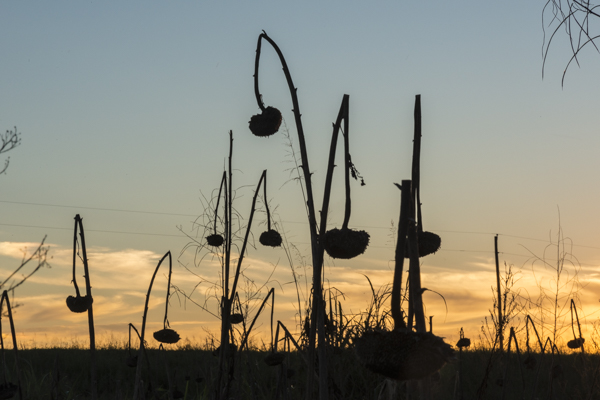
Sunflower River gave its name to a cotton-seed oil, and some sunflowers appear in the Delta today
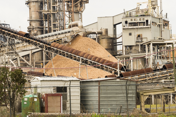
NWNL In 2015 you will paddle through what some call “Petrochemical Alley” between Baton Rouge and New Orleans. What is it like to go through that industrial strip of the Mississippi?
JOHN RUSKEY Our expedition through that chemical corridor, also called “Cancer Alley,” will include journalists and clients. Their packing lists include a respirator and a HAZMAT suit. We’ll camp on the leeward side of Louisiana refineries and power plants, scrap metal offloading, dry goods dry-docking and huge granaries. We’ll be subject to noxious gases and the “surround sound” of large factories.
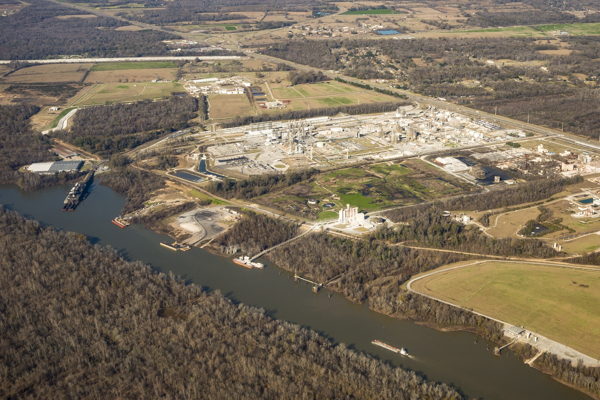
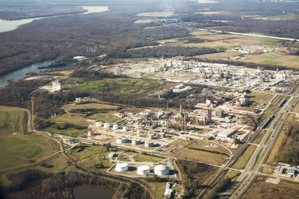
Aerial views of Petrochemical Alley, looking upstream from Baton Rouge
JOHN RUSKEY I’ve camped in some weird places. Sleeping in that environment you smell and hear things more clearly than during the day. Somehow you feel more sensitive to what’s in the air when you’re sleeping. One morning, the wind was blowing out of the south from Norco’s Shell petroleum refinery. It made all of us feel ill, and some literally sick through the next day.
It’s such a tricky section of the river that I hesitate describing or including it in the Rivergator. But we must because it’s part of the river. The Rivergator will strongly recommend taking the Atchafalaya River down to the Gulf of Mexico, not the Mississippi down to New Orleans. The latter is hazardous to your health and dangerous.
NWNL What interests you in paddling Petrochemical Alley?
JOHN RUSKEY There’s no better education in following that Lower Mississippi River route to its conclusion, because that stretch explains the reason for all the barges and towboats seen the previous 2,000 miles. “Petrochemical Alley” connects a lot of pieces. You see where all that grain is going, where all those petrochemicals come from, and where all that petroleum is produced.
The neatest thing about this stretch, as Mark Twain noted, is that the river gets narrower and deeper, at a point where most rivers spread out and get wider. The Mississippi doesn’t do that until opposite Jackson Square in New Orleans. There, at Algiers Point, the Mississippi is 250 feet deep – its naturally deepest place.
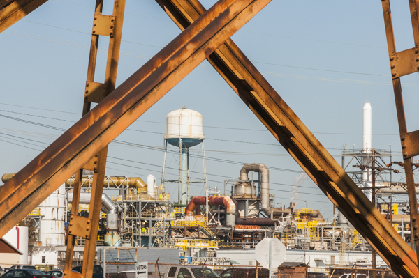

On-the-ground views of Petrochemical Alley
JOHN RUSKEY The Mississippi suffers more abuse below Baton Rouge than anywhere else, although the Greater Port of St. Louis is pretty bad. But on leaving this stretch, the river somehow sparkles with an effervescent joy and youthfulness. The Mississippi seems more exuberant than in any other stretch, except for its Minnesota beginnings. On leaving Lake Itasca, it sparkles and dances – and the river picks up those qualities again as it passes New Orleans, approaching the Gulf of Mexico.
In my poetic mind, the Mississippi is a metaphor for the life of a person. We start out as children, bubbling with youthfulness and the joy of life. We go through middle age when things are tough. After years of work, we reach old age and can let our hair down and be a kid again. Likewise, the Mississippi becomes youthful and joyful again at its end, even though besot by the injustices of industry.


River scenes from Lake Itasca to New Orleans
JOHN RUSKEY Part of Rivergator stewardship is to get more people on the river. The more paddlers on the river, the better the river. It’s like geese on a sandbar. If you have one goose on a sandbar, a coyote will sneak up and get one. But with 10 geese or a flock of 50 on a sandbar, their eyes looking in every direction will see a coyote and it won’t be able to nab any.
It’s the same with paddlers. As one paddler out there, you may or may not see that place where an oil pipeline has ruptured or where oil is spilling into a back channel. On the Sunflower I’ve seen that it only takes a pinhole in a pipeline to make a bad spill. With 50 paddlers out there, they can see that and everything happening on that river.
When people use the wilderness, it is protected. Quapaw Canoe Company shows people the river and its beauty. But Rivergator goes to the next level, teaching people how to get out in the wilderness safely by themselves.
NWNL Why is wilderness preservation important and how should it be done?
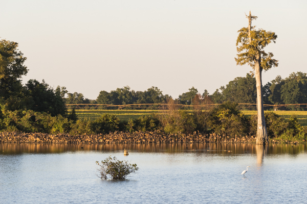
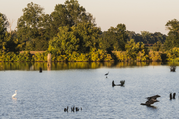
JOHN RUSKEY The Lower Mississippi still has a vibrant ribbon of wildlife in the narrow floodplain contained by the levees. And if we open up the river’s greater floodplain [by removing levees], it will be ten times as rich as it is today. Any opportunity to do that along the Lower Mississippi would greatly help.
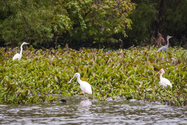
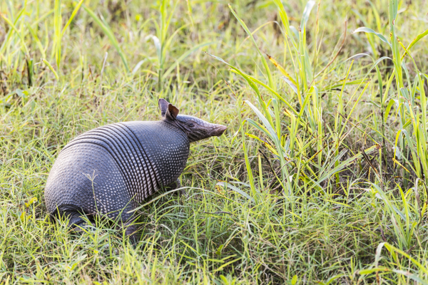
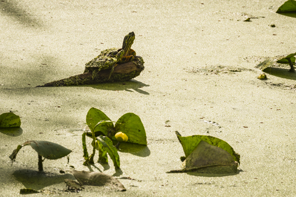
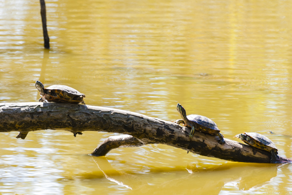
Birds, reptiles, insects on the Lower Mississippi
JOHN RUSKEY “Half-Earth” is one theory on saving the Earth and its species. It claims that we must return to Earth half of its wilderness.
[Editor’s Note: Pulitzer-Prize author Edward O. Wilson supported this vision in Half-Earth: Our Planet’s Fight For Life in 2016. The book claims that returning half of Earth’s surface to nature would save the many currently-endangered animals and micro-organisms that are critical to the health of our ecosystems.]
Saving an acre of the Mojave Desert won’t add much to the health of its wildlife. But adding an acre of the Mississippi Yazoo Delta and its rich concentration of trees greatly increases its power to sequester carbon. Forest acreage here has the highest ability to sequester carbon in North America.
NWNL John, what real hope is there for returning half of our wilderness?
JOHN RUSKEY Well, we’re not going to see half of the land here returned in my lifetime – but maybe in my daughter’s. Instead of slowing down to preserve what we’re about to lose, we just go faster and faster. People aren’t driving slower on the highways to conserve a few extra ounces of gasoline. Instead of using less, we just look at new ways to create energy.
Eventually, we’ll run out of energy. The earth will take it back. We’ll be but a blip on that timeline. Mother Earth has been around a long time. By attrition, Mother Earth will wear us out, maybe in my daughter’s lifetime. There’s no way we can continue our wasteful lifestyle.
NWNL Can we afford to turn fields back into wilderness when there’s more and more demand for food? The world’s population is booming – and hungry. The Lower Mississippi River Basin provides needed cotton and food.
JOHN RUSKEY I’m just saying we’ll run out of the capability to do it. So it’s a moot question. If we don’t have fuel, we can’t do it. It will be too expensive to power those big farm machines moving from field to field to create a bushel of corn; get it down to the river; and ship it across the world. I’m saying eventually – not tomorrow.
NWNL Where do you find hope? What will persuade us to accept limits and move forward in a new way?
JOHN RUSKEY The answer is to look deep inside ourselves and experience our soul connection to the Earth. That’s always been true, but the need to do so is more severe now because we’re running out of Earth’s resources. Following the arc of mankind, we started in a wild world where we fought to defend ourselves. Terrible things in the woods would eat us if we didn’t. But we’ve learned to survive. Now we face a different scenario. Instead of fighting, we have to learn to connect with this world and people on it. We must live in harmony – not in fear or survival mode.NWNL Since we’re discussing our health, harmony and survival, let’s return to a discussion we had in 2008 on defoliants used in cotton fields. You said:
It’s like Agent Orange. Every year we have defoliation as “ag planes” fly all around. They drop a chemical that causes cotton plants to lose their leaves, which makes the plants put all their energy into the cotton boll. In the process, the defoliant damages water quality and air quality in The Delta. And, of course, those chemicals spread everywhere as the wind blows and the water flows.

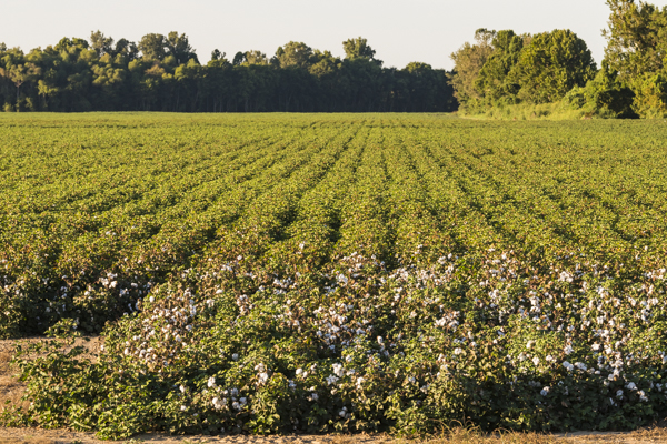
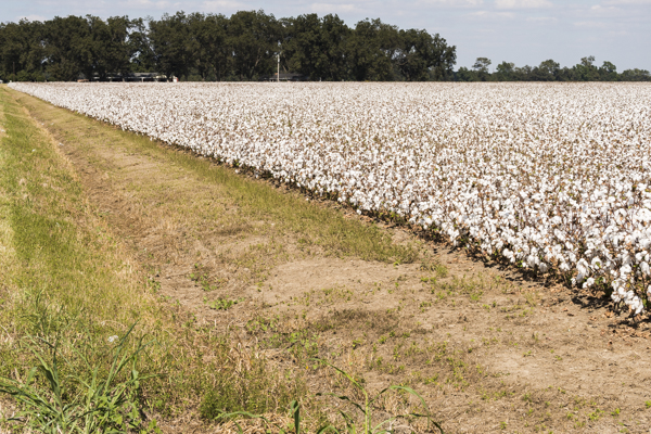

From bud to boll: Cotton farming includes defoliation of healthy plants to facilitate harvesting
NWNL This week an Arkansas farmer told me, “Oh, yeah, we still use defoliant on cotton fields.” What side effects do defoliants have on nearby plants or people?
JOHN RUSKEY None, according to the chemical companies that say it only affects the plant it lands on. But – all the people who live around cotton fields have respiratory problems; and there is a high cancer rate in the Mississippi Delta.
My experience is that water smells different in places that are sprayed. That’s a purely qualitative response to your question, but I say, “It don’t smell right.” There’s a very peculiar smell. It’s kind of acrid, tangy. When you smell it, it sticks to the back of your throat with a distinct aroma.
That’s true all year around, because the chemicals saturate the ground. They must adhere to the sediment somehow. For some reason, the defoliant smells stronger in higher humidity levels. After it’s sprayed, it smells really strong for a day. Then it comes and goes from the air.
NWNL When I asked whether defoliants have negative impacts, the Arkansas farmer said, “Absolutely not. Everything here is the safest product you could possibly find in the world. We wouldn’t be using it if the USDA didn’t let us.” Then he walked out and slammed the door.
JOHN RUSKEY Well, on the upside, every year there’s less cotton being planted and harvested, and thus less defoliant. On the downside, soybeans, and corn especially, have their own negative impacts on the waterways: that of excess nutrients, phosphorous and nitrogen.
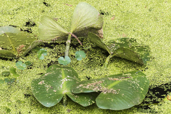
Corn is a very demanding crop. We’re experiencing the corn/ethanol craze across the middle of America. Our bayous reflect that with algal blooms. Every year for the past ten years, it’s worsened. We see bigger and bigger algal blooms choking the waterways. Places that used to be clear water now get clouded over with green gunk.
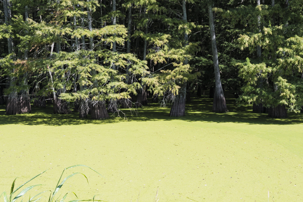
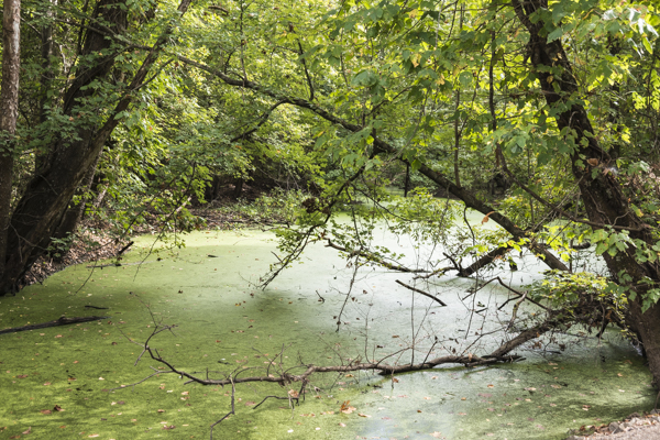
Algae from flow of farm chemicals affects farm ditches, tributaries and the Gulf of Mexico.
JOHN RUSKEY Waterways naturally have algae and phytoplankton. They are at the bottom of the food chain. Insects and fish eat plankton and then predators eat them. This is all part of this greater food chain. So we want plankton. But an excess of it chokes the waterways and that leads to “hypoxia.” That condition kills fish, because they can’t survive in a low-oxygen environment.
NWNL What about pesticides?
JOHN RUSKEY As far as I know, pesticides are still being applied. I’m not an expert, but I know the farming process here does include pesticides as well as herbicides.
NWNL Literally getting “down into the weeds,” what’s the condition of the water flowing through local agricultural ditches?
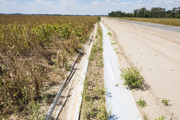
JOHN RUSKEY I don’t test water quality, but I’m sure what’s in those ditches is about the same as what’s in the Sunflower. The ditches all flow into tributaries that flow into the Sunflower. There are almost no remaining wetlands to filter chemicals and nutrients in the water. The huge wetlands that used to be found along the Lower Mississippi and its tributaries are now gone.
The earth has had natural tar pits. There have always been bad chemicals that naturally come out of the mountains, such as sulfur and heavy metals that seep and fall into the rivers. But the difference now is that there are no wetlands to filter those chemicals and nutrients before entering the rivers. The Sunflower is an extreme case of that.
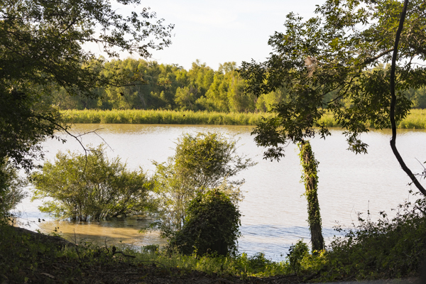
Fortunately, that “Big River,” the Mississippi, still has some wetlands serving as buffer zones. There are side channels and parallel channels. And in some places pretty significant overflow places buffer that pollution – especially in the Lower Mississippi.

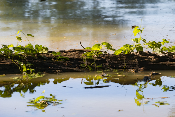
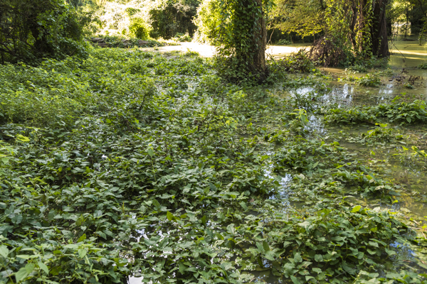


Lower Mississippi Wetlands
NWNL Upstream, many farms have buffer zones between crops and adjacent waterways, compensating for lost wetlands filtering. Those farmers lose a bit of land, but their buffers improve water quality for themselves and all downstream users. Are there similar buffer zones here?
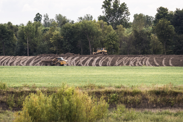
JOHN RUSKEY There is a movement by the Wetlands Restoration Program [WRP] to rebuild wetlands in the Delta. It’s a federal program that gives tax credits for returning fields to their wild state. So farmers are now creating wetlands in marginal fields that get flooded a lot. They turn over bottomland and “gumbo places” with heavy clay soil that’s hard to manage.
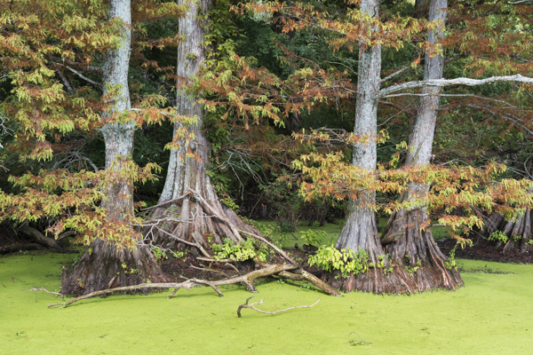
In the Delta we’re fortunate. If you cut a square mile of woods in the Amazon, trees won’t come back unless you bring topsoil and carefully nurture them back into existence. There’s no topsoil in the Amazon and no humus with nutrients from layers of leaves the roots hold together. But the Delta has a different geology with very, very thick topsoil. If you cut a square mile of woods, clear it and farm it, as soon as you stop it will immediately return to its wild state.
NWNL What is the succession for re-vegetation of these bottomland hardwoods?
JOHN RUSKEY The first year weeds suddenly sprout up. The next year more weeds and some saplings come up. The third year those saplings will be 3 feet tall, and in ten years they’ll be 20 feet tall. Willows, cottonwoods and sycamores are first to spring up to the sky. When they reach maturity, then oak, maple and cypress saplings come up in that protective shadow. One layer protects the next. Within 30 years you can’t tell that they’re not old-growth trees. You can’t tell that that was cultivated land. You can see that in different pocketed places around the Delta.
I’m not sure about reforestation this year. It’s tied to the Farm Bill, which changes bill to bill. In the Delta many farmers now reforest part of their land and have duck hunts where there was cotton. They have birding and nature festivals and kids’ outdoor events for learning to hunt, shoot a bow, swim and canoe. They do all that on a giant farm they allowed to go wild.
Willows to Cypress: Successional regrowth in bottomland forests
NWNL But what about creating buffer strips on the edge of fields so fertilizers, pesticides and defoliants are filtered before entering the farm ditches?
JOHN RUSKEY I haven’t seen any. Buffers should also be created along all the rivers. Fields here should not be farmed all the way to the river’s edge.
NWNL Are Yazoo Delta levees federal, state or local? Who maintains them?
JOHN RUSKEY The Mississippi Delta levees are under the jurisdiction of two Levee Boards: The Yazoo Mississippi Levee Board in Clarksdale, and the Mississippi Levee Board in Greenville. As independent boards of farmers and businessmen appointed by the different counties, they oversee maintenance of the levees with federal, state and local money. Funding is primarily federal, but the mix changes year to year.
NWNL How effective are the levees? Did the recent 2011 flood affect the Delta?
JOHN RUSKEY Yes, in the Flood of 2011, the Sunflower rose higher than ever before. We sandbagged to keep water from coming into “The Cave,” where we’re sitting now.
That flood did not affect most people in the Mississippi Delta, because our levees held. There was no over-topping of levees on this side of the river. There was some seepage, some boils, some scary places, and the water backed up in the lower part of the Delta. They shut the gates at Steele Bayou at the end of the Sunflower. There was a lot of rain in the Delta which had nowhere to go so it kept backing up, higher and higher. The Mississippi came within 1 inch of overtopping the backwater levee below the Yazoo.
[Editor’s Note in 2017: A March 2016 5-day flood topped the 2011 record when 26” of rain damaged over 900 homes, and the Sunflower crested within 3 inches of the 1973 Flood.]
NWNL Your maps clearly show why flooding is a big threat further south, especially in New Orleans and Baton Rouge. Why is it less severe here?
JOHN RUSKEY Our Yazoo Mississippi Delta does not have the same pressures as southern Louisiana, because we’re not on the ocean. We are about 65 feet above sea level and almost 700 miles above the mouth of the Mississippi, so we’ll never have the problem of rising oceans.
The further downstream you go, however, the more flood-prone it is. They did a really good job building these original levees. The Levee Board maintains them well and that has really protected the dry side of the levees. Part of the reason that our levees have never busted is because, from the get-go, planners allowed so much room for water to expand when it floods. But the downside of the levees still is natural floodplains services along this stretch of river are very rigidly contained.
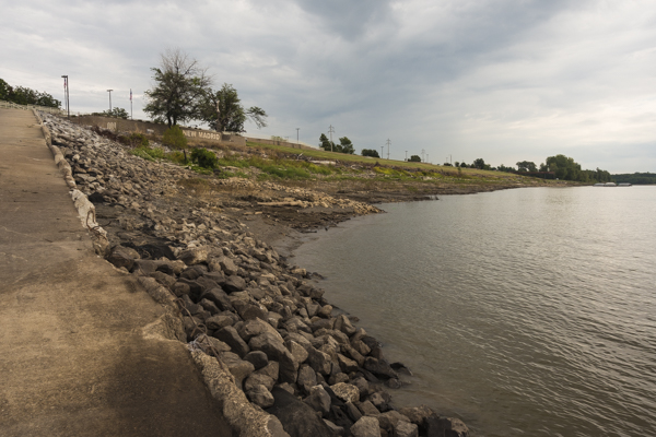
This stretch of river has a bigger floodplain than further south. Downstream and upstream, the floodplains narrow, especially at bottlenecks like Natchez. The Ohio River confluence is another bottleneck, as seen in the 2011 flood when they blew up Birds Point Levee and reopened the New Madrid Floodway so Cairo IL wouldn’t flood.
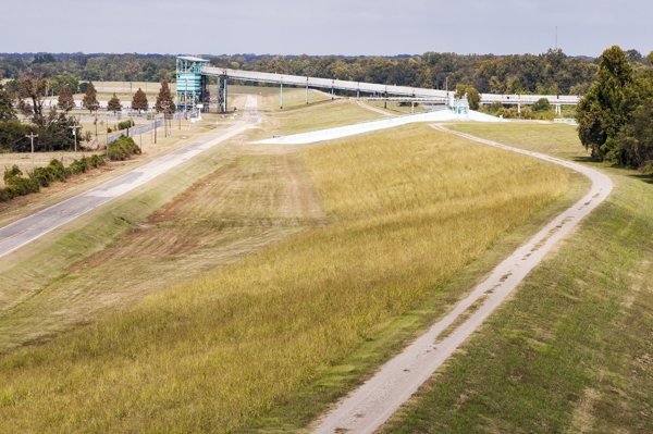


Old and new levees holding back the floods – controlling nature.
JOHN RUSKEY When the levees were built here, it was still mostly wilderness and unpopulated forest. So there was great latitude in where they set our levees from Memphis down to Natchez. Few farms had been built to the water’s edge; so they were able to leave the river a lot of room to flood in this stretch.
NWNL Does the new land development you mentioned reflect a rise in population here in the Yazoo Delta?
JOHN RUSKEY No. We’re losing population here. Clarksdale, the county seat, may be holding steady, but the overall population has declined since the mechanization of the cotton industry. That first big exodus of people has continued to this day. What used to be thriving cotton towns are now ghost towns. Every town in the Delta has experienced this. No towns are growing. Before 1990 Clarksdale had a population of 25,000. Now it’s about 18,000. I think it’s holding pretty steady around that number.
[Editor’s Note: Population in 2014 was 17,011. In 2016 it dropped to 16,272. Estimated population for 2017 was 16,272 as of Oct. 20, 2017 – exactly the same as 2016.]
[Editor’s Note: USDA’s NRCS and various partners are working on The Longleaf Pine Initiative with forestland owners in 9 states to restore 90 million acres of longleaf pine from Virginia to Texas. Only 4% of those forests remain today.]
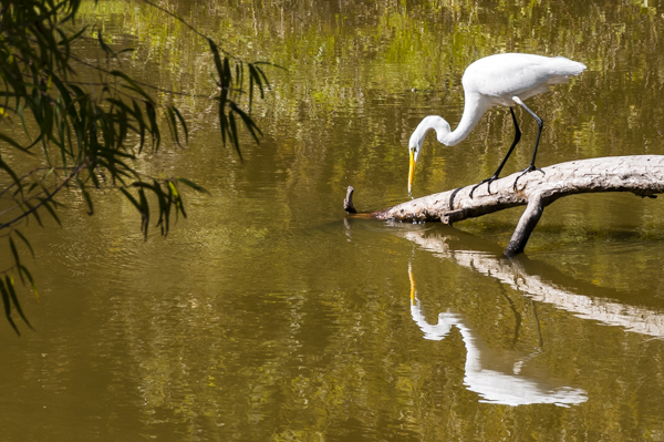
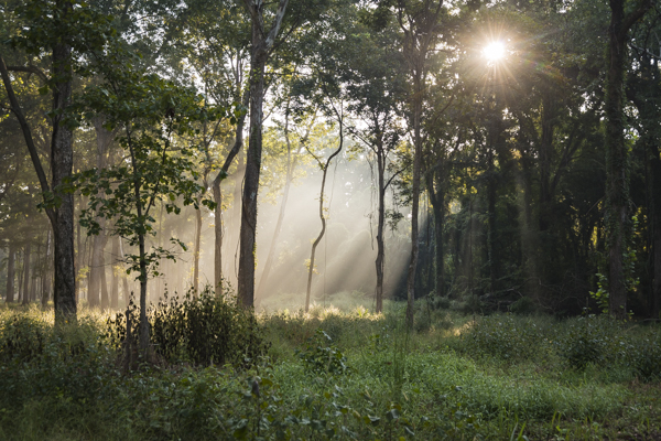
JOHN RUSKEY The Mississippi is not a very wild corridor, but it’s a vibrant one as there’s a great amount of life in water, despite less on land. There are long migrations underwater of sturgeon, freshwater shrimp and eel. I think the eel has the longest migration in North America. Beginning in the Sargasso Sea, eels swim up to American rivers, including the Mississippi. So we have an intact, vital wildlife corridor here. There’s not much wild land on either side of it, but a corridor is here because the river creates it.
The Mississippi River Corridor runs from Lake Itasca MN to the Gulf of Mexico. It connects Canada’s boreal forest to the bottom of the Appalachians and the Longleaf Pine Corridor stretching from South Carolina through Georgia, Alabama, southern Mississippi, and is strongest in Florida.

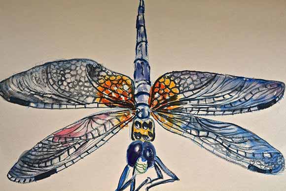
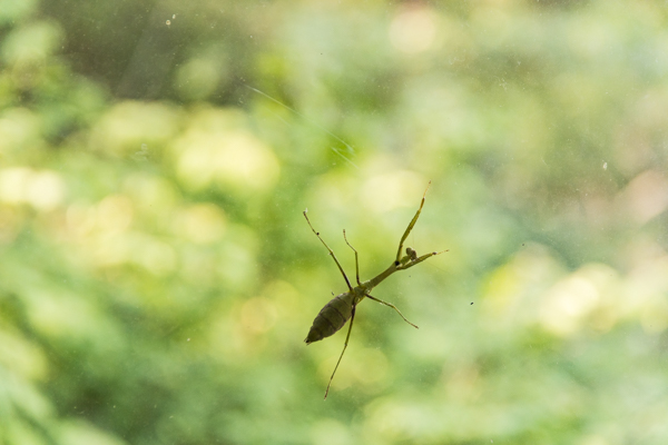
“Speyeria diana” Butterfly and Green Darner Dragonfly, © John Anton Ruskey
JOHN RUSKEY A significant role of the river in its long corridor is that of hindering further development, due to its floods. Wherever it floods, people won’t build. So we have this narrow lane on either side of the river called “the batture,” the land left wild between the river and its levees.
This narrow strip of land is very vibrant. They say it’s the richest habitat for white-tailed deer in North America. Above, we have a flyway. Those values make a pretty strong corridor that’s often overlooked.
[Editor’s Note: The batture (pronounced “batcher”) is described in Oliver Houck’s Down on the Battureas the place “where the water beats against the land, and where the river breathes…. Nobody manages the batture…. Its ownership and occupation are a tangle of obscure authorities, some as primitive as squatters’ rights…. It is a place where human beings come for the very purpose of being beyond the rules of designated places, to be in contact with the trees, the river and a sky in the late day….”]

The tangle of the batture
NWNL You’ve said, “Our rivers seem slow compared to everything else.”
JOHN RUSKEY That was a spinoff from T. S. Eliot’s poem “The Dry Salvages,” in which he talks about the rivers being “a strange, brown god.” I see parallels today to the 1930s and 1940s when Eliot grew up in St. Louis during The Industrial Age – a time of railroads and railroad bridges. People turned their backs on rivers and allowed more and more industry to be built there. The Mississippi River really took a jolt then. Its water quality was worse then than it is now.
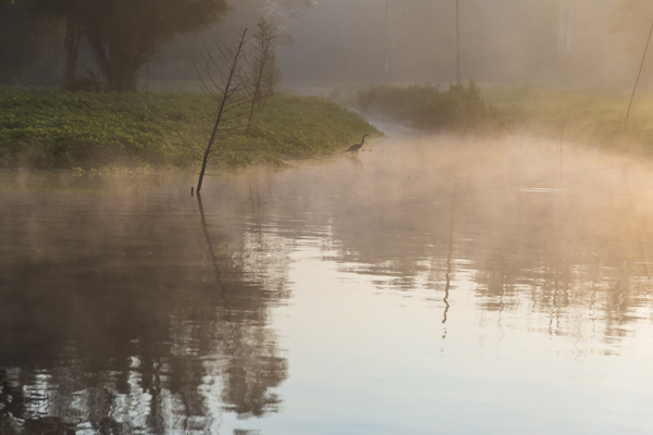
We still have our backs turned away from the rivers. In the middle of America we’ve turned away from many of our natural landscapes. In general, everyone’s lives are moving faster. It is more difficult for people to slow down, or feel the rhythms of sunrise and sunset, or notice the passage of stars through the heavens. Those things and the migrations of animals and changes of the seasons used to be tied into our lives.
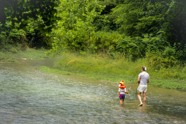
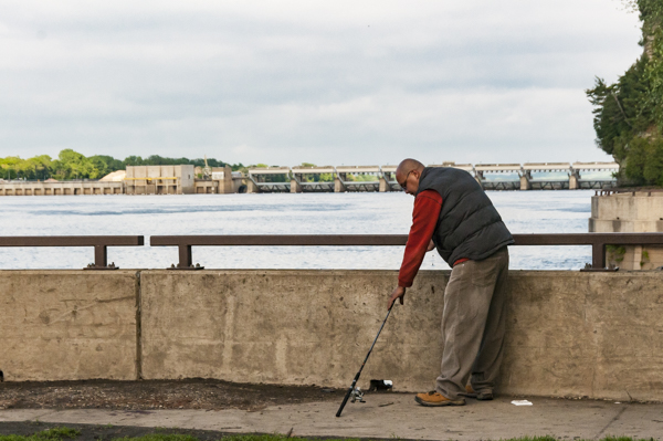
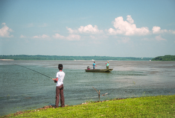
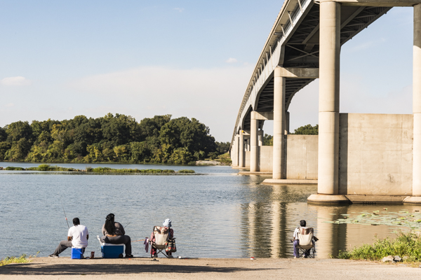
The peace of an afternoon spent fishing on the Mississippi
JOHN RUSKEY Everything has continued unchanged, except for us. The sun still rises and sets; and the Earth still passes through the sky. The animals remain. Insects still have annual and seasonal changes. But we have changed. We move faster and are more concerned with our own dramas and battles.
Rivers are a physical and very intimate reminder of nature every day. For me, the presence of a river brings me back more quickly to the rhythms of the earth than any other environment. I can walk into the woods; go up in the mountains; or go out onto the desert. But stepping into a river or paddling immediately connects me to the rhythms of the world.
So in my saying rivers are slower, I recognize that the river is where we can reconnect. We can put our finger back a couple hundred years, when humanity more successfully and harmoniously lived with the rest of the world.
NWNL How does your music, poetry and painting reflect your love of the river?
JOHN RUSKEY The river flow has always inspired artists. Part of the artistic process is getting out of the checkerboard patterns of society and into more organic patterns. The river is a great teacher for creating fluidly and organically. The Mississippi has always been my teacher. It’s neat to be able to create things that help give back to the river.
In some ways the river has a mute beauty. The river doesn’t shout out its beauty like the Rocky Mountains or Great Smoky Mountains where beauty, flowers and trees overwhelm you. The Mississippi is wild and often bewildering. But if you spend enough time with it, you see its beauty. I feel part of my work is to help the river express itself and help other people see the beauty that can be hard to see. It’s there.
NWNL John, each interview with you inspires. I look forward to our next meeting.
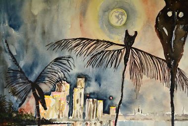
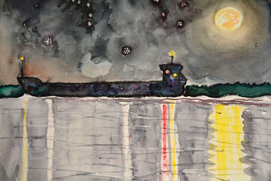
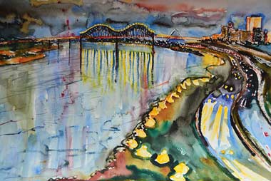
Mississippi River paintings © John Anton Ruskey
Posted by NWNL on Jan. 18, 2018.
Transcription edited and condensed for clarity by Alison M. Jones, NWNL Director.
All images © Alison M. Jones. All paintings © John Anton Ruskey. All rights reserved.