
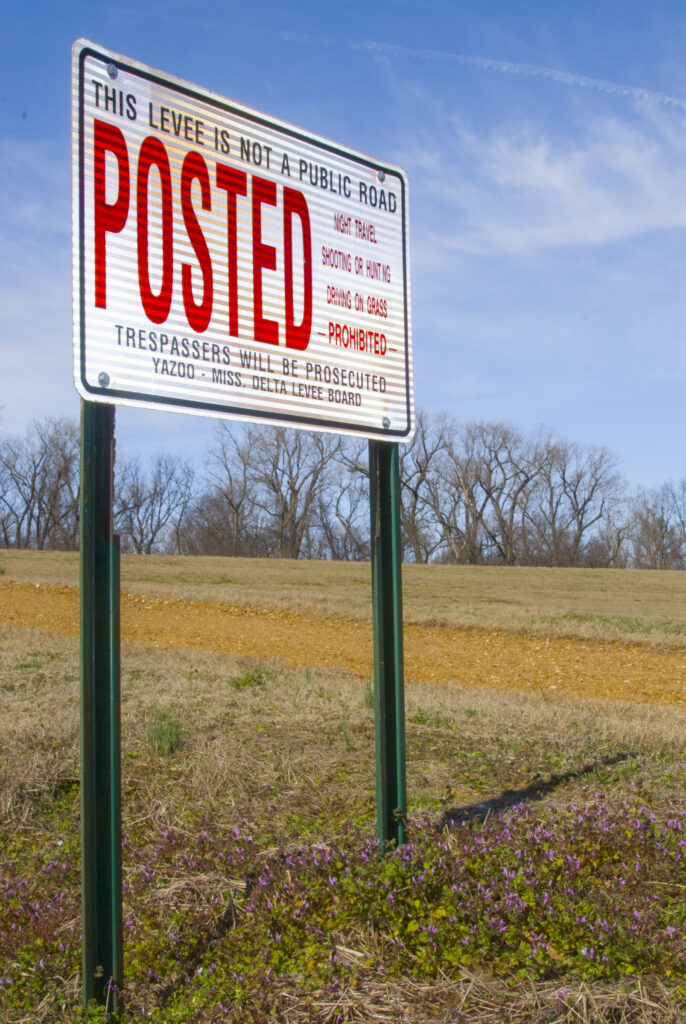
Levee Board for Yazoo-Mississippi Delta
Mississippi River Basin
|
NEW ESRI StoryMaps: What's On Our Shelves & NWNL Song Library & No Water No Life ESRI |
Mississippi River Basin
Bill Sheppard
Assistant Chief Engineer, Yazoo-MS Delta Levee Board
Sam Hobart, Jr.
Registered Levee Forester, Yazoo-MS Delta Levee Board
Tim Wilkins
Public Access Manager & Biologist, Yazoo-MS Delta Levee Board
Alison Fast
Videographer, Barefoot Workshop
The world’s first levees were constructed over 3,000 years ago along 600 miles of the Nile – another great river and NWNL case study. Studying levee’s raison d’etre and roles is essential if document the both the Nile and Mississippi Rivers. Today’s Mississippi levees are among the world’s largest such systems.
The year after our watershed expeditions began, NWNL attended a video course with the Barefoot Workshop in Clarksdale MS. While known by many as the “Crossroads of the Blues” this Delta region also represents a unique stretch of farmland, a great river, and a wild, legendary stretch of land between the Mississippi and its levees called the “batture” (pronounced “batcher”).
The locale of the Barefoot Workshop presented 2 great opportunities: documenting levees near Clarksdale and to practicing newly-learned interview procedures in a meeting with 8 Levee Board Commissioners in their office, a stone’s throw from the renowned Rock and Blues Museum!) The interview offered NWNL a great overview of the role of Mississippi River levees that NWNL would be documenting for the next 16 years.
With coaching from Alison Fast, co-owner with Chandler Griffin of The Barefoot Workshop, NWNL questioned and taped Levee Board Commissioners on their task “to erect, maintain and operate their levees.” The Commissioners protection of Mississippi-Yazoo River Delta residents and their property from flood damage involves a clearly-formed and intense commitment to the Delta’s present and future.
MISSION & HISTORY of the BOARD
LEVEE BOARD SUCCESSES
AVOIDING WATER DEFICITS
LEVEE PROTECTION
FORESTRY RESPONSIBILITIES
RIVERSIDE FARMING on the BATTURE
TERRESTIAL & RIVERINE WILDLIFE
THE YAZOO DELTA’S FUTURE
ROUTINE & EMERGENCY MAINTENANCE
WITHOUT THE LEVEES??
CONSERVATION FORESTRY
THE BOARD’S EDUCATION PROGRAMS
THE VALUE of OLD MAPS & STORIES
All images © Alison M Jones. All rights reserved.
Key Quotes The main accomplishment of the levee system in the Mississippi Valley is to make the Delta habitable for commerce and agriculture. Without the levee, this would still be a swamp. – Bill Sheppard
People moving into this area enjoy hunting, viewing wildlife and those type things. So, the Levee Board’s responsibility is to protect our wildlife areas for a future that will allow the Delta to grow. – Delta Levee Board Member
That levee protects over 300,000 citizens, over 38 school districts, over 6,000 miles or roadways, over many million acres of land…. We are here to protect that levee, the people, citizens and the property of the Delta. – Delta Levee Board Member
NWNL Hello! Let’s start our conversation with a brief history of the Yazoo-Mississippi Delta Levee Board.
BILL SHEPPARD Our primary mission is to protect life and property of about 300,000 people in our 10 counties. The history of our Yazoo-Mississippi Delta Levee Board requires an overview of our levees and progression of levee building up to today. We cover 10 counties in the Mississippi Delta. Three of these – DeSoto, Tunica and Coahoma – are mainline Mississippi River counties that cover 98 miles of levees from Memphis to the Coahoma County line.
The original levee, put up by locals to protect their farms prior to and circa the Civil War era, were probably no higher than 4-6 feet. Two years after the Flood of 1882, our Levee Board was formed. Their original levee was breached only once: in 1897 at Flower Lake in Tunica County. As a result of that, the Levee Board beefed up its levee by adding to its height and base width. That raised it above their high-water mark.
The progression of levee building began due to that of the Mississippi River floods over a 40-year period. Currently, we’re under the 1928 Flood Control Act. The height and base-width of our levee is per the perimeters set by that 1928 flood – the Maximum Probable Flood, set by the US Corps of Engineers. We have 500-year protection with about 5’ of free board above that.
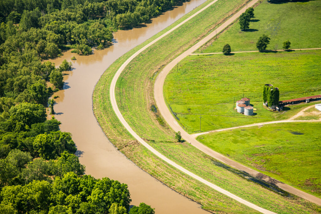
Our levees are urban levees: earth structures with a broad base. To make our levees stable, we need a certain height so that they’re not overtopped. We obtained most of its material from the riverside. Basically, we gathered it, pulled it over and built our levee.
We start with a basic side slope and top width to achieve a certain height so our levees are not overtopped. Then, we look at other proactive measures, and ask: “Is our base strong enough? When the river’s up and our levee is saturated, will we get boils on the land side?”
We have land-side berms and river-side berms. The latter have an extra layer of earth that weigh down the toe of the levee in the case of a high-water event. If water is saturating the earth at the levee’s base, prolonged hydrostatic pressure will cause the water to flow under a levee. Then when it comes up on the land side, due to the difference in hydrostatic pressure, it will take material with it. It will take clay and sand and anything that it can put in solution and create sand boils. So, when you start to have a high-water event and boils occur, we ring them off with a sandbag or earthen system and build them up high enough so the pressure dissipates, and they stop flowing.
Another proactive measure to alleviate, or strengthen, levee stability is to put relief wells into the upper aquifer in case boils occur. They can pop anywhere along the land side base of your levee. By putting in these pipes – basically wells based on the sub-strata and at varied locations – you have a controlled outlet for the hydrostatic pressure.
Instead of boils popping up anywhere, we can use these methods to dictate where we want the water to come up. We’ll then flow the water out into a ditch or reservoir. Finally we’ll pump it back over the levee. When taken together, base width, levee height, landside and riverside berms, plus relief wells form a stable levee system.

ALISON JONES I have several questions: How were you formed? What is your responsibility? How are you funded? Are you a governmental organization or community organization?
BILL SHEPPARD We were formed in 1884 and then ratified by the 1890 Mississippi Constitution to protect life and property in the 10 counties within our jurisdiction.
ALISON JONES I understand from your website that “The Board’s primary function is to protect property and people from flood damage, as well as sponsor and maintain interior rivers and streams.” Have your levees changed the landscape? How have they helped the economy? And what successes has the Levee Board had?
BILL SHEPPARD The main accomplishment of the levee system in the Mississippi Valley is to make this Delta habitable for commerce and agriculture. Without the levee, this would still be a swamp, as it was prior the 1800’s. It would be overgrown with canes and thickets full of snakes, malaria and the whole nine yards.
But instead, this Delta is now carved out to be farmed and probably is the most productive agricultural land in the U. S. I think we have the deepest topsoil anywhere — from 13-17’ deep, sometimes deeper. We have an available water table of 17-20’ – with ample water, rich soil and a great growing climate. It’s an ideal situation.
ALISON JONES How does your water availability here, from the Mississippi, compare to other river systems? You’ve said that, despite malaria and heat, people come here and appreciate the water availability in the Mississippi Delta.
BILL SHEPPARD We’re fortunate in Mississippi to have ample water availability. We have shallow groundwater for irrigation and deep groundwater for drinking. We’re one of the few states that set state laws years back to separate ground water for irrigation and ground water for drinking. Our water laws say withdrawal of all Mississippi water must be permitted. People may not have liked that in the beginning, but it has protected Mississippi, unlike other states that don’t have available water.
We do experience a deficit with our groundwater every year, but it seems to be slowing – or at least stabilizing. Geologically, we do have some groundwater recharge from the Mississippi River into the interior for a narrow width. That depends on the stage of the river; but most of our water comes from the Alabama Hills down through the Mississippi Delta.
We do have some water deficit, now. We’ve had a deficit for probably the last 15-20 years; but not as much as many other states. Right now, it would take them years to rebound their groundwater. Here, we can be proactive and use conservation practices and then, hopefully, see some change.
We are seeing some changes, but it depends on the growing season. Sometimes our aquifer rebounds; sometimes it declines, based on what type of growing season we have. Regarding rainfall, we’re fortunate here in Mississippi. We get probably around 52-53” of rain a year. That’s a lot of water for growing crops. Most of it runs off, but it still allows us to grow many crops here. We have good growing conditions and ample water, so our groundwater is in pretty good shape. I don’t know of any irrigation coming out of the Mississippi River right now, other than maybe 1 or 2 field wells installed next to the Mississippi River levee. Most of our irrigation and groundwater comes from interior deep wells.
I don’t know of any surface water used for drinking water in the Delta. There are some municipalities that use surface water for drinking water around Tupelo and other areas. We’re just fortunate here in the Delta to have ample groundwater.
ALISON JONES How would you explain to folks outside of Mississippi what the Levee Board has accomplished, and why it’s an important institution?
BILL SHEPPARD We’ve protected the people and their property in the Yazoo Delta for over 100 years. We haven’t had a levee breach since 1897 even with a smaller levee system than we have now. Today, we probably have the best levee system in the world. There’s none like it anywhere. Over $15 billion has been spent on the Mississippi River levee system; and now it provides more protection than any other levee system in the world.
SAM HOBART And we can see it in satellite images! Astronauts in the space shuttle saw the Great Wall of China and the levees along the Mississippi River. We can say, “Our levees are seen from space!”
ALISON FAST How do you protect people while also controlling the river?
SAM HOBART First, we do not control the Mississippi River.
BILL SHEPPARD We don’t even attempt to. Instead, we keep a constant vigilance on that levee, maintaining it so that we can always monitor and visually see high-water events and whether we have boils. We’re constantly working on fixing our structures after high-water events to slow any failures that could occur due to high water and saturation. Every day, we do minor maintenance on the levees. We have 16 employees training on top-of-the-line equipment every day.
So – not ‘if’ – but when the next flood occurs, we’re ready. Every man we have will be able to operate any piece of equipment we have so that we can maintain the levee during a high-water event.
And during high-water floods, we have generally of staff of 40 guys working our 98 miles of levees. We have people on 4-wheelers monitoring our modern drains at the base of levee that pull water away during floods. It’s a big job with a lot of monitoring – 24 hours a day during high-water events. We’re prepared to take on whatever challenges that high water provides. We’re ready with manpower and the equipment we have at our disposal,.
ALISON JONES How your board is funded? You must spend a lot of money on the number of people and their equipment. Thus folks ask whether the levees are governmentally or non-governmentally funded, and where that money comes from?
BOARD MEMBER We’d rather not discuss that.
SAM HOBART Bill’s talked about levee engineering. I’m a forester and most of my work involves timber management and tree planting. Anytime we take away one tree on our properties, we generally plant back about 10 trees, sometimes even 100. That’s our program’s ratio of cut trees to plant trees.
The Levee Board hired its first forester about 31 years ago; and I’ve been here 28 years. Our early Board was small, and its early Forestry Department work was mostly cutting beaver-damaged trees and managing salvage jobs. At that time, we had many bare areas where material had been taken for the construction of the levees. Those areas then held water for lengthy periods of time. Now, some of those areas now are forested.
So, we’ve gone from some very stagnate, muddy-water areas to some full forests. We’ve accomplished some good conversions. Yet, we’ve not taken away wetlands, because we know those are important as well. We’ve just changed the nature of these wetlands a little bit to the betterment.
Another tree-planting action we’ve been involved in, as Bill mentioned, serves as an engineering function of the levee. A tree screen provides a “deflection forest” or a “wave wash” as control. So, the trees along the levee structure are a part of the flood control that we work with.
ALISON JONES Are your trees planted on the river side of the levee – also called the batture – pronounced “batcher” I’ve been told.
SAM HOBART Yes, that is right.
ALISON JONES As a Northerner, I’d never heard that term till yesterday. So, do describe the “batture.”
SAM HOBART Here down South, we call it “the riverside.”
ALISON JONES Ah, it’s on the “river side” of your levees!
SAM HOBART Yes. Technically, the batture lands are where 98% of our tree planting occurs. Normally, we reforest 800-1,000 acres a year, using roughly about 300,000 seeds. We also have our own nursery that provides seeds for this planting operation. Tim, as Public Access and Wildlife Manager, you get more involved with the animal aspect.

ALISON JONES Is there a difference in the batture before and after the levees were built? What was its role in the Delta ecology and how did it impact all the cotton farms here?
SAM HOBART The historical description of the batture lands has been described as huge cane thickets. I think Ferdinand DeSoto was described as walking in a cane thicket for two days without getting out. So, they weren’t exactly beautiful forests in all the areas. Much of the riverside was described as thick, swampy, mosquito-infested, and with very harsh conditions – although there also were stories of some beautiful, giant trees providing good timber and logs that came off that land. The picture in my mind is that it was very thick with beautiful trees and a plenty of water.
I think much of that water has been drained off, some because of our work – but mostly just by human clearing, not necessarily just the Levee Board. In the batture lands, drainage is not as important as flood protection. Flood protection is the higher priority and our main issue – not drainage.
ALISON JONES Are there farms there now? If so, how do they use the river to their advantage?
SAM HOBART Bill, would you agree there’s very little farming in the batture lands now? Some of the highest ground in the Delta is right along the river, so possibly some of that land was first to be farmed in the late 1800s.
The best land was the river’s top bank, due to its formation.
TIM WILKINS With any river system that overflows, the heavier materials settle out closest to the river. That continues to build up over time into a ridge that typically stays out of the water. So that would be the best area to farm because it is best protected from overflows. Thus, initially, they chose the land adjacent to the river because it was the highest land.
Since the levees have gone up, the river has been confined between levees of Arkansas to the west and Mississippi to the east. That raises flood levels because the water no longer spreads out over a wide range of lands. So, now you don’t see much farming in those areas. The bit that exists is strictly dependent on floods. When they plant, they know they risk losses because of flooding from the Mississippi River. It’s a gamble, but some still do it. Many have taken advantage of the Wetland Reserve Programs, or Conservation Reserve Programs, that let them replant bottomland hardwood timber that will survive under those situations.
ALISON JONES Is this a species-rich region?
TIM WILKINS Yes, we have great wildlife. The Mississippi-Yazoo Delta probably has more species and a wider range of wildlife than anywhere else in the US. Sam Hobart reforests areas after our timber harvests which creates diverse habitats that attract a diverse wildlife population – from migratory song birds, to general wildlife, to insects. Few people think about insects as wildlife, but they’re part of our predator-prey food chain.
Deer are one of the most popular species in the Delta because many people hunt deer. From a wildlife standpoint, deer probably bring more people from outside the Delta than anything else. We’d like to see the public viewing our wildlife. So, we’re seeking a wider range of wildlife opportunities for economic development, by being a major attraction to the Delta in the future. Few people have seen alligators, so many come here just to see them. Add to that, interest in the Delta’s cotton, our diverse habitat and our farming approaches…, and you get a bigger picture of attractions here. We produce a lot of food for the continent, and our wildlife provides a diversity of species for the people to see.
We have also have black bear that, while uncommon, are starting to come back due to new programs. Birds tend to draw most visitors, but we have other things of interest that we’re working on. Many people will drive hundreds of miles just to see this particularly unusual region in the United States.
ALISON JONES As a friend of the Alabama photographer Bobby Harrison, I wonder if you think the Ivory Bill woodpecker, that he claims to have seen, still exists here?
TIM WILKINS We’ve not seen any evidence of an Ivory Billed woodpecker in our area. There are areas where Sam has harvested timber that would be ideal feeding areas for ivory-billed woodpeckers, but you’d more likely find them in the White River Basin’s hundreds of thousands of acres of forest. We just don’t have that here anymore.
ALISON JONES Are there indigenous or endemic species here to highlight?
TIM WILKINS We have some species that some people don’t like, like snakes. The most popular snake in the Delta is the Cottonmouth, named that because the inside of its mouth looks like a cotton-ball. It also has some little fangs which, when agitated, they will sink into your leg or some other extremity if they can — and it does hurt!
But being in the wildlife field, I don’t pay attention to snakes. I know they’re out there as part of our wildlife resource, but I don’t worry about them. We have canebrake (aka, timber) rattlesnakes (“Crotalus horridus”) which are neat species, basically found in vast areas of cane, but we only have small areas of cane right now. (Editor’s Note: This pit viper has a very potent, toxic venom) . And, of course, we’ve got alligators and other things here.
To me, one of the most colorful species in this area is the Prothonotary warbler – a neat little bird. It looks like a little yellow canary and is found in wetland habitats where it nests and rears its young. We have a wood-duck nesting box program along the levees where many wood duck nest. They are a very colorful species – one of the prettier ones of any waterfowl species. Many birds come into our sandbar areas, as they tend to produce millet and other wildlife food.
The diversity we have here would stagger the imagination of some folks. Many think the Delta as devoid of wildlife species. However, per acre, we probably have the most diversity of wildlife that you’ll find anywhere in the United States.
SAM HOBART Those of us who live in the Delta find beauty is in the eye of the beholder. It may seem a rough environment to many people, but for those of us who live here, it’s home.
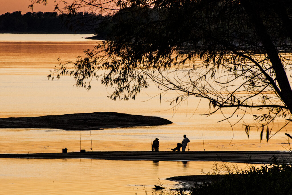
ALISON JONES And riverine wildlife…? What about your scaly friends, the fish?
TIM WILKINS Oh, yes! Our riverine species certainly attract people to the Delta, especially fish!. When the river comes up and recharges, people use the small fishing areas that we’ve established – some with boat ramps. We have croppie, which some people call “crappie” and some Louisianans call “sac-a-lait.” We also have bass and catfish, which is very popular. Our white bass is a small bass and we have Gambusia which eats the larvae of the mosquito. We like to support the Gambusia since the mosquitoes can get very bad in this part of the country – especially out in the wild areas. Deer, especially, and mammals really suffer during those times when we have a large hatch of mosquitoes, or other biting insects. The deer then pass on different diseases, which can cause a die-off situation.
Wild turkeys are very common. People love to hunt and eat them due to their great flavor. Squirrels hunting used to be cause for big family outings, but we don’t see much of that anymore. We have habitat that offers some opportunity for rabbit hunting; and we have a diversity of other mammal species, from rats to shrews to moles.
ALISON JONES What do each of you see as the future of this Delta – as an individual, or as a member of the Levee Board, or a resident? And how does the future of this part of the Mississippi River Basin tie into what you do now?
BOARD MEMBER I think the farming is going to change, since technology will create better opportunities for farmers to make a profit. But at the same time, it will be at the cost of some of our residents because changing technology won’t need as many people to do the job.
At the same time, the economy can be boosted by visitors here to view wildlife – a new industry that we could create. As people here become better educated and more opportunities arise, the Delta will improve and things will change. People love water – and the Delta’s got a lot of water, including many lakes. People moving into this area enjoy hunting, viewing wildlife and those type things. So, the Levee Board’s responsibility is to protect our wildlife areas for a future that will allow the Delta to grow.
BILL SHEPPARD We have wildlife and recreation, and they both are associated with people, infrastructure, and property values. I see our role as providing protection, and then we should be proactively looking at our future role in 50 to 100 years. Do we sit here and just tread water and do business the same way? No, we must try to be proactive.
Let’s look at flood hazards, flood control, earthquake analyses, and all things that can affect this Delta. We’re in the New Madrid earthquake zone, so we attend seminars and workgroups to create plans for disaster – not if it comes, but when it comes. We saw that Hurricane Katrina caught everybody off guard. So now, we have an Emergency Management Department. Our boss said, “We’re beefing up and we’re finding out what to do,” even before he went to view Katrina’s damage. Before he sent all our people down to work on Katrina’s devastation, they asked him, “Are you ready for a disaster?” Well, before Katrina, our boss had said, “We’re probably in pretty good shape.” After he came back from Katrina, he had much to say:
“Oh, wow, we need to be extremely proactive. Let’s look at technology and communications and disaster plans – and let’s work with other agencies. Let’s get to the point where the Levee Board is a lead agency for disaster responses for all events: tornados, hurricanes and earthquakes.”
Right now, we’re pushing and trying to get up to speed with earthquake plans. We’re part of an 8-state plan to run scenarios. As we look at our earthquake disaster readiness now, we could have catastrophic disaster from the New Madrid seismic zone. What should we do? We’ve run through scenarios of the worst thing that can happen.
We’ve looked the scenario of an earthquake happening over in Arkansas, where a 6- or 7-magnitude earthquake would produce 20 aftershocks. Let’s assume every bridge is out – and the levee is breached. Let’s go on to assume that 5,400 miles of an underground gas line has exploded; that all the water systems are gone; that all the power’s out…. We’d have nothing. Could we sustain ourselves? Could we sustain our population for 7days? 14 days? 30 days?
Who would come to our rescue? We’re the only ones coming to our rescue.
If we get a large earthquake, where’s all the protection? Where will all the responders go? They’ll go to the highly-populated areas of Memphis, St. Louis, and such. We’ll basically be on our own here. So, how can we proactively get up to speed, run scenarios, have standby equipment and personnel, and be able to dig out our part of the world? We are in the northern part of the Delta, where we’d more than likely be affected by that earthquake.
How can we get ourselves dug out from under the rubble, get everything under control and get to the edge of the earthquake boundary to seek help – because they will be coming in to try to find us. We must be able to get out to open main corridors, and replace fallen bridges with temporary bridges to get supplies, equipment, people, and our personnel moved around.
BILL SHEPPARD We’re stressing over such a scenario. We’re running hydraulic analyses of levee breaching to check our levee stability if an earthquake hits. Levee destruction will depend on how high the Mississippi River rises with such an earthquake event. If water is on the levee, we’ve got possible problems. If it stays below the levee, can we cut off any type of drainage or overflow within the natural levees in the Delta? Could we go to a highway bridge’s off-ramp? Could we slow down the rising water to provide protection downstream?
ALISON JONES It seems there are many assessment questions you must answer regarding your preparedness now and for the future.
BILL SHEPPARD We must be prepared for anything that might come up. Are our people prepared to go out on our crews to operate our equipment? Are they fully trained? Is our equipment in good shape? Is our emergency management team 3D, i.e., does it have 3 people committed for each role? That’s important as two of them might not be here. Are we 3D in everything we do? Does everybody know a little bit of the next job, if caught during a disaster or losing control in an event? What do you know how to do? Do you have it planned out? Those are questions our emergency management department needs to address. Regarding everything we do – from equipment operation to mobile command center, communications, chain of command – everybody needs to be in the loop.
If a fellow employee who does a certain job does not show up, or is gone, or is caught in a disaster, then who can step in and do that job? We are constantly training our people and keeping a constant vigil over the entire operation. Our function and our mission is to be on top of our day-to-day control and move levee protection and people protection to the next step.
ALISON FAST Can you talk about your daily-control vigil of the river?
BILL SHEPPARD Our vigils vary, depending on the current river stage. During summer months when the river’s down – what we call “non-flood months” – we basically keep up levee maintenance. That includes cutting pastures, fencing, and fixing slope failures that might occur due to high water events. We also are training personnel on equipment so that during a flood event anybody can get on any piece of equipment and do whatever is needed.
As I mentioned, we’re now working with the Corps of Engineers to install projects like the well fields I mentioned, and maybe a berm project. Our levees’ heights and bases are okay, so we’re looking at relief wells now. Getting those installed is our big push for the next 10-15 years.
ALISON FAST Is the function of relief wells to control river flooding?
BILL SHEPPARD No. During high events when the water comes up on the riverside, boils appear due to the sandy formation below the levee. When we get boils, we try to alleviate them by putting in relief wells.
ALISON FAST Can you explain relief wells and boils in laymen’s terms?
SAM HOBART Many don’t understand what a boil is. Basically, high water on the river side up against the levee will force water onto the levee, and it then boils up on the levee’s land side. In so doing, it pushes riverside material under the levee and deposits it on the land side. Our relief wells eliminate that transfer process which carries dirt with it. Thus, the boil doesn’t push the materials under the levee up to the land side and doesn’t compromise the levee’s stability or its material.
ALISON FAST Does that change the natural process of the river?
BOARD MEMBER No, it just protects the levee; and our business is levee-protection.
BILL SHEPPARD We’re much more concerned with a levee failure due to a lack of stability than we are concerned with overtopping. As I said, we have 500-year event protection plus 5’ of freeboard, a pretty disastrous scenario. We’re protected from a lot of water passing by; but prolonged high waters weaken our levees. The longer the river’s up, the more we’re concerned. Regarding boils or relief-well aspects, when the river-water stays high, it saturates our levees’ embankments. The longer water stays high, the wetter our levees get. But…, when the water goes down, that levee is still saturated and it will be for quite a while before that water bleeds out.
When the levee drops, or water bleeds out, the river side of the levee becomes unstable. That’s when failures begin causing maintenance problems if we face high water for 1 or 2 months. We could spend the next 2 years fixing the damage caused by that 1-2 month high-water event.
BOARD MEMBER Repairing that damaged levee is then our #1 job.
BILL SHEPPARD Yes, levee maintenance is our #1 Mission, absolutely. Everything else is put aside, and that levee is #1.
ALISON JONES Without the levees, where would you be?
BOARD MEMBER We would be in a swamp. I could go outside now and show you multiple high-water marks on the building next to us.
TIM WILKINS This town wouldn’t be underwater; but certainly …
BILL SHEPPARD Without levees, this town would have been under water many times since 1884.
BOARD MEMBER Would it have come over buildings, or just several feet up?
BILL SHEPPARD It would have made the town inhabitable.
SAM HOBART Without the levees, we wouldn’t have the Delta as we know it. We would have only seasonal farmers.
BILL SHEPPARD Yes, we’d have no long-term stability or infrastructure. Nobody would need infrastructure because you would just be here on a temporary basis. There wouldn’t be people, houses, schools, roads, farming operations, cotton gins, grain elevators, or anything that is part of developing an area or community. There might be a little outpost of people on high ground and another over here – but only swamp in between.
BOARD MEMBER Farmers lived in the hills in the 1800s. They came down to the Delta to farm during growing season and then returned to the hills.
TIM WILKINS Thankfully, our levee allows people to live in the Delta.
BOARD MEMBER Yes, that’s what it boils down to.
BOARD MEMBER It stayed unstable here until 1928 Flood Control Act.
BOARD MEMBER My great granddaddy farmed in the lower Delta and in Leflore County on the edge of the hills. In the 1927 flood he lost the ability to farm in the Lower Delta. After the 1927 flood, the 1932 flood got the Upper Delta. So, he came out of the Depression with two floods that basically wiped him out.
ALISON JONES How does the Levee Board link reforesting with conservation and the Levee Board’s role?
SAM HOBART The Levee Board has developed a nursery to provide seedlings for our needs on our property and to give freely to the public. We don’t sell any of our seedlings. Our give-away programs through the Natural Resource Conservation Service have worked well because they provide for our needs and individuals’ needs across our 10-county area. We use our seedlings on properties we’ve logged. We may log 300 acres a year, but we reforest another 1,000 acres in a year – so we get ahead of our cutting curve.
Our forestry, engineering and maintenance programs are a function of protecting our levee. Our urban forestry program supports cities in the Delta that are losing beautiful oaks along their avenues and boulevards. So, we’re replanting trees in many areas, as part of how we envision the future. Our forests are changing from early-stage-development cottonwood forests into oak forests, and from light-seeded species to heavier-seeded species, such as oaks and hickories. We’re just speeding up that natural process.
BOARD MEMBER It creates habitat diversity and supports a wider range of wildlife species.
ALISON JONES You mentioned folks are giving their batture land over to conservation.
BOARD MEMBER You’re speaking about the Conservation Reserve Program/CRP. We’re only involved with CRP in one area, and that may end. Others in the Delta are now involved in that public government program.
BOARD MEMBER Land use is changing on some marginal lands that were cleared in the early 60s. As Tim said, people are using government programs to put land in CRP and WRB conservation, thus getting good value from government programs.
SAM HOBART Reforestation also helps future recreational use of the Delta.
TIM WILKINS I think 150,000 acres have been reforested through WRP – half a million acres at least. That has changed the Delta considerably. Some people are returning lands that should never have been cleared back into bottom and hardwoods for economic gain. They can reforest that land; flood areas and manage for waterfowl; and then lease it to hunters. That income has a greater guarantee than gambling on a crop every year. It’s an opportunity to keep family land, enjoy family recreation and get income.
ALISON JONES You’re referring to WRP/ Wetland Reserve Program.
BOARD MEMBER CRP and conservation programs are reforestation programs with a wetland component to create diversity in the habitat.
ALISON JONES Great.
SAM HOBART Probably by 2020, all Levee Board properties will have been reforested. By then, we should be harvesting some of the trees we first planted. We want a sustained yield of good forestry helping the economics of this area and positively impacting the wildlife and our engineering. They’re all tied together. We want to do the best that we can for wildlife, timber and protecting the levee. In doing so, there’s a big picture that ties it all together. The trees protect the levee. Properly managing trees affects wildlife diversity and utilization of the area by humans for recreation. We’re being proactive with that and trying to help people understand how to do that successfully.
BOARD MEMBER Understanding our protection of the levee and local people is primary; but for the last few years we’ve also had an education program to let everybody see that levee. Many haven’t seen it and don’t know what that levee does. Those who are 4, 5 or 6 counties away don’t have a clue that that levee is protecting them. We need to educate all citizens- especially young, future citizens – that we and they don’t become complacent and ignore the importance of that levee.
We began an education program for every Delta student before graduating high school to include a tour of that levee. We have an Education Department to teach everyone what that levee does. The older ones of us know that, but perhaps your next senator or congressman could come from Jackson where they could care less about that levee. We want our people who grew up in the Delta – our future leaders, citizens, mayors, lawyers, doctors, senators and congressmen – to understand that levee has a function. Our plea is, “Don’t forget about the levee; don’t be complacent. Understand how it protects over 300,000 citizens, over 38 school districts, over 6,000 miles or roadways, over many million acres of land…! The levee is there for a reason, and we, the Levee Board are here to protect that levee, our citizens and the property of the Delta.
ALISON JONES What do you answer when asked, “What is a levee?”
BOARD MEMBER We take them on a tour. We set up a rodeo for them and other things. We’re developing fishing lakes, and so we let students fish while on a levee tour. We’re now working with Delta State to develop a curriculum program on “The Levee Board and the Levee.” Teachers come in, review our history with us, and we give them information on the levee board. They then put together a curriculum to share during the year.
BOARD MEMBER They ask us, “What’s a Levee Board? I kind of get the mission but what is the Levee Board itself?”
BOARD MEMBER We say, “We were formed in 1884 and are made up of 12 popularly elected commissioners from 3 mainline counties and 7 interior counties. Two main line county commissioners come from Tunica and Coahoma County and there’s a DeSoto County commissioner. We have 12 elected commissioners elected on a 4-year cycle.”
BILL SHEPPARD A governing council decides how to maintain the levees and put together the program, hire the people, buy the equipment, and run the day-today work needed to maintain the levee.
SAM HOBART The most important aspect of maintaining the levee is vigilance, and just being prepared. If we’re not prepared for the next flood, as Bill discussed vis a vis earthquakes and other potential disasters, we’ll be the ones to pay for it. We’re responsible for protection. That’s our Charter. That’s our original mission and will always be our primary function.
BOARD MEMBER If we fail, there’s no other backup.
BILL SHEPPARD We have on file all our original hand-drawn maps from 1894 and 1901 hand drawn maps that are very delicate. We’ve scanned all the older maps and still we use some on a day-to-day basis as we research deeds and old levee alignments. The old draftsmen and engineers had excellent penmanship and were very good map makers. That’s rare today. You don’t see that, everything’s gone on in making an AutoCAD map. Back in the old days they knew how to draw very efficient and the made excellent maps.
BOARD MEMBER What information do they provide that today is important for protecting the river?
BILL SHEPPARD Well, when we re-stake our right of way, or if we have a new project for which we need to buy right of way, we can go back to see how they laid out their levees and marked the center line. When you add on to a levee five times, the center line is still in the same spot, but covered up by at least 20 feet of dirt. So, we must re-establish that center line….
I’ve only been here since March, and I was fascinated when I read some publications about Major Dabney. He was the first chief engineer CEO of this Levee Board. I found all his old writings, letters and things in researching the man. He was amazing and ahead of his time. He instituted many practices on the river and on levees in the late 1800s before anybody thought of them; and those techniques are still used today. Pretty smart man.
They tell a story about conflicts during one of the major floods between this side of the river and the Arkansas side, regarding which levee would breach. Supposedly Major Dabney had caught someone from Arkansas coming over on a boat with explosives to blow the levee. He had a trial and a sentence on the top bank of the river.
ALISON JONES Is it okay for me to be download maps and using them?
BILL SHEPPARD On our website? Sure, sure. There’s a lot of good information on there – maps, history, history about the levee, flood misconceptions, physical description, district information. There is information on different design elements of the levee, roadway section, protective side, riverside berm, riverside bar pits, riverside timber stands, traverses, landside bar pits, land berms, collection ditches — just a little bit of everything really. It’s quite an arsenal.
We have a lot of information about FEMA here – including our response during Katrina. We learned a lot then.
ALISON JONES Did Katrina have any effect here?
BILL SHEPPARD Only that we’re a part of Emergency Service Function Three, which is engineering. We assist MEMA, the Mississippi Emergency Management, as part of the state plan. MEMA is the state arm of FEMA. Although MEMA works directly for the state, we’re a part of their disaster response team. So, we can get called out by them to assist with disaster response.
ALISON JONES You have made it very clear that your board is a uniquely valuable asset to this county and the state. We appreciate your sharing your management principles and strategy, your time and answering so many questions from us– as well as permission to use items on your website. Your background information on the levee that your board maintains has been extremely helpful. Thank you very much for your patience with our questions and for your time.
ALISON FAST Thank you.
Posted by NWNL on November 22, 2025.
Transcription edited and condensed for clarity by Alison M. Jones.
All images © Alison M. Jones, unless otherwise noted. All rights reserved.