A Mississippi River Guide
Mississippi River Basin
|
NEW ESRI StoryMaps: What's On Our Shelves & NWNL Song Library & No Water No Life ESRI |
Mississippi River Basin
John Ruskey
Quapaw Canoe Company and Rivergator, Founder
Alison M. Jones
NWNL Director & Photographer
All images © Alison M. Jones
John Ruskey has been paddling the Mississippi River out of the Mississippi Yazoo Delta since 1982, focusing particularly on the Arkansas, the Yazoo, the St. Francis, the White, the Big Sunflower and the Big Black Rivers.
In 1998 he founded Quapaw Canoe Company, the first wilderness outfitting business on the entire Lower Mississippi River. John has guided National Geographic Adventure, Outside Magazine, the BBC, ESPN Outdoors.com and other media in various river adventures & expeditions on the Mississippi. John builds voyageur style stripper canoes for use on the wild waters of the Lower Mississippi River, and is one of the most experienced builders of dugout canoes in the country. 2002–2006 John oversaw the construction of 3 dugout canoes for the Lewis & Clark Bicentennial Re-enactment, and helped the twenty-first century Corps of Discovery paddle those canoes up and down the Missouri, the Yellowstone, the Clearwater, the Snake, the Columbia, and other rivers of America.
Visit www.island63.com for more information about John and the Quapaw Canoe Company.
NWNL Note on GEOGRAPHIC TERMINOLOGY: This region has many names: the Mississippi Delta, the North Delta, the North Mississippi Delta and the Yazoo Delta. This delta is often confused with the Mississippi River Delta in Louisiana where the Mississippi River meets the Gulf of Mexico. To differentiate these two deltas, NWNL refers to Mississippi’s wetlands between the Yazoo and Mississippi Rivers as the Yazoo-Mississippi Delta. In this interview the Yazoo-Mississippi Delta is also called “The Delta,” a common term among local residents.
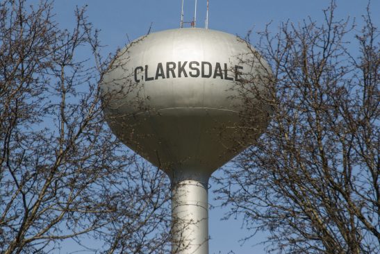
NWNL John, it’s a privilege to be here to see your hand-crafted canoes, your paintings and your Renaissance-style commitment to the Mississippi River. Could you describe who you are and where we are geologically?
JOHN RUSKEY I am the founding owner of Quapaw Canoe Company and we are on the banks of the Sunflower River in Clarksdale, Mississippi. This town is located near an old Choctaw village, long ago home to two or three thousand who settled near today’s downtown. Although today Clarksdale is 12 miles from the main channel of the Mississippi River, when this was a Choctaw village it was right on the Mississippi River which then ran just north of town. Historically, the river has meandered a lot from side to side in this big valley we call the Yazoo-Mississippi.
NWNL What defines this delta geographically?
JOHN RUSKEY The Yazoo-Mississippi Delta is bounded, as its name suggests, by the Mississippi River on the west side and the Yazoo River on the east. That roughly defines its space on this earth – and it’s a big one. It’s probably the single biggest slice of floodplain in the Lower Mississippi Valley. Once the Mississippi leaves St. Louis it cuts right through the Ozarks on one side and the hills of Southern Illinois on the other, so it has bluffs on either side. Then it explodes from those hills into this Lower Mississippi Valley floodplain, still 1,000 miles upstream of the Gulf of Mexico.
It’s actually floodplain/delta all the way downstream from Cairo, Illinois. Cairo is the southern tip of Illinois where the Ohio River comes in from the east. If you look at the Yazoo-Mississippi Delta floodplain from the air, it has a rough almond shape, with Mississippi meanders to the west and the Yazoo’s tighter loops on the east. The top is Memphis TN and the bottom is Vicksburg MS, where the Yazoo comes into the Mississippi River.
NWNL How does the history of this almond-shaped Yazoo-Mississippi Delta relate to the larger Mississippi River Basin?
JOHN RUSKEY Well, the melting of the last ice age was 10 to 15,000 years ago. The northern hemisphere had been covered by the Canadian Shield, a grey ice cap that extended over what today is the Canadian border along the U. S., a mile thick in places. The land here was then an inlet of the Gulf of Mexico. Evidence for that is this fish which lives in the Mississippi River called the gar.
Historically, the gar was a sea-going fish. Its appearance has changed very little; but this 200-million-year-ago creature has adapted to today’s fresh-water environment. The gar must be a creature like the coyote or something, because during the melting of the last ice age, it adapted to fresh water intruding into this inlet, which I think ran all the way up to Cape Girardeau, Missouri.
As those ice caps melted over the millennia, this region was filled in with silt ground off the landscape. All the seawater that was here was displaced by this new soil coming in from all over North America. At that time the Mississippi River was 20 times the size it is today. The soil that we have today is a result of that very rich mixture of minerals and earth types all the way from the Rockies to the west, the Appalachian and Alleghenies to the east, and Canada to the north.
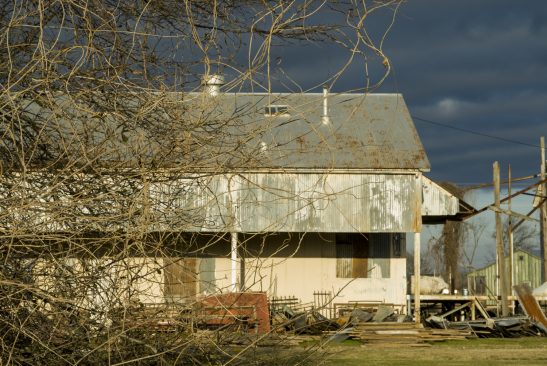
NWNL What is that soil like today?
JOHN RUSKEY It is a rich gumbo. Farmers call the thickest pieces of our soil a “gumbo.” It is a gumbo because the Mississippi River stirred up all those different soil types and mineral types. For instance, the river took rock ground up by glaciers from North Dakota and made into “rock flour.” If you planted cottonseeds in ground-up granite, you wouldn’t come up with a good crop. If you did that in Pennsylvania, it would be the same thing. If you did that with rock out of the North Woods, it would be the same thing.
But if you take and mix all those soils up, then you get the benefits of them all. So, that’s how we were endowed with this great rich soil. Tennessee Williams called it “the richest soil this side of the valley Nile.” That “gumbo” soil allowed that kind of forest to grow. Later it allowed the Cotton Kingdom to flourish.
NWNL What has happened to the forests in this floodplain?
JOHN RUSKEY The 20 million acres of bottomland hardwood forest that grew here were the richest forests in North America. And there were huge trees and a great variety of trees with limitless supplies of nutrients from underneath and regular flooding of water from above. The only advantage the Mississippi didn’t have over the Amazon was that endless Amazon summer. But it was our Amazon – 20 million acres of it – and then we cut most of it.
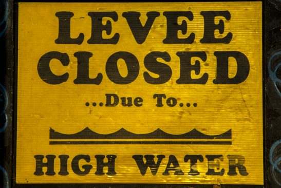
So now, there’s maybe two million acres left which we see when we go over the levee. Over the levee it still is the floodplain of the river, where the river dominates that landscape. Man builds and river takes, that’s been the history on the other side of the levee.
NWNL What were the original forests like?
JOHN RUSKEY When de Soto, the first white man to lay eyes on the Rio Grande, “discovered” the Mississippi River, he called it The Big River. He then faced an armada of 2,000 warriors. (They could have been Quapaw, or one of the other Indian nations from out here; but I like to think it was Quapaw.) All 2,000 of them were in dugout canoes. Some canoes held 60 to 80 warriors, as written in his journals. You can imagine what kind of tree it took to hold 60 to 80 warriors. They were some of the biggest trees in North America.
Later, that evidence was furthered by Teddy Roosevelt who described these trees as the biggest trees that he’d seen in North America outside of the redwoods. So, giant cypress, oaks, sweet gums, locusts, honey locusts, sycamores, cottonwoods – and cypress, that were the best for the dugout canoes.
NWNL What are the values of Yazoo-Mississippi Delta for wildlife?
JOHN RUSKEY If you go over the levee, there’s an alluvial landscape between the levee and the low-water of the main channel of the Mississippi River that they call “the Batture.” It comes from a French word [battre] that means “to strike”. The Batture is the richest habitat in North America for the white-tailed deer.
Also in the State of Mississippi, this is the greatest fishery. I think the Mississippi is the greatest inland fishery in North America. Sixty percent of the migrating songbirds of North America come down the Mississippi Flyway and something like 40 to 44% of the migratory waterfowl use the Mississippi Flyway. So, the Mississippi River is a continental-sized landscape with a certain richness and diversity of landscape that supports those kind of animals.
NWNL What are the values of Yazoo-Mississippi Delta for humans?
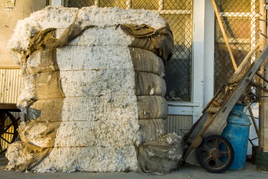
JOHN RUSKEY For humans, the Delta is still a very rich area, even though the trees were cut and the lands cleared and drained. Cotton has been growing in this landscape at least since the turn of the last century. Cotton is a very demanding crop. It takes a lot of nutrients out of the soil. The farmers have added nutrients to the soil, but it’s still very rich soil even after all those years of use and abuse. I think it averages 123 feet deep. This is still the Cotton Kingdom. The biggest cotton in the country is grown here.
NWNL What does the richness of this soil support besides cotton?
JOHN RUSKEY All plants grow taller. My wife and I put some sunflower seeds in the soil last summer. The package said these sunflowers should grow seven feet tall, and we ended up with one 13-1/2 feet without our putting anything on it. So soybeans, rice, winter wheat, and now corn. Corn has becoming a big thing. Everything grows bigger and taller here than it does elsewhere here.
There’s a farmer in northern Coahoma County near Friars Point who told me that his corn was supposed to have three ears. He said those ears were coming out seven feet high. The top of the corn stalk was way up above that. So, it’s still a very rich landscape. Everything that happens here has a certain quality to it because of the richness of the landscape – the music, the people, the food, the stories – it touches all the aspects of human and animal life.
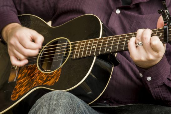
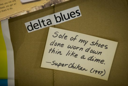
NWNL Can you talk about the “Delta Blues” and how that music may represent the culture of this rich land and the river that brought this soil?
JOHN RUSKEY Well, there aren’t a lot of blues songs about the Mississippi River in particular. But the music was born out of this particular place and so it must be there somewhere. A lot of researchers puzzle about where that comes from and what the connection is; but to me, the river and the blues are commensurate in power.
You know, the Mississippi is the most powerful river in North America: the volume of water, its turbulence created by that volume and the speed with which it travels downstream. Turbulence is a function of speed and volume; and the blues is this great art form that was born here with, perhaps, equal measure to the power of the Mississippi River. It flowed into the contemporary music setting in the 1940’s or 50’s when it really became popular. Perhaps one could compare the two that way.
NWNL You have the Delta Blues industry here. You have the cotton industry here. What other industries are here in the Yazoo-Mississippi Delta?
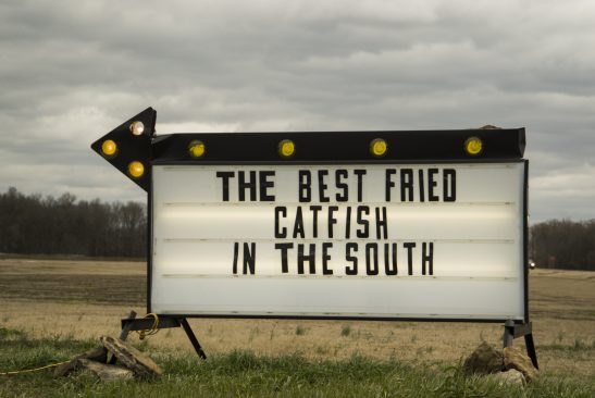
JOHN RUSKEY Well, the first one that comes to mind is the catfish farms. People here have discovered they can make inland reservoirs out of this flat landscape and grow catfish.
Otherwise, I think this land and the people are kind of a state away from other industry by and large – except the farming practices which have to be industrial scale because the land’s so big and the job is so big. All the farms here tend to be huge. This isn’t the land of the small Vermont farmer or something.
On the other hand, all the juke joints and the things that people do in their private lives, all the little towns, the hunting and fishing that goes on, the family reunions, all the many artists and writers and the sculptors and potters that you find in different places, that’s all small-scale stuff, small business. In some ways this region is similar to a third-world Latin America country.
When you drive through The Delta, you see all the little businesses that have sprung up. When someone gets an idea, they want to share it with their neighbors or their friends. They provide some service or some good that’s beneficial to their neighbors, or their friends, or someone passing by. They’re just doing it out of their homes, or out of a trailer pulled up on the side of the highway, or something: tamales, snow cones, hair cutting. Hair cutting is a big thing. If you’re good with a pair of scissors and a razor and an electric shaver, that’s all you need to make a good business here.
There was a guy who used to wander around downtown Clarksdale with a bag of yarn and a couple of knitting needles. He would knit you a hat. You’d just pick out your color and for five bucks he would knit you a hat. That’s how he made his living. How many places in the modern “first world” could you do that? Not a lot.
NWNL What are the basic challenges of settling and farming here?
JOHN RUSKEY Well, let’s talk about how life has always been difficult in The Delta. The first white people who lived here faced mosquitoes and snakes and all kinds of environmental dangers. It was like going to the Amazon. You know how you read stories about how Europeans go into the Amazon and a lot of them went crazy? It’s the same way here. Malaria was really bad.
The native people who lived here knew how to live, but the people who came from the outside world didn’t come in and learn how to live like the native people. They brought in their own way of living and imposed it on this landscape. They cleared all the fields and built these homes that would look good in Virginia. In Virginia they built homes that would look good in Yorkshire County. So, the choices that people made back then and continue to make now have not made life simple, but instead very complicated.
This is a very hot landscape for many months out of the year. Instead of building homes that were appropriate to this environment, we have homes that are really from other landscapes, without insulating or using thermal-pane windows. We have homes with windows facing south, east or west towards the sun. Yet, the Native American people would build things that were partially underground, and build stick-and-waddle walls above. We build things that are very difficult to cool. Why didn’t we learn from what the people were already doing here?
You can look at anything here and find similar parallels. The Choctaw, Quapaw and other nations who lived here didn’t build levees to keep the river away. They allowed the river to come in and do its stuff. Now, they would build little levees around their own homes or their own villages to protect their little piece of the homescape. They did that, but they didn’t cut off their connection to the forest or their connection to the river, because the forest and the river is where they got all their food.
NWNL The challenges from the creation of levees and drainage ditches, such as a drop in the water table and over-extraction of water from farming, seem to be exacerbated by climate change, pollution from agriculture’s pesticides and fertilizer, or sanitation? What effects do you see?
JOHN RUSKEY Today we see difficult ramifications from the way that we have “attacked” this landscape. It really has been in some ways “an attack.” The cutting of all these trees was mostly done by the hands of share croppers, the African-American workers who were brought in, butalso by Italian, Chinese and others draining and then building these huge fields.
And then there were all these insects that have come in and gone rampant. So they had to create means to get rid of the insects. Then in the modern day, people started using airplanes to drop pesticides in because it was faster. Some planters even used airplanes to plant the fields, so they don’t even need to go in with the tractor.
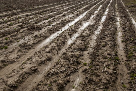
NWNL What other agricultural technological developments are detrimental to the local water supply?
JOHN RUSKEY Well, these days they don’t let cotton come to fruition, to the point that you can pick the ripe, ready cotton bolls off the plant when they’re at the perfect moment. It used to be planters would wait. With the cold weather, the plant would lose its leaves and the cotton would put all that plant energy into the seed, which is found in the cotton boll. But now, farmers want it to happen when they’re ready, not when nature is ready.
So, that’s where usage of defoliant comes in. It’s like Agent Orange. It makes the plants lose its leaves. Every year we have defoliation with these “ag planes” flying all around. They drop a chemical that causes the plants to lose their leaves, which in turn makes the plant put all its energies into the cotton boll. In the process, the defoliant damages water quality and air quality in The Delta. And, of course, those chemicals that the farmer uses spread everywhere because the wind blows and the water flows.
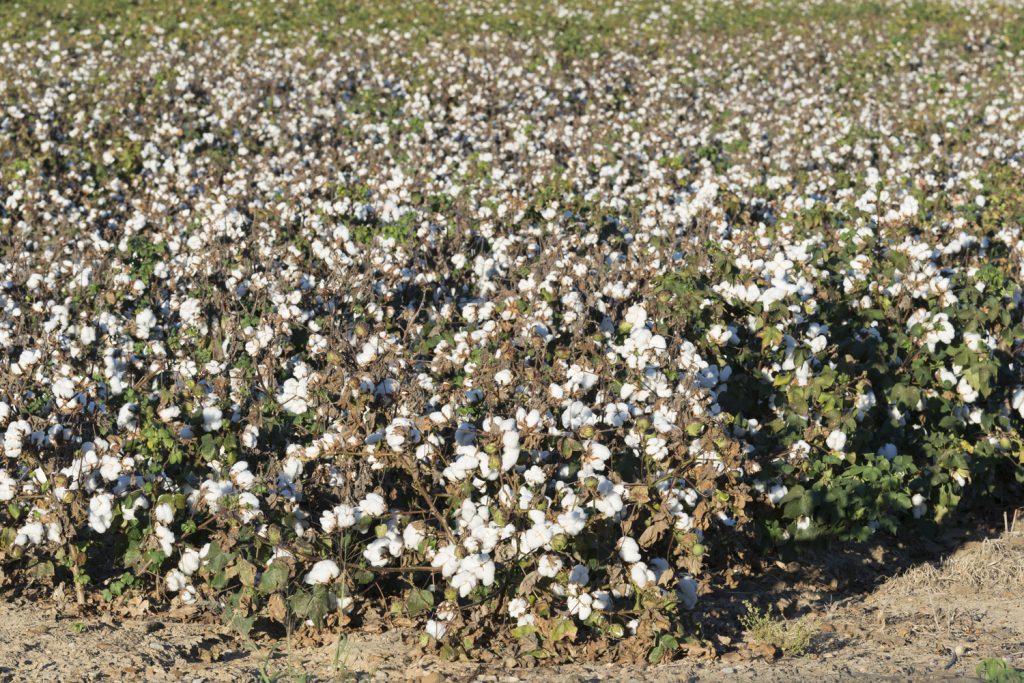
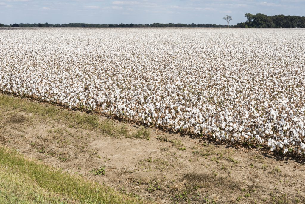
Cotton fields before (left) and after application of defoliant.
NWNL That obviously affects water quality. Are there problems that affect water availability?
JOHN RUSKEY Yes, the way modern citizens of The Delta maintain our water supply is the other great challenge. We have this magnificent river, the third biggest river in the world, for volume. So it seems we have access to a lot of fresh water. One would think this landscape has endless water regeneration, because here’s the biggest river just flowing along 44 miles of our western Coahoma County border. One would suppose all that water is going to come through the soil so you could use what you want and not worry about it.
But the fact is that the Mississippi River only replenishes certain aquifers that are located close to the river – and only in a few places. The Delta is sixty miles wide at its widest point in the center of that almond shape that I was talking about. Most of that land is replenished by aquifers that come in from the hill country or elsewhere – and the farmers are seriously depleting them. It’s not just cotton. Rice uses probably the most water, because you have to flood a field to grow rice. Corn needs lots of water, wheat not so much. Wheat is perhaps the most sustainable out of all of those.
NWNL Is there any awareness of this reduction in water supply?
JOHN RUSKEY Yes, farmers are realizing that. They want to keep their farming tradition going and keep their families alive, so, they’re trying to use better farming practices. There are organizations active in The Delta that are promoting improved farming practices along with the realization that this is not an endless supply that we have here.
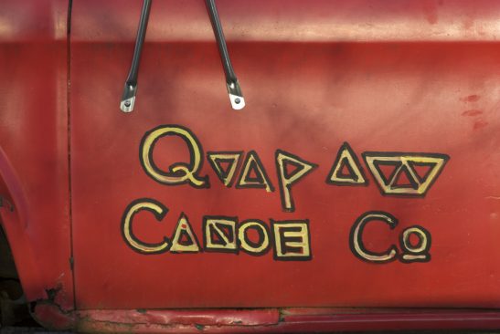
NWNL Back to you – how and why did you found the Quapaw Canoe Company?
JOHN RUSKEY Well, our mission at Quapaw Canoe Company began with a simple desire to see the river. I should say it began with my own desire first of all, because I find my solace and my self-composure on the watery landscapes. But you can’t do everything alone in this life.
For us at Quapaw Canoe Company – me and my paddling friends – our big thing is the river. We think like the river, because when you get out there and start paddling around, the movement of water means everything to you. We don’t like it when it gets too low so that we can’t get through. So, we think more like the plants and animals that actually live in The Delta.
NWNL What challenges do you face here as a paddler?
JOHN RUSKEY Every year the Sunflower River gets lower and lower. It’s very alarming. There’s less possibility for getting out there and paddling on this little river that flows from downtown Clarksdale 250 miles to the south. This is true for all the rivers in The Delta. It’s true for all the rivers in the middle part of America. We’ve been in a drought for so many years.
Our life-blood – the arteries and veins of Mother Earth – are drying up. It’s very alarming. Who knows what part global warming has to play in that, but everything is connected and the rivers make that a very tangible thing. The water that we see flowing by our western border of Coahoma County was in Illinois two weeks ago. It was in St. Louis a week ago. It was in the Quad Cities of Illinois three or four weeks ago. We see water that was up in Minnesota.
NWNL It certainly seems you feel connected to the entire Mississippi River Basin.
JOHN RUSKEY Yes, you can trace any of the Missouri River tributaries all the way up to Montana; the Ohio tributaries all the way up into western New York state; and the Cumberland tributaries through Tennessee all the way into North Carolina. You can follow the Arkansas all the way through Oklahoma and to the Colorado Rockies. All these different rivers come into the Mississippi. They touch us, you know. What happens to these waters that flow past us affect our life here directly.
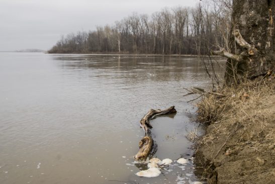
NWNL What do you suggest as solutions to combatting decrease in people connecting to their rivers and the natural world? Is this dis-connect related to the difficulty of accessing the river?
JOHN RUSKEY We have lots of people who come to Clarksdale and Coahoma County. Anyone that comes here, to the Yazoo-Mississippi Delta, to Memphis, to many of the places in the mid-South is naturally going to want to see the river. If you come all the way from Japan or France, even New York City or Atlanta, you want to see the Mississippi River. And it’s hard to get there.
This is a big floodplain, but there aren’t many landings. The river is difficult to access and it’s even more difficult to get to the beautiful places on it to see the wildlife and the big forest. So, at the very beginning, with a single canoe, I started Quapaw just to provide that access and that missing link to high-quality experiences on the river.
NWNL So what do you folks at Quapaw Canoe do to try to overcome the mental and physical barriers between people and their rivers?
JOHN RUSKEY One of our mottoes is “You’ve never seen the Mississippi till you’ve paddled on it.” Anyone who’s paddled knows the difference. But if you haven’t paddled, you don’t know the difference. If you’ve only gone out on a motorboat, if you’ve only gone out of the Mississippi Queen, or if you’ve been a deck hand on a tugboat – yes, you’ve experienced the Mississippi River. You love it because everyone who touches the river – almost everyone – is going to love it.
But still, you haven’t experienced the same thing as when you get into a canoe or kayak and you flow silently along. You feel the way the boils and eddies move you around. You hear the birds. You smell the willows and all the rich odors that come out of that floodplain forest. You don’t sense those things when you’re in a motorboat.
NWNL Do local folks have their ways to get to the river?
JOHN RUSKEY Well, there is kind of a dis-location with this river, even for Mississippians. Mississippi should have some kind of ownership. I’m not saying “owner,” because no one can own the river. No one can own the earth. But everyone has a landscape and everyone lives somewhere.
The people of the State of Mississippi do have a dislocation from one of the greatest natural resources in North America. It’s like having the Rocky Mountains on your western border. People in Colorado drive up into their mountains, and one of every two people from Denver ski, or hike, rock climb, or do something in those beautiful mountains they have right there. But in Mississippi, it’s maybe one out of 1,000 that fish or hunt. Maybe it’s one out of 10,000 that kayak or canoe. There’s very little interaction relationship with this incredible wilderness and natural resource.
NWNL Why do you feel it is so important to connect to nature?
JOHN RUSKEY You know, Henry David Thoreau, one of the great philosophers of our country, described man’s understanding of himself. His words were, “In wildness is the preservation of mankind.” It’s a contradictory thing that you have to get away from man to understand man. But likewise, you have to get away from civilization to really appreciate what it’s all about. Maybe it’s the hero story – but you’ve got to get away and be able to experience things in a whole different way. The Mississippi provides that and it’s right here in the heart of our country.
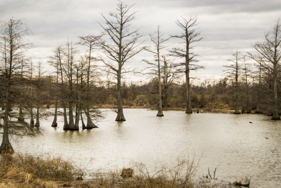
NWNL What is the cause of this limited access? Is it because people are too busy to care? Or is it because they prefer to sit in front of the TV all day? Or is it the difficult-to-overcome geography of the bluffs and the levees?
JOHN RUSKEY The land and the river has made itself inaccessible. It’s a wild landscape and you can’t just drive to it. You can’t just easily say, “I’m going to go see the Mississippi River,” like you can if you’re in Denver, Colorado.
I use that analogy because I was born in Denver actually. There, you can get in your car any given day, even on a blizzard day because they’re so good at plowing the roads there. Automobiles have access to the Rocky Mountains, but automobiles do not have access to the Mississippi. Even with the best 4-wheel-drive Hummer in the world, you can’t get there if the water’s too high or the mud that’s been left behind after high water is too deep.
Plus, the angle of fluctuation can be 50 vertical feet, so landings that were easily accessed at one point are underwater at another point. Roads that were once good become torn up and muddy. Landings can be ripped apart. So we’ve failed to make the river accessible. But on the other hand, the river opens itself up periodically, and it has always been open to those who approach it on its terms. Those are the terms that the beaver and the wading birds and the migratory waters value.
All you have to do is get on a log, push it off a levee, and you’re good to go. Our canoes are just logs. We can just hollow out a log and turn it into a vessel. We’re a little more fancy now, but we’re just like the birds out there. When we find something that actually floats in the river, we can get in it and go from point A to point B. The river likes that and we know the river likes that because it keeps allowing us to do it. We do it safely. We do it using means and methods established over thousands of years of paddling. This paddling thing, it’s been going on a long time in world history.
NWNL So, it seems your goal is to make paddling been a more established activity here now.
JOHN RUSKEY Well, we’ve taken that goal a step further here at Quapaw. Our inspiration comes from Johnny Billington, a master blues musician. Mr. Johnnie was my mentor when I came here to Clarksdale. He told me that if you’re ever going to do anything and make a go of it, then you’ve got to share it with the kids around you. If you have knowledge, you’ve got to share it.
He did that, not by becoming a public school teacher, but by teaching children how to play guitar, bass, drums and various instruments. Using his example, we started conducting an apprenticeship with our Clarksdale youth, primarily young men. But we’re really open to anybody. We’re glad to take adults, but mostly it’s young men who’ve taken an interest in it. We teach them the skills involved in canoe building and paddling and guiding.
NWNL What are those skills?
JOHN RUSKEY Children like a challenge so, we have great challenges built into what we’re doing: making a knife razor sharp; using that knife to carve something; using what you’ve carved to move from point A to point B on the Mississippi River; and then, once you get to point B, getting out and taking someone else with you.
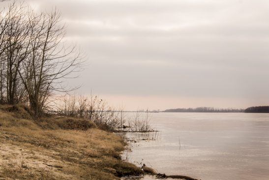
NWNL How do you foster the children who come to you in ways beyond teaching skills?
JOHN RUSKEY We have a thing called the three R’s: respect of yourself, respect of others, and respect of the river. So, once you’ve gone from point A to point B, you learn to say, “I’m not just doing it for myself, I’m doing it to share this with someone else.” So, we get them to think ahead about what they would do in certain situations on the river.
What do you do when you get to the sandbar? How do you help people out of the canoe? How do you make them comfortable? How do you build a fire? How do you put up a tent? How do you make a batch of greens? Your grandmother showed you how to make a batch of greens, how do you do it on a sandbar? For us, it’s things like that that are important.
NWNL Well, speaking of little ones, you’ve got a child at home. So, we should let you go. Thank you very much, John.
JOHN RUSKEY Oh, you’re very welcome.
Posted by NWNL on Sept. 27, 2014.
Transcription edited and condensed for clarity by Alison M. Jones, NWNL Director.
All images © Alison M. Jones. All rights reserved.
